Drone survey photography is revolutionizing various industries in the UK, offering a bird’s-eye view that traditional methods simply can’t match. From construction and agriculture to real estate and environmental monitoring, drones equipped with high-resolution cameras and advanced sensors are providing accurate, efficient, and cost-effective solutions for data collection and analysis. This article explores the diverse applications, benefits, and regulations surrounding drone survey photography, highlighting its transformative impact on the UK landscape.
What is Drone Survey Photography?
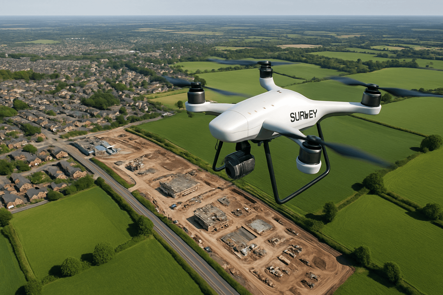
Drone survey photography, also known as aerial surveying or drone mapping, involves using unmanned aerial vehicles (UAVs) or drones equipped with cameras to capture high-resolution images and videos of a specific area. These images are then processed using specialized software to create detailed orthomosaics, 3D models, and point clouds, which can be used for various surveying and mapping applications.
How Does It Work?
- Data Acquisition: Drones are equipped with onboard cameras that take photos of the ground from different points in the air. Images are tagged with geo-coordinates captured by a GNSS sensor on the drone, indicating the precise location of each image.
- Photogrammetry: Hundreds or even thousands of images from a single drone flight are processed with photogrammetry software, which “stitches” the images together to create geo-referenced orthomosaics or 3D models of a worksite.
- Data Processing & Analysis: Through unmanned aerial surveys, 3D maps can be analyzed to obtain detailed information about project quantities, distances, elevations, and inventory.
Applications of Drone Survey Photography
Drone survey photography has a wide array of applications across various sectors:
Construction
- Site Mapping and Topography: Drones can quickly and accurately map construction sites, generating high-resolution topographic data for pre-bid topos, stockpile volume measurement, and cut/fill calculations.
- Progress Monitoring: Regular drone surveys allow for tracking changes and progress on construction sites, comparing maps to design files and previous surveys.
- Building and Roof Inspections: Drones can safely inspect roofs and other hard-to-reach areas, identifying issues and defects that may be missed by traditional inspection methods.
- Building Information Modeling (BIM): Drone data can be integrated into BIM workflows, providing a useful snapshot in time to monitor construction works.
Agriculture
- Crop Monitoring: Drones equipped with multispectral cameras can assess crop health, identify areas of stress, and optimize irrigation and fertilization strategies.
- Yield Estimation: Aerial imagery can be used to estimate crop yields, helping farmers make informed decisions about harvesting and resource allocation.
- Livestock Management: Drones can monitor livestock, track their movements, and detect potential health issues.
Real Estate
- Property Marketing: Drones can capture stunning aerial photographs and videos of properties for sale, providing potential buyers with a unique perspective.
- Property Assessment: Drone surveys offer accurate and comprehensive assessments of properties, identifying issues and informing decisions about maintenance, repairs, and development.
Environmental Monitoring
- Forestry Mapping: Drones equipped with LiDAR sensors can map dense vegetation and large areas of trees, providing valuable data for forest management and conservation.
- Wildlife Monitoring: Drones can be used to monitor wildlife populations, track their movements, and assess their habitats.
- Coastal Erosion Monitoring: Regular drone surveys can track changes in coastlines, helping to understand and mitigate the effects of erosion.
Mining and Aggregates
- Stockpile Volume Measurement: Drones offer a fast and inexpensive method for measuring stockpile volumes in mines and quarries, aiding in inventory management and monitoring.
- Quarry Pit Angle Inspection: Browser-based 3D maps from drone data enable the inspection and measurement of quarry pit angles, as well as the calculation of blast volumes.
- Material Excavation Tracking: Drones help ensure that records of material excavated, processed, and moved reconcile with accounting each month.
Other Applications
- Land Surveying and Cartography: Drones generate high-resolution orthomosaics and detailed 3D models for cadastral maps, even in complex or difficult-to-access environments.
- Archaeology: Drones can be used to map and document archaeological sites, providing a non-invasive way to study and preserve cultural heritage.
- Infrastructure Inspection: Drones can inspect bridges, power lines, and other infrastructure, identifying potential problems and reducing the need for manual inspections.
Benefits of Using Drones for Survey Photography
Compared to traditional surveying methods, drone survey photography offers numerous advantages:
Cost-Effectiveness
- Reduced Labor Costs: Drone surveys require less manpower compared to traditional methods, reducing labor costs.
- Elimination of Scaffolding and Access Equipment: Drones eliminate the need for expensive scaffolding, cherry pickers, and other access equipment, saving time and money.
- Lower Operating Costs: Drones have lower operating costs compared to airplanes and helicopters, making them a more affordable option for aerial surveying.
Time Efficiency
- Faster Data Collection: Drones can capture topographic data up to five times faster than land-based methods.
- Rapid Deployment: Drones can be deployed in minutes, quickly capturing high-resolution images of a site or structure.
- Reduced Field Time: Drone surveys significantly reduce field time, allowing surveyors to deliver results faster.
Improved Accuracy
- High-Resolution Imagery: Drones equipped with high-resolution cameras can capture detailed images, allowing for the identification of small defects and problems.
- Precise Measurements: Drones can capture many more topographic data points than traditional methods, leading to more accurate volume measurements and other calculations.
- Centimeter-Level Accuracy: Aerial mapping with drones can achieve centimeter-level accuracy, making it suitable for various surveying applications.
Enhanced Safety
- Reduced Risk to Personnel: Drones eliminate the need for surveyors to enter hazardous or difficult-to-access areas, reducing the risk of accidents and injuries.
- Safer Roof Inspections: Drone roof surveys are much safer than traditional methods, eliminating the need for climbing on roofs or using scaffolding.
Better Project Management
- Up-to-Date Site Data: Regular drone surveys provide project stakeholders with the most current data in an easy-to-understand format, ensuring projects progress according to design.
- Early Problem Detection: Up-to-date site data allows for spotting problems before they become expensive or result in rework.
- Improved Communication and Collaboration: Drone-captured survey data can boost team accountability, communication, and collaboration.
UK Drone Laws and Regulations
Operating drones for commercial purposes in the UK is subject to regulations set by the Civil Aviation Authority (CAA). These regulations aim to ensure the safety and security of the public while allowing for the growth of the drone industry.
Key Regulations
- Registration: All drone operators in the UK must register with the CAA and obtain an Operator ID if the drone weighs between 250g and 25kg.
- Flyer ID: Anyone intending to fly a drone, even if it’s not their own, must pass an online theory test and obtain a Flyer ID.
- Visual Line of Sight (VLOS): Drones must be flown within the operator’s visual line of sight at all times.
- Altitude Limit: Drones must not be flown above 400 feet (120 meters) above ground level.
- Distance from People and Property: Drones must be kept at least 50 meters away from people and properties not under the operator’s control, and 150 meters away from gatherings of 1,000 or more people.
- No-Fly Zones: Drones are prohibited from flying within 5 kilometers of an airport or airfield boundary without permission.
- A2 Certificate of Competency (A2 CofC): Drone pilots may need to obtain an A2 CofC to assure safe operations of drones close to uninvolved persons.
- General Visual Line of Sight Certificate (GVC): A GVC provides a single qualification suitable for VLOS operations within a Specific Category.
- Permission for Commercial Operations (PfCO): Although requirements for PfCO were removed in January 2021, it’s crucial to ensure any drone operator holds the relevant commercial and aviation insurances.
Privacy Considerations
- Data Protection: Drone operators must comply with data protection laws, such as the General Data Protection Regulation (GDPR), when capturing and processing personal data.
- Consent: Individuals must be informed if their personal data is being captured by a drone and provide explicit consent if necessary.
- Responsible Operation: Drone operators should operate their drones in a responsible way to respect the privacy of others, avoiding capturing or distributing images or videos without consent.
Flying Over Private Property
- Landowner Permission: While it is legal to fly a drone over private property in the UK, permission must be obtained from the landowner to take off or land on their property.
- Trespassing: Taking off or landing on private property without permission could be considered trespassing.
Drone Safety
- Risk Assessment and Method Statement (RAMS): A robust RAMS should be task and project-specific to ensure the drone operator has fully considered any potential risks and hazards involved.
- Insurance: Drone operators must have the relevant commercial and aviation insurances.
Choosing a Drone Survey Photography Service
When selecting a drone survey photography service in the UK, consider the following factors:
- Experience and Expertise: Look for a company with years of experience in the industry and a team of skilled professionals.
- CAA Approval: Ensure the company is CAA-approved and has the necessary permissions and licenses to operate drones commercially.
- Insurance: Verify that the company has adequate insurance coverage, including public liability insurance.
- Technology and Equipment: Choose a company that utilizes the latest advancements in drone technology, including high-resolution cameras, LiDAR systems, and advanced mapping software.
- Data Processing and Analysis Capabilities: Ensure the company has the expertise and software to process and analyze drone data, providing accurate and reliable outputs.
- Compliance with Regulations: Select a company that is fully compliant with UK drone laws and regulations, including data protection and privacy requirements.
- References and Testimonials: Check references and read testimonials from previous clients to assess the company’s reputation and quality of service.
The Future of Drone Survey Photography
As drone technology continues to evolve, drone survey photography is expected to play an even greater role in shaping the UK landscape. With advancements in drone capabilities, sensor technology, and data processing software, the potential applications of drone survey photography are virtually limitless.
- Increased Automation: Future drone surveys will likely involve greater automation, with drones capable of autonomously planning and executing missions.
- Real-Time Data Processing: Advancements in edge computing will enable real-time data processing on drones, providing immediate insights and decision-making capabilities.
- Integration with AI and Machine Learning: AI and machine learning algorithms will be used to analyze drone data, automatically identifying patterns, anomalies, and potential issues.
- Expansion into New Industries: Drone survey photography will expand into new industries, such as renewable energy, infrastructure management, and disaster response.
Conclusion
Drone survey photography is transforming the way we view and interact with the UK landscape. By providing accurate, efficient, and cost-effective solutions for data collection and analysis, drones are empowering businesses and organizations to make informed decisions, improve safety, and optimize their operations. As technology advances and regulations evolve, drone survey photography is poised to play an even greater role in shaping the future of the UK.


