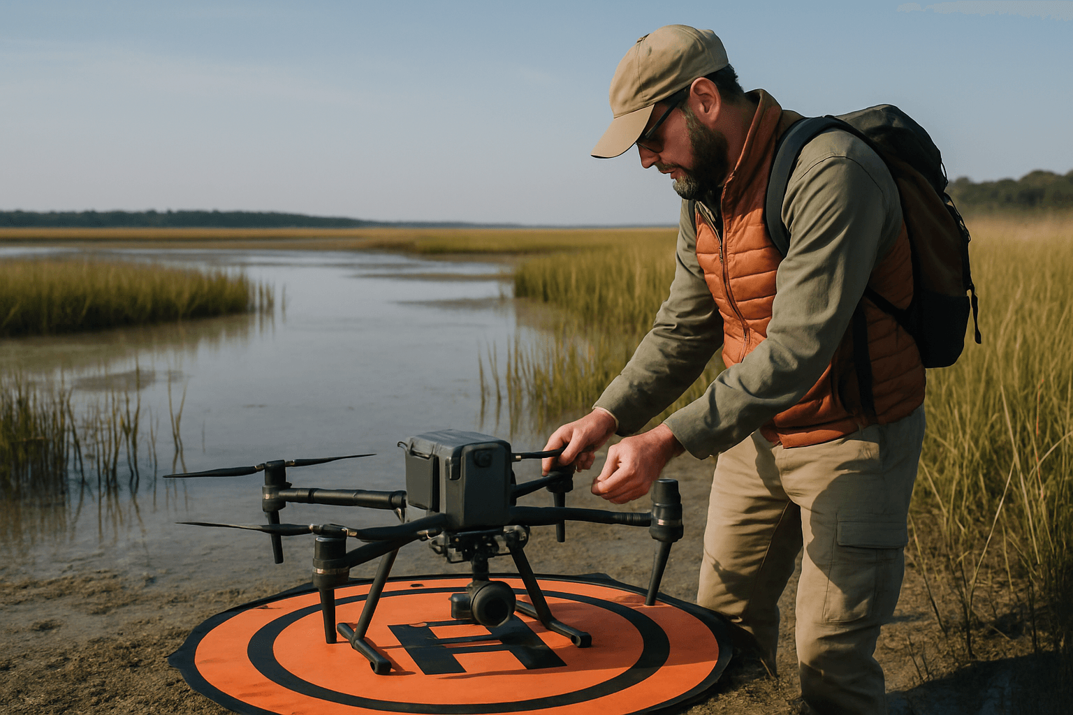
Unmanned Aerial Vehicles (UAVs), commonly known as drones, have rapidly emerged as indispensable tools in the realm of environmental monitoring and conservation. Their ability to access remote, hazardous, or vast areas, combined with their capacity for real-time, high-resolution data collection, has revolutionized how scientists, conservationists, and policymakers understand and manage the planet’s delicate ecosystems. This technological leap offers a transformative approach, providing unprecedented precision, efficiency, and cost-effectiveness compared to traditional methods.
The Transformative Potential of Drone Technology
The core advantage of drones in environmental monitoring lies in their versatility and data acquisition capabilities. Equipped with an array of advanced sensors, including high-resolution visual cameras, thermal imagers, multispectral and hyperspectral sensors, and LiDAR (Light Detection and Ranging) systems, drones can gather diverse data types from various altitudes. This aerial perspective allows for comprehensive coverage and detailed insights previously unattainable or prohibitively expensive.
Enhanced Data Collection and Accessibility
Traditional methods for environmental data collection often involve laborious ground surveys, manned aircraft, or satellite imagery. While each has its merits, they come with limitations such as accessibility to difficult terrains, high operational costs, potential disturbance to wildlife, or coarser spatial resolution. Drones overcome many of these challenges, offering:
- Access to Remote and Hazardous Areas: Drones can safely navigate dense forests, wetlands, steep mountains, and disaster zones, where human access is challenging or dangerous.
- High-Resolution and Real-Time Data: Unlike satellites, drones can fly at lower altitudes, capturing exceptionally detailed imagery and data at resolutions much greater than satellite imagery, often in real-time. This allows for immediate analysis and quicker decision-making.
- Cost-Effectiveness and Efficiency: Deploying drones is generally more affordable and time-efficient than using manned aircraft or extensive ground teams, especially for repeated monitoring tasks over large areas.
- Reduced Disturbance: For wildlife monitoring, drones can provide a non-intrusive alternative to human presence, minimizing stress and panic among animals.
Key Applications Across Environmental Disciplines
The applications of drones in environmental monitoring are broad and continue to expand with technological advancements.
Wildlife Tracking and Conservation
Drones are revolutionizing wildlife management by providing a discreet and efficient means to monitor animal populations and behavior. Equipped with thermal imaging cameras, drones can detect animals in dense vegetation or at night, tracking nocturnal species or those hidden by foliage. This technology has been successfully employed for:
- Population Counting and Distribution: Accurately counting species like elephants, rhinos, orangutans, tortoises, turtles, whales, and koalas across vast and often inaccessible terrains.
- Anti-Poaching Efforts: Surveying large areas quickly to identify potential poaching activities and relaying real-time information to rangers, significantly enhancing protection for endangered species.
- Habitat Monitoring: Observing the impact of human activities or environmental changes on wildlife habitats.
- Radio Telemetry: Advanced drone systems can integrate with radio telemetry tags, offering highly efficient and cost-effective tracking of tagged animals in real-time over challenging landscapes.
Forest and Vegetation Monitoring
From assessing forest health to combating illegal deforestation, drones provide critical data for sustainable land management. Their ability to capture multispectral and hyperspectral images allows for detailed analysis of vegetation characteristics.
- Health Assessment: Detecting early signs of plant stress, disease outbreaks (e.g., Ash Dieback), or nutrient deficiencies, enabling timely intervention.
- Illegal Logging Detection: Identifying and documenting illicit logging activities in remote areas, providing crucial evidence for law enforcement.
- Reforestation and Carbon Sequestration: Monitoring reforestation efforts and assessing the success of newly planted trees. LiDAR-equipped drones can create detailed 3D maps of forests, allowing researchers to estimate carbon storage with greater precision, which is vital for climate change research.
- Biodiversity and Habitat Mapping: Drones collect data on forest cover, species distribution, and vegetation types, aiding in biodiversity conservation and understanding ecosystem dynamics.
Water Quality Assessment and Management
Monitoring water bodies is crucial for ecological sustainability, and drones offer an effective solution for assessing water quality and detecting pollution.
- Pollution Detection and Source Identification: Drones equipped with sensors can identify pollution sources, track changes in water temperature, and measure levels of various pollutants. This data helps pinpoint the causes of contamination and enables preventative measures.
- Parameter Measurement: UAVs with specialized hardware can measure key water quality indicators such as pH levels, turbidity, conductivity, dissolved oxygen, chlorophyll, blue-green algae, total suspended solids (TSS), and chromophoric dissolved organic matter (CDOM).
- Coastal and Marine Monitoring: Drones are increasingly used to monitor sensitive ecosystems like coral reefs, tracking changes in coral cover and assessing overall marine ecosystem health. They can also detect illegal fishing activities.
- Infrastructure Monitoring: Aerial drones inspect sewer systems for blockages, leaks, and structural issues, reducing the need for hazardous manual inspections. Some drones can even collect physical water and sediment samples for laboratory analysis.
Air Quality Monitoring
Drones offer a mobile and flexible platform for assessing atmospheric conditions, particularly in areas challenging for ground-based sensors.
- Pollutant Detection: Drones can be fitted with sensors to measure a wide range of gases and particulates, including PM2.5, PM10, ozone (O3), nitrogen dioxide (NO2), sulfur dioxide (SO2), carbon monoxide (CO), and volatile organic compounds (VOCs).
- Spatial Distribution Mapping: They can quickly scan large areas, towns, and cities to map the spatial distribution of pollutants at different elevations, helping to identify pollution sources and transport routes in real-time.
- Industrial and Urban Monitoring: Applications include monitoring fugitive emissions, flare emissions, leak detection along oil pipelines, landfill methane detection, and comprehensive urban air quality networks.
- Safety in Hazardous Environments: Drones can collect air quality data in dangerous areas, such as during natural disasters or chemical incidents, reducing risk to personnel.
Disaster Response and Damage Assessment
In the wake of natural disasters, timely and accurate information is critical. Drones provide rapid damage assessment and support for response efforts.
- Wildfire Management: During wildfires, thermal imaging drones can pinpoint hotspots and guide firefighting efforts.
- Post-Disaster Evaluation: After events like hurricanes or oil spills, drones can quickly map the extent of damage to vegetation, wildlife habitats, and infrastructure, aiding in planning restoration and relief efforts.
Precision Agriculture and Environmental Impact Reduction
While primarily an agricultural application, the use of drones in precision agriculture has significant environmental benefits, contributing to sustainable farming practices.
- Optimized Resource Use: Drones enable the precise application of water, fertilizers, and pesticides based on real-time data about crop health and soil conditions. This targeted approach minimizes chemical runoff, soil erosion, and pollution, reducing the environmental footprint of farming.
- Soil and Crop Health Monitoring: Multispectral and thermal imaging helps farmers detect early signs of stress, disease, or nutrient deficiencies, allowing for proactive intervention with fewer chemical inputs.
- Land Management: Drones assist in monitoring livestock across vast grazing areas, preventing overgrazing which can lead to soil degradation. They also help in mapping land for more efficient crop planning.
Mapping Habitats and Ecosystems
Understanding the changing landscape of ecosystems is vital for effective conservation. Drones equipped with high-resolution cameras and LiDAR technology can create detailed maps and 3D models of natural habitats. This information assists scientists in tracking land-use changes, deforestation, and habitat degradation. They are particularly useful for surveying large areas, including protected zones and sites of scientific interest, providing highly accurate georeferenced imagery for environmental impact assessments.
Technological Considerations and Advancements
The effectiveness of drones in environmental monitoring is heavily reliant on the sophistication of their payloads and supporting software. Modern drones integrate:
- Diverse Sensors: From basic visual cameras to advanced multispectral, hyperspectral, thermal, and LiDAR sensors, each designed to capture specific data relevant to environmental parameters.
- GPS and Autonomous Flight: Enabling precise navigation, repeatable flight paths for consistent monitoring over time, and automated data collection.
- Data Processing and Analytics: Sophisticated software processes the vast amounts of high-resolution data collected by drones, transforming it into actionable insights, including 2D maps, 3D models, and visual representations of pollutant concentrations.
Ongoing advancements continue to push the boundaries of drone capabilities. The integration of Artificial Intelligence (AI) and Machine Learning (ML) promises to enhance real-time data processing, enabling automatic identification of species, detection of environmental changes, and prediction of future trends. The Internet of Things (IoT) will further augment functionalities, allowing for immediate habitat monitoring and more integrated systems. Future developments also include solar-powered drones for extended flight durations and even biodegradable drones for temporary missions in sensitive areas.
Challenges and Future Outlook
Despite their immense potential, the widespread adoption of drones in environmental monitoring faces several challenges.
Regulatory and Ethical Considerations
The rapid growth of drone technology has outpaced regulatory frameworks in many regions, leading to concerns around data ownership, privacy, and airspace restrictions. Clear guidelines are essential to ensure responsible use, particularly concerning high-resolution cameras operating in public or sensitive natural spaces.
Technical Limitations
Current technical limitations include restricted battery life and flight duration, which can hinder the ability to cover vast areas or monitor for extended periods. The high cost of sophisticated equipment and the need for specialized expertise in processing large volumes of complex data also remain significant barriers for some organizations. Furthermore, a lack of standardized operations and performance specifications for drones in environmental applications still exists.
Environmental Impact of Drones Themselves
While generally less intrusive than traditional methods, drones are not without their own environmental footprint. Noise pollution from drones can disturb wildlife, potentially altering behavior or even causing abandonment of habitats. The production and disposal of lithium-polymer batteries, which power most commercial drones, also pose environmental challenges due to hazardous materials and associated carbon emissions, depending on electricity sources.
Data Interpretation and Integration
There is a risk of over-reliance on drone-derived data without integrating it with broader ecological knowledge and essential ground-truthing. Drones simplify complex ecological systems into quantifiable data, and a holistic understanding of ecosystem health requires a multi-faceted approach, combining drone data with other research methods.
Conclusion
Drones have undeniably revolutionized environmental monitoring, providing invaluable data and insights that significantly bolster conservation efforts and environmental management worldwide. Their unique blend of cost-effectiveness, efficiency, safety, and access to challenging locations makes them an indispensable tool in the environmental scientist’s toolkit. As technology continues to advance, integrating AI, IoT, and improved sensor capabilities will further enhance their potential, promising a future where drones play an even more pivotal role in safeguarding our planet’s natural heritage. However, addressing the existing challenges—from regulatory frameworks and data management to minimizing their own environmental footprint—will be crucial to fully harness their power for a more sustainable future.


