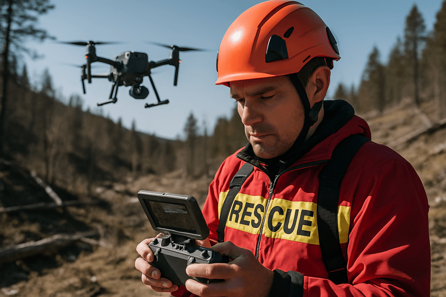
Unmanned Aerial Systems (UAS), commonly known as drones, have transitioned from niche tools to indispensable assets in modern search and rescue (SAR) operations, fundamentally reshaping how emergency responders approach critical missions. Their ability to rapidly deploy, access perilous or inaccessible terrains, and provide real-time data has revolutionized the efficiency, safety, and success rates of finding and aiding individuals in distress.
The Strategic Advantages of Drones in SAR
The integration of drones into SAR efforts offers a multitude of benefits that traditional methods often cannot match.
Unprecedented Speed and Coverage
Time is the most critical factor in search and rescue missions; the chances of finding someone alive decrease significantly after 72 hours. Drones can be deployed within minutes, swiftly covering vast and often challenging terrains, such as dense forests, mountainous regions, or disaster-stricken urban areas. This rapid aerial assessment allows responders to scan large areas far more quickly than ground teams, increasing the odds of a timely rescue.
Enhanced Situational Awareness
Drones provide a critical bird’s-eye view, offering real-time aerial imagery and data that is invaluable for command centers and ground teams. This allows for immediate assessment of disaster scenes, monitoring of individual movements, and gathering crucial information to guide rescue efforts and plan the most effective routes. By mapping entire search zones, drones help pinpoint potential locations where a missing person might be.
Access to Inaccessible or Hazardous Areas
One of the most significant advantages of drones is their capacity to reach locations too dangerous or difficult for human responders or traditional vehicles. This includes surveying damage after natural disasters like earthquakes or floods, entering collapsed buildings to search for survivors, or navigating rugged wilderness. This capability not only accelerates searches but also significantly enhances the safety of rescue personnel by reducing their exposure to risks.
Cost-Effectiveness
Compared to manned aircraft like helicopters, drones offer a significantly more cost-effective solution for aerial surveillance in SAR operations. Their lower operational costs and greater flexibility make them a sustainable option for ongoing and widespread deployment.
Advanced Technologies Powering SAR Drones
Modern SAR drones are equipped with a suite of sophisticated technologies that dramatically enhance their effectiveness.
Thermal Imaging (EO/IR)
Thermal cameras are a pivotal component of SAR drones, enabling the detection of heat signatures from humans, even in conditions of low visibility such as darkness, smoke, fog, dense foliage, or under snowpacks. These sensors can differentiate between human body heat and surrounding environmental temperatures, making it possible to locate individuals who are hidden from view. Popular models like the DJI Matrice 30T and DJI Mavic 3T are equipped with high-resolution thermal cameras, crucial for night operations and challenging environments.
High-Resolution Visual Cameras and Optics
Alongside thermal sensors, drones carry high-resolution visual cameras that capture detailed imagery and video, providing critical visual information for ground teams. Zoom capabilities on these cameras allow operators to inspect areas closely from a safe distance.
Artificial Intelligence (AI) and Machine Learning (ML)
AI and ML are revolutionizing SAR by enabling drones to process vast amounts of data swiftly and efficiently.
- Object Detection: AI algorithms can be trained to detect humans, vehicles, and other specific objects in drone-captured images and video footage, reducing human error and improving search efficiency. Some systems can identify anomalies even if they appear as small as a single pixel on the screen.
- Autonomous Navigation and Path Planning: AI allows drones to navigate autonomously through complex environments, avoiding obstacles and optimizing flight paths to cover search areas more effectively. This autonomy frees human operators to focus on critical mission aspects rather than manual piloting.
- Data Analysis: AI-powered tools can analyze real-time data, highlighting areas of interest and potential survivor locations, which assists in allocating ground teams and resources.
Communication and Delivery Payloads
Drones can be equipped with loudspeakers to broadcast messages to missing persons or ground crews, facilitating direct communication. Some can also act as temporary communication relays, restoring connectivity in areas where traditional infrastructure is compromised, particularly after natural disasters. Beyond communication, SAR drones can carry and deliver essential supplies such as first aid kits, food, water, radios, and even life jackets to stranded individuals.
Other Advanced Sensors
- LiDAR Systems: These provide precise 3D mapping of terrain, invaluable in complex landscapes or collapsed structures.
- IMSI Catchers & Mobile Phone Detectors: These payloads allow drones to locate cellular phones and mobile devices by detecting their unique signals, pinpointing locations to within a few meters.
- Multispectral Sensors: These can help identify disturbed vegetation or ground anomalies, aiding in searches.
Applications Across Diverse Environments
Drones are proving indispensable across a wide range of SAR scenarios:
- Urban Search and Rescue (USAR): In densely populated areas or after building collapses, thermal drones help locate survivors in rubble, and create 3D maps of unstable structures.
- Mountain and Avalanche Rescue: Drones equipped with thermal cameras are used to detect heat signatures beneath snow or rugged terrain, significantly expediting rescue efforts in time-sensitive conditions. The Mountain Rescue Service of the Czech Republic, for instance, relies on a network of drones for avalanche response.
- Wilderness and Missing Persons Searches: For lost hikers or individuals in remote areas, drones rapidly scan vast tracts of wilderness, reducing search times and covering areas inaccessible to ground teams. Notable examples include locating a lost hiker in the Adirondack Mountains in 2019 using thermal cameras, and finding two hikers in California’s San Gabriel Mountains who had been missing for over a week.
- Flood Monitoring and Response: Drones provide real-time updates on flood zones, identify at-risk areas, locate stranded individuals, and can even deliver supplies. Following Hurricane Harvey in 2017, drones were instrumental in assessing flood damage and locating stranded individuals in Houston, Texas.
- Maritime Search and Rescue (MSAR): Thermal drones assist in locating individuals at sea by detecting their heat signatures against the cooler water, offering precise coordinates.
- Firefighting Rescues: Drones quickly locate and assess fire hotspots, provide real-time data to rescue teams, and improve response times and safety during operations by giving an aerial overview of fire progression.
Challenges and Considerations
Despite their transformative potential, the widespread integration of drones in SAR faces several challenges:
- Regulatory Compliance: Drones must comply with local and national aviation regulations, such as those set by the Federal Aviation Administration (FAA) in the US. This includes obtaining necessary permissions (e.g., Part 107 licenses or Certificates of Authorization for public safety agencies), maintaining visual line-of-sight, avoiding manned aircraft, and adhering to temporary flight restrictions. Operating in controlled or restricted airspace often requires special authorization.
- Battery Life and Endurance: Limited battery life remains a significant constraint, affecting the duration of search missions and the size of areas that can be covered without needing to land for recharging. However, advancements are leading to longer flight times, with some professional SAR drones offering up to 55 minutes of endurance.
- Payload Constraints: While drones can carry various payloads, there are limitations on the weight and size of equipment they can transport, which can impact the types of sensors or supplies delivered.
- Weather Limitations: While some drones can operate in adverse weather, extreme conditions like heavy rain, strong winds, or very low temperatures can still hinder their deployment and effectiveness.
- Human-Drone Interaction and Training: Integrating multi-drone systems, particularly drone swarms, can increase operator workload and attentional demands, requiring sophisticated human-swarm interaction (HSI) interfaces and comprehensive training programs for SAR teams to ensure optimal use and effective communication.
- Data Visualization and Situational Awareness: Managing and interpreting the vast amounts of data collected by multiple drones simultaneously can be challenging for operators. Effective software platforms are needed for real-time analysis and seamless integration into SAR workflows.
- Public Perception and Privacy: Ethical considerations, including privacy concerns related to aerial surveillance, and public acceptance of drone use in emergency situations, must be addressed. Some states have specific laws regarding drone surveillance and facial recognition.
- Technical Issues: Drones are complex systems prone to malfunctions or loss of connection, which can impede SAR operations.
The Future of Drones in SAR
The role of drones in SAR is continually evolving, with promising advancements on the horizon:
- Drone Swarms: The development of coordinated multi-drone systems or “swarms” has the potential to cover even larger areas more quickly and perform coordinated tasks, significantly enhancing efficiency in large-scale disasters.
- Increased Autonomy: Future advancements in AI and autonomy will enable drones to perform more complex tasks with minimal human intervention, from optimal flight path planning to autonomous object tracking and detection.
- Enhanced Sensor Integration: Continued research will lead to improved detection capabilities through more advanced infrared imaging, radar, and potentially biometric monitoring.
- Drone Docking Stations: Automated drone docks facilitate continuous operations by providing deployment, charging, and data transfer capabilities without on-site human presence, extending operational range and endurance.
- Cross-Organizational Collaboration: Development of systems that allow different agencies to collaborate and share resources through integrated drone operations.
Drones are no longer merely supplementary tools but a strategic imperative for modern SAR. Their capacity for rapid response, extended coverage, and real-time data provision is setting new standards for emergency response effectiveness, ultimately contributing to the preservation of human lives worldwide.


