Urban planning, a multifaceted discipline balancing infrastructure growth, environmental factors, and community needs, has historically relied on conventional methods such as ground surveys, satellite imagery, and historical records for decision-making. However, these traditional approaches often suffer from limitations, including outdated data, high costs, and cumbersome procedures. The advent of Unmanned Aerial Systems (UAS), commonly known as drones, and the invaluable data they collect, has fundamentally transformed this landscape, offering unprecedented precision, efficiency, and real-time insights into urban environments. Drones are rapidly becoming an indispensable instrument in the urban planner’s toolkit, reshaping how cities are designed, monitored, and maintained, and driving the development of smart, sustainable urban ecosystems globally.
Key Benefits of Drone Data in Urban Planning
The integration of drone technology into urban planning workflows provides a multitude of advantages that enhance every stage of the development cycle.
Enhanced Accuracy and Detail
Drones equipped with high-resolution cameras, Light Detection and Ranging (LiDAR) sensors, and GPS technology can quickly gather accurate data about a city’s topography, building structures, and other important features. This capability allows for the creation of highly accurate 3D models and detailed 2D maps, including orthomosaics, which provide centimeter-level precision crucial for zoning, infrastructure design, and land-use planning. Unlike satellites, drones capture intricate details, helping to pinpoint minor features like infrastructure damage or accurate land boundaries that might be overlooked from the ground.
Efficiency and Cost-Effectiveness
One of the most significant benefits of using drone data in urban planning is the considerable savings in time and cost compared to traditional methods. Drones can quickly map and survey large areas in hours, a process that would typically take days using conventional ground surveys. This efficiency leads to reduced labor costs and allows more budget to be directed towards essential urban development projects. Some analyses suggest cities can save up to 40% on survey costs when utilizing drone technology.
Accessibility to Challenging Areas
Drones can access areas that are difficult, hazardous, or even impossible for human surveyors to reach, such as high-rise buildings, complex terrains, or disaster zones. This ensures thorough data gathering without compromising human safety, providing real-time data for critical decision-making.
Real-Time Insights
Drone technology offers the ability to collect up-to-the-minute aerial photographs and data, providing planners with an updated perspective of the land and allowing for real-time monitoring of urban environments. This current data collection is vital for dynamic planning and adapting instantly to changes, especially in rapidly developing urban landscapes.
Applications of Drone Data in Urban Planning
The versatility of drone data extends across various critical aspects of urban planning, offering solutions that were previously unimaginable or far more cumbersome.
Urban Mapping and Land Use Planning
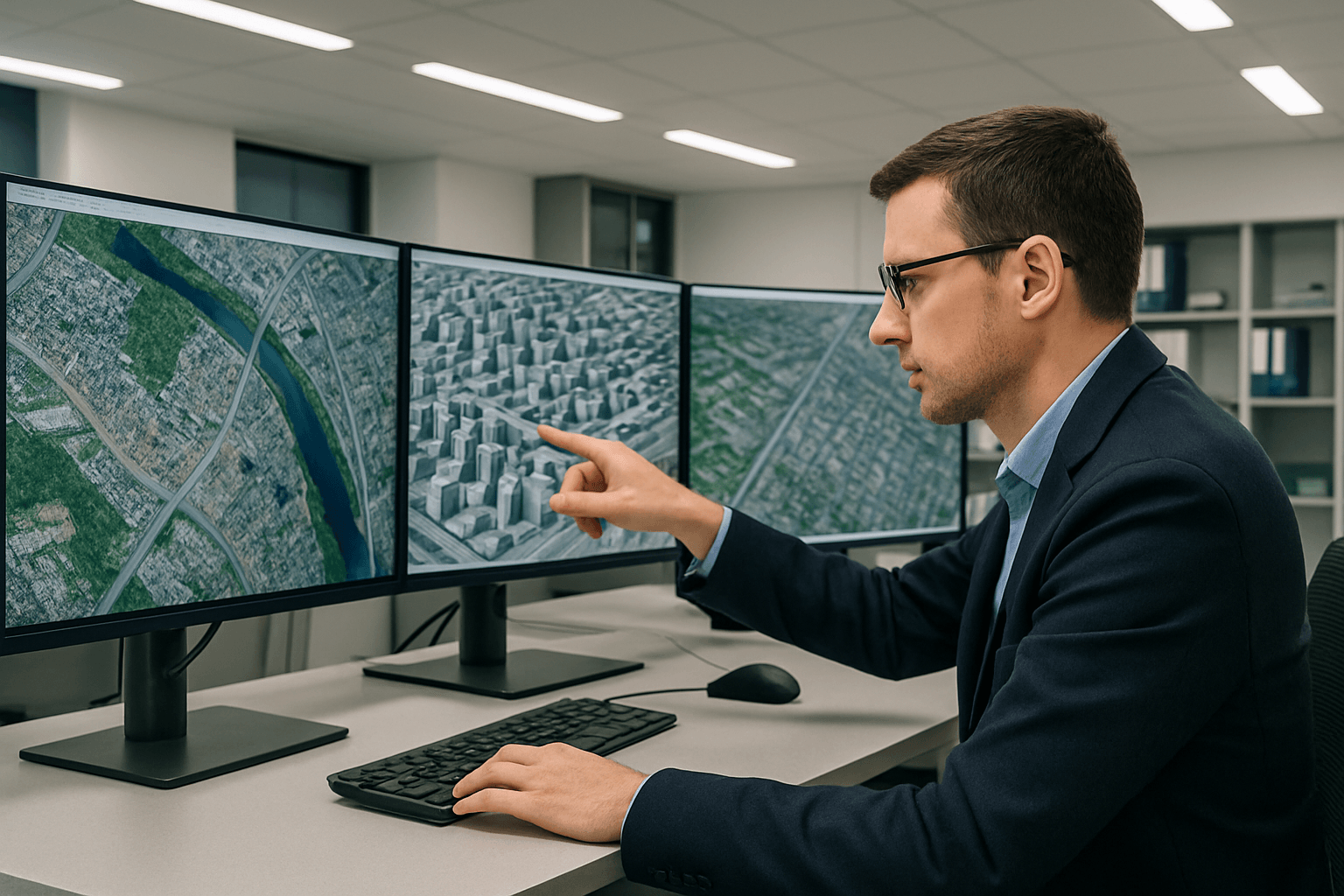
Drones play a prominent role in urban planning and mapping by providing high-resolution aerial images that assist in the design and development of roads, buildings, and drainage systems. They offer a bird’s-eye view of existing land use patterns, helping planners identify suitable zones for residential, commercial, and industrial developments. The detailed 2D and 3D maps generated from drone data are essential for spatial planning, land use classification, and zoning decisions.
Infrastructure Inspection and Management
Infrastructure monitoring is an invaluable application of drones. They are used to inspect bridges, roads, power lines, and other critical infrastructure, identifying potential issues like wear and tear before they escalate into costly problems. This proactive approach can cut maintenance costs significantly and extend asset longevity. Drones provide real-time data and images that help engineers and city authorities make informed decisions about maintenance and repairs, offering a safer and quicker alternative to traditional manual inspections.
City Modeling and Visualization
Drones are powerful tools for creating accurate 2D and 3D reality models of urban landscapes. These models, generated using photogrammetry software or LiDAR, reflect landform and architectural information, allowing planners to visualize how new developments will fit into the existing environment. The 3D models integrate seamlessly with Geographic Information Systems (GIS) and Building Information Models (BIM), streamlining the planning process and enhancing decision-making. They can be used to simulate and visualize future scenarios, guiding the implementation of sustainable infrastructure.
Environmental Monitoring and Green Space Development
Environmental sustainability is a core principle of smart city development, and drones play a critical role in monitoring the environment. They can be equipped with sensors to detect air quality, pollution levels, temperature, and other environmental factors, providing data essential for decisions about sustainable development and public health. Drones contribute to green urban planning by assessing green spaces, monitoring vegetation health, promoting biodiversity, and assisting in reforestation efforts. For instance, drones have been used to monitor reforestation areas as part of initiatives to plant millions of trees.
Traffic Management and Smart Mobility
Traffic congestion is a major challenge in urban centers, and drones can assist in traffic management by providing real-time aerial surveillance of traffic patterns. By analyzing aerial traffic flow and congestion hotspots, city planners can design more efficient public transport routes, optimize road networks, and potentially reduce road congestion by up to 25%. Drone data also aids in planning parking spaces and improving rider and pedestrian safety.
Disaster Management and Resilience Planning
In the face of natural disasters, drones are invaluable for risk assessment, disaster preparedness, and response. They can provide real-time imagery to assess damage, map evacuation routes, and allocate resources more efficiently. Post-disaster rebuilding efforts can be managed efficiently with detailed maps generated quickly after incidents. Drones can also monitor evacuation conditions, identify affected infrastructure, and provide critical public safety information.
Urban-Rural Classification
Drones and associated software solutions combine various types of geographic information to create 2D orthomosaics and 3D models, aiding in the accurate classification and planning of urban and rural landscapes. This helps in understanding the interplay between urban structures and green spaces.
Technologies Powering Drone Data Collection
The effectiveness of drone data in urban planning is underpinned by sophisticated technologies.
Sensors and Cameras
Drones are equipped with a range of advanced sensors and cameras to capture comprehensive data. High-resolution cameras are essential for capturing detailed aerial images and videos. LiDAR (Light Detection and Ranging) sensors use laser pulses to measure distances and create detailed 3D maps, particularly useful for measuring building heights. Multispectral sensors provide advanced data for assessing vegetation health, pollution levels, and land use patterns. Thermal imaging cameras can be used to assess the heat island effect or diagnose air leakages in buildings.
GPS and RTK/PPK
Global Positioning System (GPS) technology is fundamental for georeferencing the captured data, ensuring that images and models are accurately positioned in space. Real-Time Kinematic (RTK) and Post-Processed Kinematic (PPK) technologies further enhance precision, providing centimeter-level accurate data, which is crucial for detailed mapping and measurements.
Data Processing Software
Raw drone data is transformed into actionable insights using specialized software. Photogrammetry software stitches together overlapping images captured by drones to create 2D orthomosaics and 3D models. Geographic Information Systems (GIS) software, such as ArcGIS, Drone2Map, and SiteScan, are critical for managing, analyzing, and visualizing drone-derived products. These platforms allow for detailed topographical analysis, spatial analytics, and the integration of drone imagery with other crucial location data.
Challenges and Ethical Considerations
Despite the transformative potential of drone data, several challenges and ethical considerations must be addressed for its widespread and effective integration into urban planning.
Privacy Concerns
As drones capture images of both public and private spaces, privacy remains a significant concern. Establishing ethical use guidelines and engaging in ongoing discussions are essential to address these issues and ensure public trust.
Regulatory Hurdles
Regulations around drone use in urban areas are still evolving and vary across different regions. Ensuring safe drone operations in bustling city airspace is crucial, and creating clear policies will help integrate drones into urban planning more smoothly. Managing drone operations in sensitive areas like airports or historical sites often requires special permissions, which can delay operations.
Data Management and Security
The large volumes of data generated by drones present challenges in terms of storage, processing, and security. Protecting private information and ensuring that data is received, stored, and processed securely is a major difficulty that needs robust solutions.
Initial Investment and Skill Requirements
The initial investment in drone technology, including the cost of drones themselves and specialized software, can be a barrier to adoption for some cities or organizations. Additionally, operating drones and processing the collected data requires specialized training and skilled professionals, which can be a barrier to broader implementation.
Weather Dependence
Drone operations can be dependent on weather conditions, with adverse weather limiting their use and potentially impacting data collection schedules.
The Future of Drone Data in Urban Planning
The integration of drones into smart city planning and management is only just beginning, with limitless potential for future advancements. As drone technology continues to evolve, it is expected that drones will become even more sophisticated, with advanced capabilities such as AI-powered data analysis, autonomous navigation, and longer flight durations.
The linking of drones with Internet of Things (IoT) technology can enable real-time infrastructure monitoring and further increase their efficiency and utility. Artificial intelligence (AI) will allow UAS to perform tasks autonomously, analyze environments, and make real-time decisions, such as identifying areas of interest or detecting anomalies in data without human intervention. This will drastically improve various safety and efficiency criteria in urban planning.
Drones are poised to play an integral role in shaping the smart cities of tomorrow, contributing to more sustainable, efficient, and livable urban environments. By providing precise, real-time data and actionable insights, drone data will continue to be an essential tool in managing urban growth, reducing environmental impact, and improving the quality of life for residents for generations to come.


