The field of botanical research is undergoing a significant transformation, propelled by advancements in robotics and aerospace technology. Unmanned Aerial Vehicles (UAVs), commonly known as drones, equipped with sophisticated imaging capabilities, have emerged as indispensable tools for collecting high-resolution aerial data. This innovative application of drones for aerial photography in botanical studies is revolutionizing how scientists survey, monitor, and analyze plant life across diverse environments.
The Transformative Role of Drones in Botanical Research
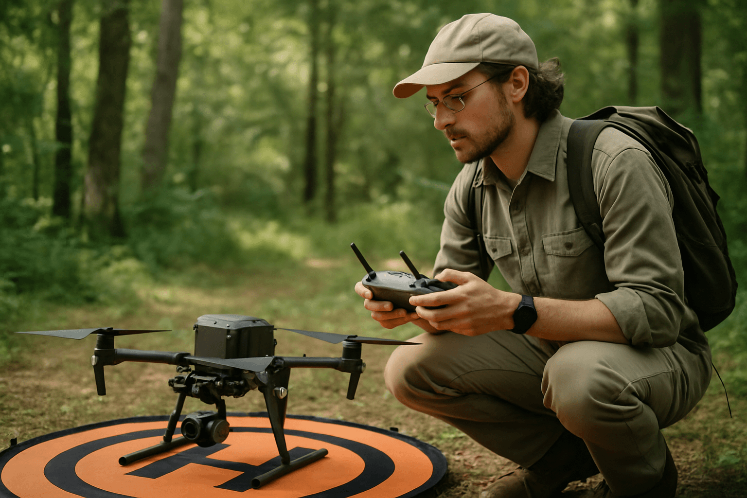
Drones represent a paradigm shift in ecological data acquisition, offering unprecedented opportunities for plant ecologists to study issues from individual plants to entire regional scales.
Beyond Traditional Fieldwork: A New Perspective
Traditional ground-based remote sensing, often relying on handheld devices or tower crane equipment, is time-consuming and limited to specific points, making it challenging to apply in complex or extensive environments. Satellite-based remote sensing, while offering broad coverage, often has limitations in spatial and temporal resolution for small-scale field phenotyping, although higher resolution satellite imagery is becoming available.
Drones, by contrast, offer a flexible and dynamic platform. They can access remote and challenging-to-reach areas, such as inaccessible cliff ecosystems, with minimal disturbance to the environment. This capability has enabled remarkable discoveries, such as the reappearance of plant species thought to be extinct and the identification of new populations of rare species.
Advantages Over Conventional Methods
The deployment of drones for botanical studies offers several compelling advantages:
- High Spatial and Temporal Resolution: Drones can acquire imagery with centimeter-level resolution, allowing for unparalleled detail that far exceeds most satellite imagery. This enables the study of fine canopy properties, individual plant characteristics, and localized changes. They can also be deployed on-demand, offering high temporal resolution for repeated observations.
- Cost-Effectiveness and Flexibility: Compared to traditional aircraft aerial photography or extensive ground surveys, drones can be more economical, especially for small to medium-sized areas. Their ease of deployment and ability to take off and land in complicated environments increase their utility in ecological studies.
- Safety and Efficiency: Drones can survey vast areas or hazardous terrains rapidly, reducing the need for manual, time-consuming, and potentially dangerous fieldwork. For example, a seeding operation that would take a team a full day of hand-seeding was completed in two hours using a drone.
Key Applications of Aerial Photography in Botany
The integration of aerial photography from drones has expanded the scope and efficiency of various botanical studies.
Mapping Vegetation and Biodiversity
High-resolution aerial photographs are crucial for vegetation mapping, particularly in inaccessible environments like wetlands. Drones can capture images with sub-centimeter pixel resolution, enabling detailed mapping and identification of small vegetation communities. This technology is instrumental in habitat mapping and monitoring, significantly enhancing plant biodiversity conservation efforts. Researchers can track changes in vegetation over time, providing essential data for assessing environmental impacts and conservation strategy effectiveness.
Assessing Plant Health and Stress Detection
Drones equipped with advanced sensors are revolutionizing the assessment of plant physiological status. They enable early detection of issues like pest infestations, disease symptoms, or nutrient deficiencies by identifying subtle changes in plant color, size, and reflectance. This is particularly vital in precision agriculture, where timely insights can optimize fertilizer use, improve crop yield, and reduce environmental impact. Studies have shown that drone-based imaging can effectively monitor crop growth and health, informing nutrient management decisions.
Species Identification and Population Monitoring
The ultra-high spatial resolution images obtained from drones are promising for identifying specific plant species and monitoring their populations. This is especially critical for rare, endangered, or invasive species. For instance, drones have been successfully used to map invasive weed species in diverse native environments, even in areas difficult to reach on foot. By capturing close-up still photos, botanists can manually identify individual plants in the lab, which are then mapped using GIS software.
Ecosystem Management and Conservation
Drones contribute significantly to ecosystem-scale monitoring and management. They facilitate the characterization of community composition, structure, foliar functional traits, and biomass. In conservation, drones provide a more comprehensive and precise representation of terrain and vegetation structure than traditional ground surveys, aiding in the development of conservation plans. They can also be utilized for tasks like strategic seeding of native grassland species in large, disrupted areas.
Advanced Sensor Technologies for Botanical Drones
The utility of drones in botanical studies is largely dependent on the variety and sophistication of the sensors they carry.
RGB Cameras: Visual Insights
Standard RGB (Red, Green, Blue) cameras capture images in the visible spectrum, similar to the human eye. These are widely used for general vegetation mapping, land use classification, and environmental monitoring due to their low cost, ease of acquisition, and high spatial resolution. Data from RGB cameras can be processed to produce orthomosaics, point clouds, and digital elevation models, providing foundational visual information.
Multispectral and Hyperspectral Sensors: Unveiling Plant Physiology
Multispectral cameras capture images across several discrete spectral bands, including those beyond the visible light range, such as Near-Infrared (NIR), Red Edge, Green, and Blue. This allows researchers to measure the light reflected and absorbed by plants in different wavelength ranges, revealing insights into plant health, chlorophyll content, and stress levels. Healthy plants, for example, reflect more NIR light.
Hyperspectral sensors take this a step further by measuring over 100 continuous spectral bands, providing extremely detailed spectral signatures. While more economically costly, hyperspectral data can detect minute differences in vegetation, offering unique insights into the physiological status of plants related to water stress, pest infestations, and disease infections.
Thermal Infrared Imaging: Detecting Stress Signatures
Thermal infrared sensors capture the thermal radiation emitted by plants, which can be used to estimate surface temperature. Changes in plant surface temperature can indicate physiological stress, such as water deficit or the onset of disease, making these sensors valuable for early detection of plant health issues.
LiDAR: 3D Structural Analysis
Light Detection and Ranging (LiDAR) sensors use pulsed laser light to measure distances to targets, generating highly accurate three-dimensional data. In botanical studies, LiDAR is crucial for characterizing canopy structural parameters like tree height, crown width, and canopy cover. It enables the creation of detailed 3D models of vegetation, which is invaluable for biomass estimation, forest inventory, and understanding complex canopy structures, even in multi-layered forests.
Data Processing and Analytical Techniques
The raw data acquired by drone-mounted sensors require sophisticated processing and analytical techniques to transform them into meaningful botanical insights.
From Pixels to Botanical Insights
Data processing typically involves imagery-based methods, point cloud analysis (for RGB and LiDAR data), and the application of statistical and physical models for multispectral and hyperspectral data. Software tools, including object-based image analysis, are employed to detect and classify vegetation. The quality and interpretability of the data depend heavily on factors such as flight altitude, image amplitude, and spatial resolution.
Integrating AI and Machine Learning
The volume and complexity of drone-acquired data increasingly necessitate the integration of artificial intelligence (AI) and machine learning (ML) techniques. These advanced algorithms can process high-resolution and spectral images to identify small-scale changes in plant health, detect disease symptoms, classify plant species, and even estimate crop yields. AI assists in analyzing canopy reflectance, which helps map and understand plant health accurately.
Challenges and Future Directions
While the utility of drones in botanical studies is undeniable, certain challenges persist.
Overcoming Operational and Data Complexities
Operational limitations such as line-of-sight requirements, relatively short battery life (typically 15 to 30 minutes), and sensitivity to weather conditions (e.g., wind) can restrict drone deployment and data collection efficiency. Furthermore, the sheer volume of high-resolution data generated by advanced sensors can lead to significant data processing complexity. Accurate identification of plant species in areas with high floristic diversity can also be challenging from imagery alone, especially when species look similar.
The Symbiosis of Drones and Other Remote Sensing Platforms
Future advancements in drone technology for botanical studies will likely focus on improving cost-effectiveness, user-friendliness, payload capacity, and battery life. A key area of development is the integration of drone data with other remote sensing platforms, such as satellite imagery. While drones excel at delivering localized, high-resolution imagery with real-time flexibility, satellites offer unmatched coverage and frequent revisit capabilities. Combining these data sources provides a comprehensive remote sensing system, enabling botanists to make more precise and informed decisions across various scales. The fusion of drone and satellite imagery, coupled with continuous advancements in sensor technology and AI-driven analytics, promises to further unlock the full potential of aerial photography in understanding and conserving the world’s botanical diversity.


