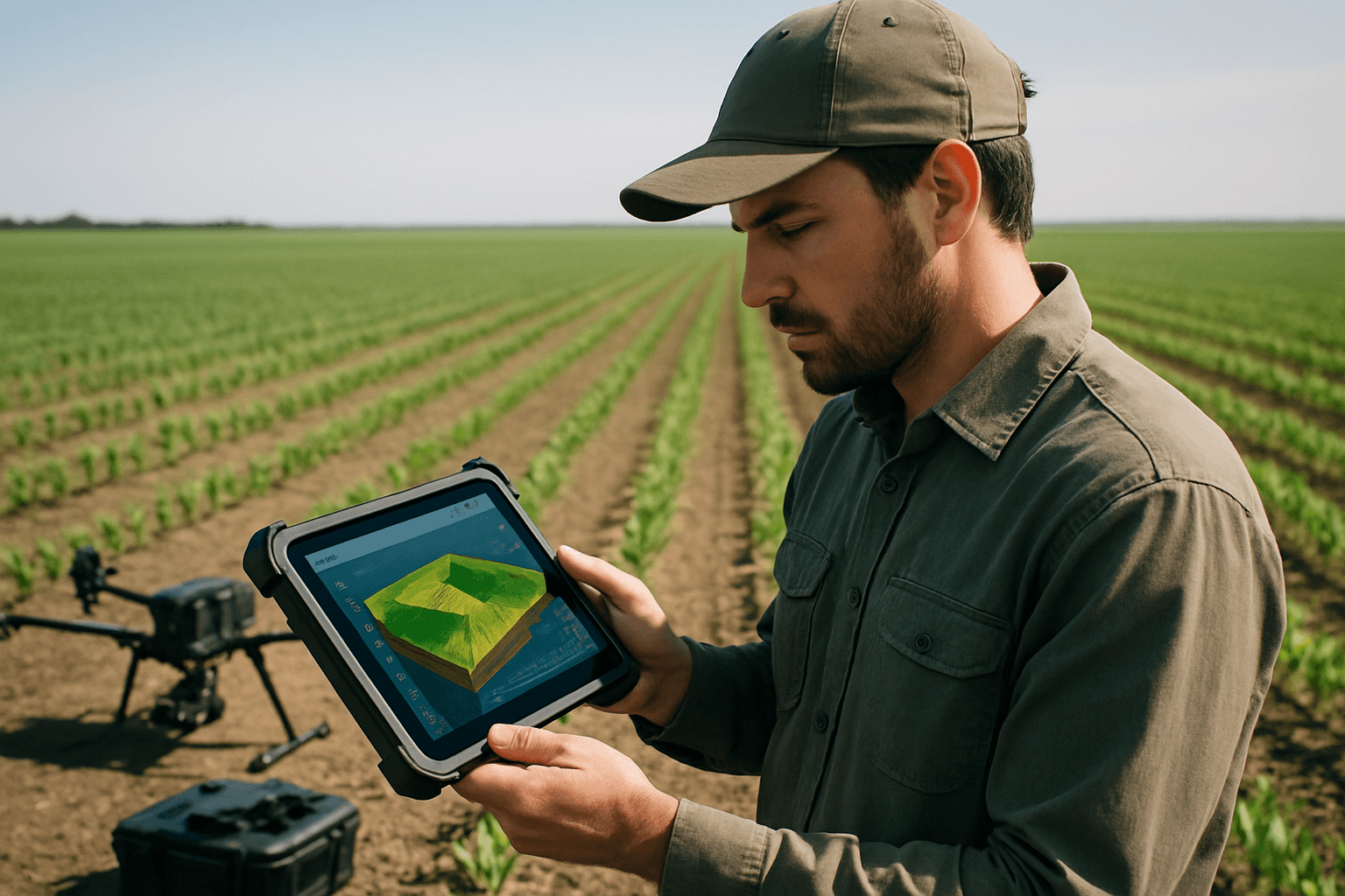
Precision agriculture is undergoing a profound transformation, driven by advancements in data-driven insights and technologies like unmanned aerial vehicles (UAVs), commonly known as drones. The ability to create detailed three-dimensional (3D) models of agricultural fields using drone data provides an unprecedented view of terrain, crop health, and environmental conditions, enabling farmers and agronomists to make highly informed decisions. This approach moves beyond traditional scouting, offering a comprehensive and real-time understanding of vast agricultural landscapes.
Understanding the Core Technology: Photogrammetry vs. LiDAR
At the heart of creating 3D field models from drone data are two primary technologies: photogrammetry and LiDAR (Light Detection and Ranging). Both methods ultimately generate detailed spatial representations but do so through different principles.
Photogrammetry
Photogrammetry involves capturing multiple overlapping two-dimensional (2D) images of an area from various angles. Specialized software then stitches these images together by identifying common points across different photos, triangulating their positions in 3D space. The result is a dense “point cloud” – a collection of millions of data points, each with X, Y, and Z coordinates, representing the field’s surface and features. From this point cloud, realistic 3D models with textures, orthomosaic maps (geometrically corrected aerial images), and Digital Surface Models (DSMs) can be generated. Photogrammetry is often a cost-effective solution, especially for areas with clear sightlines and less dense vegetation.
LiDAR
LiDAR technology, in contrast, uses laser pulses to measure distances. A drone equipped with a LiDAR sensor emits laser pulses towards the ground and measures the time it takes for each pulse to return. These measurements create a highly accurate 3D point cloud, even capable of penetrating dense foliage to map the bare earth beneath, which photogrammetry may struggle with. LiDAR is particularly valuable for precise terrain mapping, drainage analysis, and volumetric measurements, offering centimeter-level accuracy.
Essential Hardware for Data Capture
The quality and utility of 3D field models heavily depend on the drone and sensor payload used for data collection.
Drones (UAV Platforms)
The choice of drone depends on the size of the field, required flight time, and environmental conditions:
- Multirotors (e.g., Quadcopters): These are common for smaller fields or areas requiring high maneuverability and the ability to hover. They are generally easier to operate and deploy.
- Fixed-Wing Drones: Ideal for covering large agricultural areas quickly due to their higher speed and longer flight endurance on a single battery charge. They typically require more space for takeoff and landing.
- VTOL (Vertical Take-Off and Landing) Fixed-Wing Drones: Combine the advantages of both multirotors (vertical takeoff/landing) and fixed-wings (efficient forward flight), making them versatile for varied terrain and larger coverage.
Sensors
The type of sensor dictates the kind of data collected and, consequently, the insights that can be derived:
- RGB Cameras: Standard visible light cameras capture images similar to what the human eye sees. These are useful for basic visual inspections, mapping field boundaries, and creating orthomosaics. High-resolution RGB cameras (e.g., 20 MP minimum, up to 61 MP) provide detailed imagery for general field mapping.
- Multispectral Sensors: These cameras capture data across specific light spectrums beyond visible light, particularly in near-infrared. This is crucial for calculating vegetation indices like NDVI (Normalized Difference Vegetation Index) or NDRE (Normalized Difference Red Edge), which reveal plant health, stress levels, nutrient deficiencies, and disease outbreaks often invisible to the naked eye.
- Hyperspectral Sensors: Offer even finer spectral resolution than multispectral sensors, providing more detailed information for advanced crop analysis and precise identification of issues.
- Thermal Cameras: Detect heat signatures, useful for monitoring irrigation effectiveness, identifying water stress, or spotting areas of unusual temperature, which can indicate pest infestations or disease.
- LiDAR Sensors: As discussed, these active sensors are essential for accurate elevation modeling, especially in vegetated areas, providing detailed terrain models and volumetric measurements.
Positioning Systems
To ensure the accuracy and georeferencing of the collected data, drones are equipped with:
- GPS/GNSS (Global Navigation Satellite System): Provides precise positioning data for the drone and the captured images, enabling accurate spatial referencing.
- RTK (Real-Time Kinematic) and PPK (Post-Processed Kinematic) Systems: These technologies enhance GPS accuracy to centimeter-level precision by correcting positional errors using a ground-based reference station or post-processing algorithms. This eliminates the need for extensive ground control points (GCPs) in many cases, although GCPs can still further improve accuracy.
- IMU (Inertial Measurement Unit): Measures the drone’s acceleration, angular rate, and orientation, providing crucial data for stabilizing the sensors and accurately positioning the captured imagery.
Optimizing Drone Flight for Data Collection
Effective data collection is the foundational step for creating high-quality 3D models. Flight planning software and adherence to best practices are critical.
Mission Planning
Most professional drone mapping involves automated flight planning software (e.g., Pix4Dcapture Pro, DroneDeploy). These applications allow operators to:
- Define Flight Paths: Plot the specific area to be mapped, ensuring complete coverage.
- Set Altitude: Flight altitude directly influences the ground sample distance (GSD) or resolution of the captured images; lower altitudes yield higher resolution but cover smaller areas per flight.
- Determine Overlap: High image overlap (typically 60-70% front-lap and side-lap) is crucial for photogrammetry software to accurately stitch images and create precise 3D models.
- Specify Camera Angle: While nadir (straight down) shots are common, capturing images at oblique angles (e.g., 30°, 45°, 70° gimbal angle) from different altitudes can significantly improve the detail and accuracy of 3D models, especially for features with vertical complexity.
Environmental Considerations
- Weather Conditions: Flights should ideally occur in clear weather to avoid shadows, inconsistent lighting, and wind, which can affect image quality and processing accuracy.
- Time of Day: Consider sun angle to minimize long shadows that can obscure ground features and negatively impact photogrammetric reconstruction.
Processing Drone Data into 3D Models
Once drone data is collected, it moves into the processing phase, transforming raw images or LiDAR scans into actionable 3D models and maps.
Photogrammetry Software
This specialized software is the “engine” that processes drone-captured images into 3D models and maps. Popular options include:
- Pix4D (e.g., Pix4Dfields, Pix4Dmapper): Offers comprehensive solutions for agricultural mapping, generating orthomosaics, vegetation index maps, DSMs, and zonation maps. Pix4Dfields can even process data rapidly in-field without an internet connection.
- DroneDeploy: A cloud-based platform known for intuitive workflows, automated flight planning, and rapid processing to generate 2D maps and 3D models.
- DJI Terra: Specifically designed to work seamlessly with DJI Enterprise drones and payloads, supporting accurate 2D and 3D reconstruction from visible light and LiDAR data.
- Agisoft Metashape: A professional photogrammetry software capable of generating high-quality 3D models from a minimal number of photographs.
- Other Options: Correlator3D and ODM are also recognized for their capabilities in generating accurate 2D maps and 3D models.
The general workflow within these software solutions involves:
- Image Stitching and Alignment: Overlapping images are aligned and stitched together to create a single, georeferenced orthomosaic.
- Point Cloud Generation: Based on the aligned images, a dense 3D point cloud is constructed.
- Mesh and Texture Creation: The point cloud is used to generate a 3D mesh (a digital skeleton of vertices, edges, and faces), and textures from the original images are applied to create realistic 3D models.
- Digital Surface Model (DSM) / Digital Elevation Model (DEM) Generation: These models represent the elevation of the terrain and crops. A DSM includes the height of objects on the surface (e.g., plants, buildings), while a DEM often represents the bare earth elevation.
LiDAR Processing Software
For LiDAR data, specialized software (e.g., LiDAR 360, DJI Terra) processes the laser scan data to create highly accurate point clouds and subsequent terrain models, often focusing on ground surface features.
Key Outputs and Their Agricultural Applications
The 3D models and derived maps generated from drone data offer a wealth of information for precision agriculture:
Digital Surface Models (DSMs) and Digital Elevation Models (DEMs)
These models provide detailed topographic data of the field.
- Drainage Analysis: Identifying areas of poor drainage or water accumulation, crucial for optimizing irrigation and preventing waterlogging.
- Slope Analysis: Understanding terrain variations for optimal planting patterns, erosion control, and planning agricultural machinery routes.
- Volumetric Measurements: Calculating quantities of stockpiles, earthworks, or even biomass for yield estimation.
Orthomosaic Maps
High-resolution, georeferenced 2D maps of the entire field.
- Field Mapping: Accurate mapping of field boundaries, existing infrastructure, and land use.
- Base Layer for Analysis: Serve as a foundational visual layer for overlaying other data like soil samples or sensor data.
Point Clouds
Raw 3D data representing surfaces and objects within the field.
- Detailed Site Representation: Provide a comprehensive 3D digital twin of the field, allowing for detailed measurements and visualization from any angle.
- Input for Further Analysis: Can be used to derive specific measurements such as plant height or canopy volume, contributing to crop growth progression analysis.
Vegetation Indices (e.g., NDVI, NDRE)
Derived from multispectral imagery, these maps visualize plant health and stress.
- Crop Health Monitoring: Early detection of disease, pest infestations, and nutrient deficiencies.
- Variable Rate Application (VRA): Creating prescription maps for targeted application of fertilizers, pesticides, and irrigation, reducing waste and optimizing input use.
- Yield Estimation: Analyzing crop vigor and growth patterns to predict potential yields.
Best Practices for Accurate 3D Field Modeling
To maximize the accuracy and utility of 3D models from drone data, consider the following best practices:
- Consistent Data Collection: For time-series analysis (monitoring crop growth over seasons), collect data under similar environmental conditions (e.g., time of day, cloud cover) and at consistent altitudes and overlaps to ensure comparability.
- Optimal Overlap and Side-lap: Maintain at least 60-70% image overlap to ensure sufficient common points for robust photogrammetric reconstruction.
- Varying Camera Angles: Incorporate oblique imagery in addition to nadir shots for improved 3D model detail, especially for vertical structures or complex terrain.
- Ground Control Points (GCPs): While RTK/PPK systems reduce the reliance on GCPs, strategically placed and accurately surveyed GCPs can significantly enhance the absolute accuracy and georeferencing of the final 3D model, particularly for larger areas or precise measurements.
- Data Integration: Combine drone data with other agricultural datasets (e.g., soil tests, weather data, yield maps) within a Geographic Information System (GIS) for a holistic view and more powerful analytical capabilities.
- Ground Truthing: Always verify drone-derived insights with on-the-ground observations. This helps in calibrating the models and validating the interpretations, leading to more reliable decision-making.
- Choosing the Right Software: Select processing software that aligns with your specific needs, drone hardware, and desired outputs for agricultural applications. Many software solutions are tailored for agriculture, offering specialized tools for crop health analysis and prescription map generation.
Conclusion
The creation of 3D models of fields using drone data is a cornerstone of modern precision agriculture. By systematically collecting high-resolution imagery and spatial data with advanced drones and sensors, and subsequently processing this data with sophisticated photogrammetry or LiDAR software, agricultural professionals gain unparalleled insights into their fields. This technology empowers data-driven decision-making, leading to optimized resource management, improved crop health, increased yields, and a more sustainable and efficient farming future.


