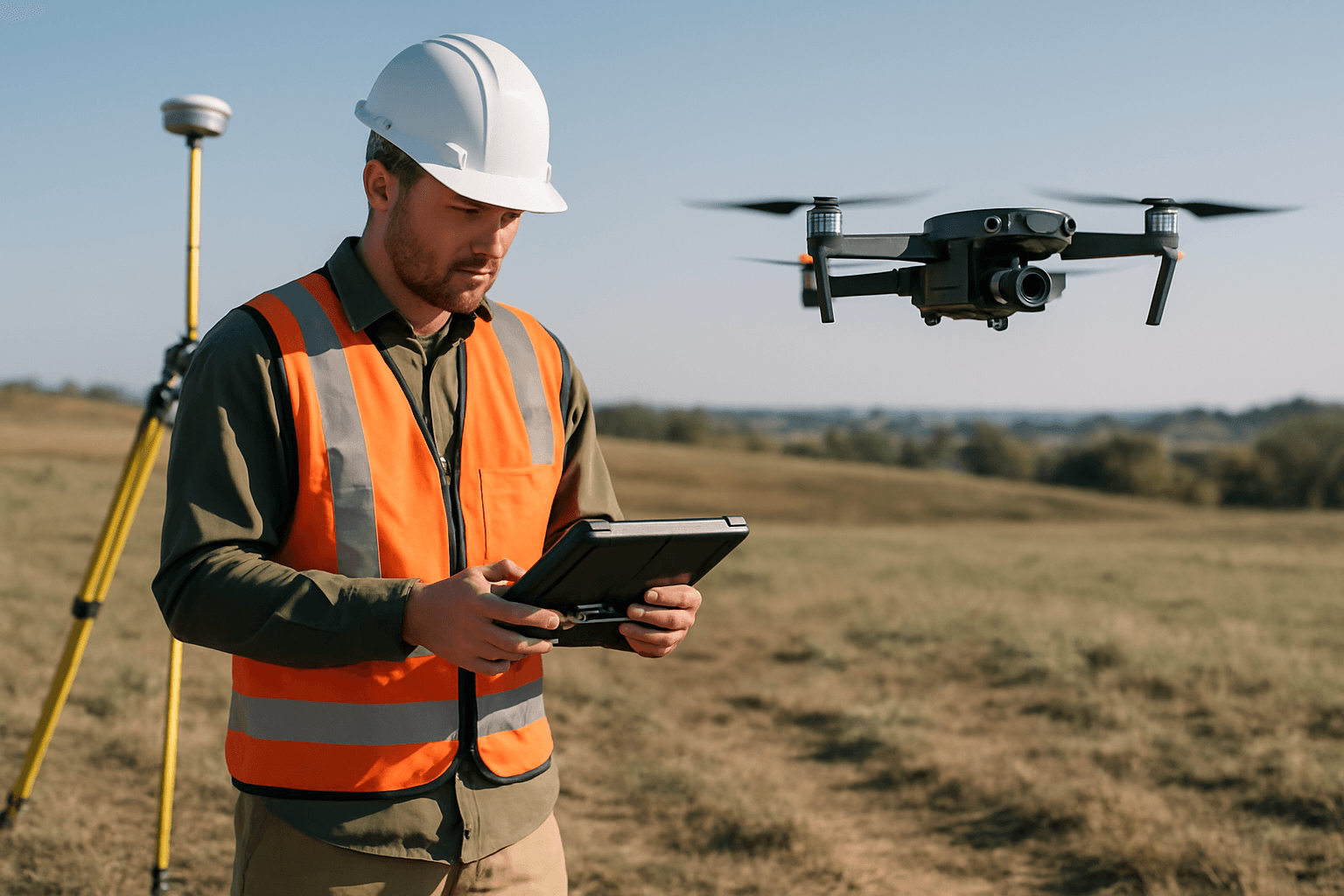
The landscape of land surveying has been fundamentally transformed by the advent of Unmanned Aerial Systems (UAS), commonly known as drones. These sophisticated aerial platforms, equipped with advanced sensors and precise navigation systems, offer a compelling alternative to traditional surveying methods. The integration of drones into surveying workflows provides a multitude of benefits, enhancing efficiency, accuracy, safety, and cost-effectiveness across various industries.
Enhanced Efficiency and Speed in Data Acquisition
One of the most significant advantages of employing drones for land surveying is the remarkable increase in speed and efficiency of data collection. Traditional surveying methods, often labor-intensive and time-consuming, can take days or even weeks to cover large or challenging areas. In stark contrast, a single drone can rapidly survey vast tracts of land, capturing high-resolution images and data in a mere fraction of that time—sometimes covering hundreds of hectares in just a couple of flights. This rapid data acquisition significantly accelerates project timelines, enabling faster planning and decision-making for various development and management initiatives. Studies indicate that capturing topographic data with a drone can be up to five times faster than land-based methods and requires less manpower.
Superior Accuracy and Data Precision
Drones equipped with advanced Global Positioning System (GPS) technology, LiDAR (Light Detection and Ranging) sensors, and high-resolution cameras enable surveyors to collect exceptionally accurate and detailed data. This enhanced precision is crucial for critical applications in urban planning, environmental monitoring, construction, and agriculture.
High-Resolution Imagery and 3D Modeling
Drone surveys generate high-resolution orthomosaics and detailed 3D models, even for areas with outdated or no existing data. The captured images, often with a low Ground Sample Distance (GSD) of 1-3 cm, provide intricate details that may be missed by traditional methods. Post-processing with photogrammetry software allows for the creation of geo-referenced orthomosaics, detailed elevation models, contour lines, breaklines, and 3D reconstructions of land sites or buildings. These models can be used to extract highly accurate distances, volumetric measurements, and other critical geospatial information.
Advanced Sensor Technology
The integration of LiDAR sensors in drones is a game-changer for surveying, as it uses laser pulses to measure distances and create highly detailed 3D models of terrain, even penetrating through foliage and clouds. This capability is particularly beneficial for identifying elevation changes and subtle landscape features. Real-Time Kinematic (RTK) and Post-Processed Kinematic (PPK) systems further enhance accuracy, refining satellite data to achieve centimeter-level precision.
Enhanced Safety and Accessibility
Traditional land surveying often involves exposing personnel to hazardous environments such as steep slopes, remote locations, active construction sites, or areas with difficult terrain. Drones significantly mitigate these risks by allowing surveyors to collect data from a safe distance.
Reaching Inaccessible or Dangerous Areas
An aerial surveying drone can take off and fly almost anywhere, overcoming limitations posed by unreachable areas, unsafe steep slopes, or harsh terrain unsuitable for traditional measuring tools. Drones can navigate dense forests, rugged mountains, cliffs, railways, or even operate in areas with hazardous conditions without putting human surveyors in harm’s way. This capability is invaluable for surveying sites that are environmentally sensitive or challenging to navigate on foot.
Minimal Site Disruption
Drone surveys can often be conducted without needing to close down highways, train tracks, or interrupt ongoing site operations, which contributes to overall safety and reduces organizational overhead.
Significant Cost-Effectiveness
While there might be an initial investment in drone technology, the long-term cost savings associated with drone surveying are substantial, making it a more economical option compared to traditional methods, especially for large-scale projects.
Reduced Labor and Operational Costs
Drones significantly reduce labor costs as they require less manpower and time on-site. A survey that might take a week with traditional methods could be completed in a single day using drones. This minimizes expenses related to crew, equipment, travel, and accommodation. The operating costs of drones are considerably lower than those of manned aircraft or helicopters, which can be up to 10 times more expensive for aerial topography.
Faster Project Completion
The accelerated data collection and processing capabilities of drones lead to faster project completion times. This efficiency translates directly into cost savings by reducing holding costs and accelerating project timelines, particularly crucial in land development and property transactions.
Comprehensive Data and Repeatability
Drones capture a more comprehensive set of data compared to traditional point-by-point measurements, allowing for a richer understanding of the surveyed area. The repeatability of drone surveys also ensures consistent data acquisition over time.
Detailed and Versatile Deliverables
Unlike total stations that generate individual point measurements, drones produce a greater number of measurements that can be represented in various formats, including Digital Terrain Models (DTM), Digital Surface Models (DSM), point clouds, contour lines, and orthomosaic maps. This wealth of 3D geographic information allows for more accurate volume measurements and detailed topographic surveys for land management and planning.
Real-time Monitoring and Analysis
Drones enable remote monitoring and data analysis, providing stakeholders with intricate data in near real-time. This capability facilitates early identification of potential issues, aids in dispute resolution, and improves project management by allowing for confident and accurate tracking of changes and progress over time.
Environmental Benefits
Beyond the direct surveying advantages, the use of drones also offers environmental benefits. Drones generally produce less noise and emissions compared to traditional surveying methods involving ground vehicles or manned aircraft, thereby reducing the environmental impact of the surveying process. They can also be used to monitor and assess the environmental impact of construction or development projects.
In conclusion, the integration of UAS technology has profoundly revolutionized land surveying. The unparalleled benefits of drones in terms of speed, accuracy, safety, cost-effectiveness, and data richness make them an indispensable tool for modern surveyors across a myriad of industries. As drone technology continues to advance, its role in shaping the future of geospatial data acquisition and analysis will undoubtedly continue to expand.


