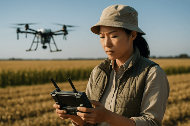
Environmental emergencies, ranging from catastrophic oil spills to devastating wildfires and hazardous material releases, pose immediate and long-term threats to ecosystems and human populations. The urgency and often hazardous nature of these events demand rapid, accurate, and safe assessment and response. Unmanned Aerial Systems (UAS), commonly known as drones, have emerged as an indispensable tool, revolutionizing how agencies deploy resources and gather critical intelligence in these high-stakes scenarios. Their ability to access remote, dangerous, or otherwise inaccessible areas provides a unique vantage point and real-time data, enhancing situational awareness and informing crucial decision-making.
The Pivotal Role of Drones in Environmental Emergency Response
Traditionally, environmental emergency responses relied on manned aircraft or ground teams, which can be slow, costly, and dangerous. Drones offer a safer, faster, and more cost-effective alternative, capable of providing high-resolution data in real-time without risking human lives. They can navigate complex terrains, hazardous environments, and areas with compromised infrastructure, offering a comprehensive overview of the affected zone.
Defining Environmental Emergencies and Drone Utility
Environmental emergencies encompass a broad spectrum of incidents with significant ecological impact, including:
- Oil and Chemical Spills: Accidental releases into marine or terrestrial environments.
- Wildfires: Large-scale, uncontrolled blazes that devastate natural habitats.
- Hazardous Material (HAZMAT) Incidents: Leaks or explosions involving toxic substances.
- Natural Disasters: Earthquakes, floods, hurricanes, and landslides that disrupt ecosystems and infrastructure.
In these scenarios, drones are utilized for:
- Rapid Damage Assessment: Quickly surveying affected areas to gauge the extent of damage to infrastructure and natural resources.
- Situational Awareness: Providing live video feeds and imagery to command centers, enabling informed decision-making.
- Environmental Monitoring: Detecting and mapping the spread of pollutants, identifying hotspots, and tracking environmental changes.
- Search and Rescue (SAR): Locating missing persons or wildlife in difficult-to-reach areas, often using thermal imaging.
- Communication Relay: Restoring communication networks in areas where traditional infrastructure is damaged.
- Delivery of Supplies: Transporting vital medical supplies, food, or other essentials to isolated areas.
Key Drone Deployment Strategies
Effective drone deployment in environmental emergencies requires tailored strategies based on the specific incident, terrain, and desired outcomes.
1. Rapid Response and Initial Assessment
In the immediate aftermath of an environmental emergency, speed is paramount.
- First Responder Drones: Lightweight, easily deployable multirotor drones (e.g., DJI Mavic 2 Enterprise) equipped with high-resolution visual and thermal cameras are ideal for initial scene assessment. These can be launched within minutes to provide an aerial overview, identify immediate threats, and locate victims or hazardous materials.
- Real-time Data Streaming: Drones should be capable of live video streaming to incident command, ensuring that responders on the ground and decision-makers off-site have immediate situational awareness.
- Small-scale Mapping: For localized incidents, drones can quickly generate 2D or 3D maps to understand the immediate impact and plan initial response routes.
2. Systematic Mapping and Large-Area Coverage
For widespread environmental disasters, systematic mapping strategies are employed to cover larger areas efficiently.
- Fixed-wing UAVs: These drones are more stable, can fly longer at higher speeds, and cover vast expanses, making them suitable for aerial surveys and photogrammetry over large affected regions, such as extensive wildfires or floodplains. Some fixed-wing models now offer Vertical Take-Off and Landing (VTOL) capabilities, combining the advantages of both types.
- Grid and Transect Patterns: Automated flight plans leverage grid or transect patterns to ensure comprehensive data collection for mapping, damage assessment, and tracking the spread of contaminants.
- High-Resolution and Multispectral Imaging: Equipped with advanced sensors like multispectral, hyperspectral, and LiDAR, these drones can capture detailed data for environmental impact assessments, vegetation health analysis post-fire, or precise mapping of spill extents.
3. Persistent Monitoring and Long-Term Surveillance
Environmental emergencies often require prolonged monitoring to track recovery, detect ongoing issues, or survey wildlife.
- Long-Endurance Drones: Drones with extended battery life or hybrid power systems (e.g., some fixed-wing or specialized multirotors) are crucial for continuous surveillance over hours or even days.
- Automated Missions: Pre-programmed autonomous flights allow for repetitive data collection over the same area, enabling change detection and long-term environmental trend analysis.
- Payload Versatility: For specific monitoring tasks, drones can be fitted with specialized sensors like gas sniffers for air quality monitoring, water samplers for pollution assessment, or acoustic sensors for wildlife tracking.
Applications in Specific Environmental Emergency Scenarios
Oil and Chemical Spills
Drones play a vital role in marine and coastal environmental emergencies involving spills. They can rapidly assess the extent and movement of oil or hazardous noxious substances (HNS) on the sea surface. Thermal cameras can detect marine fauna affected by spills, even at night, while specialized samplers can collect floating pollutant samples.
Wildfire Management
During wildfires, drones provide critical aerial perspectives to identify hotspots, track the fire’s spread, and guide firefighting efforts. Thermal imaging is particularly effective for detecting heat signatures through smoke. Post-fire, drones can assess damage to infrastructure and vegetation.
Hazardous Material (HAZMAT) Incidents
In HAZMAT situations, drones equipped with gas and chemical sensors can detect toxic fumes and volatile substances from a safe distance, providing crucial data on concentration and dispersion without exposing human responders to risk.
Ecological Surveys Post-Disaster
Following floods or other natural disasters, drones can assist experts in conducting wildlife surveys, monitoring animal populations, and assessing habitat damage. The ability to operate beyond visual line of sight (BVLOS) can be especially useful for searching for wildlife over large areas.
Essential Considerations for Effective Drone Deployment
Successful drone operations in environmental emergencies require careful planning and adherence to best practices.
Regulatory Framework and Airspace Management
Navigating complex regulatory frameworks is a primary challenge. Different countries and even local jurisdictions have varying laws regarding drone usage, including altitude limits, no-fly zones, and licensing requirements.
- Expedited Approvals: Establishing pre-approved disaster management protocols and obtaining emergency-specific certifications or waivers (e.g., FAA Part 107 waivers, Special Governmental Interest (SGI) process in the US) can significantly expedite deployment during critical times.
- Temporary Flight Restrictions (TFRs): Responders must be aware of and comply with TFRs issued around disaster zones, ensuring their operations do not interfere with manned aircraft involved in relief efforts.
- BVLOS Operations: For extensive areas, Beyond Visual Line of Sight (BVLOS) operations are often necessary, requiring special permissions and advanced training. The proposed FAA Part 108 aims to streamline these complex operations.
Drone Hardware and Payload Selection
The choice of drone and its payload is critical for mission success.
- Durability and Weather Resistance: Drones must be rugged, waterproof, and dustproof, capable of operating in harsh conditions like strong winds, heavy rain, or extreme temperatures.
- Flight Time and Battery Management: Long flight times are essential, supported by swappable battery systems or solar-powered drones for continuous operation.
- Sensor Compatibility: Drones should support a variety of advanced sensors, including high-resolution RGB, thermal, multispectral, hyperspectral, LiDAR, and gas detectors, depending on the specific environmental challenge.
- Navigation and Obstacle Avoidance: GPS navigation, obstacle avoidance capabilities, and stable flight in challenging environments are crucial.
Data Management and Processing
Drones generate vast amounts of data, necessitating robust management and analysis systems.
- Large Data Volume: A single drone flight can produce terabytes of high-resolution images and video.
- Automated Analysis: Artificial intelligence (AI) and machine learning algorithms are vital for automating data interpretation, identifying anomalies, and extracting critical information from large datasets quickly.
- Cloud-based Processing and GIS Integration: Cloud platforms facilitate processing and management, while compatibility with Geographic Information System (GIS) tools enables seamless integration with existing mapping and planning systems.
Team Training and Collaboration
Effective drone operations rely on highly trained personnel and seamless team collaboration.
- Certified Pilots and Experts: A survey team typically requires experienced drone pilots, experts in environmental assessment (e.g., marine biologists for spills), and data analysts.
- Continuous Training: Operators need comprehensive training in flight controls, advanced navigation, emergency procedures, and adapting to evolving regulations.
- Inter-agency Coordination: Multi-agency collaboration, including police, fire, emergency management, and environmental agencies, is crucial for coordinated response efforts.
The Future of Drone Deployment in Environmental Emergencies
The role of drones in environmental emergencies is continually expanding. Future trends point towards increased autonomy, drone swarms, and deeper integration with IoT (Internet of Things) and AI. Advancements in battery technology, ruggedized drone designs, and improved communication systems will further enhance their capabilities. As regulatory frameworks evolve and technology becomes more sophisticated, drones will become even more integral to safeguarding our environment and responding effectively to crises.


