In an era marked by an increasing frequency and intensity of natural and man-made catastrophes, the ability to rapidly assess disaster impact is paramount. Every minute saved in the immediate aftermath can mean the difference between life and death. Unmanned Aerial Systems (UAS), commonly known as drones, have emerged as transformative tools in disaster management, revolutionizing how first responders and search and rescue (SAR) teams operate in complex, hazardous environments. From pinpointing survivors amidst rubble to mapping vast destruction zones, drones offer an unprecedented aerial advantage for swift and informed decision-making.
The Urgent Need for Rapid Disaster Assessment
Traditional disaster assessment methods often involve significant risks to human responders and are constrained by limited accessibility, treacherous terrain, and poor visibility. Manned aircraft, while powerful, are expensive, require extensive logistical support, and cannot operate safely in all conditions or at low altitudes over disaster zones. These limitations highlight a critical gap in early-phase disaster recovery, where timely information is crucial for successful search and rescue operations. Drones address these challenges by offering a safer, faster, and more cost-effective alternative for data collection and situational awareness.
Core Drone Deployment Techniques for Disaster Impact Assessment
Effective drone deployment hinges on tailored strategies that leverage specific drone types and advanced payloads for various assessment needs.
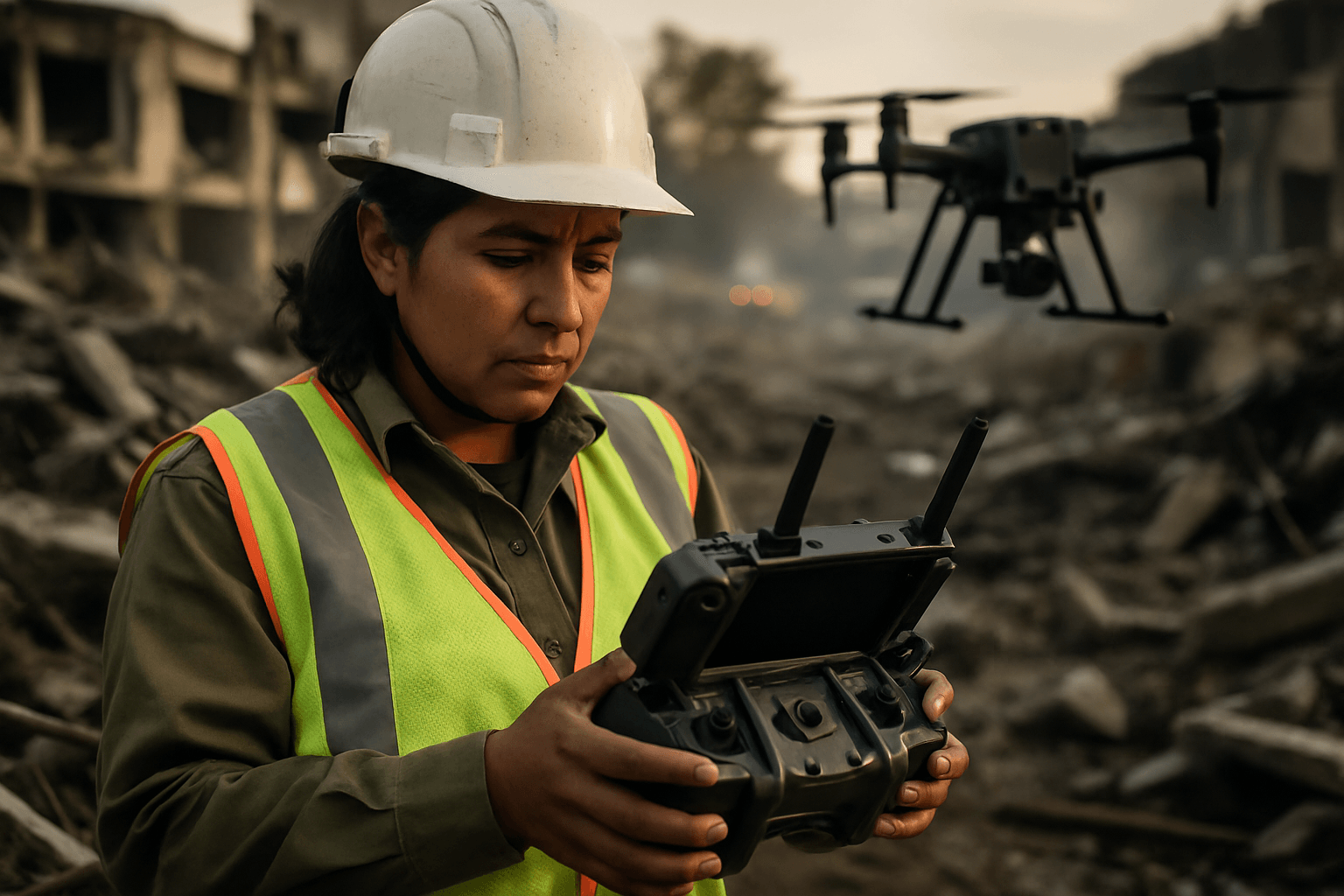
Aerial Reconnaissance and Situational Awareness
One of the most immediate uses of drones in a disaster is initial rapid assessment and providing real-time situational awareness.
- Rapid Sweeps: Lightweight, easily deployable multi-rotor drones (e.g., DJI Mavic 3 Thermal, Autel EVO MAX 4T) can be airborne within minutes to conduct initial sweeps of affected areas, providing live video feeds to command centers. Fixed-wing drones, like the SenseFly eBee X, are better suited for covering vast areas quickly due to their longer flight times and efficiency.
- Live Video Streaming: This capability ensures that ground responders and decision-makers receive immediate visual intelligence, helping them understand the scope of the disaster, identify immediate hazards, and plan initial response routes.
Advanced Mapping and 3D Modeling
Beyond live video, drones excel at generating precise spatial data critical for comprehensive damage assessment and recovery planning.
- LiDAR Drones: Light Detection and Ranging (LiDAR) drones utilize laser pulses to create highly accurate 3D models of terrain and structures, even penetrating dense vegetation. This is invaluable for assessing structural damage, identifying safe routes through debris, mapping floodplains, and evaluating changes in elevation caused by landslides or earthquakes. Popular LiDAR-equipped drones include the DJI Matrice 300 RTK.
- Photogrammetry with High-Resolution Cameras: Drones equipped with high-resolution cameras capture detailed imagery that, when processed through photogrammetry software, can generate orthomosaic maps and 3D reality captures. These detailed visuals aid in quantifying the extent of devastation, assessing the integrity of damaged buildings and roads, and identifying critically impacted zones.
Thermal Imaging for Search and Rescue (SAR)
Thermal imaging (infrared) cameras are game-changers in search and rescue, enabling drones to detect heat signatures invisible to the naked eye.
- Low-Visibility Operations: Thermal drones are essential in conditions with poor visibility, such as dense smoke from wildfires, fog, complete darkness, or through light foliage and rubble. They can efficiently locate missing or trapped persons by identifying their body heat.
- Examples in SAR: Thermal imaging has been successfully used to spot survivors in collapsed buildings after earthquakes, locate individuals stranded in floodwaters, and track people lost in wilderness or marine environments. Drones like the Parrot Anafi USA and DJI Mavic 3 Thermal come equipped with FLIR thermal sensors.
Specialized Deployment Methods and Capabilities
The versatility of drones extends to several other critical functions in disaster response.
- Drone Swarms: For large-scale search operations, drone swarms can be deployed to cover vast areas efficiently. These coordinated fleets divide the search zone, with each drone responsible for a specific section, significantly reducing search time. Their collective intelligence allows them to adapt search patterns based on real-time data and focus resources on high-probability areas.
- Communication Relays: Disasters often disrupt cellular networks, isolating affected regions. Drones can act as temporary communication relays, establishing mesh networks or satellite communication links to restore connectivity for rescue teams and survivors, enabling better coordination and information sharing.
- Payload Delivery: Cargo or payload drones can transport essential supplies, such as medical aid, food, water, ropes, or harnesses, to hard-to-reach areas where traditional ground or air vehicles cannot access.
- Environmental Monitoring: Drones equipped with specialized sensors can detect and map the spread of pollutants, identify hazardous material leaks, monitor air quality, and track environmental changes post-disaster, crucial for containment and safety.
Enabling Technologies and Advanced Payloads
The effectiveness of drone deployment is heavily reliant on cutting-edge hardware and software.
- Sensor Suites: Beyond standard visual and thermal cameras, drones for disaster response can carry multispectral and hyperspectral cameras for detailed environmental analysis, zoom cameras for close-up inspections, and gas detectors for hazardous material identification. Some are also equipped with spotlights and speakers for communicating with survivors or directing ground teams.
- AI and Machine Learning: Artificial Intelligence (AI) and machine learning algorithms are revolutionizing drone data processing. AI can analyze vast amounts of drone imagery in real-time, rapidly identifying damage patterns, classifying building and road damage, and distinguishing between humans and animals. Systems like CLARKE, developed at Texas A&M University, can assess thousands of homes in minutes, providing actionable insights and even suggesting safe routes for responders. AI also assists in optimizing flight paths and predicting survivor locations.
- Connectivity: Robust communication systems are vital. Drones can be controlled over 4G/LTE/5G networks, and some are equipped with satellite communication systems and mesh networks to ensure uninterrupted data transmission and control, even when local infrastructure is compromised.
- Drone Types: A mix of drone types is often required. Multi-rotor drones (e.g., DJI Phantom 4 RTK, DJI Matrice 300 RTK) are highly maneuverable and can hover, making them ideal for detailed inspections and confined spaces. Fixed-wing drones are designed for long-range flights and efficient coverage of large areas. Hybrid VTOL (Vertical Takeoff and Landing) drones combine the agility of multi-rotors with the endurance of fixed-wings, offering greater operational flexibility.
Benefits of Drone-Assisted Disaster Response
The integration of UAS into disaster management offers numerous advantages:
- Increased Safety for Responders: Drones minimize the risk to human personnel by allowing remote assessment of dangerous, unstable, or contaminated environments.
- Faster Response and Assessment Times: Drones can be deployed rapidly, often within minutes, providing critical data far quicker than traditional methods. This speed is crucial during the “golden hours” for search and rescue.
- Access to Dangerous and Inaccessible Areas: Drones can navigate collapsed structures, dense forests, floodwaters, or hazardous material zones that are too risky or impossible for humans to reach.
- Enhanced Data Accuracy and Detail: High-resolution cameras, thermal sensors, and LiDAR systems provide highly detailed and accurate information, enabling better planning and resource allocation.
- Cost-Effectiveness Compared to Manned Aircraft: Deploying drones is generally more cost-effective than using helicopters or other manned aircraft for aerial surveillance and data collection.
Challenges and Considerations in Drone Deployment
Despite their immense potential, drone deployment in disaster scenarios faces several hurdles:
- Regulatory and Legal Frameworks: Navigating complex and varying regulations regarding airspace, flight restrictions over certain areas, and licensing can delay deployment during emergencies. Establishing pre-approved protocols and emergency-specific waivers can help streamline this process.
- Limited Flight Time and Battery Life: Most drones have finite battery life, which can restrict their range and operational duration, particularly in large-scale disasters. Solutions include advancements in battery technology (e.g., solar-powered, hydrogen-powered), swappable battery systems, and multi-drone deployment strategies for continuous coverage.
- Data Overload and Processing Bottlenecks: Drones generate massive amounts of data. Managing, analyzing, and translating this raw data into actionable insights in real-time can be overwhelming. The integration of AI and machine learning is crucial for efficient data processing.
- Communication and Connectivity Issues: Damaged infrastructure in disaster zones can lead to unreliable communication networks, hindering drone control and data transmission. Satellite communication and mesh networks can provide solutions.
- Adverse Weather Conditions: Strong winds, heavy rain, or extreme temperatures can limit drone flight capabilities and performance. Drones designed for durability and weather resistance are essential.
- Ethical and Privacy Concerns: Using drones in populated areas raises questions about privacy and surveillance. Transparent communication and adherence to strict data privacy measures are necessary to build public trust.
- Public-Private Partnerships and Coordination: Effective drone deployment requires seamless collaboration and coordination among government agencies, NGOs, private companies, and even volunteer pilots. Establishing clear chains of command and shared software platforms are best practices.
Case Studies: Drones in Action
Drones have proven their worth in numerous real-world disaster scenarios:
- During Hurricane Harvey and Irma (2017), drones were deployed for damage assessment, providing critical situational awareness for responders and recovery programs.
- Following the 2020 Beirut port explosion, drones were instrumental in mapping the widespread destruction, facilitating relief efforts and accurate damage assessment for restoration projects.
- In the aftermath of the 2015 Nepal earthquake, international agencies deployed drones to better assess the situation and aid in relief work, especially when traditional transportation routes were destroyed.
- The 2024 hurricane season saw the deployment of AI tools like CLARKE, which used drone imagery to rapidly assess building and road damage in Florida and Pennsylvania after Hurricanes Debby and Helene, saving lives and resources.
The Future of Drones in Disaster Response
The future of drones in disaster response is rapidly advancing. Further integration of AI and machine learning will lead to more autonomous operations, allowing drones to make intelligent decisions in the field, optimize search patterns, and provide even faster analysis. Developments in battery technology, including hydrogen-powered drones, will extend flight times and operational range. Improved sensor capabilities, combined with advanced data processing platforms, will offer even higher resolution data and more sophisticated environmental monitoring. Standardization of protocols and enhanced inter-agency cooperation will ensure more efficient and coordinated drone deployments globally. The concept of “drone-in-a-box” solutions, where drones are strategically stationed and ready for immediate, autonomous deployment, also holds significant promise for rapid response.
Conclusion
Drone technology has undeniably transformed rapid assessment of disaster impact and search and rescue operations. By overcoming the limitations of traditional methods, providing real-time data, enhancing responder safety, and delivering unparalleled situational awareness, drones are now an indispensable asset in the global effort to mitigate the devastating effects of disasters. As these technologies continue to evolve, their role will only become more critical in saving lives, expediting recovery, and building more resilient communities worldwide.


