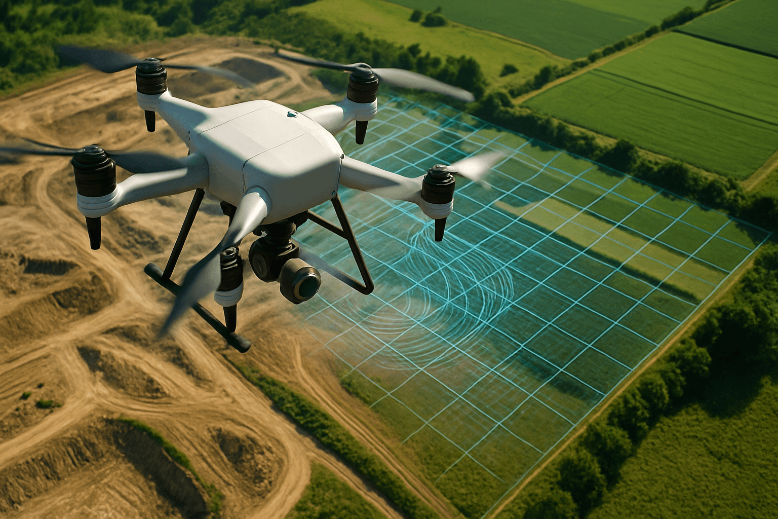
Drone mapping photography is revolutionizing industries, offering a bird’s-eye view that transforms data collection and analysis. By capturing high-resolution aerial images, drones create detailed 2D maps and 3D models of landscapes and structures. This technology, also known as aerial surveying or drone surveying, is increasingly adopted across various sectors due to its speed, accuracy, and cost-effectiveness.
What is Drone Mapping Photography?
Drone mapping photography, at its core, is about measuring from photos. It involves using unmanned aerial vehicles (UAVs), or drones, equipped with high-resolution cameras to capture aerial images of a specific area. These images are then processed using specialized software to create accurate, detailed maps and 3D models.
Photogrammetry: The Key Technique
The primary technique used in drone mapping photography is photogrammetry. Photogrammetry is the science of making measurements from photographs. By taking multiple overlapping photos of an area from different angles, specialized software can stitch these images together to create a larger, composite image or 3D model.
Orthomosaics: Geometrically Corrected Images
One of the key outputs of drone mapping photography is an orthomosaic. An orthomosaic is a georeferenced image where distortions due to camera tilt and topography are corrected, making it true to scale. This means that objects and features in an orthomosaic are scaled accurately, allowing for precise measurements of location, distance, and area.
Drone vs Traditional Mapping
Compared to traditional mapping methods, drone mapping photography offers several advantages:
- Speed: Drones can cover large areas quickly and be deployed easily.
- Accuracy: Drones provide high-resolution data with centimeter-level accuracy.
- Cost-Effectiveness: Drone surveys require less personnel and equipment than traditional methods.
Benefits of Drone Mapping Photography
The benefits of drone mapping photography extend across various industries, offering significant improvements in efficiency, safety, and data quality.
Time and Cost Savings
One of the most significant advantages of drone mapping is the reduction in time and costs. Drones can survey areas much faster than traditional land-based methods, reducing project timelines. The operating costs are also lower compared to manned aircraft such as airplanes and helicopters.
Enhanced Safety
Drones can be used to survey hazardous or difficult-to-access terrains, reducing the need for personnel to enter dangerous areas. This improves safety for workers and minimizes potential risks associated with inspections in challenging environments.
High-Quality Data
Drone mapping provides high-resolution aerial data that is more accurate and detailed than traditional survey methods. This increased accuracy leads to better decision-making and more informed planning and analysis.
Better Planning and Decision-Making
3D maps and models generated from drone mapping serve as virtual representations of environments, providing a better reference for planning and development. These models enable stakeholders to visualize projects, track progress, and identify potential issues in real-time.
Streamlined Data Collection and Analysis
Drone mapping streamlines data collection and analysis by automating data capture. Drones can fly predetermined routes and capture data automatically, reducing the need for manual labor and minimizing human error.
Improved Collaboration
Drone mapping enhances collaboration between stakeholders by providing a common visual reference point. 3D models and maps can be easily shared, facilitating communication and decision-making among team members.
Applications of Drone Mapping Photography
Drone mapping photography has a wide range of applications across various industries, transforming how data is collected, analyzed, and utilized.
Construction
In the construction industry, drone mapping is used for site surveying, progress monitoring, and stockpile management. Drones can capture high-resolution images of construction sites, allowing project managers to track progress, identify potential issues, and optimize resource allocation.
Agriculture
Drone mapping plays a crucial role in precision agriculture, enabling farmers to monitor crop health, optimize irrigation, and assess field conditions. Multispectral cameras can be used to capture data on crop health, helping farmers identify areas that need attention and improve yields.
Environmental Monitoring
Drone mapping is used for environmental monitoring and conservation, providing a new perspective on monitoring and preserving natural habitats. Drones equipped with high-resolution cameras and LiDAR technology can create detailed maps and 3D models of natural habitats, enhancing our understanding of environmental changes and supporting conservation efforts effectively.
Archaeology
In archaeology, drone mapping is used to create detailed 3D models of archaeological sites, helping researchers to study and preserve historical landmarks. Drones can capture high-resolution images of excavation sites, providing a comprehensive record of the progress and findings.
Mining
Drone mapping is utilized in the mining industry for site surveying, stockpile management, and environmental monitoring. Drones can capture high-resolution images of mining sites, allowing managers to track production, assess environmental impact, and ensure safety.
Real Estate
Real estate professionals use drone photography to capture high-quality aerial images and videos of properties, providing potential buyers with a unique perspective. Drones can showcase the property’s features, surroundings, and location, enhancing marketing efforts and attracting more interest.
Emergency Response
Drone mapping is used to support disaster relief and emergency management during hurricanes, floods, landslides, and search and rescue operations. Drones can quickly assess damage, identify affected areas, and provide real-time information to emergency responders.
Equipment for Drone Mapping Photography
To perform drone mapping photography, you need specific equipment, including a suitable drone, camera, and software.
Drones
Choosing the right drone is crucial for successful mapping. Key features to consider include:
- High-Resolution Camera: Opt for drones with a high megapixel count (e.g., 20MP or greater) for capturing finer details.
- GPS Capabilities: Drones with GPS capabilities can accurately record the location of each image, which is essential for creating georeferenced maps.
- Stable Flight Platform: A stable flight platform ensures smooth and steady flights, reducing the risk of blurry images.
- Mechanical Shutter: Unlike electronic shutters, mechanical shutters eliminate motion blur, ensuring crisp, distortion-free images during high-speed flights.
Some popular drone models for mapping include:
- DJI Matrice 350 RTK
- DJI Mavic 3 Enterprise
- Autel EVO II Pro (V3)
- Parrot ANAFI
Cameras
The camera is a critical component of drone mapping photography. Essential features to consider include:
- High Resolution: Cameras with high resolution capture finer details, resulting in superior map quality and more reliable data for post-processing.
- RGB Sensors: Opt for cameras with high-quality RGB sensors for capturing accurate color information.
- Gimbal Stabilization: A gimbal stabilizes the camera, reducing vibrations and ensuring smooth, clear images.
Software
Specialized software is required to process the images captured by the drone and create maps and 3D models. Key features to look for in mapping software include:
- Photogrammetry Processing: The software should be able to stitch together overlapping images to create orthomosaics and 3D models.
- Georeferencing: The software should be able to georeference the images, ensuring that the maps are accurately aligned with real-world coordinates.
- 3D Modeling: The software should be able to create 3D models from the images, allowing for detailed analysis and visualization.
Some popular software options for drone mapping include:
- PIX4Dmapper
- DroneDeploy
- Maps Made Easy
- DroneMapper
UK Drone Laws and Regulations
In the UK, drone operations are regulated by the Civil Aviation Authority (CAA). It is essential to understand and comply with these regulations to operate your drone safely and legally.
Registration
In the UK, drones weighing over 250 grams need to be registered with the CAA. The registration process involves providing personal details and obtaining a unique Operator ID, which must be displayed clearly on the drone.
Operator and Flyer IDs
When you register with the CAA, you’ll receive an Operator ID and a Flyer ID. The Operator ID is required for the person or organization responsible for the drone, while the Flyer ID is needed for anyone who intends to fly the drone.
Age Restrictions
The legal age for operating a drone in the UK is 18 years or older. Younger individuals can only operate drones under the direct supervision of an adult.
Altitude and Distance Limits
Drones must not be flown above 400 feet (120 meters) above ground level. It’s important to keep your drone at least 50 meters away from people and properties not under your control, and 150 meters away from gatherings of 1,000 or more people.
No-Fly Zones
Be aware of no-fly zones, such as airports and restricted areas, where drone flight is prohibited. Flying drones within 5 kilometers of an airport or airfield boundary is strictly prohibited unless you have received permission from the airport or air traffic control.
Privacy and Data Protection
It’s important to respect individuals’ privacy when flying your drone. Do not capture or distribute images or videos without their consent, and avoid recording in areas where privacy is expected, such as private gardens.
Commercial Operations
Anyone offering services like drone roof inspections and drone wedding photography for payment must have approval to operate from the Civil Aviation Authority (CAA). Approval comes in the form of a Permission for Commercial Operations (PfCO), which involves studying and passing an exam on drone laws in the UK, health and safety considerations, and how to ensure a drone is airworthy.
Getting Started with Drone Mapping Photography
If you’re interested in getting started with drone mapping photography, here are some steps to follow:
- Choose the Right Drone: Select a drone with a high-quality camera, GPS capabilities, and a stable flight platform.
- Understand the Basics: Learn the basics of aerial mapping, including flight planning, camera settings, and image overlap.
- Plan Your Flight: Identify the area you want to map and determine the altitude, flight path, and image overlap needed for your project.
- Capture Images: Fly your drone and capture a series of overlapping images of the area. Aim for at least a 60-70% front overlap and 30-40% side overlap between images.
- Process the Data: Use specialized software to process the images and create maps and 3D models.
- Analyze the Results: Analyze the maps and models to extract valuable insights and make informed decisions.
- Stay Compliant: Familiarize yourself with the drone laws and regulations in your area and ensure that you operate your drone safely and legally.
Drone mapping photography is a powerful tool that can transform industries and improve outcomes. By understanding the basics of drone mapping, investing in the right equipment, and complying with regulations, you can unlock the potential of this technology and achieve your mapping goals.


