The confluence of aerospace engineering and agricultural science has ushered in a transformative era for food production, fundamentally reshaping traditional farming practices. At the forefront of this revolution are Unmanned Aerial Vehicles (UAVs), commonly known as drones, which have become indispensable tools in precision agriculture. These specialized aircraft, equipped with an array of advanced sensors and data collection technologies, empower farmers with an unprecedented ability to monitor, analyze, and manage their fields with unparalleled precision, leading to significant gains in efficiency, sustainability, and yield.
The Dawn of Precision Agriculture with Drones
Precision agriculture is a methodology centered on optimizing resource use and enhancing productivity by managing specific sections of fields rather than treating entire areas uniformly. Historically, farmers relied on manual inspections, ground equipment, or satellite imagery for aerial views, which often lacked the necessary detail, timeliness, or flexibility. Drones address these limitations by providing high-resolution, real-time data, enabling site-specific interventions that were previously unattainable. The market for agricultural drones is experiencing rapid growth, with projections indicating a substantial increase in adoption across both large and small-scale farms.
Types of Agricultural Drones
The diverse needs of modern farming have led to the development of several types of agricultural drones, each with distinct advantages:
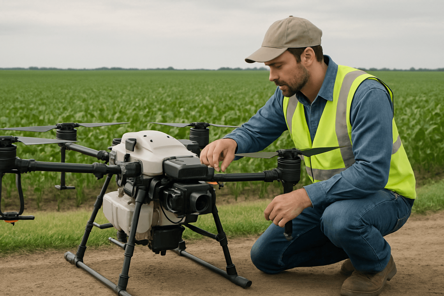
- Multirotor Drones: These drones, such as quadcopters and hexacopters, are celebrated for their exceptional maneuverability, hovering capabilities, and ability to fly at low altitudes. This makes them ideal for applications requiring high precision, such as targeted spraying, detailed crop inspection, and operations in challenging terrains, thanks to their vertical take-off and landing (VTOL) capabilities. They are generally easier to operate and require less training.
- Fixed-Wing Drones: Designed to cover extensive areas, fixed-wing drones operate at higher altitudes, allowing them to capture high-resolution images over vast agricultural zones. They are particularly effective for large-scale mapping and surveillance missions where endurance and wide coverage are paramount.
- Hybrid Drones: Combining the benefits of both multirotor and fixed-wing designs, hybrid drones (including eVTOL drones) offer superior flexibility. They can take off and land vertically like multirotors but possess the efficiency and range of fixed-wing aircraft, making them adaptable to a wide range of applications from mapping to targeted crop management.
Core Technologies and Sensors
The efficacy of agricultural drones hinges on their sophisticated payloads and integrated technologies. These “eyes and ears” of the drone collect the critical data needed for informed decision-making:
Advanced Sensing Capabilities
- RGB Cameras: Standard high-resolution visible light cameras capture images akin to those from a digital camera, providing visual data for general field monitoring and basic mapping.
- Multispectral Sensors: Crucial for assessing plant health, multispectral cameras record information beyond the visible spectrum, including near-infrared (NIR) and red-edge bands. This allows for the calculation of vegetation indices like NDVI (Normalized Difference Vegetation Index), which helps detect plant stress, disease, or nutrient deficiencies long before they are visible to the human eye.
- Hyperspectral Sensors: Offering an even greater range of spectral bands than multispectral sensors, hyperspectral cameras provide hundreds of narrow bands of data. While typically having lower spatial resolution, they offer highly detailed insights into crop conditions, such as chlorophyll content and specific nutrient stress.
- Thermal Sensors: These cameras detect variations in temperature, making them invaluable for assessing water stress, irrigation efficiency, and identifying issues like malfunctioning irrigation systems.
- LiDAR (Light Detection and Ranging) and 3D Mapping Systems: LiDAR systems mounted on drones revolutionize 3D mapping by using laser beams to create detailed three-dimensional models of the terrain. This data is vital for terrain mapping, elevation analysis, drainage patterns, and precise planning.
- Microwave and Environmental Sensors: Microwave sensors assess soil properties and environmental conditions, while environmental sensors monitor factors like temperature, humidity, and wind, providing comprehensive data for holistic farm management.
Navigation and Data Processing
- GPS and RTK (Real-Time Kinematics): High-precision GPS and RTK systems ensure consistent coverage and centimeter-level accuracy for drone operations, critical for precise mapping and targeted applications.
- On-board Computers and Communication Systems: Drones are equipped with internal computers, inertial measurement units (IMUs), and pressure sensors that track speed, orientation, and gravitational forces. Communication systems, often operating on frequencies like 2.4 GHz and 5.8 GHz, enable real-time video and data transmission to ground control stations.
- Software and AI Integration: The raw data collected by drones becomes actionable through specialized software for flight planning, data processing, and analysis. Platforms like DroneDeploy, Pix4D, Sentera FieldAgent, Skippy Scout, Agremo, SkyDeck, FlyPix AI, and Botlink turn images into georeferenced orthomosaics, point clouds, 2D/3D maps, and provide insights such as NDVI/NDRE analysis, plant vigor, weed mapping, and stand counts. The integration of Artificial Intelligence (AI) and Machine Learning (ML) is particularly significant, as it allows for predictive analytics, early disease detection, yield estimation, and optimized irrigation management by uncovering patterns invisible to the human eye.
Key Applications in Precision Agriculture
The versatility of drones has led to their widespread adoption across numerous agricultural tasks, transforming every stage of the crop cycle.
Crop Monitoring and Health Assessment
Drones provide an unparalleled aerial vantage point for continuous surveillance of agricultural landscapes. They offer an efficient solution for monitoring crop conditions throughout the entire growth cycle, enabling timely and targeted interventions.
- Early Disease and Pest Detection: Equipped with multispectral and thermal cameras, drones can swiftly identify subtle signs of crop stress due to drought, pests, or disease before symptoms become widespread or irreversible. This allows farmers to address problems proactively, safeguarding yields and profitability.
- Nutrient and Water Stress Analysis: Multispectral and hyperspectral sensors provide data to assess nutrient status and water stress by analyzing plant chlorophyll content and biomass. Thermal cameras detect temperature variations that indicate water potential, optimizing irrigation strategies and identifying areas of over or under-watering.
- Plant Health and Vigor Mapping: Drones evaluate vegetative indices like NDVI, mapping the vigor and health of plants across the field. This allows farmers to identify areas needing specific attention, leading to healthier, higher-quality crops.
Mapping and Surveying
Precision mapping and surveying are foundational applications of drones in agriculture, offering detailed insights into the physical characteristics of fields.
- 2D and 3D Field Mapping: Drones capture high-resolution imagery to create detailed 2D orthomosaics and 3D models of fields, including elevation changes and boundaries. This data is crucial for planning, analysis, and documentation.
- Yield Estimation and Prediction: Drones assist in creating yield estimates for insurance purposes and help predict future yields by assessing crop density and health. For high-value crops like orchard fruit, AI and 3D mapping can provide high-accuracy yield estimates and reduce fruit variability.
- Drainage and Terrain Analysis: Elevation information from drone mapping is useful in determining drainage patterns and identifying wet or dry spots, which in turn informs more efficient watering techniques.
Precision Application of Inputs
One of the most impactful applications of drones is the precise application of agricultural inputs, moving away from uniform broadcast methods.
- Targeted Spraying: Drones equipped with precision spraying systems can apply pesticides, herbicides, or fertilizers with pinpoint accuracy only to areas that need treatment. This significantly reduces chemical usage (by 20-30%), minimizes waste, lowers costs, and reduces environmental impact, including runoff and chemical drift.
- Variable Rate Application: UAV data can be used to map areas requiring variable rates of nitrogen or other plant growth regulators, optimizing canopy size for better yield potential.
- Seeding and Planting: Drones are increasingly used for mass sowing and planting, including cover crops and tree saplings in forestry, efficiently covering hard-to-reach areas and enabling faster deployment than traditional methods.
Soil Health Analysis
Drones facilitate the collection of diverse soil samples and provide data for analyzing soil fertility, pH levels, and moisture content. Informed decisions regarding nutrient management and soil conditioning can then be made, enhancing agricultural productivity and longevity.
Livestock Management
Beyond crops, drones are also valuable for livestock management, monitoring cattle movement and health, performing counts, herding animals, and locating stray livestock. These applications improve safety and reduce the labor and time required for manual inspections.
Benefits and Return on Investment (ROI)
The adoption of drone technology in precision agriculture offers a multitude of tangible benefits that translate into significant economic and environmental advantages for farmers.
Economic Benefits and Cost Savings
- Reduced Input Costs: By enabling precise application, drones can reduce the use of fertilizers and pesticides by 20-30%, leading to substantial cost savings.
- Labor Cost Reduction: Drone spraying requires significantly less labor (75-90% less) compared to traditional methods, addressing issues of labor scarcity and rising wages. Tasks like scouting that traditionally took days can be completed in minutes or hours.
- Increased Efficiency and Time Savings: Drones can cover vast areas much faster than traditional methods. For instance, a drone can treat 30-40 acres per hour, compared to 15-20 acres for traditional equipment. Some drones can cover 4,000–6,000 square meters in just 10 minutes for precision spraying. This efficiency allows for more timely applications during critical growth stages.
- Improved Yields: Early disease and pest detection, optimized resource use, and precise interventions can boost crop yields by 10-25%. Reduced soil compaction from drones (compared to heavy machinery) can also improve yields by 5-10% in heavily trafficked fields.
- Overall ROI: Despite initial investment costs ($5,000 to $50,000 for drones, plus training and software), studies suggest that the break-even period for most farms can be as short as 1-3 years, with larger farms potentially realizing ROI even faster due to economies of scale. Drones are considered one of the fastest ROI investments in agriculture due to these combined savings and yield improvements.
Environmental Benefits
- Reduced Chemical Runoff and Pollution: Targeted spraying minimizes the over-application of chemicals, significantly reducing runoff into water bodies and mitigating environmental harm.
- Water Conservation: Optimized irrigation strategies based on drone data lead to more efficient water use and substantial water savings. For example, agricultural drones globally have yielded cumulative savings of 210 million metric tons of water.
- Lower Carbon Emissions: Decreased fuel consumption from fewer field visits and reduced reliance on heavy machinery contributes to lower greenhouse gas emissions. Drone use has reportedly reduced carbon emissions by 25.72 million metric tons globally.
- Enhanced Biodiversity: Precise pest management through targeted application reduces the broad impact of chemicals, promoting healthier ecosystems and biodiversity.
Challenges to Adoption
Despite the compelling advantages, the widespread adoption of drones in agriculture faces several hurdles:
- High Initial Investment: The cost of acquiring high-end drones, advanced sensors, and associated software, along with training and maintenance, can be substantial, particularly for small to medium-sized farms.
- Regulatory Hurdles: Diverse and evolving regulations regarding drone usage, airspace permissions, and operator certifications (such as FAA Part 137 in the U.S.) can create confusion and delays. Harmonizing regulations for beyond visual line of sight (BVLOS) flights remains a key challenge.
- Technical Expertise and Training: Operating drones and interpreting the complex data they collect requires specialized skills and training, which may not be readily available to all farmers.
- Data Management and Analysis Complexity: Handling the massive amounts of data generated by drones, processing it, and deriving actionable insights can be daunting without proper workflows and software.
- Environmental and Operational Limitations: Weather conditions (wind, rain) can affect drone performance and limit flight operations. Battery life and flight range can also restrict their utility for very large-scale farming operations, though technological advancements are continuously addressing these.
- Privacy Concerns: The use of drones for aerial surveillance can raise privacy issues, necessitating careful consideration of ethical implications.
- Integration with Existing Systems: Seamlessly integrating drone technology and data into existing farm management systems can be a challenge for some operations.
The Future of Agricultural Drones
The trajectory of drone technology in agriculture points towards increasingly sophisticated and autonomous systems. Future advancements are expected to address current limitations and unlock even greater potential:
- Drone Swarms: The development of AI-driven swarming techniques promises enhanced efficiency for tasks like scouting and spraying, allowing multiple drones to work collaboratively over large areas. This would require significant regulatory adjustments.
- Improved Energy Autonomy: Innovations in battery technology and alternative power sources will lead to longer flight times and increased operational range, reducing downtime for battery swaps or refueling.
- More Sophisticated Decision-Support Systems: Further integration of AI, machine learning, and IoT (Internet of Things) will enable even more precise predictive analytics, offering deeper insights into agricultural patterns and trends. These systems will provide highly refined, actionable recommendations, making farming smarter and more responsive.
- Enhanced Sensor Capabilities: Continued research and development will likely introduce even more advanced sensor types, providing unprecedented levels of detail and analytical capabilities for crop and soil health.
- Increased Accessibility and Affordability: As the technology matures and becomes more widespread, the cost of drones and associated services is expected to decrease, making precision agriculture more accessible to a broader range of farmers, including smallholders. Government initiatives and subsidies also play a crucial role in facilitating uptake.
In conclusion, drones have transitioned from novelties to essential components of modern agricultural practice, fundamentally transforming how food is produced. By providing accurate, real-time data and enabling highly precise interventions, these unmanned aerial vehicles are driving efficiency, enhancing sustainability, and significantly boosting productivity across the globe. As technological advancements continue and regulatory frameworks adapt, the role of drones in shaping a more resilient and resource-efficient agricultural future will only expand.


