For centuries, the enigmatic journeys of migrating animals have captivated human curiosity. From the epic flights of monarch butterflies to the arduous treks of wildebeest across the Serengeti, these movements are vital to ecosystem health, yet their sheer scale and often inaccessible routes have made them incredibly challenging to study. Traditionally, tracking animal migration relied on labor-intensive methods like ground-based radio telemetry, which often involved physically tagging animals and then manually searching for signals, a process that was not only slow and resource-intensive but could also be disruptive to the animals themselves. However, a technological revolution is underway in environmental monitoring: Unmanned Aerial Vehicles (UAVs), commonly known as drones, are providing conservationists and researchers with an unprecedented “bird’s-eye perspective,” offering a safer, more efficient, and less invasive way to unravel the mysteries of animal migration.
The Limitations of Traditional Tracking Methods
Before the widespread adoption of drone technology, wildlife researchers faced significant hurdles in monitoring animal movements, particularly migratory patterns. Radio telemetry, while foundational, is often time-consuming and resource-intensive, restricting researchers to tracking animals one at a time. The equipment’s signal detection range is typically limited to a few hundred meters, making it difficult to follow fast-moving species or those that cover vast distances. Furthermore, challenging terrains such as dense bushland, swamps, gorges, or cliff-tops often limit access for ground-based teams, making data collection incomplete or impossible. Physical approaches for tagging and monitoring could also cause stress and disturbance to the animals, potentially impacting their natural behaviors. Even advanced systems like MOTUS, which records signals as animals pass fixed stations, may not provide the real-time, location-specific data needed to track animals continuously once they move beyond the network.
The Drone Advantage: Unlocking New Perspectives
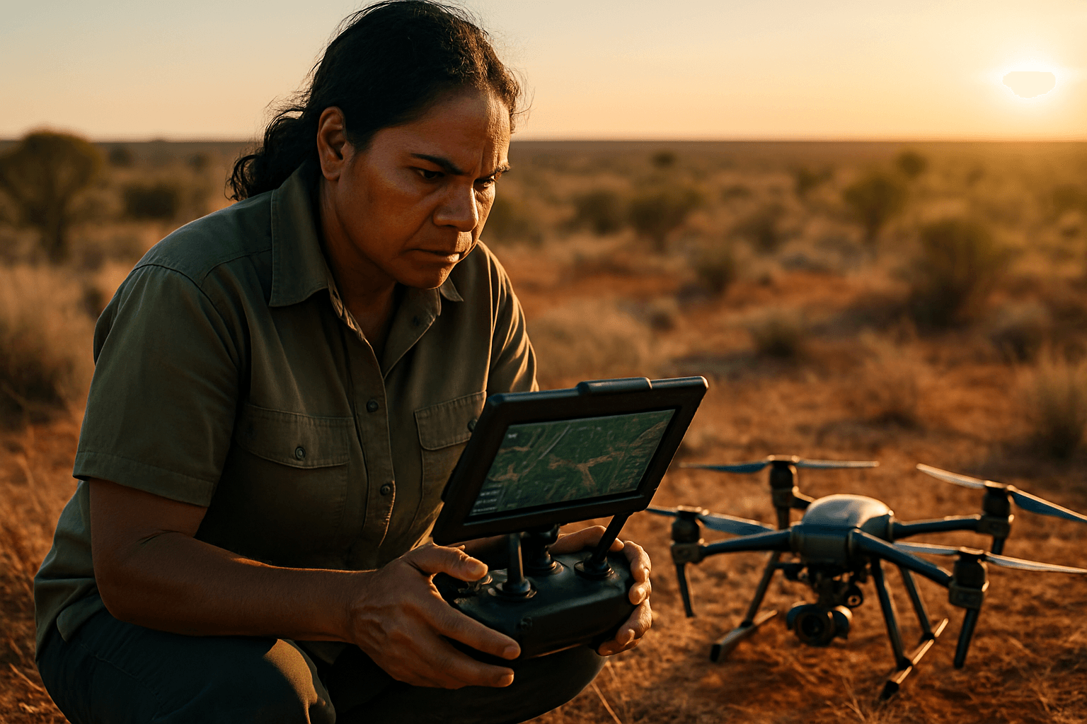
Drones offer a compelling alternative to these traditional methods, providing a suite of advantages that are transforming wildlife monitoring. Their ability to access remote, inhospitable, and previously unreachable areas significantly expands the scope of research. Unlike human-crewed aircraft or ground teams, drones can conduct surveys with minimal disturbance to wildlife, collecting data from a safe distance without interfering with natural behaviors. This non-intrusive surveillance is particularly crucial for endangered or sensitive species where maintaining their well-being is paramount.
Moreover, drones enhance efficiency and coverage. They can survey large areas quickly, sometimes covering several hectares in minutes, a fraction of the time required by traditional methods. This increased efficiency allows for more thorough data collection and analysis, making them a cost-effective solution compared to traditional aerial surveys with manned aircraft. The high-resolution data captured by drones, combined with advanced sensors, provides insights into habitat conditions, wildlife populations, and environmental changes that were once unattainable.
Diverse Applications in Migration Tracking
The versatility of drones has led to a wide array of applications in tracking animal migration and broader environmental monitoring:
Population Counting and Distribution Mapping
Drones equipped with high-resolution cameras can accurately count animal populations, even in dense or camouflaged environments, significantly reducing human counting errors. This is crucial for assessing conservation status and efforts, especially for endangered species. The imagery also helps in mapping species distribution across vast territories.
Mapping Migration Routes and Corridors
Drone mapping transforms how researchers monitor animal migration patterns by capturing comprehensive movement data across extensive areas. Automated drone surveys can document complete migration cycles across multiple seasons, revealing how environmental changes affect migration timing. GPS-tagged drones can follow herds for thousands of miles, and time-lapse mapping can show variations in migration routes over different years. This allows for unprecedented precision in tracking wildlife corridors.
Behavioral Observation and Analysis
With their ability to provide a stable, overhead view, drones enable detailed observation of animal behavior without direct human interference. This includes social interactions, foraging strategies, and reproductive behaviors, offering insights into the motivations and “traffic rules” of animal groups, as seen in studies of caribou herds.
Real-Time Monitoring and Threat Detection
Drones can provide real-time monitoring of animal movements, aiding quick decision-making for conservation strategies and emergency responses. Equipped with night-vision and thermal imaging, drones can also detect and deter illegal activities like poaching, patrolling protected areas and enabling rapid response teams to react to incidents.
Advanced Technologies Powering Drone Monitoring
The effectiveness of drones in wildlife monitoring stems from the sophisticated technologies they integrate:
- High-Resolution and Thermal Imaging: RGB (Red, Green, Blue) cameras capture detailed visual data for species identification and habitat assessment. Thermal cameras, on the other hand, detect heat signatures, allowing researchers to locate animals through dense foliage, in low light, or at night, and even identify injured individuals.
- Multispectral Sensors and LiDAR: Going beyond the visible spectrum, multispectral sensors analyze plant health and habitat composition by capturing data from different light wavelengths, while LiDAR (Light Detection and Ranging) creates detailed 3D maps of terrain and vegetation structure.
- Acoustic Sensors: Mounted on drones, these sensors record animal vocalizations, such as bird songs or frog calls, and can also detect illegal activities like gunshots or chainsaw noises.
- GPS and Radio Telemetry Receivers: Drones are equipped with advanced GPS and navigation systems for precise positioning and autonomous flight planning. They can also carry radio telemetry receivers to track animals fitted with traditional GPS or VHF collars, significantly extending the range and efficiency of signal detection compared to ground-based methods, allowing for simultaneous tracking of multiple animals.
- Artificial Intelligence (AI) and Machine Learning (ML): AI algorithms are revolutionizing data analysis, enabling drones to process vast amounts of collected imagery. AI-powered techniques, including deep learning models, can identify and count diverse animal species with high accuracy, analyze behavior, and even differentiate between animal movements and human activity.
Challenges and Ethical Considerations
Despite their immense potential, the use of drones in wildlife monitoring is not without challenges and ethical considerations. One of the primary concerns is the potential for wildlife disturbance. The noise and visual presence of drones can cause stress to animals, potentially altering their migration, feeding, and breeding patterns. Ethical use necessitates studying and minimizing these impacts, ensuring that conservation efforts do not inadvertently harm animal well-being. Minimum approach distances and careful flight protocols are essential.
Technological limitations also exist. Dense vegetation, animal camouflage, and the size or thermal signature of certain species can still hinder detection. Furthermore, drone operations are subject to practical constraints like battery life and weather dependency (e.g., strong winds or rain).
Regulatory and logistical hurdles are another significant factor. Drone regulations vary widely across regions, and obtaining necessary permits for wildlife tracking missions can be complex and time-consuming. Restrictions on airspace, altitude, and operating hours can further limit the scope and effectiveness of drone deployments.
Finally, privacy and data security concerns arise. Drones can inadvertently collect data on humans, raising questions about surveillance and the misuse of personal information, especially for indigenous communities living within or near conservation areas. Researchers must ensure data protection, obtain consent where necessary, and maintain transparency and accountability regarding data use. There’s also a risk of technological over-reliance without sufficient ecological expertise or ethical oversight, potentially leading to widespread, unregulated deployment.
The Future of Drone Applications in Animal Migration
The integration of drones and AI-driven solutions has significantly advanced wildlife monitoring, offering numerous benefits across key applications. As drone technology continues to evolve, the future promises even more innovative applications. Emerging technologies like swarm drone technology, where multiple drones operate together in a coordinated, autonomous group, could revolutionize large-scale surveys, further enhancing coverage and data collection efficiency. Continued advancements in AI and machine learning will refine species identification, behavioral analysis, and threat detection, making drone-based monitoring even more precise and actionable.
By carefully balancing technological innovation with ethical considerations and robust regulatory frameworks, drones will undoubtedly play an increasingly pivotal role in understanding, tracking, and ultimately protecting the remarkable migratory patterns of animals across our planet.


