The drone industry is rapidly evolving, with cutting-edge innovations poised to revolutionise various sectors, from agriculture and construction to logistics and public safety. As we advance into 2025, it’s crucial to understand the latest technological trends shaping the future of unmanned aerial vehicles (UAVs). This article delves into these advancements, highlighting their potential impact on the UK and beyond.
AI-Powered Autonomy: Smarter Than Ever
Artificial Intelligence (AI) is at the heart of the latest drone technology. AI algorithms are transforming drones into autonomous problem-solvers, enabling them to perform complex tasks with minimal human intervention.
Key Advancements:
- Autonomous Navigation: AI-powered drones can navigate complex environments, detect obstacles, and make real-time decisions, allowing them to execute missions without constant human control.
- Real-time Data Processing: AI enables drones to process data from sensors and cameras in real-time, providing actionable insights for various applications.
- Object Recognition: AI algorithms allow drones to identify objects and features on the ground, enabling them to make informed decisions about flight paths and task completion.
- Predictive Maintenance: AI can analyse drone performance data to predict potential failures, allowing for proactive maintenance and minimizing downtime.
Applications:
- Precision Agriculture: AI-driven drones can monitor crop health, detect pests, and optimize irrigation, improving yields and reducing resource usage.
- Infrastructure Inspection: Drones can autonomously inspect infrastructure like bridges, pipelines, and wind turbines, identifying potential issues with pinpoint accuracy.
- Search and Rescue: AI-equipped drones can quickly scan vast areas to locate missing persons or disaster survivors, even in challenging conditions.
- Security: Drones are able to patrol designated areas, detect intrusions, and provide real-time alerts.
Autonomous Flying: The Next Frontier
Manual piloting is becoming a thing of the past as drones become increasingly autonomous. Advanced navigation systems enable drones to handle complex missions without human intervention.
Key Features:
- Beyond Visual Line of Sight (BVLOS) Operations: Drones can fly beyond the pilot’s visual range, expanding their operational scope for delivery, surveying, and other applications. The FAA Reauthorization Act of 2024 is set to enable BVLOS operations in the US, and Canada is introducing new BVLOS regulations starting November 4, 2025.
- AI-Powered Navigation: Drones use AI to navigate autonomously, adapting to changing conditions and avoiding obstacles.
- Pre-programmed Missions: Drones can execute pre-defined tasks or follow predetermined flight paths without requiring real-time decision-making capabilities.
Applications:
- Delivery Services: Autonomous drones can deliver packages, groceries, and medical supplies directly to customers’ doorsteps, reducing delivery times and costs.
- Precision Agriculture: Autonomous drones can map, monitor, and even treat crops with minimal oversight.
- Industrial Inspections: Infrastructure like bridges, pipelines, and wind turbines can be inspected with pinpoint accuracy.
- Mapping and Surveying: Drones can quickly and accurately survey large areas of land, generating 3D maps and topographic data for construction, mining, and environmental monitoring.
Delivery Drones: The New Normal
Drone delivery is rapidly becoming mainstream. Expect to see an expanded rollout of drone delivery services, bringing groceries, medical supplies, and packages directly to your doorstep.
Key Benefits:
- Reduced Delivery Times: Drones can bypass traffic congestion and deliver goods faster than traditional delivery methods.
- Lower Emissions: Drone delivery can reduce emissions compared to traditional delivery vehicles, contributing to a more sustainable future.
- Greater Accessibility: Drones can reach remote areas and deliver essential supplies to people in need.
Companies Leading the Way:
- Zipline: Specializes in delivery drones designed for businesses and personal use, particularly for medical supplies.
- Amazon Prime Air: Resumed drone deliveries in Texas and Arizona with its MK30 drone, which carries up to 5 pounds and delivers in under 60 minutes.
- Wing (Google): Uses drones that can zip up to six miles, carrying packages weighing a couple of pounds.
- A2Z Drone Delivery: Innovating with hybrid drones and integrated robot-drone delivery systems.
- Serve Robotics: Partnering with Wing to pair sidewalk robots with drones for urban pickups and deliveries.
Enhanced Camera and Imaging Technology
High-resolution cameras and sensors are pushing the boundaries of drone photography and videography.
Key Features:
- 8K Footage: Drones will capture stunning 8K footage, delivering cinema-quality visuals at a fraction of the cost.
- Thermal Imaging: Drones equipped with thermal cameras can detect heat signatures, making them useful for search and rescue, infrastructure inspection, and environmental monitoring.
- Multispectral Data: Drones can capture multispectral data, providing valuable insights into crop health, soil conditions, and environmental changes.
- LiDAR Sensors: Drones with LiDAR sensors provide accurate mapping data and detect deviations.
Applications:
- Filmmaking: Drones will deliver cinema-quality visuals at a fraction of the cost.
- Environmental Monitoring: Advanced imaging will help track deforestation, pollution, and wildlife populations.
- Construction: Drones can create detailed maps and 3D models of construction sites, track progress, and identify potential issues.
- Agriculture: Drones can monitor crop health, detect irrigation needs, and assess soil conditions, enabling farmers to make informed decisions.
Drones for Smart Cities
The integration of drones into smart city ecosystems is accelerating.
Key Applications:
- Traffic Monitoring: Drones can monitor traffic and provide real-time data on congestion, accidents, and other incidents, optimizing traffic flow and reducing congestion.
- Public Safety: Drones can provide real-time video surveillance and monitoring of public spaces, helping law enforcement agencies respond quickly to incidents and identify potential threats.
- Infrastructure Inspection: Drones can inspect critical infrastructure such as bridges, power lines, and buildings, identifying potential issues and ensuring safety.
- Environmental Monitoring: Drones can monitor air quality, noise levels, and other environmental factors, helping cities to create a more sustainable environment.
5G Connectivity: Unleashing Drone Potential
5G technology is set to revolutionise drone operations.
Key Benefits:
- Low Latency: 5G’s significantly reduced latency enables real-time control, which is pivotal for BVLOS operations where quick reactions to environmental changes are essential.
- Increased Bandwidth: 5G offers increased bandwidth, allowing drones to transmit large amounts of data in real-time, enabling applications like high-resolution video streaming and 3D mapping.
- Edge Computing: 5G enables edge computing, processing data on-site and minimizing energy use, allowing drones to cover greater distances per mission.
Applications:
- Infrastructure Inspection: 5G drones can capture high-resolution imagery of power lines and pipelines from remote locations, reducing the risk and cost associated with human inspections.
- Search and Rescue: 5G drones can cover vast, difficult terrain, streaming thermal and visual data to responders in real time.
- Agriculture: 5G drones enable rapid, high-quality analysis of crop health across large fields, helping farmers make timely adjustments to increase yields.
UK Drone Regulations: Navigating the Skies Safely
The UK Civil Aviation Authority (CAA) is committed to improving how it delivers services and is constantly updating drone regulations to support the safe growth of the sector.
Key Updates:
- Clearer, Simpler Rules: The CAA is introducing clearer, simpler rules for drone operations, including renaming sub-categories in the ‘Open’ category to make it more obvious what they allow.
- Increased Education Requirements: The free online mandatory Flyer ID training is extended to users of drones over 100g, and improvements are being made to make guidance more user-friendly.
- Drone Product Standards: The introduction of drone product standards via class-marking will improve safety and security from the point of manufacture.
- Remote ID: Implementation of Direct Remote ID requirements will enable a drone to broadcast identification and location data.
- UK SORA: From April 23rd 2025, the CAA will adopt the Specific Operations Risk Assessment (SORA) methodology to evaluate and approve higher-risk drone operations.
- Transitional Period: The Department for Transport (DfT), in collaboration with the CAA, has extended legacy and transitional provisions for drones operating in the Open Category until January 1st, 2026.
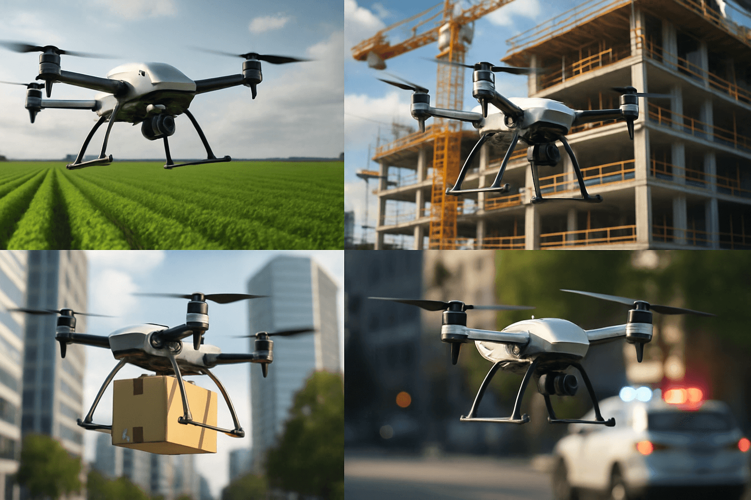
Drones in Construction: Building a Better Future
Drones are rapidly becoming an essential tool in the construction industry.
Key Benefits:
- Land Surveying and Mapping: Drones can quickly and accurately survey large areas of land, generating detailed 2D and 3D models for improved site planning and earthwork calculations.
- Progress Monitoring: Drones capture regular aerial images and videos, allowing for efficient progress tracking.
- Structural Inspections: Drones can inspect roofs, towers, and high-rise buildings without scaffolding or lifts.
- Site Safety Audits: Thermal drones can help detect overheating equipment or potential electrical faults.
- Inventory and Asset Management: Drones help track construction materials and equipment across sprawling sites.
- Improved Site Security: Drones can assess a potential site security breach.
Drones in Agriculture: Cultivating Innovation
Drones are revolutionising the agricultural sector.
Key Applications:
- Crop Monitoring: Drones can monitor crop health, growth, and yield, providing farmers with valuable insights for optimising their operations.
- Soil Analysis: Drones can collect valuable soil data, highlighting soil compaction, erosion pathways, and poaching throughout your farm.
- Precision Spraying: Drones can be used for precision crop spraying, reducing the overall volume of chemicals used and minimising waste.
- Livestock Management: Drones can monitor livestock movement and health remotely, sending real-time data on herd locations and behaviors.
- Seeding: Drones are able to plant seeds at precise locations.
Drone Startups to Watch
Several innovative drone startups are making significant impacts across different sectors with their groundbreaking technologies and applications.
Key Startups:
- EHang (China): Shaping the future of urban air mobility with its EH216-S autonomous aerial vehicle (AAV) for short-distance passenger flights.
- Terra Drone (Japan): Innovating industrial inspection and mapping with drones equipped with state-of-the-art sensors and LiDAR technology.
- Azur Drones (France): Specializes in fully autonomous drone flights and autonomous radiation detection at nuclear facilities.
- BEI Corp (Korea): Focuses on developing artificial intelligence applications for drone systems, enhancing their autonomous capabilities and performance in various operational scenarios.
- Ninano Company Inc (Korea): Develops specialized drone solutions with applications across multiple sectors, contributing to Korea’s growing reputation for UAV innovation.
The Future is in the Sky
The latest drone technology is transforming industries, improving efficiency, and creating new opportunities. From AI-powered autonomy and advanced imaging to 5G connectivity and evolving regulations, the future of drones is bright. As the UK continues to invest in drone innovation and streamline regulations, we can expect to see even more exciting developments in the years to come.


