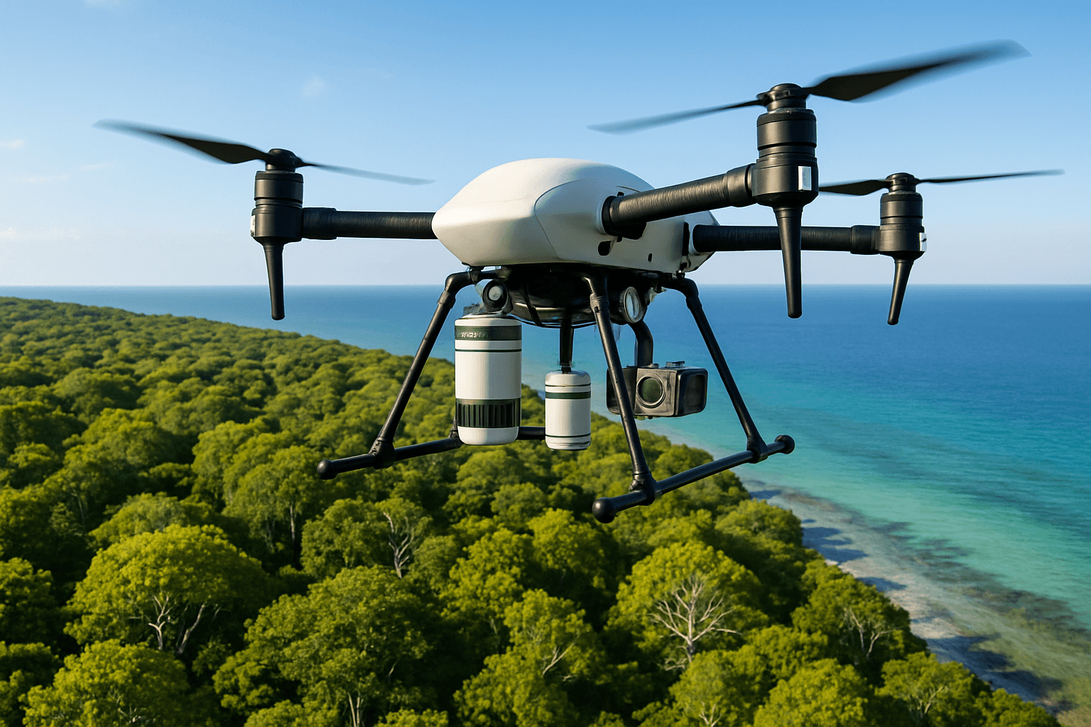
Drones are rapidly transforming the landscape of environmental monitoring, offering unprecedented capabilities for data collection, analysis, and conservation efforts. These unmanned aerial vehicles (UAVs) provide a cost-effective, efficient, and safe alternative to traditional monitoring methods, enabling researchers and conservationists to access remote areas, gather high-resolution data, and develop sustainable conservation strategies. From wildlife tracking to pollution monitoring, drones are becoming indispensable tools for understanding and protecting our planet.
Why Drones are Taking Flight in Environmental Monitoring
Accessing the Inaccessible
Drones can reach remote and hazardous locations that are difficult or impossible for humans to access. This capability is particularly valuable for monitoring:
- Fragile Ecosystems: Drones can survey sensitive environments without causing disturbance to wildlife or vegetation .
- Disaster Zones: They can provide rapid assessments of damage following floods, wildfires, or oil spills, enabling quicker and more effective response efforts .
- High-Altitude Regions: Drones can monitor glaciers, snow cover, and ice formations in mountainous areas, providing crucial data on the effects of climate change .
Enhanced Data Accuracy and Collection
Drones equipped with high-resolution cameras and sensors can capture detailed imagery and data from precise vantage points, improving the accuracy and consistency of environmental monitoring.
- High-Resolution Imagery: Drones can create detailed maps and models of terrain, vegetation, and infrastructure using photogrammetry and LiDAR technology .
- Real-Time Data: They can transmit video data in real-time to operators and supervisors, allowing for immediate assessment of environmental conditions .
- Precise Measurements: Drones can collect data on key environmental parameters such as air quality, water quality, and soil composition with greater accuracy than traditional methods .
Cost-Effectiveness
Drones offer a cost-effective alternative to traditional monitoring methods, reducing the need for extensive manpower, equipment, and time.
- Reduced Labor Costs: Drones can survey large areas with minimal personnel, lowering labor costs associated with data collection .
- Lower Equipment Costs: Drones are generally less expensive to operate and maintain than manned aircraft or ground-based monitoring systems .
- Efficient Data Processing: Advances in drone technology have led to more efficient data processing techniques, reducing the time and cost of analysis .
Improved Safety
Drones eliminate the need for personnel to enter dangerous environments, reducing the risk of accidents and injuries.
- Hazardous Terrain: Drones can survey areas with dangerous terrain, such as steep cliffs or dense forests, without putting researchers at risk .
- Polluted Environments: They can monitor air and water quality in polluted areas, reducing the risk of exposure to harmful substances .
- Emergency Response: Drones can assess damage and monitor conditions during natural disasters, providing critical information to first responders without endangering their lives .
Key Applications of Drones in Environmental Monitoring
Wildlife Tracking and Conservation
Drones are powerful tools for monitoring and protecting wildlife populations.
- Population Counts: Drones can be used to count bird colonies, estimate marine mammal abundance, and monitor wildlife populations in large areas .
- Habitat Mapping: They can capture color images and extract data on patch characteristics and vegetation types, helping to map and monitor animal habitats .
- Anti-Poaching Efforts: Drones can be equipped with thermal cameras to detect poachers and monitor illegal activities in protected areas .
- Species Identification: Drones can identify areas where endangered species live, and monitor their behavior without disturbing their natural environment .
Forest and Vegetation Monitoring
Drones play a crucial role in assessing the health and condition of forests and vegetation.
- Forest Health Assessments: Drones can detect diseases, monitor deforestation, and assess the overall health of forests using multi and hyperspectral imaging .
- Vegetation Characterization: They can capture color images to extract data on patch characteristics and vegetation types, aiding in vegetation monitoring .
- Monitoring Reforested Areas: Drones can monitor the progress of reforestation efforts and assess the success of tree planting initiatives .
Water Quality Assessment
Drones can be used to assess water quality in lakes, rivers, and coastal areas.
- Pollution Monitoring: Drones equipped with sensors can measure pollutants in water bodies, such as sewage discharge and thermal pollution .
- Water Depth Mapping: Drones can be integrated with echo sounders to map underwater terrain and chart water depths .
- Water Enrichment Monitoring: Drones can monitor water quality in natural resource surveys .
Air Quality Monitoring
Drones are equipped with air quality sensors can detect and monitor various gases, particulate matter, and other pollutants in the air.
- Industrial Emission Monitoring: Industries in the UK, especially those involved in manufacturing and power generation, face stringent emission standards, and drones can be deployed to monitor air quality around industrial facilities, measuring pollutants like NO₂, SO₂, CO, and particulate matter .
- Marine Emission Monitoring: Drones can monitor emissions from marine vessels and harbours, making it a powerful tool for assessing maritime pollution and supporting marine conservation efforts .
- Pollution Level Measuring: Drones can measure pollution levels in natural reserves, monitor air quality in rural areas, and study emissions impacting local wildlife .
Environmental Enforcement
Drones enhance enforcement efforts by providing a valuable tool to detect, monitor, and combat environmental violations more effectively.
- Illegal Waste Disposal: Drones can monitor sensitive areas, such as industrial sites, waterways, and agricultural land, capturing real-time evidence of potential breaches such as illegal waste disposal, and pollution incidents .
- Compliance with Environmental Regulations: Drones provide aerial surveys of hard-to-reach locations, enabling the UK Environment Agency to assess compliance with environmental legislation quickly and efficiently .
Drone Technology and Sensors
Multi and Hyperspectral Imaging
Multi and hyperspectral imaging on drones allows for low-cost monitoring at a higher resolution. They can retrieve key health descriptors and have been used in case studies on mangroves, forests, and reforested areas.
LiDAR (Light Detection and Ranging)
LiDAR collects measurements for maps and models of terrain and objects, technology as an example—it’s crucial for coastal erosion monitoring. You can use drones to collect data from areas with vast coastlines. This allows you to produce high-res maps by the use of photogrammetric images.
Thermal Cameras
Drones equipped with thermal cameras can find tortoises and are also used for tracking oceanic animals like turtles and whales.
Air Quality Sensors
Drones are equipped with air quality sensors can detect and monitor various gases, particulate matter, and other pollutants in the air.
Echo Sounders
Drones can be integrated with echo sounders to map underwater terrain and chart water depths. This functionality enables detailed mapping of underwater terrain, crucial for tasks such as charting water depths and studying aquatic ecosystems.
Case Studies: Drones in Action
Monitoring Endangered Species in Ecuador
A conservation group in Ecuador used an E384 drone to analyze large areas of land and identify areas where the brown-headed spider monkey could live. The drone collected massive amounts of data, which was used to create an orthomosaic of the 1000-hectare area with a ground sample distance (GSD) for eight centimeters .
Environmental Monitoring in Sanjiangyuan, China
The Sanjiangyuan National Park Administration in China used JOUAV CW-15 and CW-25E vertical take-off and landing (VTOL) fixed-wing drones to monitor wetlands, lakes, and snowy mountains in the region. The drones flew at high altitudes and captured images of glaciers, snow cover, and ice formations, providing researchers with a bird’s eye view of the area .
Gas Monitoring in New Zealand
Drones fitted with precision gas monitoring payloads can detect the exact locations and volumes of methane emissions, enabling landfill operators to target problem areas and take immediate action. Drones represent a game-changing solution to the world’s environmental challenge – a cost-effective, efficient, accurate tool that reduces costs and safety risks .
Environmental Enforcement in the UK
Eagle Eye Innovations (EEI) supported the UK Environment Agency by providing a capability demonstration using cutting-edge RPAS (Remotely Piloted Aircraft Systems) technology during an enforcement operation, reinforcing the Environment Agency’s commitment to protect the environment and ensure compliance with local environmental regulations .
Challenges and Considerations
Regulatory Framework
The use of drones for environmental monitoring is subject to various regulations and restrictions, including airspace management, airworthiness, and pilot qualification. In the UK, drone law is primarily governed by section 60 of the Civil Aviation Act 1982 and the Air Navigation Order 2016 SI 2016/765 (as amended) (the ANO), which regulate and place obligations on drone operators and pilots .
Data Management
The large volumes of data collected by drones require efficient storage, processing, and analysis.
Technological Limitations
There are still limitations compared to conventional approaches, and further development is needed for on-board sensors and data processing .
Privacy Concerns
The use of drones for environmental monitoring raises privacy concerns, particularly in populated areas.
The Future of Drones in Environmental Monitoring
Integration with IoT
The incorporation of drones with the Internet of Things (IoT) for immediate habitat monitoring has the potential to augment the functionalities of drones in conservation endeavors .
AI-Powered Analysis
The integration of artificial intelligence (AI) and machine learning (ML) algorithms can enhance the analysis of drone-collected data, enabling more accurate and efficient environmental monitoring .
BVLOS Operations
The development of routine beyond visual line of sight (BVLOS) operations will enable drones to cover larger areas and access more remote locations.
Increased Autonomy
Advancements in drone technology are leading to increased autonomy, allowing drones to perform more complex tasks with minimal human intervention.
Conclusion
Drones are revolutionizing environmental monitoring, providing a powerful and versatile tool for protecting our natural resources. By overcoming the limitations of traditional methods, drones enable us to collect more data, more efficiently, and with less impact on the environment. As technology continues to advance and regulations evolve, drones are poised to play an increasingly important role in environmental conservation and sustainability efforts.


