Our oceans, vital regulators of global climate and biodiversity, are facing an unprecedented crisis: plastic pollution. From vast swirling gyres to invisible microplastic particles, this pervasive contaminant poses a significant threat to marine ecosystems and human health. As traditional monitoring methods prove inadequate against the sheer scale of the problem, a new technological frontier is emerging to aid in the fight: drones. These unmanned aerial vehicles (UAVs), equipped with advanced sensors and artificial intelligence, are revolutionizing how we detect, map, and ultimately combat the plastic scourge in our planet’s waters.
The Growing Crisis of Ocean Plastic Pollution
The ubiquity of plastic in modern life has led to a staggering amount of waste entering our natural environments, with a significant portion ending up in the oceans.
The Scale of the Problem
Estimates suggest that between 75 to 199 million tons of plastic waste are currently in our oceans, with an additional 33 billion pounds entering marine environments annually. This constant influx means that the amount of plastic particles has increased from 5.25 trillion in 2016 to somewhere between 15 to 51 trillion particles in 2021. The global annual plastic production has seen a tenfold increase from the 1970s to 2016, reaching 330 million tons, with packaging accounting for approximately 40% of plastic application and being the most likely to end up in nature. One of the most infamous examples is the Great Pacific Garbage Patch, a colossal accumulation of marine debris containing an estimated 1.8 trillion pieces of plastic, covering an area twice the size of Texas.
Impact on Marine Ecosystems
Plastic pollution directly harms marine life through entanglement, suffocation, and ingestion. Over 700 marine species are affected, including sea turtles, seals, seabirds, fish, whales, and dolphins. Animals often mistake plastic debris for food, leading to internal blockages, tears in their digestive systems, starvation, and the accumulation of toxic chemicals. A new disease, “Plasticosis” (plastic-induced fibrosis), has even been observed in seabirds, caused by tiny plastic pieces irritating their digestive tracts and forming scar tissue that disrupts growth, digestion, and overall health. Fishing nets, known as “ghost nets,” are a significant contributor to entanglement, trapping and killing countless marine creatures.
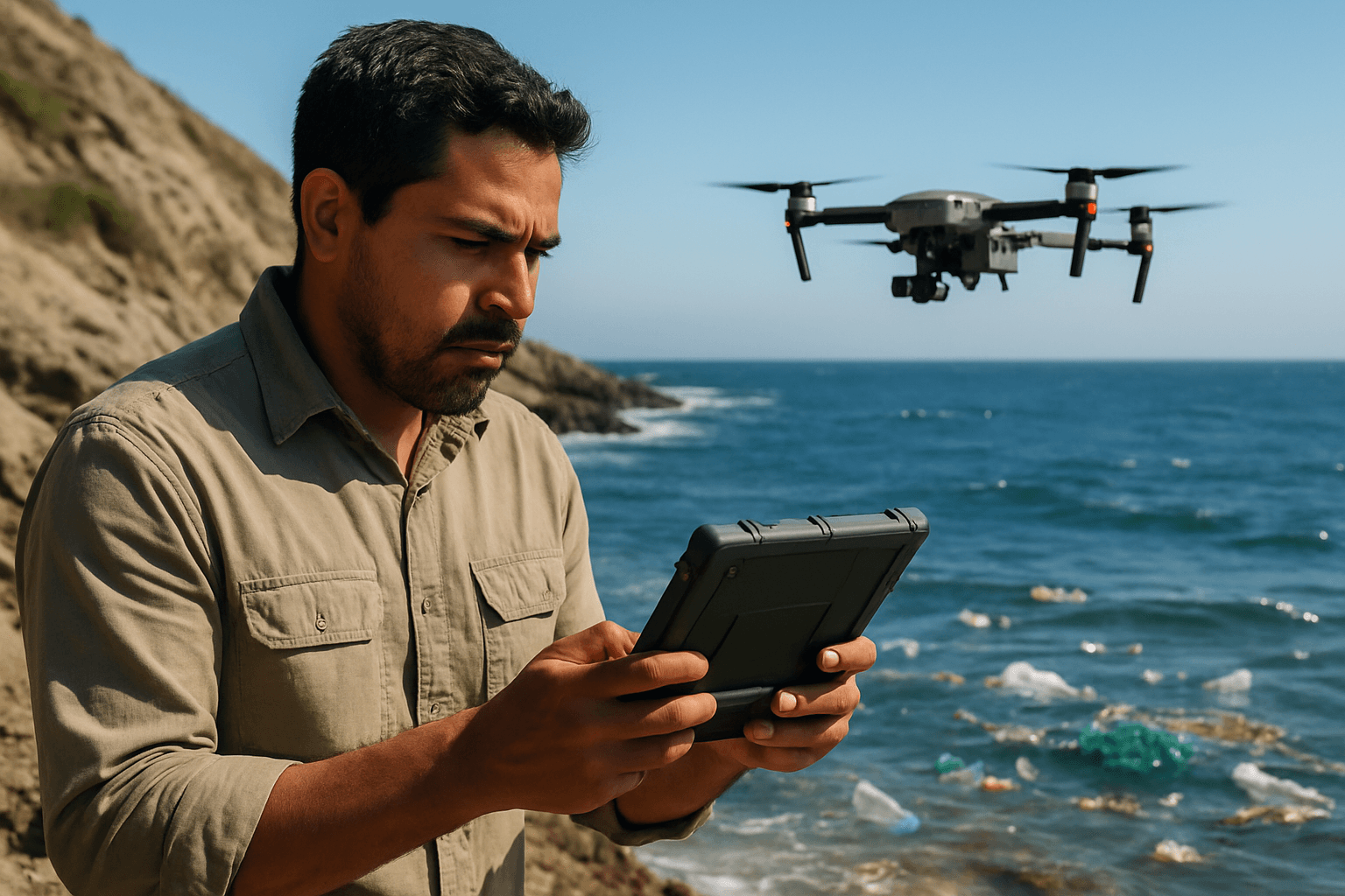
Drones: A New Frontier in Environmental Monitoring
In the face of this monumental challenge, drones offer unparalleled advantages for environmental monitoring.
Why Drones? Advantages Over Traditional Methods
Traditional methods for monitoring plastic pollution, often relying on manual surveys or large ship-based operations, are costly, time-consuming, and insufficient for the vastness of the oceans. Drones provide a transformative alternative due to their ability to cover large areas quickly and efficiently. They offer enhanced data collection, cost-effective solutions by avoiding piloted aircraft, and real-time monitoring capabilities. Drones can access remote and difficult-to-reach areas, providing high-resolution data with unprecedented spatial and temporal detail. Moreover, their eco-friendly operation can reduce the carbon footprint compared to traditional methods.
Types of Drones Used
Both aerial and surface-based drones are being deployed. Aerial Unmanned Aerial Vehicles (UAVs) are the primary tool for tracking and mapping, coming in various sizes from miniature quadcopters to larger fixed-wing aircraft. They can be categorized into low- or high-altitude platforms, with small drones typically operating below 300m. For direct collection in waterways, aquatic drones like the WasteShark and Clearbot are also used, capable of autonomously navigating and collecting floating debris.
How Drones Track Plastic Pollution
The effectiveness of drones in tracking plastic pollution stems from their advanced sensor technologies and intelligent data processing.
Sensor Technologies
Drones are equipped with a range of sophisticated sensors to detect plastic debris:
- RGB Cameras: Standard high-resolution cameras are used to capture visual data of plastic on the surface, especially larger items.
- Multispectral and Hyperspectral Imaging: These advanced sensors analyze light across a wider spectrum, allowing for the identification of plastic based on its unique spectral signatures, even when mixed with organic matter or slightly submerged.
- Thermal Infrared Sensors: These can detect temperature differences, potentially useful for identifying larger aggregations of plastic that may retain heat differently than surrounding water bodies.
- LiDAR (Light Detection and Ranging): LiDAR technology provides precise 3D mapping of the ocean surface, enabling better quantification of plastic volume and distribution.
Data Collection and Analysis
The true power of drone-based tracking lies in the integration of Artificial Intelligence (AI) and Machine Learning (ML) for data analysis. Drones capture thousands of aerial photos and videos, which are then fed into AI algorithms, particularly deep learning models like Region-Based Convolutional Neural Networks (R-CNN), Faster R-CNN, SSD, YOLOv8, and Mask R-CNN. These algorithms are trained to recognize plastic waste and differentiate it from natural elements like shells, jellyfish, or vegetation.
Key aspects of this process include:
- Automated Detection: AI algorithms enable real-time plastic detection, filtering out noise and identifying target materials with high accuracy.
- Geo-tagging and Mapping: Identified plastic debris is geo-tagged, allowing for the creation of accurate, open-source maps of pollution hotspots along coastlines and in open waters.
- Predictive Modeling: By integrating drone data with information on oceanic currents, wind patterns, and river outflow, AI can develop predictive models to forecast where plastic waste is likely to accumulate, optimizing future cleanup operations.
- Adaptive Survey Strategies: AI allows drones to dynamically adjust their flight paths based on real-time data, concentrating efforts on areas with higher plastic concentrations to optimize survey efficiency.
Real-World Applications and Success Stories
Several initiatives worldwide are demonstrating the efficacy of drones in combating ocean plastic pollution.
Case Studies and Research Initiatives
- The Plastic Tide (UK): This volunteer-based project uses drone imagery of coastlines to train an AI algorithm to identify and map plastic debris, creating a database of over 7,000 images to inform cleanup strategies.
- The Ocean Cleanup: This non-profit organization extensively leverages AI, drones, machine learning, and remote sensing to detect, track, and remove plastic debris from areas like the Great Pacific Garbage Patch and from rivers using interceptor barriers. Their Automatic Debris Imaging System (ADIS) uses AI-driven image recognition to classify plastic waste and quantify pollution density.
- Galapagos Conservation Trust: Drone-based mapping in the Galapagos helps identify key accumulation sites and optimal landing spots for cleanup teams, significantly reducing the need for manual surveying and allowing more time for actual cleanup efforts.
- AIDMAP Project (Vietnam): Researchers are combining small drones and in-situ observations with AI for the automatic detection of floating and slightly submerged marine plastic litter, evaluating performance using high spatial resolution RGB and multispectral imagery.
- CSIRO (Australia): Scientists have used drones to survey rivers like the Mekong, geo-tagging plastic pollution to create hotspot maps and understand its distribution, significantly reducing survey time compared to manual methods.
- South Korea: The Ministry of Science and ICT has funded projects using drones to collect information on floating plastic garbage, identifying types, sources, and estimating quantities to aid cleanup efforts.
Contributing to Cleanup Efforts
The detailed, high-resolution data provided by drones is invaluable for targeted cleanup operations. By pinpointing accumulation sites, cleanup crews can work more efficiently, maximizing their impact. Drone data also helps monitor the effectiveness of cleanup initiatives and policy interventions, such as plastic bag bans, by tracking changes in pollution levels over time.
Challenges and Limitations
Despite their immense potential, drone-based plastic tracking faces several hurdles.
Environmental Factors
Operating drones in marine environments presents significant challenges. Harsh weather conditions, strong winds, rain, and variable lighting can affect image quality and drone stability. Rough seas and wave interference can make it difficult for sensors to differentiate plastic from natural debris, and detection rates often decline in such conditions.
Technical Hurdles
A major limitation remains the reliable detection of microplastics and submerged plastics, which are the most pervasive and insidious forms of ocean pollution. Current sensor technologies, while advanced, still struggle to identify these smaller, less visible particles. Furthermore, the sheer volume of data generated by drone operations requires sophisticated processing capabilities and extensive datasets to train accurate AI models. The degradation processes of plastic can also alter its characteristics, making spectral responses different from laboratory samples.
Regulatory and Operational Hurdles
Strict regulations govern drone use, particularly in sensitive environments and over large oceanic expanses, limiting their operational range and scalability. High costs and maintenance requirements in harsh marine conditions also pose barriers to widespread global rollout.
The Future of Drone-Based Plastic Tracking
The trajectory for drones in environmental monitoring is decidedly upward, with continuous advancements promising even greater capabilities.
Advancements in Drone Technology
The future will see drones becoming more autonomous, with improved navigation, communication, and payload capacities. Swarming technology, where multiple drones work together to cover larger areas more efficiently, could become a reality. Further developments in drone and sensor technology are expected to enhance their ability to detect even smaller particles, including microplastics and nanoplastics, potentially utilizing techniques like Raman spectroscopy or advanced fluorescence imaging.
Integration with Other Monitoring Systems
Drones are increasingly being integrated with other remote sensing technologies, such as satellite imagery and High-Altitude Pseudo-Satellites (HAPS), to provide a comprehensive and sustainable long-term monitoring solution. This synergistic approach combines the high spatial resolution of drones with the broad coverage of satellites, allowing for calibration and validation of large-scale datasets.
Towards a Cleaner Ocean
Ultimately, the future of drone-based plastic tracking is intertwined with a broader shift towards a circular economy and proactive mitigation strategies. Data from drones can inform and drive these initiatives by identifying major sources of plastic leakage, tracking waste movement, and monitoring the effectiveness of source reduction and recycling programs. By optimizing waste management systems and targeting interventions where they are most needed, drones will play a pivotal role in accelerating positive impact on marine ecosystems and fostering a cleaner, healthier ocean for generations to come.
Drones are not merely a tool for observation; they are becoming intelligent agents in the global effort to reclaim our oceans from plastic pollution, offering hope for more strategic, efficient, and impactful conservation efforts.


