Drone technology has revolutionized numerous industries, and surveying is no exception. Among the many applications of drones, creating orthomosaics stands out as a powerful tool for generating accurate and detailed maps. This comprehensive guide explores the world of drone orthomosaics, specifically focusing on their use and relevance within the UK.
What is a Drone Orthomosaic?
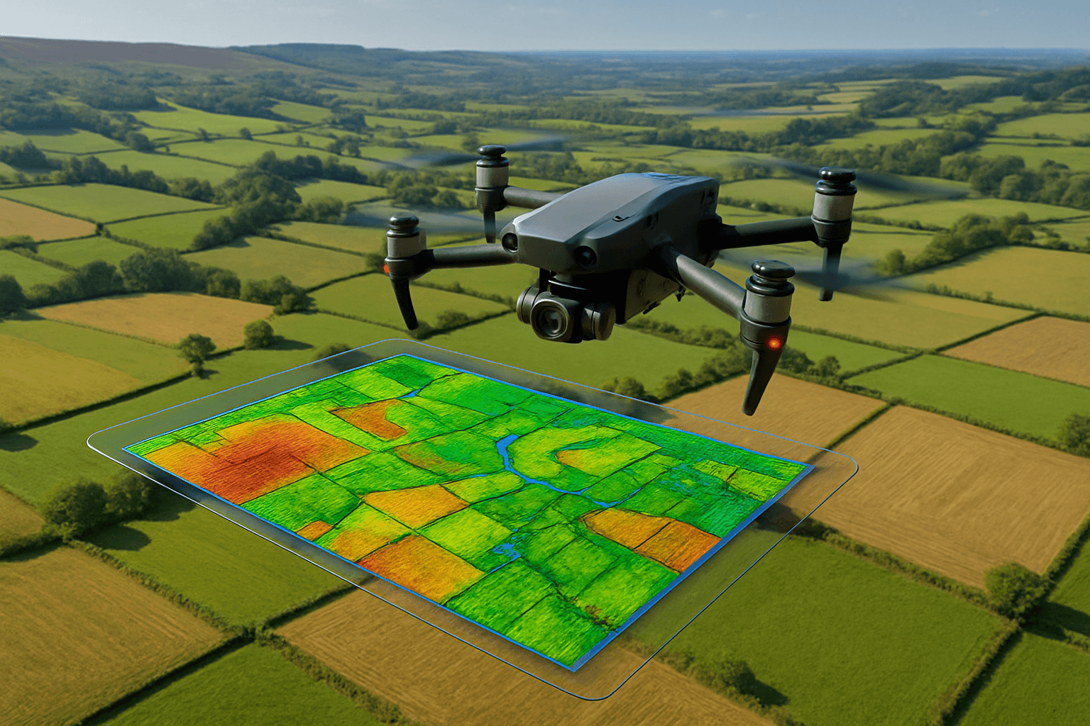
An orthomosaic is a high-resolution, geometrically corrected aerial image created by stitching together multiple overlapping drone-captured photos. Unlike traditional aerial photos, orthomosaics are orthorectified, meaning they’ve been corrected for distortions caused by camera perspective, lens distortion, and terrain relief. This process results in a seamless, true-to-scale representation of the Earth’s surface, allowing for accurate measurements of distances, angles, and areas. Orthomosaics are also commonly called orthoimages or orthophotographs.
2D vs. 3D Orthomosaics
There are two main types of orthomosaics:
- 2D Orthomosaics: These provide a top-down view, like a detailed map with precise coordinates. They are useful for applications like farming and city planning.
- 3D Orthomosaics: These add a height dimension to the 2D image, providing both horizontal and vertical information. They are suitable for construction and forestry, offering a comprehensive understanding of the terrain.
How are Drone Orthomosaics Made?
Creating an orthomosaic involves several key steps:
- Image Capture: A drone, equipped with a high-resolution camera, flies over the target area, capturing numerous overlapping images from different angles. The drone pilot programs the flight path to ensure optimal coverage, considering factors like resolution, overlap, and relevancy.
- Image Transfer and Preprocessing: After the flight, the images are transferred to a computer and undergo preprocessing to prepare them for alignment and merging.
- Georeferencing: GPS coordinates are assigned to each image to accurately align them with the Earth’s surface.
- Photogrammetry: Specialized photogrammetry software processes the images, identifying common features and creating a 3D point cloud to generate an initial map.
- Orthorectification: The map is orthorectified to correct for distortions caused by terrain and the drone’s angle during flight, making the map geometrically accurate.
- Stitching and Mosaicking: The orthorectified images are stitched together to create a seamless, high-resolution orthomosaic.
Key Factors Affecting Accuracy
Several factors can impact the accuracy of a drone orthomosaic:
- Ground Control Points (GCPs): GCPs are marked points on the ground with known geographic locations. Using GCPs improves positional accuracy by tying the drone’s data to real-world coordinates. The number of GCPs required depends on the size and complexity of the mapping area.
- Drone Calibration and Sensor Accuracy: Accurate sensors, such as GPS and IMU (Inertial Measurement Unit), are crucial for orthomosaic mapping. Regularly calibrating the drone ensures accurate and consistent measurements.
- Image Overlap and Coverage: Sufficient image overlap is vital for successful drone orthomosaic mapping. A general guideline is to have at least 70% image overlap.
- Environmental Factors: Wind, lighting, and weather conditions can affect the quality of drone imagery.
- Software and Processing: The choice of photogrammetry software and processing techniques can influence the accuracy of the final orthomosaic.
Benefits of Using Drone Orthomosaics
Drone orthomosaics offer numerous advantages over traditional surveying methods:
- Accuracy and Precision: Orthomosaics provide highly accurate and precise maps with centimeter-level accuracy when using advanced sensors and GPS technology. They eliminate perspective distortion, allowing for precise distance and area measurements.
- Efficiency and Speed: Drones can cover large areas quickly, significantly reducing the time required for surveying tasks.
- Cost-Effectiveness: Drone surveys are typically less expensive than traditional methods, as they require fewer personnel and less equipment.
- Safety: Drones reduce the need for human operators to work in hazardous or inaccessible areas, improving safety at work sites.
- Enhanced Data Collection and Analysis: Drones enable comprehensive data collection and analysis, providing detailed insights that are not possible with traditional methods. The high-resolution images captured by drones can be processed to create detailed 3D models, topographic maps, and other valuable datasets.
- Improved Communication: Detailed orthomosaics can be easily shared among team members, stakeholders, and clients, facilitating better communication and collaboration.
- Regular Updates: Orthomosaic maps can be updated over time by acquiring new aerial or satellite imagery and processing it using the same algorithms used to create the original map. This allows for accurate tracking of changes over time.
Applications of Drone Orthomosaics in the UK
Drone orthomosaics have a wide range of applications across various industries in the UK:
- Construction:
- Site Planning and Design: Orthomosaics provide a better understanding of the construction site’s topography, helping architects and engineers tailor their designs to the site.
- Project Monitoring and Progress Reporting: Drone mapping allows for real-time tracking of construction project progress. Regularly updated maps ensure adherence to timelines and prompt addressing of any deviations.
- Stockpile and Volume Measurements: Orthomosaics enable precise volume calculations of stockpiles, excavations, and fills.
- Quality Control and Inspection: High-resolution orthomosaics facilitate detailed inspections of construction sites.
- As-built Documentation: Serve as detailed as-built documents for future reference and maintenance planning.
- Agriculture:
- Crop Health Assessment: Farmers can use orthomosaics to evaluate crop health and development, identifying areas affected by pests, diseases, or inadequate irrigation.
- Precision Farming: Orthomosaics enable precise measurements of fields, which is perfect for tasks like precision farming.
- Land Surveying and Mapping:
- Cadastral Mapping: Generate high-accuracy cadastral maps quickly and easily, even in complex or difficult-to-access environments.
- Topographic Surveys: Orthomosaics are used for topographical surveying and mapping, such as hydrological mapping.
- Environmental Monitoring:
- Habitat Assessment: Useful in a range of applications, including environmental projects for habitat assessment.
- Change Detection: Detect changes in earth movement and measure its velocity.
- Infrastructure Inspection:
- Creating detailed maps to facilitate thorough inspections of infrastructure such as roads.
- Emergency Response and Law Enforcement:
- Mapping Busy Areas and Crime Scenes: Police officers and firefighters use UAV mapping to map out busy areas and crime scenes.
- Urban Planning:
- Orthomosaics provide up-to-date aerial imagery of large areas, allowing for detailed monitoring and analysis of changes over time.
- Archaeology:
- Orthomosaics can be used to create detailed maps of archaeological sites, helping researchers to identify and document features that may not be visible from the ground.
Drone Orthomosaic Software
Several software solutions are available for processing drone imagery and creating orthomosaics. Some popular options include:
- DJI Terra: Generates 2D orthomosaics in real-time, with rapid and accurate 2D reconstructions. It also offers 3D mapping and reconstruction, LiDAR processing, and data analysis.
- PIX4Dmapper: Professional photogrammetry software for drone mapping. It transforms ground or aerial images into digital maps and 3D models.
- Agisoft Metashape: Standalone software product performing photogrammetric processing of digital images.
- OpenDroneMap (ODM) and WebODM: An open-source command-line toolkit and user-friendly application for processing aerial images.
- DroneMapper: Provides desktop photogrammetry software for generating orthomosaics and DEMs (Digital Elevation Models).
- Esri Drone2Map: Rapidly creates 2D and 3D mapping products from drone imagery.
- Mapware: Flight planning software to capture images and seamlessly send them to photogrammetry software.
UK Drone Regulations
Operating drones for commercial purposes in the UK is subject to regulations set by the Civil Aviation Authority (CAA). Key regulations include:
- Registration: Drones weighing more than 250 grams must be registered with the CAA, and the drone operator must pass an online safety test to obtain a Flyer ID and an Operator ID.
- Altitude and Distance Restrictions: Drones cannot be flown above 400 feet (120 meters) in altitude or further than 500 meters away from the pilot without permission.
- Visual Line of Sight: The drone must always remain within the pilot’s visual line of sight.
- Restricted Areas: Drones must be kept away from aircraft, helicopters, airports, and airfields. They must not be flown within 150 meters of a congested area or large group of people, or within 50 meters of any person, vehicle, vessel, or building.
- Insurance: It’s recommended to have personal liability insurance in case the drone crashes and causes damage.
Staying Compliant
To ensure compliance with UK drone regulations, it’s essential to:
- Obtain the necessary licenses and IDs from the CAA.
- Understand and adhere to altitude and distance restrictions.
- Maintain visual line of sight with the drone at all times.
- Avoid flying in restricted areas.
- Obtain appropriate insurance coverage.
Cost of Drone Orthomosaics
The cost of creating drone orthomosaics varies depending on several factors, including:
- Project Size and Complexity: Larger and more complex projects typically cost more.
- Data Resolution and Accuracy Requirements: Higher resolution and accuracy requirements increase costs.
- Equipment and Software Used: The cost of drone equipment, sensors, and processing software can vary significantly.
- Service Provider Fees: If you hire a drone service provider, their fees will depend on their experience, equipment, and the services they offer.
Pricing Models
Common pricing models for drone mapping services include:
- Price per Acre: $100 to $500 per acre for larger areas.
- Price per Hour: $75 to $300 per hour.
- Price per Day: $500 to $1,500 per day.
- Price per Project: $500 to $5,000 per project.
- Price per Deliverable: $100 to $500 per deliverable (e.g., orthomosaic, point cloud).
- Custom Quote: Offered for more complex projects based on specific client needs.
Drone Orthomosaics vs. Traditional Surveying
Drone surveying offers several advantages over traditional surveying methods:
- Speed: Drone surveys are significantly faster, completing large-scale surveys in days compared to weeks for traditional methods.
- Cost: Drone surveys are generally more cost-effective due to reduced labor, equipment, and setup costs.
- Safety: Drones reduce the risk of injury in hazardous environments.
- Data Richness: Drone mapping produces significantly more data, allowing for the creation of highly accurate and detailed 3D models and surfaces.
- Completeness: Drones capture the entire survey site, reducing the need for return visits to collect missing data.
However, traditional surveying methods still offer the utmost accuracy and reliability, particularly in fields that require strict legal compliance or surveyor expertise.
Best Practices for Creating High-Quality Orthomosaics
To ensure the creation of high-quality orthomosaics, follow these best practices:
- Plan Your Flight Carefully:
- Determine the appropriate flight altitude to balance coverage and image detail.
- Plan for sufficient image overlap (70-80% is recommended).
- Implement Ground Control Points (GCPs) for accurate georeferencing.
- Consider your flight speed to avoid blurry images.
- Check the weather conditions before flying.
- Be aware of local drone regulations.
- Capture High-Quality Images:
- Use a high-resolution camera.
- Ensure images are taken at the nadir (camera pointed straight down).
- Maintain consistent lighting conditions.
- Process Data Carefully:
- Use specialized photogrammetry software.
- Remove any problematic images (blurry, over/underexposed, etc.).
- Optimize processing settings for your specific project requirements.
- Conduct a pre-flight check.
- Regularly Calibrate Equipment: Calibrate your drone, camera, and GNSS equipment regularly for accurate and consistent measurements during your photogrammetry missions.
- Select a Suitable Base Station Location: To ensure optimal satellite visibility and signal reception, choose a base station location with a clear view of the sky.
- Have Emergency Procedures in Place.
Conclusion
Drone orthomosaics have emerged as a game-changing technology in the UK, offering a cost-effective, efficient, and accurate solution for mapping and surveying across various industries. By understanding the principles behind orthomosaics, adhering to best practices, and staying compliant with UK drone regulations, professionals can unlock the full potential of this technology and achieve superior results.


