The agricultural landscape is undergoing a significant transformation, driven by technological advancements aimed at increasing efficiency and sustainability. At the forefront of this revolution are drones, or Unmanned Aerial Vehicles (UAVs), which are rapidly becoming indispensable tools for precision agriculture, particularly in the critical area of soil analysis.
Historically, soil analysis has been a labor-intensive and time-consuming process involving the physical collection of soil samples and their subsequent laboratory testing. This traditional method, while providing valuable data on nutrient levels, pH, and organic matter, can take days or even weeks for results to be delivered. In contrast, drone imagery offers a rapid, cost-effective, and highly accurate alternative, enabling farmers to gain real-time insights into their soil’s makeup without ever taking a physical sample.
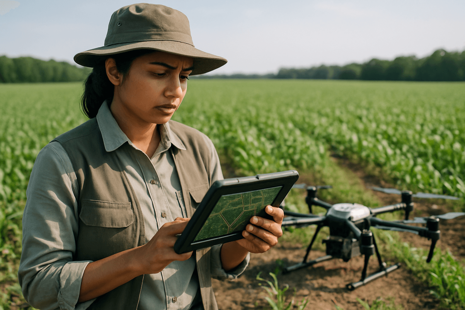
The Mechanism: How Drones Analyze Soil
Drone soil analysis leverages sophisticated imaging technology and remote sensing to gather detailed information about soil conditions. Drones equipped with specialized sensors and cameras fly over agricultural fields, capturing images in various wavelengths across the electromagnetic spectrum. This data, imperceptible to the naked eye, reveals subtle differences in soil properties.
Advanced Sensor Technologies
The effectiveness of drone-based soil analysis hinges on the advanced sensors integrated into the UAVs:
- Multispectral Sensors: These cameras capture light from specific bands of the electromagnetic spectrum, typically including visible light (red, green, blue) and near-infrared (NIR) and red-edge bands. Multispectral imaging is crucial for assessing soil characteristics like moisture content, organic matter, and nutrient levels, as different elements reflect unique wavelengths of light. They are also used for Normalized Difference Vegetation Index (NDVI) calculations, which indirectly indicate nutrient deficiencies through plant health.
- Hyperspectral Sensors: Taking data collection a step further, hyperspectral cameras capture data across hundreds of narrow, contiguous spectral bands. This provides even more detailed information about soil composition, offering a finer-grained understanding of subtle differences in soil properties. Studies have shown that UAV hyperspectral data can outperform satellite sources in estimating soil moisture content due to superior spatial and spectral resolution.
- Thermal Cameras: These sensors detect infrared radiation, allowing for temperature measurements of the soil and plants. Thermal imaging can identify variations in soil moisture, water stress, and even issues with irrigation systems.
- LiDAR (Light Detection and Ranging): LiDAR sensors use laser beams to measure distances and create detailed 3D maps of the terrain. These maps are invaluable for understanding soil elevation, drainage patterns, and identifying wet or dry spots.
- RGB Cameras: Standard Red, Green, Blue cameras provide visual inspections of fields, assisting with overall field mapping and identifying superficial issues.
Data Processing and Analysis
Once collected, the vast amounts of data from these sensors are processed using sophisticated software, often powered by artificial intelligence (AI) and machine learning (ML) algorithms. This software translates the raw visual and spectral inputs into actionable information and detailed maps. These maps can highlight variations in soil properties, moisture levels, organic matter content, pH levels, and nutrient distribution. AI-supported software can even predict soil health, aiding farmers in planning for future seasons.
Benefits of Drone Imagery for Soil Analysis
The integration of drone technology into soil analysis offers a multitude of advantages for modern agriculture, contributing significantly to precision farming practices.
Enhanced Efficiency and Speed
Drones can cover vast agricultural areas quickly, capturing data across hundreds or even thousands of acres in a fraction of the time it would take for manual sampling. This rapid data acquisition provides farmers with near real-time insights, allowing for immediate decision-making and interventions.
Unprecedented Accuracy and Detail
Unlike traditional manual sampling, which provides point-specific data, drones capture information on every inch of the field, offering a continuous and comprehensive map of soil variability. This detailed view enables farmers to identify minute differences and problematic zones that might be missed by conventional methods.
Optimized Resource Management
With precise data on soil properties, farmers can make informed decisions regarding the application of vital inputs such as water, fertilizers, and pesticides. This targeted approach minimizes over-application, reducing waste, lowering costs, and contributing to more sustainable farming practices. For instance, low potassium levels can be quickly identified, enabling targeted fertilization and preventing environmental harm from runoff.
Proactive Problem Solving and Yield Optimization
Drone data allows for the early detection of soil deficiencies, moisture imbalances, and even plant stress before visible symptoms appear. This proactive monitoring enables farmers to implement timely interventions, adjust irrigation strategies, and tailor nutrient applications to maximize crop health and productivity, potentially increasing yields by as much as 5% or more.
Challenges and Future Outlook
Despite the numerous benefits, the widespread adoption of drones for soil analysis faces certain challenges. The initial cost of purchasing and maintaining advanced drones and sensors can be a significant investment for farmers. Furthermore, operating these complex machines and interpreting the collected data requires specialized training and technical knowledge. Factors such as weather conditions and sensor calibration can also influence the accuracy of data collection.
However, ongoing advancements in drone technology, sensor capabilities, and AI-powered data analytics are continually addressing these limitations. The future of drone imagery in soil analysis points towards even greater integration with Internet of Things (IoT) sensors and big data platforms, creating highly automated and responsive farm management systems. As the technology matures and becomes more accessible, drones are poised to transition from an optional tool to a core component of every smart farm, further revolutionizing how we understand and manage the health of our planet’s most vital resource—soil.


