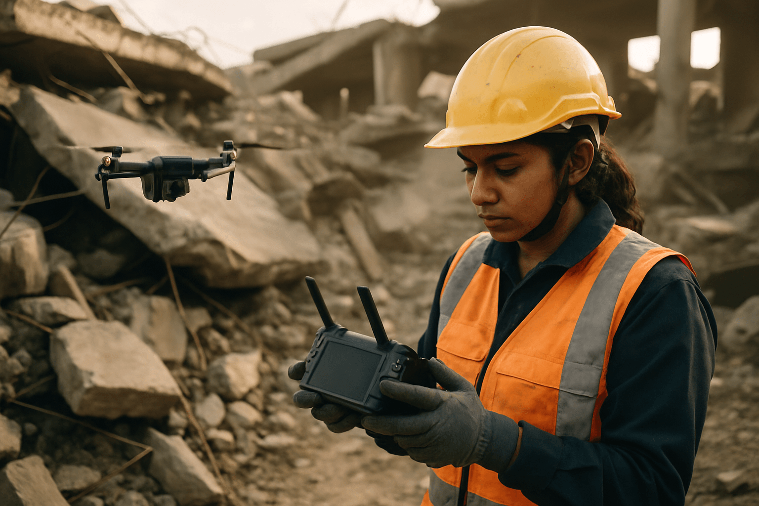
Urban search and rescue (USAR) operations present a unique and formidable set of challenges. From collapsed buildings and dense infrastructure to compromised communication networks and the sheer scale of potential disaster zones, these environments demand rapid, efficient, and safe response methods. Unmanned Aerial Systems (UAS), commonly known as drones, have emerged as transformative tools, offering unprecedented capabilities to enhance situational awareness, locate victims, and streamline rescue efforts in complex urban landscapes. This article delves into the critical drone deployment strategies that are revolutionizing urban SAR.
The Unique Challenges of Urban Search and Rescue
Urban environments, by their very nature, complicate traditional search and rescue efforts. Disasters such as earthquakes, explosions, or industrial accidents can leave behind a labyrinth of unstable structures, debris, and confined spaces. Responders face dangers including secondary collapses, hazardous materials, and limited access to affected areas. Traditional methods, often relying on ground teams and manned aircraft, can be slow, costly, and put human lives at significant risk.
Key challenges in urban SAR include:
- Accessibility: Rubble, damaged roads, and confined spaces make it difficult for ground teams to reach victims.
- Visibility: Smoke, dust, and structural obstructions severely limit visibility, making visual searches challenging, especially in low-light conditions.
- Situational Awareness: Gaining a comprehensive overview of a large, complex disaster site is crucial but often elusive with traditional means.
- Communication: Existing communication infrastructure can be compromised, hindering coordination among rescue teams.
- Risk to Rescuers: Entering unstable or hazardous areas poses significant threats to human responders.
Advantages of Drones in Urban SAR Operations
Drones address many of these challenges by offering a rapid, cost-effective, and safe alternative for initial assessment and ongoing surveillance. Their ability to fly over obstacles, access confined spaces, and carry advanced payloads makes them indispensable.
The primary advantages include:
- Rapid Deployment and Speed: Drones can be airborne within minutes, providing immediate aerial data and covering vast areas much faster than ground teams or even manned helicopters. This speed is critical, as the chance of extricating a casualty alive drops dramatically after 24 hours.
- Enhanced Situational Awareness: Drones provide real-time aerial views and data, allowing responders to map search zones, identify potential hazards, and pinpoint victim locations. This bird’s-eye perspective is invaluable for strategic planning.
- Reduced Risk to Personnel: By deploying drones into dangerous or inaccessible areas, SAR teams can gather critical information without exposing human rescuers to immediate threats.
- Advanced Sensor Capabilities: Equipped with thermal cameras, high-resolution optical cameras, and even specialized gas sensors, drones can detect heat signatures of survivors through smoke, debris, or in darkness, and identify structural weaknesses.
- Access to Inaccessible Areas: Small drones, including nanodrones, can navigate through ventilation ducts, collapsed structures, and narrow passages to locate trapped individuals, providing “eyes within ruins” before manual clearing begins.
- Logistical Support: Cargo drones can deliver essential supplies like water, food, and medicine to stranded victims in hard-to-reach areas, and even transport equipment to high floors or roadless zones.
Key Drone Deployment Strategies for Urban SAR
Effective drone deployment in urban SAR requires systematic planning and execution, often leveraging specific search patterns and technologies.
1. Aerial Reconnaissance and Mapping
Initial deployment often focuses on gaining immediate situational awareness. Drones can quickly:
- Assess Damage: Fly over the disaster zone to identify the extent of structural damage, road blockages, and affected areas.
- Create 2D/3D Maps: Generate orthomosaic maps and 3D models of the scene, providing a detailed visual record for planning and analysis.
- Identify Entry/Exit Routes: Locate safe pathways for ground teams and assess the stability of the terrain.
2. Standardized Search Patterns
For systematic coverage of search areas, various pre-programmed flight patterns are utilized:
- Grid Pattern: Involves flying back and forth in parallel lines. This is effective when assignment boundaries are well-defined and ensures thorough coverage, especially with overlapping passes. A “double pass” grid can incorporate opposite traversals for enhanced probability of detection (POD).
- Spiral Pattern: Involves flying in widening circles from a high-priority point, such as an initial planning point (IPP) or the last known location of a missing person. This is ideal for initial reflex flights or scene awareness. Square spiral patterns are also used, sometimes alternating direction each revolution.
- Line Search Patterns: Allows for building a string of waypoints for the drone to traverse at a consistent height, useful for following specific features like trails or roads.
- Sector Search Pattern: A more complex pattern designed to provide extensive coverage at various angles, particularly useful for looking through and around obstructions.
The choice of pattern is often driven by the terrain, desired Probability of Detection (POD) goal, and operational phase. Factors like camera angle, speed, altitude, and even time of day are adjusted to maximize detection.
3. Confined Space Exploration with Small UAS
For internal structural searches, specialized smaller drones are deployed:
- Nanodrones: These micro-UAVs are essential for navigating highly confined spaces such as ventilation shafts, pipes, and small voids within collapsed buildings, providing crucial visual intelligence before human entry.
- Collision-Tolerant Drones: Equipped with protective cages, these drones can bump into obstacles without crashing, making them suitable for navigating dark, debris-filled, and unstable interiors.
4. Tethered Drones for Persistent Surveillance and Communication
Tethered drones remain connected to a ground station via a micro-tether, offering distinct advantages in urban SAR:
- Extended Endurance: The tether provides continuous power, allowing for unlimited flight time and persistent aerial surveillance over an area.
- Secure Communications: The tether can transfer secure data without relying on radio frequency, which can be jammed or interrupted in dense urban environments.
- Temporary Communication Relays: In areas where communication networks are down, tethered drones can establish temporary mesh networks, restoring vital connectivity for rescue teams.
- Enhanced Stability: Tethering can improve stability in windy conditions or “urban canyons” created by high-rise buildings.
5. AI-Powered Detection and Analysis
Artificial intelligence (AI) is rapidly enhancing drone SAR capabilities:
- Automated Object Detection: AI algorithms can analyze vast amounts of real-time video and imagery to identify human forms, differentiate them from animals, and pinpoint potential survivors more quickly and accurately than human operators.
- Predictive Analytics: AI can help predict survivor locations based on factors like weather, terrain, and known behavioral patterns.
- Optimal Flight Path Planning: AI can generate the most efficient flight paths, reducing search times and maximizing coverage.
- Swarm Technology: Future advancements include drone swarms where multiple UAVs coordinate autonomously, covering larger areas and sharing real-time data to dramatically speed up blanket searches.
Operational Considerations and Regulatory Landscape
Deploying drones in urban SAR environments requires careful consideration of several operational and regulatory factors:
Airspace Regulations
Urban airspace is often complex, with proximity to airports, helipads, and restricted zones. Operators must navigate regulations from authorities like the FAA (in the US) regarding altitude limits (typically 400 feet AGL), visual line of sight (VLOS), and operations over people or moving vehicles. Obtaining waivers or authorizations for specific SAR missions is often necessary, especially for flights beyond visual line of sight (BVLOS). Local ordinances may also impose additional restrictions, such as designated no-fly zones near schools, hospitals, or public parks.
Environmental Factors
Urban environments present unique environmental challenges:
- GPS Interference: High-rise buildings and dense structures can cause GPS signal loss or magnetic interference, impacting drone navigation and stability.
- Wind Tunnels: Wind currents between tall buildings can create unpredictable conditions, requiring durable drones and experienced pilots.
- Electromagnetic Interference (EMI): Dense urban areas can have high levels of radiofrequency noise, which can interfere with drone control signals.
Payload Selection and Battery Life
Choosing the right drone and payload is crucial. SAR drones often require:
- Thermal and Optical Cameras: High-resolution cameras with zoom capabilities and thermal imaging are essential for day and night operations.
- Loudhailers/Communication Relays: For communicating with victims or ground teams.
- Delivery Mechanisms: For dropping essential supplies.
- Extended Battery Life: Drones like the DJI Matrice series and Autel EVO Max offer longer flight times, allowing for more extensive and persistent search operations. Tethered drones offer a solution for unlimited endurance.
Data Management and Integration
The vast amount of data collected by drones needs efficient management. Real-time video feeds must be relayed to command centers for informed decision-making and shared seamlessly with multiple SAR teams. AI-powered software can assist in processing and analyzing this data to identify critical information quickly.
The Future of Drones in Urban SAR
The role of drones in urban SAR is continuously evolving with technological advancements. Future trends include:
- Enhanced Autonomy: Drones will become more autonomous, performing complex search patterns and obstacle avoidance with minimal human intervention.
- Swarm Intelligence: Coordinated drone swarms will cover larger areas more efficiently and rapidly, sharing data in real-time.
- 5G Integration: Ultra-low latency 5G networks will enable high-resolution data streaming and real-time communication, even in remote or compromised areas.
- Improved Battery Technology: Advances in battery life will allow for longer flight durations and more sustained operations.
- Miniaturization and Specialization: Smaller, more agile drones will be developed for even more confined and hazardous spaces.
- Drone as First Responder (DFR) Programs: DFR programs, where drones are dispatched instantly to emergencies, are expected to expand, making drones a standard part of SAR response.
Conclusion
Drone deployment strategies are fundamentally transforming urban search and rescue. By providing unparalleled speed, safety, and situational awareness, UAS offer critical advantages in complex and dangerous urban environments. From systematic aerial mapping and diverse search patterns to specialized confined-space exploration and persistent surveillance with tethered systems, drones are empowering rescue teams to locate victims faster and conduct operations more effectively. As technology continues to advance, drones are poised to become an even more integral and indispensable component of modern urban SAR, ultimately saving more lives and enhancing the safety of responders.


