The health of our planet’s aquatic ecosystems is under increasing threat from pollution, climate change, and human activity. Accurately and efficiently monitoring water quality is paramount, yet traditional methods often fall short, being resource-intensive, time-consuming, and geographically limited. Enter drone technology, an innovative solution rapidly transforming how we understand, assess, and protect our vital water resources, offering unprecedented precision, accessibility, and real-time insights.
The Imperative of Water Quality Monitoring
Water is an indispensable resource for all life, essential for drinking, agriculture, industry, and maintaining healthy ecosystems. Consequently, vigilant monitoring of water quality is critical to understanding ecosystem health, identifying pollution sources, ensuring safe water supplies, and managing natural resources effectively. Parameters such as pH levels, turbidity, temperature, dissolved oxygen, and nutrient concentrations like nitrates and phosphates are key indicators of water body health and potential contamination.
Traditional Water Quality Monitoring: Facing the Current
Historically, water quality assessment has relied on manual sampling and in-situ measurements, often followed by laboratory analysis. While providing accurate point-based data, these methods are fraught with limitations:
- Resource-Intensive and Costly: Traditional sampling requires significant labor, specialized equipment, and can be expensive to conduct over large areas or at high frequencies.
- Limited Spatial and Temporal Coverage: Manual sampling offers discrete, “point-based assessments” and infrequent temporal snapshots, often failing to capture the dynamic and heterogeneous nature of water bodies or sudden pollution events.
- Accessibility Challenges: Many critical water bodies, such as remote reservoirs, wetlands, industrial runoff zones, or hazardous mine pit lakes, are difficult or dangerous for human access.
- Human Error and Sample Integrity: Manual processes are prone to human error, and the transit of samples to a laboratory can sometimes alter water characteristics, affecting the reliability of results.
- Lack of Real-time Data: Traditional methods typically involve delays between collection and analysis, hindering rapid response to contamination events.
- Satellite Limitations: While satellite-based remote sensing offers broad perspectives, it is often constrained by coarse spatial resolution, making it unsuitable for small water bodies like narrow rivers or ponds, and is heavily affected by atmospheric interference like clouds.
These limitations highlight a significant gap in our ability to conduct comprehensive, timely, and safe water quality monitoring.
How Drones Revolutionize Water Quality Monitoring
Unmanned Aerial Vehicles (UAVs), commonly known as drones, equipped with advanced sensor payloads, are bridging the gaps left by traditional and satellite-based approaches. They offer a dynamic, high-resolution, and often more cost-effective solution for assessing water quality.
Sensor Integration: The Eyes and Ears of the Drone
Drones can carry a diverse array of sensors, transforming them into mobile “mini laboratories” capable of collecting a wide range of water quality data:
- Multispectral Sensors: These capture images across several discrete bands of the electromagnetic spectrum, including visible light, red-edge, and near-infrared. They are highly effective in estimating optically active parameters such as chlorophyll-a (an indicator of algal blooms), total suspended solids (TSS), turbidity, and colored dissolved organic matter (CDOM).
- Hyperspectral Sensors: An advancement over multispectral, hyperspectral cameras separate light into hundreds of narrow, contiguous spectral bands. This provides even more detailed spectral information, enabling more accurate and precise retrieval of various water quality parameters, including specific pollutants and organic matter.
- Thermal Cameras: Used to measure surface water temperature, a critical parameter influencing aquatic life and chemical processes.
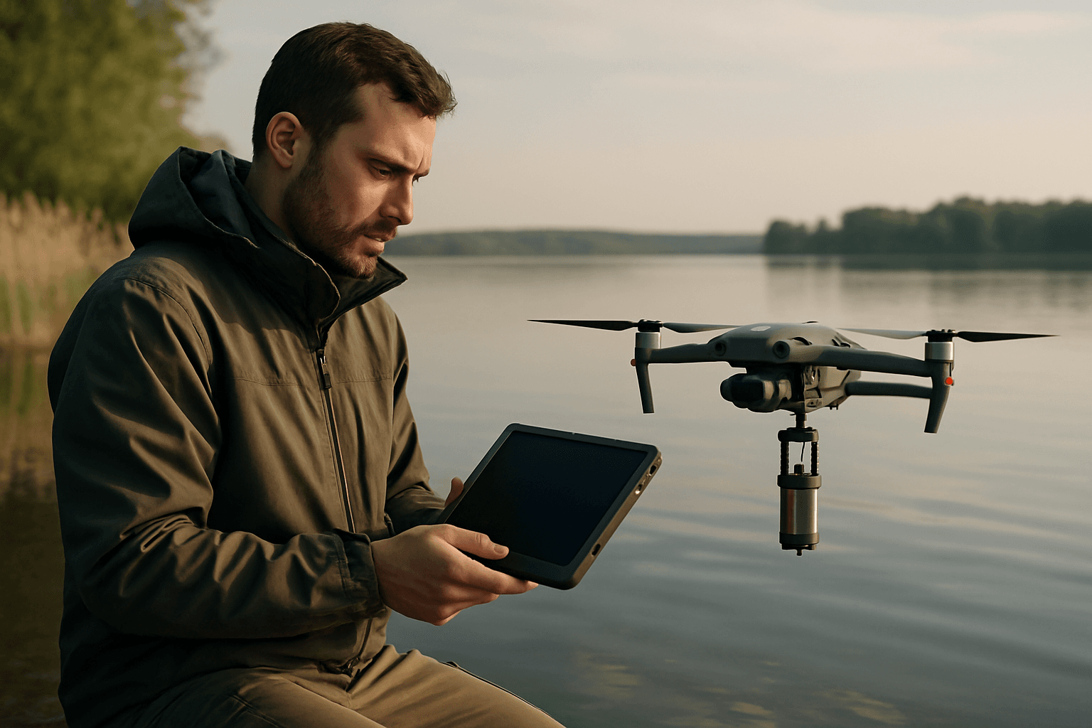
- In-situ Probes and Samplers: Some drones are designed to hover and lower physical probes into the water to directly measure parameters like pH, temperature, conductivity, dissolved oxygen (DO), nitrate, and phosphate. Other systems can collect actual water samples for later laboratory analysis, particularly in areas unsafe for humans.
- LiDAR: While not directly measuring water quality, LiDAR can be used for bathymetry (water depth mapping) and water level monitoring, which are indirectly relevant to water body health.
Data Acquisition and Coverage: Beyond the Horizon
Drones offer significant advantages in data acquisition:
- High Spatial Resolution: Drones can capture imagery at centimeter-scale resolution, significantly higher than satellite data, allowing for the detection of fine-scale spatial heterogeneity and localized pollution sources that would otherwise be missed.
- Flexible Temporal Resolution: Unlike satellites with fixed revisit times, drones offer on-demand data acquisition, enabling frequent and timely monitoring campaigns to track rapid changes, short-term events like pollution spills, or seasonal variations in water quality. They are also less sensitive to cloud cover, requiring only sufficient light.
- Accessibility to Difficult Areas: Drones can easily access remote, hazardous, or difficult-to-reach areas of lakes, reservoirs, rivers, and coastal waters, improving safety for monitoring personnel and enabling data collection where traditional methods are impossible or dangerous.
- Non-Contact Detection: Drones can monitor water bodies from above, avoiding direct contact and preventing secondary contamination that might occur with traditional sampling.
Real-time and Near Real-time Analysis
The integration of drone technology with advanced analytics allows for more immediate insights. Onboard or cloud-based AI systems can analyze data in real time, detecting anomalies such as algal blooms, sediment build-up, or oil slicks. Some systems can even provide real-time data transmission and analysis from the drone to the shore.
Key Techniques and Technologies Employed
The application of drones in water quality monitoring leverages several cutting-edge techniques:
Remote Sensing with Optical Sensors
This is the most common drone-based approach. Multispectral and hyperspectral cameras analyze the spectral reflectance characteristics of water. Different water quality parameters, such as chlorophyll-a, suspended sediments, or dissolved organic matter, alter how light is reflected from the water column. By analyzing these distinct spectral signatures, researchers can infer the concentration and spatial distribution of these parameters.
- Chlorophyll-a and Algal Blooms (HABs): High concentrations often signify harmful algal blooms. Multispectral sensors, particularly in green and red-edge bands, are highly sensitive to chlorophyll-a, enabling the creation of predictive maps for identifying eutrophication hotspots and tracking bloom distribution.
- Turbidity and Total Suspended Solids (TSS): These are critical indicators affecting light penetration and potentially carrying pollutants. Multispectral imagery in the red and near-infrared bands is effective in estimating turbidity and TSS concentrations, as these bands are strongly affected by light scattering from suspended particles.
- Colored Dissolved Organic Matter (CDOM): Important for light penetration and pollutant transport, CDOM can also be estimated using remote sensing, especially with hyperspectral data.
In-Situ Sampling with Drone-Mounted Probes
For parameters not easily detected by remote sensing (non-optically active substances like pH, metals, or E. coli), drones can be equipped with mechanisms to lower physical probes or collect water samples directly. Some innovative drones can even float on the water, conserving energy and acting as communication relays while taking measurements. This allows for the collection of water samples at precise depths or locations without manual intervention, and some systems can even perform basic on-site analysis before transporting samples back.
AI and Machine Learning for Data Analysis
The vast amounts of data collected by drones necessitate advanced analytical tools. Artificial intelligence (AI) and machine learning (ML) algorithms are increasingly integrated to:
- Improve Accuracy and Robustness: AI models can process complex spectral data to more accurately retrieve water quality parameters, especially for non-optically sensitive parameters.
- Real-time Anomaly Detection: Onboard or cloud-based AI systems analyze data as it’s collected to identify sudden changes or pollution events, enabling rapid response.
- Predictive Insights: AI algorithms learn from historical data to predict potential threats to water quality, shifting management from reactive to proactive.
- Automated Reporting: AI systems can generate instant reports, heat maps, and alerts, streamlining decision-making processes.
Advantages of Drone-Based Monitoring
The benefits of integrating drones into water quality monitoring are multifaceted:
- Cost-Effectiveness and Efficiency: Compared to manned aerial surveys or extensive manual sampling, drone operations are generally less expensive and require less personnel, dramatically reducing the overall cost of monitoring.
- Enhanced Safety: Drones eliminate the need for human personnel to enter hazardous or inaccessible environments, significantly improving worker safety.
- High-Resolution and Comprehensive Data: Centimeter-scale resolution and wide-area coverage provide detailed spatial distribution maps, invaluable for Geographic Information System (GIS) integration and informed decision-making.
- Flexible and Rapid Response: Drones can be deployed quickly and on-demand, allowing for frequent monitoring and rapid response to sudden pollution events or dynamic processes like harmful algal blooms.
- Environmental Protection: Non-contact methods prevent secondary contamination, and precise monitoring aids in safeguarding sensitive ecosystems and ensuring compliance with environmental regulations.
Challenges and Future Outlook
Despite their immense potential, drone-based water quality monitoring techniques face several challenges:
- Regulatory Hurdles: Airspace regulations and flight restrictions can limit drone operations, especially in sensitive areas.
- Data Processing and Calibration: Deriving accurate water quality products from drone imagery requires careful data processing, including geometric and radiometric corrections, glint effect mitigation, and robust calibration. Data quality control, processing, and model generalization remain complex.
- Cost of Advanced Sensors: While overall operational costs can be lower, advanced sensors like hyperspectral imagers can be expensive.
- Technical Skills and Infrastructure: The effective deployment and analysis of drone data require specialized technical skills and, in remote areas, reliable communication infrastructure.
- Battery Capacity: Drone battery life can still be a limiting factor for extended missions over very large water bodies.
Looking ahead, the field is continuously evolving with promising trends:
- Hyperspectral Integration: Decreasing costs and sizes of hyperspectral sensors are expected to lead to wider adoption, providing even more detailed spectral information for a broader range of parameters.
- Advanced AI and Machine Learning: Continued development in deep learning and stacked ensemble models will further improve the accuracy and robustness of water quality parameter retrieval and predictive capabilities.
- Multi-Sensor Fusion: Combining data from multispectral cameras with thermal sensors, LiDAR, and even gas or custom sensors will provide a more holistic understanding of water quality and pollution events.
- Real-time Monitoring and IoT Integration: Future developments aim for seamless real-time analysis and decision-making by integrating drone data with Internet of Things (IoT) systems, enabling immediate detection and response to contamination.
- Autonomous Operations: The development of fully autonomous, waterproof drones capable of navigating, sampling, and relaying data without human intervention will further enhance efficiency and coverage.
Conclusion
Drone-based water quality monitoring represents a transformative advancement in environmental stewardship. By offering high-resolution, flexible, and accessible data acquisition capabilities, drones are effectively overcoming the limitations of traditional methods. From detecting harmful algal blooms and suspended sediments to measuring pH and dissolved oxygen in remote locations, these aerial platforms provide invaluable insights for scientists, environmental managers, and policymakers. As sensor technology and AI continue to advance, drones are poised to become an indispensable tool in our collective effort to safeguard the world’s precious water resources, moving us towards a future of more proactive, informed, and effective environmental protection.


