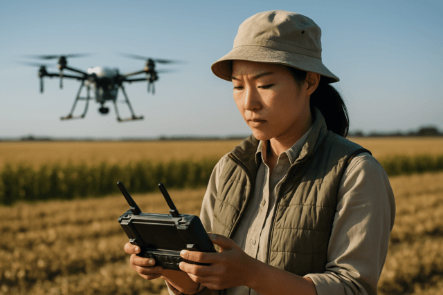
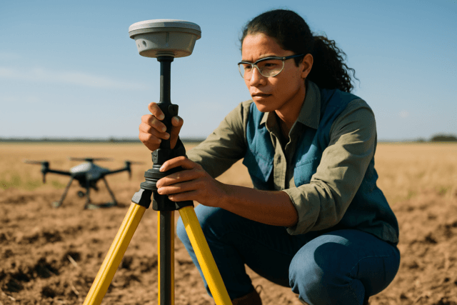
Unmanned Aerial Systems (UAS), commonly known as drones, have revolutionized surveying and mapping, offering unprecedented efficiency, cost-effectiveness, and access to challenging terrains. From construction sites to agricultural fields, drones provide high-resolution data for various applications, including creating precise orthomosaics, 3D models, and topographic maps. However, the reliability and accuracy of these drone mapping operations are significantly influenced by a dynamic and often unpredictable factor: weather conditions. Understanding how meteorological elements impact drone performance and data acquisition is paramount for ensuring safe, successful, and accurate results in this specialized discipline.
The Unseen Force: How Weather Shapes Drone Data Quality
Weather conditions can compromise flight stability, battery performance, sensor operation, and ultimately, the quality and accuracy of the collected data. Ignoring these factors can lead to blurred imagery, inaccurate measurements, and even equipment loss.
Wind: The Stability Disruptor
Wind is arguably the most significant weather factor influencing drone operations and mapping accuracy.
- Stability and Control: Strong winds can cause a drone to drift off course, making it difficult to maintain stability and control. This can lead to erratic movements, making automated flight paths challenging and increasing the risk of crashes.
- Image Quality: Drone mapping software relies on stitching together individual photos by identifying common features between adjacent images. When a drone is unstable due to wind, images can become blurred or distorted due to motion, making it difficult for the software to match points accurately.
- Overlap Issues: Headwinds can slow the drone, causing it to take too many images in the same area and wasting processing time and storage. Conversely, tailwinds can speed up the drone, leading to insufficient image overlap and gaps in the final map. Crosswinds can cause yaw instability, affecting image alignment.
- Battery Life: Drones flying against headwinds or in gusty conditions must expend more energy to maintain course and speed, leading to faster battery depletion and reduced flight times, thereby limiting the mission’s scope.
Mitigation Strategies:
Operators should always check wind speed and direction forecasts and adhere to the drone’s recommended wind limits, typically avoiding flights in winds higher than 10 mph. Flying at lower altitudes can minimize wind impact, as wind speeds generally increase with altitude. Increasing image overlap and utilizing drones with advanced stabilization (like gimbals) or Real-Time Kinematic (RTK) / Post-Processed Kinematic (PPK) GPS systems can enhance stability and accuracy.
Precipitation (Rain and Snow): A Direct Threat
Rain, snow, and even high humidity pose direct threats to drone equipment and data quality.
- Equipment Damage: Most commercial drones are not waterproof. Rain and moisture can damage sensitive electronic components, motors, sensors, and cameras, potentially leading to malfunctions or complete failure.
- Lens Obstruction and Visibility: Water droplets on camera lenses can distort image details, leading to blurry or obscured imagery. Precipitation also significantly reduces visibility, making it difficult for operators to maintain line of sight and for sensors to effectively capture data.
- Aerodynamics: In snowy conditions, ice can accumulate on the drone’s body and propellers, affecting its aerodynamics and causing stability issues.
Mitigation Strategies:
It is generally recommended to avoid flying drones in heavy rain, snow, or high humidity conditions. If flights in light precipitation are unavoidable and the drone is IP-rated (Ingress Protection), operators should carry microfiber cloths for quick lens cleaning.
Temperature Extremes: Battery and Component Stress
Both extreme heat and cold can significantly affect drone performance and data collection.
- Battery Performance: Cold temperatures can drastically reduce battery efficiency, leading to shorter flight times and potential mid-air power failures, with performance potentially dropping by up to 40% in sub-freezing conditions. Conversely, high temperatures can cause lithium-polymer batteries to overheat, reducing their lifespan and potentially causing the drone’s flight software to shut down or reduce power.
- Component Functionality: Extreme temperatures can impact the performance of other electronic and mechanical components, leading to reduced efficiency and stability. Cold weather can also cause condensation on sensors and camera lenses, while hot weather can increase image noise.
- Thermal Imaging Accuracy: For thermal mapping, ambient temperature and solar loading can significantly impact the accuracy of temperature data, necessitating careful timing of flights (e.g., dawn/dusk for roofing, before noon for solar panels).
Mitigation Strategies:
Plan flights during mild temperatures, ideally between 15°C and 35°C (59°F and 95°F). Batteries should be kept at optimal temperatures before and during flight. Acclimating equipment to the ambient temperature before use can also help.
Lighting Conditions (Sunlight and Clouds): The Imaging Challenge
Consistent and adequate lighting is crucial for high-quality imagery in drone photogrammetry.
- Shadows and Glare: Low sun angles, common during early morning, late afternoon, or winter months, create long, pronounced shadows from objects like trees and buildings. These shadows can obscure ground features, reduce contrast, and introduce inconsistencies in imagery, making it difficult for photogrammetry software to accurately identify matching points and create reliable 3D models or orthomosaics. Midday sun can also create harsh glare, especially over water, washing out images.
- Inconsistent Exposure: Partly cloudy days are particularly problematic. Rolling clouds create varying light intensities and shadows across the survey site, leading to inconsistent exposures in images. This variability can result in an uneven map with distorted color tones and contrasts.
- Reduced Light: In general, low light conditions (dusk, dawn, heavy overcast) require higher camera sensitivity (ISO), which can introduce noise and reduce image detail.
Mitigation Strategies:
The best time for drone mapping is often mid-day when the sun is highest, minimizing shadows and providing consistent light. Alternatively, a uniformly thick cloud cover can act as a natural diffuser, providing soft, consistent lighting without harsh shadows. Avoiding partly cloudy days is recommended. Adjusting camera settings (ISO, shutter speed, aperture) to suit the lighting conditions is also essential.
Humidity and Fog: Visibility and Lens Obstruction
High humidity and fog primarily impact visibility and image clarity.
- Reduced Visibility and Haze: Fog, mist, or high humidity can significantly limit visibility, making it challenging to maintain visual line of sight and for the drone’s sensors to capture clear data. High humidity can also create atmospheric haze, reducing image clarity and contrast.
- Condensation: High humidity can cause condensation to form on the drone’s camera lens, resulting in blurry or distorted images. It can also promote internal moisture buildup within the drone.
- Stability: Similar to strong winds, high humidity levels can sometimes affect drone stability and control.
Mitigation Strategies:
Avoid flying in foggy conditions or when humidity levels are excessively high (e.g., typically recommend between 30% to 70% humidity). Companies often choose to delay operations until visibility improves, despite potential costs.
Strategies for Mitigating Weather’s Impact on UAS Mapping
To ensure the highest accuracy in drone mapping, a proactive approach to weather management is crucial.
Pre-Flight Planning and Monitoring
Thorough pre-flight checks must include detailed weather forecasts. Utilizing drone-specific weather apps can provide hyper-local data on wind speed and direction, temperature, and precipitation. Monitoring weather patterns and historical data can help identify optimal times for flights.
In-Flight Adjustments and Technology
- Increased Overlap: In less-than-ideal conditions (e.g., light wind, low light, or over areas with fresh snow), increasing image overlap (both front and side) provides more data points for photogrammetry software, improving the chances of accurate stitching and reducing noise in elevation models.
- Lower Altitude: Flying at a lower altitude can capture more detail and more data points, leading to higher accuracy (lower Ground Sampling Distance – GSD), and can also mitigate the impact of higher winds found at greater altitudes.
- RTK/PPK Systems: Drones equipped with RTK (Real-Time Kinematic) or PPK (Post-Processed Kinematic) GPS systems can achieve survey-grade accuracy by correcting GPS data in real-time or post-processing, making them more resilient to minor environmental disturbances.
- Mechanical Shutter Cameras: Using cameras with mechanical shutters helps reduce the “rolling shutter effect” often seen with electronic shutters, which can warp images during motion and negatively affect map accuracy.
Post-Flight Considerations
Even with careful planning, post-flight data validation is crucial to identify and correct any inconsistencies or inaccuracies that may have resulted from unexpected weather shifts. This includes checking image quality, overlap, and the integrity of the generated models.
Advanced Solutions
The integration of AI and advanced Numerical Weather Prediction (NWP) models is becoming increasingly vital. AI-driven systems can process real-time weather data to optimize flight paths and speeds, enabling quick responses to changing conditions. Improved weather radar coverage also aids in anticipating adverse weather, allowing operators to make informed decisions.
The Best Conditions for Optimal Drone Mapping Accuracy
For the most accurate and reliable drone mapping results, ideal weather conditions include:
- Clear skies with minimal cloud cover: This provides consistent and sufficient natural light. Uniformly overcast days can also be beneficial, acting as a natural diffuser and eliminating harsh shadows.
- Low winds: Calm conditions, generally below 10 mph, are crucial for maintaining drone stability, preventing image blur, and ensuring consistent image overlap.
- Mild temperatures: Operating within the drone’s recommended temperature range (e.g., 15-35°C) preserves battery life and ensures optimal component performance.
- Good visibility: Absence of fog, mist, or heavy haze ensures clear imagery and safe operation within visual line of sight.
Conclusion
While drone technology continues to advance, the fundamental forces of weather remain a critical consideration for any Unmanned Aerial Systems (UAS) mapping project. Wind, precipitation, temperature, and lighting each present unique challenges that can degrade data quality and compromise the accuracy of outputs. By thoroughly understanding these impacts and implementing robust pre-flight planning, in-flight adjustments, and leveraging technological innovations, drone operators can significantly mitigate weather-related risks. Adhering to best practices ensures that the flexibility, efficiency, and precision promised by drone mapping are consistently delivered, yielding authoritative and publish-ready results for a multitude of industries.


