In the chaotic aftermath of a disaster or during the urgent search for a missing person, every second counts. Traditional search and rescue (SAR) operations often contend with limited visibility, hazardous terrain, and outdated maps, hindering rapid response and endangering responders. Enter drone-generated 3D models, a transformative technology that provides SAR teams with unprecedented situational awareness and precise planning capabilities, fundamentally changing how these critical missions are executed.
The Power of 3D Modeling in Search and Rescue
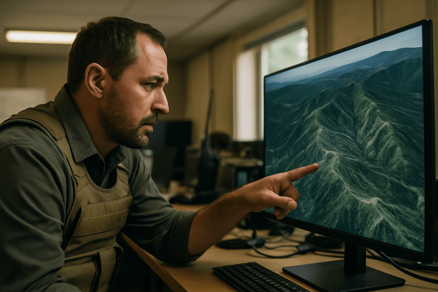
Drone-generated 3D models offer a high-resolution, up-to-date, and spatially accurate representation of a search area. This detailed digital twin of the environment allows SAR coordinators and ground teams to visualize complex terrains, collapsed structures, or vast wilderness areas from multiple perspectives, providing critical intelligence that directly impacts decision-making. By rapidly mapping large or hard-to-access areas, drones significantly enhance the efficiency and success rate of SAR operations.
From Air to Map: Generating 3D Models with Drones
The creation of these vital 3D models involves several key steps, from data acquisition in the field to sophisticated processing using specialized software.
Data Acquisition: Photogrammetry and LiDAR
Two primary technologies are employed by drones for 3D data capture in SAR:
- Photogrammetry: This technique involves capturing numerous overlapping 2D images of a subject from various angles. Specialized software then analyzes common points across these photos, stitching them together to reconstruct the three-dimensional space. Photogrammetry is often more cost-effective and excels at capturing rich visual details, including textures and colors, creating visually realistic 3D models and orthomosaics. For optimal results, drone flights are planned with a significant overlap between images, typically 70-80% forward overlap and 60-75% lateral overlap, and often include oblique (angled) imagery in addition to nadir (straight down) shots to capture more detail of vertical structures and overhanging features.
- LiDAR (Light Detection and Ranging): Unlike passive photogrammetry, LiDAR is an active sensing method that uses laser scanners to measure distances. The scanner emits light pulses that bounce off surfaces, and by analyzing the time it takes for the light to return, LiDAR creates a highly accurate 3D point cloud of the scanned area. LiDAR is particularly effective in challenging environments, such as those with dense vegetation or low-light conditions, as its laser pulses can penetrate canopies to map the true ground surface, providing centimeter or even millimeter-level accuracy.
In some cases, combining both LiDAR and photogrammetry is highly recommended to leverage their distinct strengths, resulting in 3D models that are both geometrically precise and visually rich.
Flight Planning and Data Capture Techniques
Effective 3D model generation begins with meticulous flight planning. Automated flight patterns can be programmed into drones, ensuring systematic coverage of the search area. The use of RTK (Real-Time Kinematic) or PPK (Post-Processed Kinematic) GPS modules in drones can significantly increase the precision of geotagged photos, leading to more accurate models and reducing the need for numerous ground control points (GCPs) in inaccessible areas.
During data capture, factors such as site terrain, altitude limitations (e.g., FAA’s 400-foot rule), and environmental conditions like wind and rain must be considered. Drones can collect high-resolution still imagery, which is often preferred over video due to its superior resolution for mapping purposes.
Processing Raw Data into Actionable 3D Models
Once aerial images or LiDAR data are collected, specialized software transforms this raw data into usable 3D models. Popular software tools for drone-based 3D modeling include Pix4D Mapper, DroneDeploy, Agisoft Metashape, RealityCapture, WebODM, Esri SiteScan, and 3Dsurvey. These platforms process thousands of images to generate:
- Point Clouds: Dense collections of data points representing the 3D geometry of the environment.
- Textured Meshes: 3D models with realistic surface textures derived from the captured imagery.
- Orthomosaics: Georeferenced, high-resolution 2D maps stitched together from multiple images, corrected for distortion.
- Digital Surface Models (DSMs) and Digital Terrain Models (DTMs): Representations of the earth’s surface, including all features (DSM) or just the bare ground (DTM), providing crucial elevation data.
The processing speed can vary depending on the dataset size and computing power, with some cloud-based solutions offering faster turnaround times.
Strategic Advantages of 3D Models for SAR Planning
The integration of drone-generated 3D models into SAR planning offers a multitude of strategic benefits:
- Enhanced Situational Awareness: Provides a real-time, comprehensive, and detailed view of the disaster zone, allowing responders to quickly assess the extent of destruction and pinpoint high-risk zones. This immediate access to detailed maps helps responders act quickly.
- Terrain Analysis and Obstacle Identification: 3D models accurately depict the contours of the land, identifying natural obstacles like rivers, fences, cliffs, and hills, as well as man-made structures and potential hazards such as unstable buildings or collapsed areas. This prevents teams from encountering unforeseen dangers unprepared.
- Optimal Resource Deployment: Incident commanders can use these models to plan safer and more efficient routes for rescue teams, prioritize search areas, and strategically allocate personnel and equipment.
- Improved Team Safety: By identifying unstable structures, hazardous entry points, and potential dangers, 3D maps help emergency responders avoid high-risk areas and plan safer rescue routes, protecting both victims and rescue teams.
- Effective Briefing and Collaboration: The visual nature of 3D models ensures that all parties involved, from command center staff to “boots on the ground” personnel, share a common, up-to-date understanding of the search area. This fosters better collaboration among agencies, governments, and NGOs.
- Post-Event Analysis and Documentation: Beyond immediate response, 3D mapping is invaluable for damage assessment, documenting changes to critical infrastructure, and retrospective analysis after a disaster.
Challenges and Considerations
Despite their immense benefits, the use of drone-generated 3D models in SAR is not without challenges:
- Data Volume and Processing Power: Generating high-resolution 3D models from hundreds or thousands of images creates large datasets that require significant computational power and storage for processing.
- Accuracy in Complex Environments: Achieving optimal accuracy can be challenging in areas with highly reflective surfaces, dense vegetation (though LiDAR mitigates this), or in scenarios where ground control points (GCPs) cannot be placed due to inaccessibility.
- Weather and Environmental Limitations: Adverse weather conditions such as high winds, rain, or extreme temperatures can affect drone stability, battery life, image clarity, and overall operational safety.
- Regulatory Compliance: Navigating airspace regulations and obtaining necessary permissions for drone flights, particularly in emergency zones or near critical infrastructure, can be complex and time-consuming.
- Cost of Advanced Equipment and Software: While commercial drones have become more affordable, high-end LiDAR sensors and professional-grade processing software can still represent a significant investment for SAR organizations.
Conclusion
Drone-generated 3D models have emerged as an indispensable tool in modern search and rescue operations, offering a significant leap forward in situational awareness, planning precision, and operational safety. By providing rapid, detailed, and accurate geospatial data, this technology empowers SAR teams to make informed decisions faster, deploy resources more effectively, and navigate hazardous environments with greater confidence. As drone technology and associated software continue to advance, the integration of 3D modeling will undoubtedly play an even more crucial role in saving lives and mitigating the impact of emergencies worldwide.


