Inspecting the labyrinthine networks beneath our cities and industrial complexes has always been a hazardous, time-consuming, and costly endeavor. From aging sewer lines and vital utility tunnels to complex mining operations and hazardous underground vaults, these hidden worlds pose significant dangers to human inspectors, including toxic gases, structural collapses, and limited visibility. However, a new era of safety and efficiency is dawning, driven by the remarkable advancements in drone technology. These unmanned aerial vehicles (UAVs) are transforming how we assess critical subterranean infrastructure, allowing for comprehensive evaluations without ever placing a human in harm’s way.
The Perilous Landscape of Traditional Underground Inspections
Historically, examining underground infrastructure has necessitated sending human personnel into extremely dangerous confined spaces. Workers face numerous threats, such as exposure to harmful gases like hydrogen sulfide (H2S), the risk of structural collapse due to premature wear, high water levels, and slippery surfaces. Poor lighting, dust concentration, and magnetic interference further compound these challenges, making manual data collection difficult and often incomplete. Traditional methods often involve expensive scaffolding, rope access, or even shutting down operations, leading to significant downtime and costs. The need to physically enter these environments to identify issues like corrosion, leaks, or structural anomalies exposes personnel to considerable risk and liability.
How Drones Revolutionize Safety in Underground Inspection
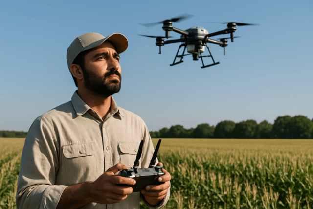
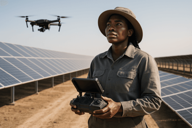
The most significant advantage of employing drones for underground infrastructure inspection is the dramatic enhancement of safety by removing humans from hazardous environments. Drones can navigate tight, inaccessible, and dangerous areas, collecting vital data while inspectors remain safely on the surface, significantly reducing the risk of accidents, injuries, and exposure to harmful conditions. This fundamental shift transforms a process once fraught with peril into a remote, controlled operation.
Key Technologies Enabling Safe Underground Drone Navigation
For drones to operate effectively and safely in the challenging conditions of underground environments, they must be equipped with specialized technologies that overcome the absence of GPS, confined spaces, and harsh environmental factors.
GPS-Denied Navigation
Traditional drones heavily rely on GPS for navigation and stability. Underground, this signal is unavailable, necessitating advanced internal navigation systems.
- Simultaneous Localization And Mapping (SLAM): This complex algorithm allows autonomous drones to build a map of an unknown environment while simultaneously tracking their position within it. SLAM is crucial for navigating GPS-denied subterranean areas and can utilize various sensors like LiDAR, ultrasonic sensors, and cameras.
- LiDAR (Light Detection and Ranging): LiDAR sensors emit laser pulses to measure distances and generate highly detailed 3D point clouds, which are essential for precise mapping of tunnel surfaces, detecting deformations, and creating digital twins of confined spaces.
- Visual Odometry and Inertial Navigation Systems (INS): These systems, often fused with SLAM, provide drones with reference points and data on their altitude, attitude, and location, enabling stable flight and precise positioning even without GPS.
Collision Tolerance and Durability
Underground spaces are often tight and unpredictable, increasing the risk of collisions.
- Protective Cages: Many indoor inspection drones, such as the Flyability Elios series, are enclosed within durable carbon fiber cages. This design allows them to withstand impacts and navigate confined environments without compromising flight stability, ensuring continuous operation even after minor collisions.
Advanced Sensor Payloads
Modern inspection drones carry a suite of sensors tailored for detailed data collection in harsh conditions.
- High-Resolution Cameras and Thermal Imaging: These capture detailed visual and thermal data, identifying cracks, corrosion, water leaks, structural anomalies, and hot spots that might be invisible to the naked eye. Drones can be equipped with powerful LED lighting (e.g., 10,000 lumens) to illuminate dark sewer systems and other underground structures.
- Specialized Non-Destructive Testing (NDT) Probes: Some drones can be fitted with ultrasonic and electromagnetic acoustic transducer (EMAT) probes to detect surface and subsurface defects, including their size, shape, depth, and direction.
- Gas Sensors: While not universally standard, some future developments aim to integrate gas sensors for explosive or toxic environments, enhancing safety further. Drones with specialized hyperspectral or infrared cameras can even identify the nature of leaks by measuring the absorption of background radiation.
Enhanced Communication Systems
Maintaining reliable communication in confined, subterranean spaces is crucial.
- High-Frequency, Low-Interference Systems: Signal interference from walls and metal structures is a significant challenge. Solutions include using high-frequency radio signals and signal repeaters or extenders to ensure a stable connection between the drone and the operator, allowing for real-time data streaming and control.
Applications of Drones in Underground Infrastructure
The versatility and safety benefits of drones make them ideal for inspecting a wide array of underground infrastructure:
Tunnels
For transportation, water, and utility tunnels, drones transform inspections by providing detailed 3D maps and identifying deformations, cracks, and leaks without the need for human entry or costly traffic disruptions. They can quickly cover vast distances, streamlining the inspection process and reducing downtime.
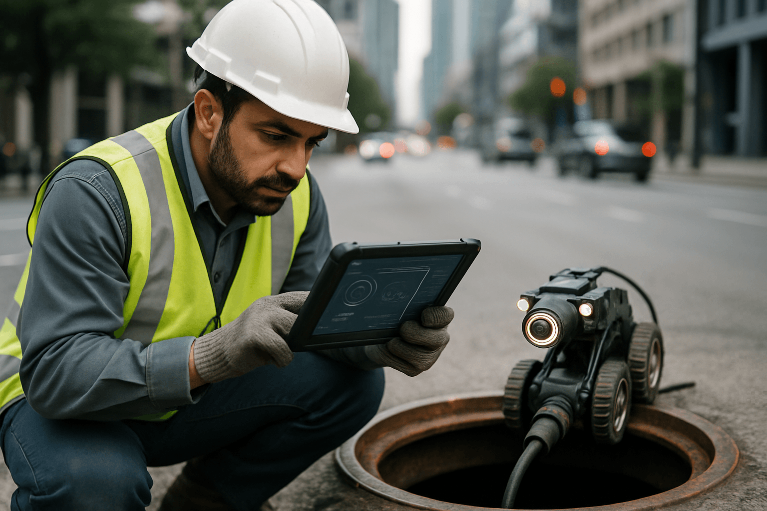
Sewer and Wastewater Systems
Inspecting sewers manually poses significant risks due to harmful gases, high water levels, and structural instability. Drones offer a safe, efficient, and cost-effective way to identify blockages, assess network functionality, and detect structural problems, even in large or rapidly flowing pipes. Companies report drone inspections being twice as efficient and 40% less expensive per meter compared to human inspections.
Mines (Active and Abandoned)
Underground mines present extreme challenges with confined spaces, poor visibility, and potential hazards like collapses and gas leaks. Drones like the Elios 3 are specifically designed for these environments, offering remote inspection capabilities, real-time data collection, and 3D mapping of tunnels, shafts, ventilation systems, and process equipment. They can swiftly identify issues such as equipment wear or corrosion, optimize asset management, and enhance worker safety by exploring areas inaccessible or hazardous to humans.
Underground Vaults and Pipelines
Drones can access critical infrastructure like underground vaults used for nuclear waste storage, collecting high-resolution imagery and precise 3D LiDAR scans in minutes, a process that would otherwise be extremely risky and time-consuming. For buried pipelines, drones equipped with thermal imaging or optical gas imaging can detect internal corrosion and escaping gases, helping to prevent costly incidents.
Beyond Safety: Additional Benefits of Drone Inspections
While safety is paramount, drones bring a host of other advantages to underground infrastructure inspection:
- Efficiency and Speed: Drones can cover large areas in a fraction of the time compared to manual methods, enabling more frequent and proactive inspections. A complete inspection of an old mine working, which would be risky and incomplete with traditional methods, can be done in 15 minutes with a drone.
- Cost Savings: By reducing the need for extensive labor, expensive equipment like scaffolding or lifts, and minimizing operational downtime, drones can cut inspection costs significantly, sometimes by as much as 50% to 80%.
- High-Quality Data and 3D Mapping: Drones capture high-resolution images, videos, thermal data, and precise 3D point clouds, offering a comprehensive and accurate view of the infrastructure’s condition. This detailed data allows for early detection of problems and informed decision-making.
- Reduced Downtime: Faster inspections mean operations can resume promptly, minimizing disruptions which can be critical in industries where downtime is very costly.
Challenges and Future Outlook
Despite the significant advancements, challenges remain for widespread drone adoption in underground inspections. Battery life is a critical factor, as constant maneuvering and sensor usage demand considerable power in confined spaces. Further research is needed to develop drones with extended flight times and to improve their ability to carry gas sensors for hazardous environments. Environmental factors like extreme temperatures, dust, moisture, and magnetic interference can still affect sensor accuracy and communication reliability.
The future of drone technology for underground infrastructure promises even greater autonomy, improved sensor capabilities, and more robust communication systems. Continued innovation will lead to drones that are smaller, more agile, and even more resilient to the harsh conditions found beneath the surface, further solidifying their role as essential tools for ensuring the safety and integrity of our vital underground networks.
Conclusion
The deployment of specialized drones has fundamentally transformed the safety landscape of underground infrastructure inspection. By eliminating the need for human entry into perilous environments and leveraging advanced navigation and sensing technologies, drones provide a safer, faster, and more cost-effective means of assessing critical assets. As this technology continues to evolve, drones will become even more integral to proactive maintenance, risk mitigation, and the overall longevity of the hidden infrastructure that supports our modern world.