Wildfires pose an increasing threat to rural communities, natural ecosystems, and agricultural lands worldwide. The vast, often inaccessible terrain of rural areas makes traditional methods of wildfire detection and monitoring incredibly challenging. However, advancements in aerospace engineering, particularly in drone applications, are revolutionizing wildfire management by offering unprecedented capabilities for early detection, real-time monitoring, and post-fire assessment. This innovative integration of technology promises to enhance safety, reduce response times, and mitigate the devastating impact of these catastrophic events.
The Growing Threat of Wildfires in Rural Landscapes
Rural areas, characterized by sprawling forests, rangelands, and agricultural fields, are particularly vulnerable to wildfires. These landscapes often contain dense vegetation that acts as fuel, and remote locations can hinder rapid intervention.
Challenges of Traditional Detection Methods
Historically, wildfire detection has relied on a combination of lookout towers, ground patrols, and occasional manned aerial surveillance. These methods, while foundational, come with significant limitations. Lookout towers have restricted lines of sight, ground patrols are slow and labor-intensive, and manned aircraft operations are costly, limited by visibility (especially at night or in smoky conditions), and can put human lives at risk. The sheer scale of many rural areas makes comprehensive coverage by traditional means practically impossible, leading to delayed detection and allowing small fires to escalate rapidly into major infernos.
The Impact on Rural Communities and Agriculture
Wildfires devastate rural communities, leading to loss of homes, infrastructure, and, tragically, lives. For the agricultural sector, the impact is profound. Crops, livestock, and vital irrigation systems can be destroyed, resulting in immense economic losses and long-term recovery challenges. Beyond immediate destruction, wildfires degrade soil quality, disrupt water cycles, and contribute to air pollution, further impacting the health and sustainability of rural environments and livelihoods.
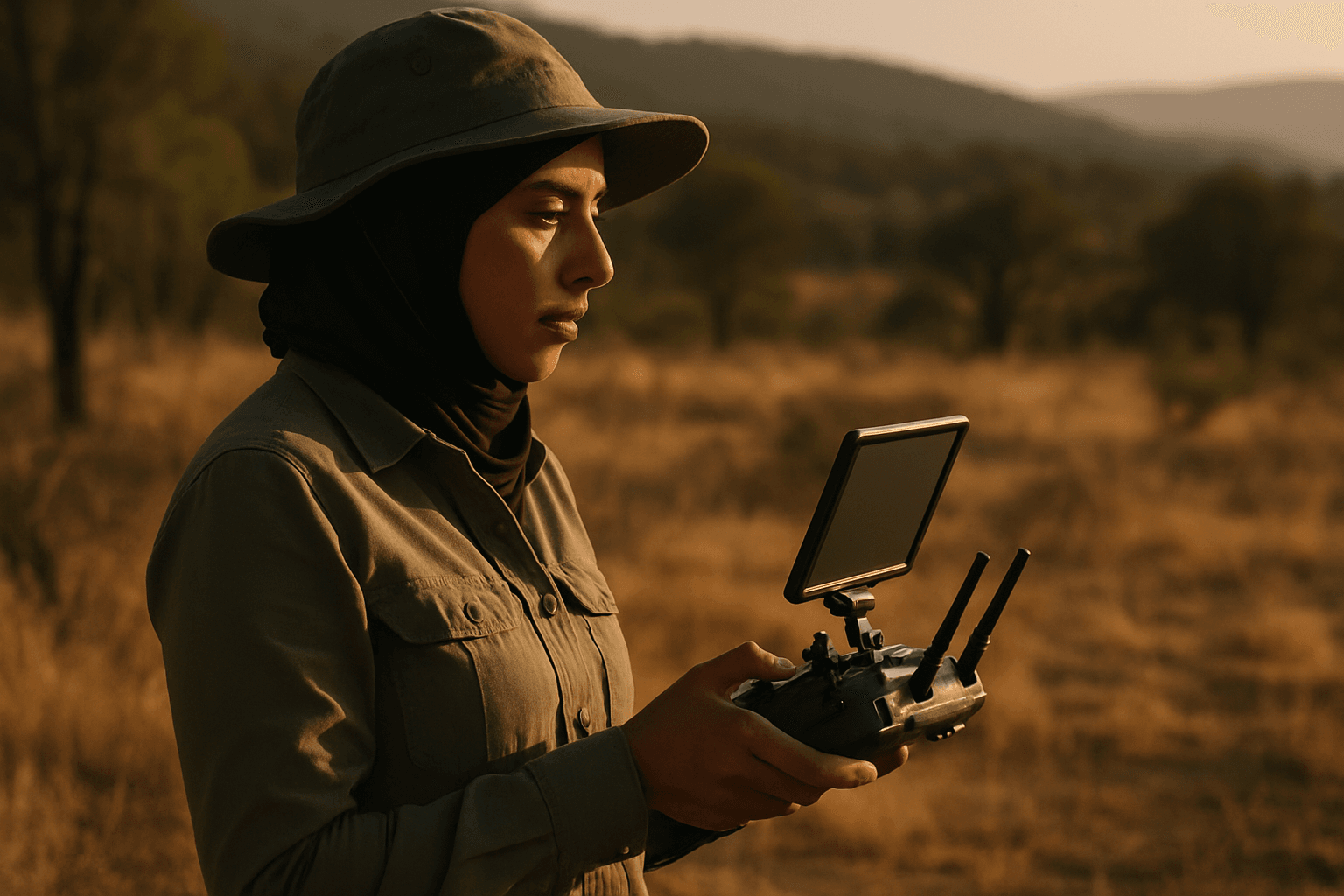
How Drones Revolutionize Wildfire Management
Drones, or Unmanned Aerial Systems (UAS), are rapidly becoming indispensable tools in every phase of wildfire management, from prevention to recovery. Their agility, endurance, and ability to carry advanced sensor payloads offer significant advantages over conventional methods.
Early Detection Capabilities
The ability to detect wildfires in their incipient stages is crucial for effective containment. Drones equipped with visual and thermal sensors can be deployed quickly to scan vast areas for signs of smoke, flames, or smoldering hotspots that are invisible to the naked eye. Thermal cameras, in particular, are game-changers, as they can identify heat signatures through smoke and in darkness, enabling detection even before a visible flame or significant smoke plume appears. Some advanced systems can autonomously launch drones upon detection of a potential wildfire by intelligent ground sensors, providing immediate aerial verification and monitoring.
Real-time Monitoring and Situational Awareness
Once a fire has ignited, drones provide critical real-time data to firefighting teams. They can rapidly map the affected area, track the fire’s perimeter, monitor its behavior and progression, and transmit high-resolution images and thermal data directly to incident command centers. This continuous flow of information allows fire managers to assess the fire’s size, direction, and intensity accurately, enabling more strategic allocation of resources and dynamic adjustment of containment strategies. Drones can also identify quick escape routes for ground crews, significantly enhancing firefighter safety.
Post-Fire Assessment and Damage Mapping
After a wildfire is contained, drones continue to play a vital role in the post-fire environment. They swiftly survey large areas to assess damage, mapping burn areas, and identifying lingering hotspots that could reignite. High-resolution imagery can be transformed into 3D maps, invaluable for assessing damage extent, guiding recovery efforts, and facilitating insurance claims. Drones are also being explored for reforestation efforts, with some companies using drone swarms to map out devastated areas and drop seed vessels in ideal locations for survival.
Key Drone Technologies for Wildfire Applications
The effectiveness of drones in wildfire management is largely due to the sophisticated technologies they integrate.
Thermal and Multispectral Cameras
Thermal imaging cameras are paramount for wildfire detection, as they capture infrared radiation, revealing temperature differences invisible to the human eye. This allows for the identification of hotspots through smoke, fog, and at night. Multispectral cameras, on the other hand, capture data across multiple light spectrums, providing insights into vegetation health, fire intensity, and burn severity that are crucial for both pre-fire risk assessment and post-fire ecological analysis. Drones like the DJI Matrice series with Zenmuse H20T or H30T cameras are examples of professional-grade tools used for these applications, offering both thermal and visual capabilities with powerful zoom.
AI and Machine Learning for Data Analysis
Artificial intelligence (AI) and machine learning (ML) are transforming drone-based wildfire management. AI algorithms can analyze vast amounts of drone-collected data—including thermal and optical imagery—to autonomously detect fires, predict fire behavior, and identify high-risk areas. This enables proactive and more effective firefighting strategies. Researchers are training AI models to analyze prescribed burns on the fly, incorporating environmental factors to predict a burn’s movement with greater accuracy. Swarms of AI-piloted drones are also being developed to work collectively for early detection and even suppression.
Long-Endurance and Autonomous Flight Systems
For effective monitoring of vast rural areas, drones require significant flight endurance and autonomous capabilities. Advances in battery technology and the development of hybrid (oil-electric) drones are extending flight times, with some models offering up to 8 hours of endurance and ranges of 200 km. Autonomous flight systems allow drones to follow pre-programmed routes, navigate challenging terrains, and adapt to changing weather conditions without constant human intervention, thereby increasing coverage efficiency and reducing operational costs. Swarm technology, where multiple autonomous drones work in concert, is a promising future direction for covering extremely large areas like entire states.
Benefits for Precision Agriculture
The application of drones in wildfire detection and monitoring directly benefits precision agriculture, a discipline focused on optimizing agricultural inputs and outputs.
Protecting Crops and Livestock
Early wildfire detection directly protects agricultural assets. By rapidly identifying and monitoring fires, drones allow farmers and emergency services to implement protective measures for crops and evacuate livestock before fires reach critical areas. This proactive approach minimizes direct losses and safeguards livelihoods in rural farming communities.
Reducing Economic Losses
The economic toll of wildfires on agriculture can be staggering. Drones contribute to reducing these losses by enabling faster, more targeted firefighting efforts, thereby limiting the spread and intensity of fires that could destroy valuable agricultural infrastructure, equipment, and produce. Post-fire assessments also aid in more accurate damage estimation for insurance and recovery planning.
Enhancing Rural Resilience
By integrating drone technology into wildfire management, rural communities, including those focused on agriculture, can build greater resilience against fire events. Improved detection and monitoring capabilities mean quicker response times, reducing the likelihood of catastrophic fires. This enhanced preparedness allows agricultural operations to recover faster and maintain continuity, fostering a more secure and sustainable future for rural economies. Drones are even being used for tasks like targeted herbicide spraying of invasive species, such as cheatgrass, which can increase wildfire risk, further aiding in fire prevention within agricultural landscapes.
Challenges and Future Outlook
Despite their immense potential, the widespread adoption of drones for wildfire management faces several challenges, alongside exciting future developments.
Regulatory Hurdles and Airspace Integration
Integrating drones into national airspace, especially alongside manned firefighting aircraft, presents significant regulatory hurdles. Unauthorized drone flights near wildfires can force the grounding of all aircraft, including essential air tankers and helicopters, endangering firefighters and allowing fires to spread unchecked. Clear regulations, airspace management protocols, and collaboration between drone operators and fire agencies are critical to ensure safe and effective integration. Federal laws in the U.S. now promote the use of drones in wildland fire management operations, but strict rules against unauthorized public drones near active fires remain.
Battery Life and Range Limitations
Current commercial drones often have flight times ranging from 20-60 minutes and operational ranges of 20-40 km, which can be significantly reduced by environmental factors like terrain, heat, and smoke. While hybrid models offer extended endurance, continuous monitoring of vast, remote rural areas still requires innovations in battery technology, charging infrastructure, and potentially drone relay networks or docking stations for hot-swapping batteries.
The Future of Drone Swarms and Advanced Sensors
The future of drone applications in wildfire management is moving towards highly autonomous, collaborative systems. Research is focusing on drone swarms, where multiple drones work together, guided by AI, to cover vast areas for detection, mapping, and even precision suppression. Advanced sensors like Synthetic Aperture Radar (SAR) could penetrate smoke and darkness, offering capabilities beyond traditional optical and thermal cameras. Integrating drones with the Internet of Things (IoT) can create networks of sensors providing real-time data on weather and environmental conditions, further enriching decision-making.
Conclusion: A New Era of Wildfire Defense
Drones represent a paradigm shift in wildfire detection and monitoring in rural areas. By providing unparalleled capabilities for early detection, real-time situational awareness, and comprehensive post-fire analysis, these unmanned aerial systems are enhancing the safety of communities and firefighters, while also protecting valuable agricultural resources. As aerospace engineering continues to innovate with longer endurance, more sophisticated sensors, and advanced AI-driven autonomy, drones are poised to become an even more indispensable component of a resilient and proactive wildfire defense strategy for our vulnerable rural landscapes.


