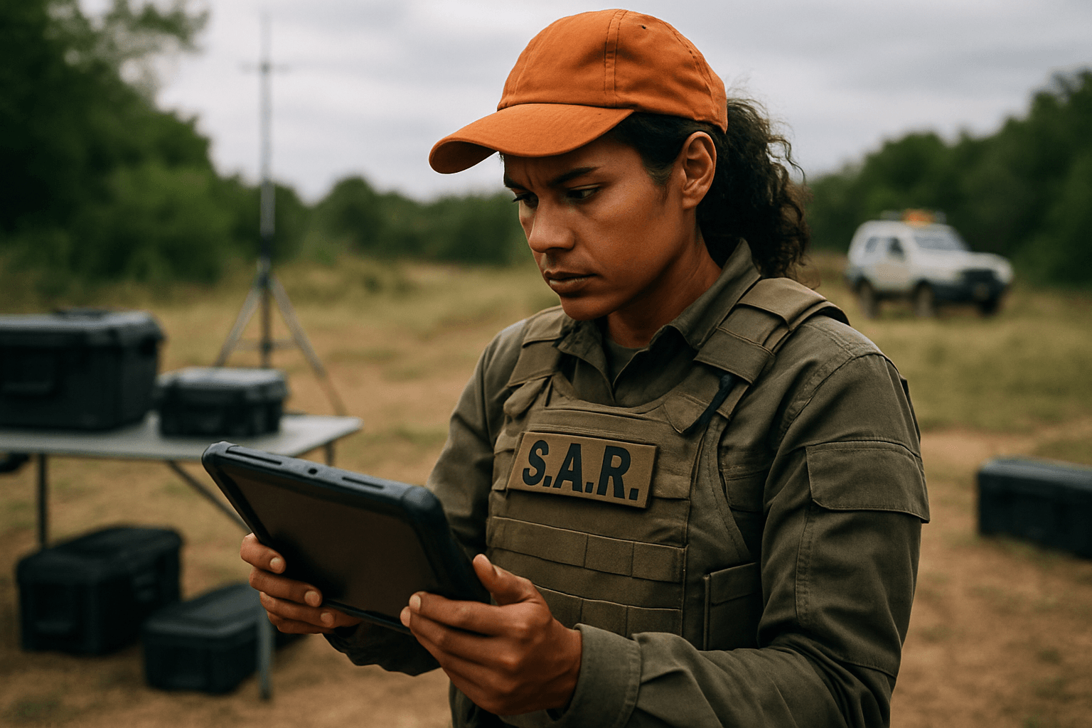
In the high-stakes world of Search and Rescue (SAR), every second counts. The rapid evolution of Unmanned Aerial Systems (UAS), commonly known as drones, has revolutionized how emergency responders locate missing persons and assess hazardous environments. However, the true power of these aerial assets is only unlocked when the vast amounts of data they collect are seamlessly integrated into the ground teams’ communication and operational workflow. This integration creates a cohesive, real-time common operating picture, significantly enhancing response times and improving the chances of a successful outcome.
The Indispensable Role of Drones in Modern SAR
Drones have transitioned from novel technology to an indispensable tool in emergency response, offering critical advantages that traditional methods struggle to achieve.
Enhanced Situational Awareness and Rapid Deployment
Drones can be deployed swiftly, providing immediate aerial oversight of a search area within minutes. This speed is crucial in time-sensitive scenarios. They offer a bird’s-eye view, helping SAR teams monitor disaster scenes, track movements, and gather critical information, which is invaluable for situational awareness and effective decision-making.
Advanced Sensor Capabilities
Equipped with high-resolution visual and thermal cameras, SAR drones can capture detailed imagery and detect heat signatures, even in complete darkness or dense foliage. Thermal imaging is vital for locating individuals trapped under rubble, inside smoke-filled environments, or in dense forests, enabling rescuers to pinpoint locations with precision. Some drones can also carry LiDAR systems to create accurate 3D maps, aiding in planning rescue routes in complex terrains.
Expanding Reach and Safety
Drones can cover vast areas more quickly than ground teams, accessing challenging or inaccessible terrain such as mountains, forests, cliffs, or flood zones, thus minimizing risk to human rescuers. They can navigate collapsed tunnels in mining emergencies or scan coastlines for distressed vessels.
Key Drone Data Types for SAR Operations
The effectiveness of drones in SAR hinges on the actionable data they provide. This data comes in various forms, each critical for different aspects of a mission.
Real-Time Visual and Thermal Imagery
Live video streams from drones are perhaps the most immediate and impactful data type. They allow command centers and ground teams to see the search area in real-time, facilitating quick decision-making and enabling teams to respond instantly when something of interest is spotted. Thermal imagery extends this capability, allowing detection of heat signatures through challenging conditions like snow, foliage, or darkness.
Geospatial Data and Mapping
Drones equipped with GPS navigation systems provide precise mapping and route planning capabilities. They can capture high-resolution photos that are processed into map layers, offering search management teams real-time terrain visibility. This geospatial data includes GPS coordinates of potential targets, identified hazards, and surveyed areas, all contributing to a comprehensive operational map.
Establishing Robust Communication Pathways
Reliable communication links are the backbone of effective drone-ground team integration, especially in often remote and infrastructure-compromised SAR environments.
Direct Radio and Proprietary Links
Many commercial and public safety drones utilize proprietary radio frequency (RF) protocols for control, telemetry, and video transmission, often operating in ISM bands like 2.4 GHz and 5.8 GHz. Systems like DJI Lightbridge/OcuSync offer reliable HD video streaming. Direct radio contact with ground teams is also crucial, requiring clear communication protocols and often a dedicated person to manage information exchange.
Leveraging Cellular Networks (LTE/5G)
Cellular-based drone communication systems operating on LTE/5G frequencies enable Beyond Visual Line of Sight (BVLOS) missions and real-time data streaming over extended ranges, allowing centralized fleet management. While promising, challenges exist as cellular antennas are typically ground-oriented, leading to potential signal issues and frequent handoffs for drones flying at altitude.
Satellite Communication for Remote Areas
For operations in remote or disaster-stricken areas where traditional signals are weak or non-existent, satellite links (Ku/Ka band) provide global coverage and a robust communication solution. Portable satellite internet units, such as Starlink kits, can be deployed to enable real-time communication, map updates, and streaming even in deep canyons or above tree line.
Communication Relay Drones
Some drones are specifically designed to act as temporary communication hubs or relays. Equipped with loudspeakers, they can communicate directly with stranded victims or ground crews, providing instructions or reassurance. They can also carry communication modules to establish or restore radio and data links in areas where infrastructure is compromised, bridging communication gaps for ground teams.
Software and Platforms for Seamless Data Integration
The raw data collected by drones becomes truly valuable when processed and presented in an accessible format to ground teams. Specialized software and platforms are essential for this integration.
Centralized Command and Control Systems
Software like UgCS Command & Control allows for centralized drone operations management. It enables operators to plan and upload drone flights, monitor live video streams from multiple drones, track drone locations, and receive placemarks (pins of coordinates and images) set by drone pilots. This provides command centers with real-time overviews and analysis.
Geospatial Information Systems (GIS) Integration
GIS platforms are vital for creating a common operating picture. Drone-captured photos can be processed into map layers and imported into mapping applications like CalTopo/SarTopo or ArcGIS. This allows SAR teams to overlay drone data with existing topographical information, property ownership, and other critical layers, guiding rescue efforts and coordinating ground teams efficiently. Esri’s ArcGIS Online and Collector for ArcGIS have been used to great effect, allowing volunteers to post search data and view it in real-time on a dashboard.
AI-Powered Analysis Tools
Advanced software with Artificial Intelligence (AI) capabilities is increasingly used to analyze drone imagery. Tools like the Automated Drone Image Analysis Tool (ADIAT) can programmatically identify “areas of interest,” such as human forms or specific color spectrums, in digital images and videos. ADIAT, for example, can operate offline and includes AI-based person detection, significantly speeding up the analysis process and reducing the workload on human operators. Other tools like Eagle Eyes Search also process live and post-flight footage for real-time and post-mission analysis, integrating with SAR mapping tools.
Overcoming Communication Challenges in SAR Environments
Despite the immense benefits, integrating drone data with ground team communication faces several challenges.
Terrain Obstacles and Line of Sight
Mountains, dense forests, and urban structures can obstruct radio signals, impacting the line of sight (LOS) required for drone control and data transmission. This can lead to signal loss and unreliable connections, especially for Beyond Visual Line of Sight (BVLOS) operations, which often require redundant communication systems.
Bandwidth Limitations and Network Infrastructure
In remote or disaster-stricken areas, existing communication infrastructure like cell towers can be compromised or non-existent. Limited bandwidth can hinder the real-time transmission of large data streams, such as high-resolution video, necessitating buffering and later upload.
Ensuring Data Security
With increasing reliance on digital data and networked systems, the security of drone communication protocols is paramount. Ensuring secure channels, mutual authentication, and strong key exchange between drones and ground control stations is crucial to prevent cyber-attacks, eavesdropping, or hijacking, especially in sensitive operations.
Best Practices for Effective Drone-Ground Team Integration
Successful integration requires more than just technology; it demands careful planning, training, and operational discipline.
Standardized Communication Protocols and Roles
Establishing and adhering to clear, standardized communication procedures is essential. This includes defining roles for drone pilots, visual observers, payload operators, and ground team liaisons to prevent cognitive overload and ensure all aspects of the mission are covered. Constant contact between the drone operator and the ground user is critical, often requiring a second team member to manage information flow.
Comprehensive Training and Scenario-Based Drills
Robust training programs are necessary to equip drone operators and ground teams with the skills needed for high situational awareness. Training should include meticulous pre-flight planning, continuous in-flight monitoring and data interpretation, effective communication practices, and realistic scenario-based learning. Practice with radio systems and drone operations in various scenarios is vital.
Real-time Information Sharing and Feedback Loops
Efficiently relaying critical findings, such as the location of a missing person or hazardous conditions, to support coordinated response efforts is key. Platforms that provide live video feeds, map updates, and allow for immediate data sharing to incident command are invaluable. Post-flight debriefings are also important for continuous improvement and refining search strategies.
The Future of Drone-Ground Communication in SAR
The field of drone technology in SAR is continuously evolving, with exciting advancements on the horizon.
Autonomous Swarms and AI Integration
Researchers are developing algorithms that enable multiple drones to communicate and cooperate, sharing data and adapting to dynamic conditions on the fly. These autonomous UAV swarms can cover large areas more quickly and collaboratively, enhancing the efficiency of search and rescue efforts, especially in large-scale disasters. AI-powered systems will continue to improve data analysis, enabling drones to autonomously scan vast areas, differentiate between humans and animals, and even predict movement patterns.
Integrated Sensing and Communication (ISAC)
Emerging technologies like Integrated Sensing and Communication (ISAC) offer the potential for seamless solutions where a drone can perform SAR imaging while simultaneously providing essential wireless connectivity to rescuers. This dual capability could further optimize operations in disaster-affected or remote areas where both sensing and communication infrastructure are compromised.
By embracing these advanced technologies and implementing robust operational procedures, the integration of drone data with ground team communication will continue to save lives and enhance the effectiveness of Search and Rescue operations worldwide.


