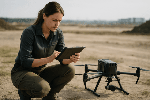
The integration of Unmanned Aerial Systems (UAS), or drones, has revolutionized Search and Rescue (SAR) operations, offering unparalleled aerial perspectives and significantly enhancing efficiency in critical situations. Drones can swiftly cover vast, often inaccessible terrains, providing real-time visual and thermal data crucial for locating missing persons, assessing hazards, and coordinating rescue efforts. However, the effectiveness of this technology hinges on robust data management and analysis practices after the mission. Proper handling of drone-collected data ensures that valuable insights are extracted, operational procedures are refined, and legal and ethical standards are maintained.
The Critical Role of Drone Data in Search and Rescue
Drones provide a “bird’s-eye view” that allows SAR teams to identify potential hazards, locate survivors using advanced sensors like thermal imaging cameras, and plan the safest routes for ground teams, even in low-visibility conditions or at night. This capability significantly reduces the time it takes to gather critical intelligence, potentially saving lives, and also enhances the safety of rescue personnel by providing preliminary information before ground deployment. The data collected, including high-resolution photos, videos, and thermal imagery, often comes with critical geotagging (EXIF data) that precisely links imagery to location.
Immediate Post-Mission Data Handling and Processing
Upon a drone’s return from a SAR mission, the immediate steps for data handling and processing are crucial for timely analysis and decision-making.
Secure Data Transfer and Initial Backup
The first priority is to securely transfer data from the drone’s storage media (e.g., SD cards) to a robust system. It’s best practice to create immediate backups to prevent data loss due to corruption or physical damage. Rugged, reliable backup devices, such as those that can operate in the field without a laptop, are invaluable for ensuring critical data is secured quickly and that files are organized by flight and location.
Preliminary Data Quality Check
Before extensive processing, a preliminary quality check of the acquired images and videos is recommended. This involves reviewing factors such as camera calibration, accurate elevation, exposure, and image overlap. Identifying poor-quality data early allows for potential re-flights if conditions permit, ensuring the integrity of subsequent analysis.
Real-Time Data Streaming and Collaboration
While much analysis occurs post-mission, many advanced SAR drones offer real-time video streaming capabilities. This allows command centers and ground teams to monitor live feeds, sharing intelligence and making immediate decisions. This real-time intelligence sharing can significantly improve coordination and decision-making during active operations.
Advanced Data Analysis Techniques and Tools
Leveraging specialized software and analytical methods maximizes the value of drone data for SAR.
Geospatial Mapping and Orthomosaic Generation
High-resolution overlapping photos captured by drones can be processed into detailed 2D orthomosaics and 3D models of the search area. These current-condition map layers can vastly outperform outdated satellite basemaps, providing a clear overview of the terrain, helping to narrow down search areas, and guiding rescuers through safe routes. Software like NOVA Drone Mapping and Web ODM are used for generating orthomosaics. CalTopo (or SarTopo) is a widely used application for building and coordinating maps in SAR missions, allowing for the integration of drone data.
Automated Image Analysis with AI and Computer Vision
Manually reviewing thousands of images and video frames is slow and prone to human error. Automated tools employing Artificial Intelligence (AI) and computer vision are transforming this process by programmatically identifying “areas of interest”.
- ADIAT (Automated Drone Image Analysis Tool): Developed by TEXSAR, ADIAT is a free, open-source desktop application that uses algorithms, including AI-based person detection, to scan digital and thermal images for anomalies or specific color spectrums. A key advantage is its ability to operate offline, making it suitable for remote SAR environments.
- Eagle Eyes Search: This tool processes live video, post-flight footage, and still images, utilizing computer vision to enhance detections during real-time missions and post-flight reviews. It can integrate with SAR mapping tools like CalTopo to provide actionable intelligence.
- Other AI Solutions: The integration of AI and machine learning algorithms further enhances drone capabilities, enabling them to autonomously identify objects of interest, differentiate between humans and animals, and even predict potential movement patterns of lost individuals.
Integrating Detection Tools into Workflows
The effective use of these analysis tools requires seamless integration into the overall SAR workflow. La Plata County Search and Rescue (LPCSAR) integrates detection tools into their orthomosaic workflows, allowing multiple software platforms to evaluate high-overlap imagery after the flight to enhance detections in challenging environments like snow or low-contrast terrain.
Data Storage, Archiving, and Retention
The sheer volume of data generated by drones necessitates a well-planned strategy for storage and archiving.
Tiered Storage Solutions
A robust data storage strategy involves classifying data based on its access frequency and criticality.
- Hot Data: High-resolution imagery from recent missions requiring quick access for immediate analysis. This is typically stored on high-performance drives (e.g., SSDs) or readily accessible cloud storage.
- Warm Data: Older but still relevant imagery for ongoing operational planning or training. This can be moved to standard cloud storage.
- Cold Data: Raw data from completed projects, historical archives, or data required for long-term legal or compliance reasons. This is best stored on low-cost object storage or external hard drives for long-term archiving.
Leveraging Cloud-Based Storage
Cloud storage offers significant advantages for drone data management, including scalability, organization, remote access, enhanced security, and improved collaboration among teams. Cloud platforms provide automatic backups and geographic redundancy, storing multiple copies of data in secure locations to protect against localized failures. Modern cloud platforms can handle bulk uploads of thousands of images, streamlining the transfer process.
Data Organization and Metadata Management
Effective data management is about understanding and controlling the data. It is crucial to:
- Label and Organize Files: Clearly label hard drives and cloud storage with details like year or mission type for easy retrieval.
- Implement Metadata Tagging: Leverage tools that automatically extract metadata from drone logs and image files. This allows for easy searching (e.g., all imagery from a specific area during a particular time) and identification of data anomalies.
- Establish Clear Data Classification and Hierarchy: Categorize data based on its sensitivity, criticality, and regulatory requirements.
Data Retention Policies
Developing clear data retention policies is vital, involving legal and operational stakeholders to define how long data should be kept based on regulations, contractual obligations, and its inherent value. Implementing automated archiving tools can help migrate data between storage tiers and initiate deletion according to these policies.
Legal and Ethical Considerations
The use of drones in SAR missions involves significant legal and ethical responsibilities, particularly concerning privacy and data security.
Data Privacy and Protection
Drones collect vast amounts of sensitive information, including high-resolution images, video, thermal data, and geolocation information, often capturing individuals or private property without explicit consent.
- Compliance with Regulations: Adhere to data protection laws, such as the General Data Protection Regulation (GDPR) in relevant jurisdictions, which apply to processing personal data collected by drones. These laws require transparency about data collection and limit its use to specific, legitimate purposes.
- Clear Protocols: Establish clear protocols for data handling, secure storage, data retention periods, and transparent procedures for dealing with accidentally captured sensitive information. The principle of “data minimization” – collecting only what’s necessary – should guide all operations.
- Consent and Notification: Always obtain written consent from property owners before flying over private property and, where feasible, inform nearby residents about planned drone operations to avoid disputes and respect privacy.
Data Security
Protecting drone data from unauthorized access, alteration, or destruction is paramount.
- Encryption: Implement encryption for data both during transfer and while in storage to safeguard sensitive information.
- Access Controls: Utilize role-based access control (RBAC) to ensure that only authorized personnel can access specific drone data.
- Regular Audits: Conduct regular security audits to assess and strengthen security measures.
- Trained Personnel: Ensure all personnel involved in drone operations are trained on data protection laws and how to handle personal data in compliance with these laws.
Regulatory Compliance
Drone operators must comply with federal, state, and local regulations. In the U.S., commercial drone operators need a Part 107 Remote Pilot Certificate and must adhere to FAA guidelines regarding altitude limits, visual line of sight, and airspace authorization. State-specific privacy laws can also dictate how drones can be used, particularly over private property. Failing to comply can lead to significant fines or even criminal charges.
Conclusion
Effective drone data management and analysis are indispensable for maximizing the life-saving potential of UAS in SAR missions. From the immediate post-flight data transfer and quality checks to advanced AI-powered analysis and secure long-term archiving, each step is critical. Adhering to best practices for data processing, storage, and robust security measures, while diligently navigating legal and ethical considerations, ensures that drone technology remains a transformative and trusted asset in the critical field of search and rescue.


