Drone technology has revolutionized surveying and mapping, offering unprecedented efficiency and detail. However, operating Unmanned Aerial Systems (UAS) near airports presents unique challenges due to the critical need to ensure aviation safety. This article outlines essential best practices, regulatory requirements, and communication protocols for conducting drone surveying operations in the vicinity of airports.
Understanding Airspace Regulations and Authorization
Operating drones near airports requires strict adherence to aviation regulations, primarily focused on preventing interference with manned aircraft operations.
Controlled vs. Uncontrolled Airspace
Airspace is categorized to manage air traffic. Controlled airspace (Class B, C, D, and some Class E) typically surrounds airports and requires prior authorization for drone operations. Uncontrolled airspace (Class G) generally does not require prior authorization for flights under 400 feet, but drone operators must still be aware of and avoid traffic patterns and yield to all other aircraft.
FAA Part 107 and Airspace Authorization
For commercial drone surveying in the United States, pilots must be certified under the FAA’s Part 107 (Small Unmanned Aircraft Systems) regulations. A key aspect of Part 107 is the requirement to obtain airspace authorization before flying in controlled airspace near airports.
This authorization can often be obtained efficiently through the Low Altitude Authorization and Notification Capability (LAANC) system. LAANC is a collaboration between the FAA and private industry that provides near real-time processing of airspace authorizations for flights at or below 400 feet in controlled airspace. If an airport does not participate in LAANC, a manual authorization process through the FAA DroneZone portal may be required, which can take longer.
European Regulations (EASA)
In Europe, the European Union Aviation Safety Agency (EASA) has similar regulations. Drone operators must check their National Aviation Authority’s geographical zones, which delineate areas where drones may not fly (e.g., near airports, national parks) or may only fly under certain conditions with authorization. Registration of drone operators and certified drones is mandatory in EU countries.
Essential Pre-Flight Planning and Checks
Thorough pre-flight planning is paramount for safe and compliant drone surveying near airports.
Airspace Awareness and Mapping Tools
Before every flight, drone operators must check for airspace restrictions, including temporary flight restrictions (TFRs) and other limitations. Tools like the FAA’s B4UFLY app are crucial for checking controlled airspace, restricted zones, and TFRs in the U.S. Other platforms like AirMap and Aloft (formerly Kittyhawk) also provide airspace information and streamline the LAANC authorization process. DJI drones often integrate airspace information into their GEO system.
Site Assessment and Obstacle Identification
A detailed site assessment is necessary to identify potential hazards such as trees, power lines, buildings, and even birds. Clearing the launch and landing sites of obstacles and ensuring stable, level ground is also essential.
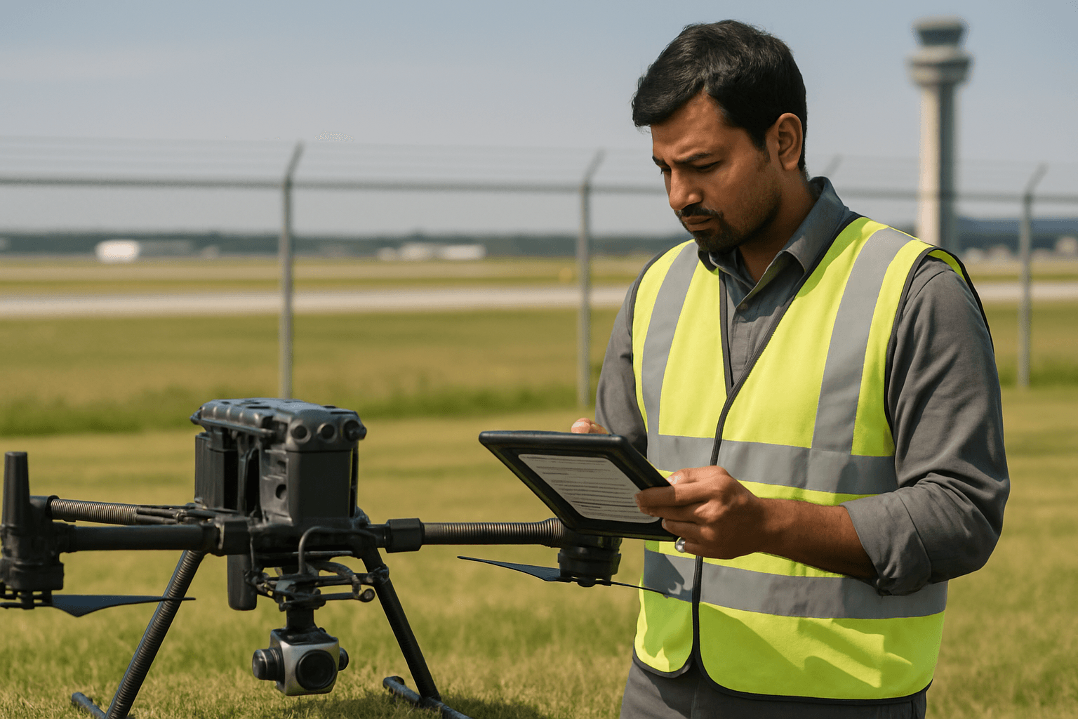
Drone and Equipment Inspection
A comprehensive pre-flight checklist is vital to ensure the drone and all its components are fit for flight. This includes:
- Document Validation: Confirming pilot certifications (e.g., Part 107), insurance, and required flight permits.
- Equipment Inspection: Visually inspecting the drone’s frame, propellers, and landing gear for damage.
- Battery Health: Checking battery charge levels, looking for physical damage or swelling, and ensuring secure mounting.
- System Testing: Verifying software, firmware, and GPS systems are up-to-date and operational.
- Sensor and Camera Systems Check: Calibrating sensors (e.g., LiDAR, high-resolution cameras) and verifying obstacle avoidance sensors are functioning correctly.
- Communication Checks: Ensuring controllers and communication links are working.
Weather Conditions
Assessing environmental conditions, especially wind speed, direction, precipitation, and visibility, is critical. Tools like UAV Forecast and AccuWeather Pro can provide reliable weather data.
Communication and Situational Awareness
Effective communication and maintaining high situational awareness are non-negotiable when operating drones near airports.
Air Traffic Control (ATC) and Common Traffic Advisory Frequency (CTAF)
For flights in controlled airspace, drone operators must receive airspace authorization from ATC. While small UAS operators generally should not contact ATC directly via radio or telephone for airspace access, specific authorization processes like LAANC handle coordination. However, monitoring local CTAF (Common Traffic Advisory Frequency) radio traffic is encouraged for enhanced situational awareness, particularly at uncontrolled airports. This can provide insights into manned aircraft movements, even though pilots are not always legally required to announce their intentions.
Right-of-Way and Traffic Patterns
Drone operators must always yield the right-of-way to all manned aircraft. It is crucial to be aware of airport traffic patterns, approach corridors, taxiways, runways, and helipads, and to avoid interfering with any airport operations.
Visual Observers
Utilizing a visual observer (VO) is a highly recommended best practice, especially when flying near busy airports. A VO can help the remote pilot maintain visual line of sight with the drone while also scanning the airspace for other aircraft, significantly enhancing safety and reducing the pilot’s workload.
Risk Mitigation and Safety Protocols
Proactive risk mitigation is paramount when conducting drone surveying near airports, where the consequences of an incident can be severe. Over 2,000 drone sightings near airports have been reported since 2021, leading to flight delays and near misses.
Adhering to Altitude Limitations
Part 107 mandates that drone pilots fly below 400 feet above ground level (AGL), with exceptions for flying within 400 feet of a structure. Airspace authorizations acquired through LAANC will specify approved altitudes, and adhering to these limits is critical.
Emergency Procedures
Remote pilots in command are responsible for the safe operation of their UAS and must have the ability to direct the drone to ensure compliance and avoid undue hazard. Knowing emergency procedures, such as what to do in case of a mid-flight malfunction or loss of control, is vital. If uncomfortable with the flight conditions or proximity to manned aircraft, terminating the flight immediately is often the safest decision.
Geofencing and Counter-Drone Technologies
Some drone manufacturers, like DJI, incorporate geofencing technology that restricts drone operation in sensitive areas, including near airports. Airports are also increasingly exploring and implementing counter-drone technologies, such as detection systems that identify rogue drones and mitigation measures to neutralize them, while ensuring they do not interfere with legitimate operations or airport communications.
Maintaining Professionalism
Always prioritize safety over expediency. Even with deadlines, it’s better to postpone a flight if conditions are not optimal or if there are any doubts about safety or compliance. Detailed mission planning with contingency measures and thorough pilot training are crucial components of a robust drone risk management plan.


