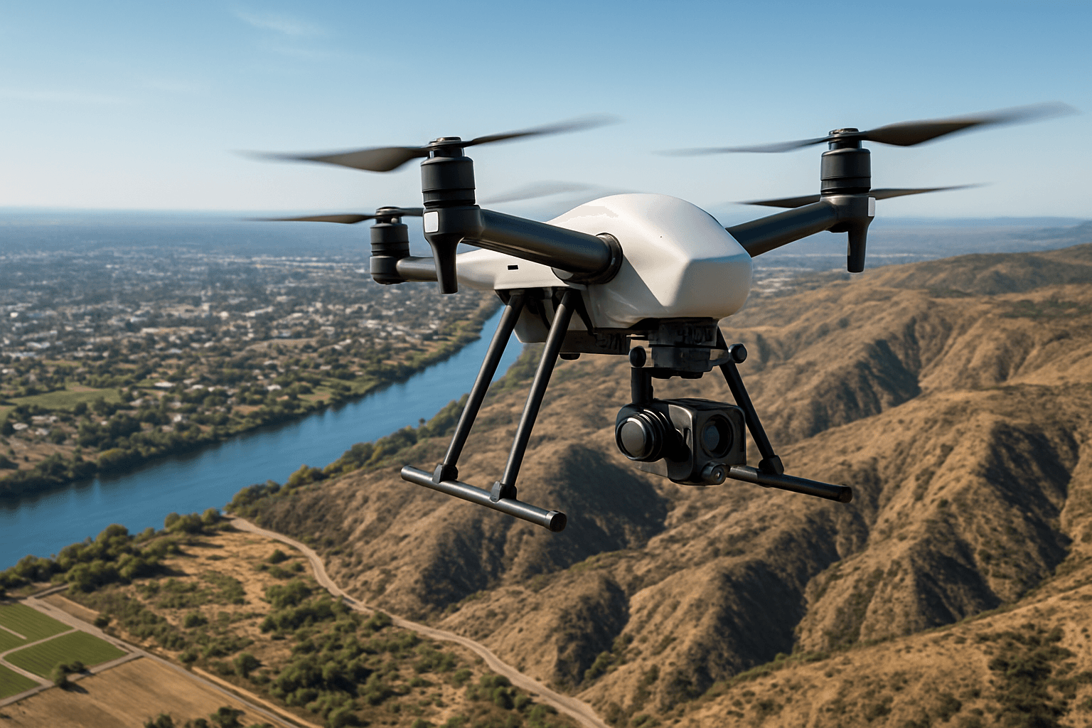
Drone surveying, also known as unmanned aerial vehicle (UAV) surveying, is transforming how professionals capture, analyze, and utilize spatial data. It involves using drones equipped with advanced sensors and cameras to capture aerial data for mapping, modeling, and analysis of land and infrastructure. Unlike traditional surveying methods, which involve manual measurements and ground-based instruments, drone surveying leverages aerial imagery and photogrammetry techniques to create highly accurate and detailed maps and models of surveyed areas.
Why Use Drone Surveying?
Drone surveying offers several advantages over traditional methods:
- Efficiency and Speed: Drones can survey large areas much faster than traditional methods, reducing project completion times.
- Cost-Effectiveness: Drone surveys often cost less than traditional surveys due to reduced labor and equipment costs.
- Safety: Drones can access hazardous or difficult-to-reach areas, improving worker safety.
- Accuracy: Equipped with advanced GPS and sensor technology, drones can provide highly accurate and detailed data.
- Versatility: Drones can be used in various industries and applications, from construction to agriculture to environmental monitoring.
Key Techniques in Drone Surveying
Several key techniques are used in drone surveying to ensure accurate and reliable results:
1. Flight Planning
Careful flight planning is crucial for a successful drone survey. Key considerations include:
- Defining Project Objectives: Determine whether the goal is a detailed map, accurate volume calculations, or an interactive 3D model.
- Area Size and Detail Level: Determine the precise area size and the level of detail required, which will guide decisions on flight altitude, overlap settings, and sensor choices.
- Airspace and Weather Conditions: Understand airspace restrictions and weather conditions to ensure safe and legal operation.
- Flight Path: Plan the drone’s flight path to ensure complete coverage of the survey area with sufficient image overlap. Several common flight patterns exist:
- Grid Pattern: The drone flies in a grid pattern, capturing images along parallel lines.
- Crosshatch Pattern: A grid pattern is flown, followed by another grid pattern flown at a 90-degree angle.
- Circular Pattern: The drone circles the area or object, altering flight altitude vertically and repeating the circling process.
- Inspection Pattern: This type of survey is typically flown manually and doesn’t follow a specific pattern or altitude and is ideal for inspecting structures and job sites.
- Terrain Awareness: If the survey area has significant terrain variations, consider setting the mission to terrain follow. The drone will maintain its cruising altitude, keeping it a consistent distance above the ground level.
2. Ground Control Points (GCPs)
Ground control points (GCPs) are physical markers placed on the ground with known coordinates. They serve as reference points for georeferencing drone imagery and improving accuracy.
- Placement: GCPs should be evenly distributed throughout the survey area and positioned at clear, visible locations. For relatively flat and narrow areas, at least 4-5 GCPs are recommended. If there are large terrain elevation variations, place markers near the highest and lowest areas of the site. To prevent a “doming” effect (distorted elevation data), it is better to place one or more GCPs inside the mapping area or in the center.
- Measurement: The geographic coordinates of GCPs are accurately measured using high-precision GNSS (Global Navigation Satellite System) or surveying equipment.
- Usage: During data processing, GCPs serve as reference markers, facilitating the georeferencing of captured drone imagery and aligning it with real-world locations.
3. Real-Time Kinematic (RTK) and Post-Processed Kinematic (PPK)
RTK and PPK are GPS correction technologies that enhance the positional accuracy of drone surveys.
- RTK: RTK involves correcting GPS signals in real-time, achieving centimeter-level precision. RTK corrections are sent to the drone in real time.
- PPK: PPK involves post-processing GPS data to improve positional accuracy. PPK retains the high accuracy of RTK hardware with more flexibility, and since data is processed post-flight, you can fly behind obstacles and in remote locations without worrying about maintaining a real-time connection to a base station.
- Workflow Selection: A PPK workflow is recommended for nearly every use case because you retain the high accuracy of RTK hardware with more flexibility.
4. Data Acquisition
During the drone survey, it is important to:
- Maintain Consistent Flight Parameters: Maintain a consistent altitude and speed throughout the flight to ensure uniform image quality. Lower altitudes provide higher-resolution imagery, improving accuracy but increasing flight time.
- Ensure Adequate Image Overlap: Adequate image overlap (front-to-back) and sidelap (side-to-side) are essential for accurate photogrammetry processing.
- Adjust Camera Settings: Adjust camera settings for clear images.
5. Data Processing
After the drone survey, the captured data needs to be processed to generate useful outputs. This involves several steps:
- Data Transfer and Organization: Transfer the images to a computer and organize them for processing.
- Photogrammetry: Use photogrammetry software to stitch the individual images together, creating a cohesive mosaic that represents the entire area. Photogrammetry combines images that contain the same point on the ground from multiple vantage points to yield detailed 2D and 3D maps. The software analyzes overlapping features and calculates the spatial relationships between them to reconstruct the three-dimensional geometry of the scene.
- Georeferencing: Use GCPs to georeference the data, aligning it with real-world coordinates.
- Data Extraction and Cleaning: Clean the rich 3D models to only include the relevant data about the project site.
- Output Generation: Generate various outputs, such as orthomosaic maps (geo-referenced images with corrected perspective), digital elevation models (DEM), 3D models, contour lines, and vegetation health maps (using multispectral data).
6. Accuracy Assessment
Accuracy is a critical factor in drone surveying. It refers to how closely measurements collected by survey hardware can align with real-world measurements under ideal surveying conditions.
- Absolute Accuracy: Absolute accuracy refers to how closely your drone survey data matches real-world coordinates, such as GPS positions or known benchmarks. It assesses how accurately features are positioned on the Earth’s surface relative to their true geographic locations.
- Relative Accuracy: Relative accuracy focuses more on precision rather than accuracy. It emphasizes the consistency of measurements relative to each other within the dataset.
- Techniques to Enhance Accuracy:
- Employ RTK or PPK workflows to drastically improve positional accuracy.
- Optimize GCP placement.
- Ensure consistent camera calibration.
Applications of Drone Surveying
Drone surveying has diverse applications across many industries:
- Construction: Monitoring construction progress, capturing existing conditions safely and efficiently.
- Agriculture: Assessing crop health, estimating yields, and optimizing irrigation.
- Environmental Monitoring: Tracking ecosystem changes and assessing the environment.
- Infrastructure Inspection: Inspecting critical infrastructure such as bridges and pipelines.
- Mining: Calculating stockpile volumes.
- Land Management and Development: Aerial images taken by drones greatly accelerate and simplify topographic surveys for land management and planning.
Choosing the Right Drone
The ideal drone for surveying depends on your project needs and the survey area. Factors to consider include:
- Site Size: For larger areas requiring extensive coverage, fixed-wing drones offer longer flight times and efficiency. For smaller areas, multirotor drones are recommended due to their precise maneuverability.
- Surrounding Landscape: If launching next to vertical obstacles, consider a quadcopter or VTOL (vertical takeoff and landing) drone.
- Budget: Quadcopters are the most affordable drones on the market.
Regulatory Considerations
Commercial drone regulations vary by region, so it’s essential to check regional guidelines before flying. In the United States, surveyors must obtain a Remote Pilot Certificate from the FAA under Part 107 regulations. In Canada, operators conducting advanced drone operations need an Advanced Operations Certificate issued by Transport Canada.
The Future of Drone Surveying
The future of drone surveying is promising, with advancements in technology and expanding applications. Expanded permissions for beyond visual line-of-sight (BVLOS) operations are anticipated, unlocking significant growth opportunities by allowing surveyors to safely and efficiently cover vast areas without visual observers. By staying informed about these evolving technologies and trends, drone surveyors can better position themselves to harness new capabilities, enhance operational efficiencies, and maintain competitive advantages in a rapidly transforming industry.


