Drones have rapidly transformed from futuristic gadgets into essential tools in the UK construction industry. In 2025, they’re no longer just a novelty but a driving force behind increased efficiency, safety, and accuracy across various construction projects. From surveying and mapping to progress monitoring and site security, drones offer a bird’s-eye view that traditional methods simply can’t match. This article explores the key use cases, benefits, and regulatory landscape of drones in UK construction, providing a comprehensive guide for construction professionals looking to integrate this cutting-edge technology into their operations.
What Are Drones and How Are They Used in Construction?
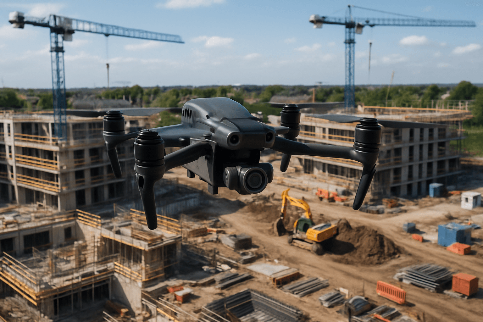
Drones, also known as Unmanned Aerial Vehicles (UAVs), are remotely controlled flying machines equipped with high-resolution cameras, LiDAR sensors, or thermal imaging capabilities. In the UK construction sector, drones have become a disruptive force, offering new ways to monitor, inspect, and plan building projects. Site managers can now use drones to perform overhead scans of entire construction sites in minutes, replacing traditional, time-consuming surveying tools. Whether it’s measuring stockpiles, tracking progress, or checking for structural faults, there’s a drone for that.
A Brief History of Drones in Construction
The integration of drones into construction didn’t happen overnight. A decade ago, drones were primarily associated with hobbyists or military applications. However, as technology evolved, with lighter frames, better batteries, and advanced imaging, the commercial drone sector exploded. In the UK, drone integration into construction began in earnest around 2015, with early adopters mainly using them for aerial photography. By 2020, major firms like Balfour Beatty and Kier had fully embraced drones for surveying and safety audits.
The Current State of Drone Usage in UK Construction
According to a 2024 report by PwC, the UK’s construction industry is now the second-largest adopter of commercial drones, trailing only agriculture. Approximately 64% of construction firms with more than 50 employees report using drones regularly or occasionally, a significant increase from just 22% five years prior. This surge in adoption is driven by the competitive edge that drones provide, with firms reporting faster project completion, fewer site incidents, and higher accuracy in site measurements.
In cities such as Manchester and Leeds, local councils are partnering with construction companies to deploy drones for infrastructure audits and maintenance planning. Drones are rapidly becoming standard practice, not just a trend.
Drone Use Cases on UK Construction Sites
Drones are versatile tools with a wide range of applications across construction sites. Here are some of the most common use cases:
Surveying and Mapping
Traditional land surveys can take days or even weeks to complete. Drones can accomplish the same task in hours, generating 3D maps, topographic data, and more. They capture detailed maps, contour lines, and 3D models with millimeter accuracy using aerial photogrammetry and LiDAR sensors. This allows construction managers to generate digital elevation models (DEMs) and orthomosaics much faster and cheaper than traditional methods.
Progress Monitoring
Drones can capture visual and thermal data through weekly flights to create progress timelines. Regular drone flights track project progress in real-time, helping identify delays, monitor milestones, and make timely adjustments. This ensures projects stay on schedule with accurate, current reports.
Structural Inspections
Drones can inspect roofs, towers, and high-rise buildings without the need for scaffolding or lifts. They access hard-to-reach areas and provide high-resolution imagery to detect structural defects, moisture intrusion, and other issues that may compromise the integrity of buildings or infrastructure.
Site Safety Audits
Thermal drones help detect overheating equipment or potential electrical faults, ensuring site safety and compliance. Drones can also quickly assess potential site security breaches, such as issues with fencing after extreme weather, allowing for rapid deployment of temporary fencing to reduce the risk of theft and trespass.
Inventory and Asset Management
Drones help track construction materials and equipment across sprawling sites. By monitoring the location and state of equipment, drones assist in quickly locating equipment, managing assets more efficiently, and rapidly reviewing equipment conditions for required repairs or removal.
3D Reconstruction
Drones enable precise site mapping and 3D reconstructions, offering capabilities for improved project management. Platforms like Evercam allow users to inspect progress from every angle, conduct remote measurements, and place annotations directly on the model to highlight information for the team.
Marketing and Promotion
Drones capture visually stunning imagery that can be used for marketing materials, presentations, and online platforms, helping construction companies stand out in a competitive market. They offer comprehensive overviews of construction sites, allowing stakeholders to monitor progress, identify potential issues, and make informed decisions.
Benefits of Drones in the UK Construction Sector
The use of drones in construction offers numerous benefits, including:
Enhanced Site Surveying and Mapping
Drones improve accuracy in site measurements. With aerial photogrammetry and LiDAR sensors, drones can capture detailed maps, contour lines, and 3D models with millimeter accuracy. Construction managers can generate digital elevation models (DEMs) and orthomosaics in just a few hours, which is faster, cheaper, and more accurate than traditional methods.
Improved Safety and Risk Management
Drones reduce the need for workers to enter dangerous or hard-to-reach areas. Falls on site were the second-highest cause of fatalities in the UK construction industry, so keeping workers on the ground and sending drones up instead can contribute to overall worker safety and risk management. Drones can also quickly assess a potential site security breach and ensure site security.
Cost Savings and Efficiency Gains
UK construction firms leveraging drone tech report up to 20-30% time savings on surveying and progress tracking tasks. This translates to major cost reductions over the course of a multi-month build, including:
- Reduced Labour Costs: A single drone operator can do the work of several surveyors in a fraction of the time.
- Faster Decision-Making: With drone-generated data available in near real-time, managers can make faster, more informed decisions, cutting down on project delays.
- Minimized Rework: High-accuracy scans and photogrammetry help catch errors early, reducing the need for expensive fixes.
- Reduced Equipment Rentals: Drones eliminate the need for scaffolding or cranes just for inspections.
Real-Time Project Updates
Drones capture project updates in seconds, allowing for real-time tracking and instant ROI. This provides a continuous workflow system that makes it easier to manage projects and collaborate with the team.
Enhanced Communication
Visual data from drones can be easily shared with all project stakeholders, including construction teams, investors, and clients. This facilitates better communication, allowing for informed discussions and swift resolution of any issues.
Key Technologies Behind Construction Drones
Several key technologies enable the diverse applications of drones in construction:
LiDAR and Photogrammetry
- LiDAR (Light Detection and Ranging): LiDAR systems measure distances with pulsed laser light, providing 3D visualizations and mapping for detailed terrain analysis.
- Photogrammetry: This technique uses aerial photographs to create detailed 3D models and maps of construction sites.
AI and Real-Time Data Processing
Artificial Intelligence (AI) has transformed drones into more than just passive data collectors. AI is now used to process data in real-time, making drone insights immediately actionable. AI-powered platforms interpret drone data automatically and present it in easy-to-read dashboards, providing visual reports, progress metrics, and red-flag alerts without the need to sift through raw footage.
Drone Software and Integration with BIM
Drone software integrates with Building Information Modelling (BIM) to allow clients to get a feel for what the finished project would look like and track progress against the final product. Software can utilize drone data to produce different types of maps of the entire site, record all construction activities, manage operations and contractors more effectively, and provide irrefutable evidence should disagreements arise over project progress/status.
Legal and Regulatory Framework in the UK
Flying drones in the UK isn’t a free-for-all. The Civil Aviation Authority (CAA) governs all drone operations through the UK Drone Code, and construction companies must follow strict regulations to stay compliant.
CAA Regulations and Licensing
If a drone weighs more than 250g or is used for commercial purposes, like on a job site, operators need to register with the CAA and possibly obtain a General Visual Line of Sight Certificate (GVC). Key regulations include:
- Registering the drone with the CAA.
- Ensuring pilots have valid training (A2 CofC or GVC).
- Conducting risk assessments for each site.
- Submitting flight plans for areas with restricted airspace.
- Maintaining a maximum 500m distance line of sight at all times by operator visibility to the naked eye (VLOS).
- Ensuring the maximum height of a SUA does not exceed 122 m above the level of take-off.
- Carrying insurance in compliance with EC Regulation 785/2004.
GDPR Compliance and Data Security
Construction companies using drones with cameras need to handle data carefully, as the extension of the Data Protection Act includes CCTV footage and images. They need to pay attention to these new rules and ensure they comply with GDPR.
Insurance and Risk Management
Operators of unmanned aircraft must comply with EC Regulation 785/2004 (Article 2) on Insurance Requirements for Air Carriers and Aircraft Operators. Operators of small unmanned aircraft and small unmanned surveillance aircraft are advised to consult the regulation to determine the minimum level of insurance required.
Key Changes to UK Drone Regulations in 2025
New UK drone regulations are being implemented from 2025, with full enforcement expected by 2026. Failing to comply could ground operations. Key changes include:
- Introduction of drone class marking: Starting January 1st, 2026, the UK will implement drone class marking. Drones in the Open Category (for low-risk activities) will need to meet new safety and technical standards.
- Specific Operations Risk Assessment (SORA): From April 23rd 2025, the CAA will adopt the Specific Operations Risk Assessment (SORA) methodology to evaluate and approve higher-risk drone operations.
- Beyond visual line of sight (BVLOS) operations: New policies will make BVLOS operations more accessible, permitting these operations at low altitudes near structures where the risk to other aircraft is minimal, which aims to reduce operational costs and improve efficiency for maintenance and security tasks.
Challenges and Limitations of Drone Use
Despite the numerous benefits, there are also challenges and limitations to consider:
Weather Dependency and Flight Restrictions
Weather conditions can significantly impact drone operations, with rain, wind, and extreme temperatures affecting flight stability and data quality. Additionally, certain areas may have flight restrictions due to proximity to airports or other sensitive locations.
Privacy Concerns and Public Perception
The use of drones raises privacy concerns, particularly regarding the collection of personal data and potential surveillance. Addressing these concerns and ensuring compliance with data protection regulations is crucial for maintaining public trust.
Technical Skill Requirements
Operating drones requires technical expertise, including piloting skills, data processing knowledge, and an understanding of relevant regulations. Training and certification for drone operators are essential for ensuring safe and effective drone use.
Choosing the Right Drone and Software
Selecting the right drone and software is critical for maximizing the benefits of drone technology in construction. Consider the following factors:
Drone Features
- Camera Quality: High-resolution cameras are essential for detailed inspections and accurate mapping.
- Flight Time: Longer flight times allow for more extensive data collection in a single flight.
- Sensor Capabilities: LiDAR and thermal sensors provide valuable data for specific applications.
- Durability: Choose a drone that can withstand the rigors of a construction site environment.
Software Compatibility
- Mapping Software: Software like DJI Terra streamlines the workflow from mission planning to processing 2D and 3D models.
- AI-Powered Platforms: Platforms like Sensat and Skyports offer AI-powered data interpretation and easy-to-read dashboards.
- BIM Integration: Ensure the software integrates seamlessly with BIM to track progress against the final product.
ROI and Cost-Benefit Analysis
Implementing drones in construction requires an upfront investment, but the long-term savings and benefits often outweigh the initial costs. Here are some factors to consider:
Upfront Investment vs Long-Term Savings
- Drone Purchase: The cost of the drone and necessary accessories.
- Training and Certification: Expenses for training drone operators.
- Software Licensing: Costs for mapping and data processing software.
- Maintenance: Ongoing maintenance and repair costs.
ROI Metrics and Tracking Tools
- Time Savings: Measure the reduction in time spent on surveying, inspections, and progress monitoring.
- Cost Reduction: Calculate the savings in labor, equipment rentals, and rework.
- Improved Safety: Track the decrease in site incidents and associated costs.
- Data Accuracy: Assess the improvement in data accuracy and its impact on project outcomes.
By carefully evaluating these factors and tracking relevant metrics, construction companies can determine the ROI of drone technology and make informed decisions about implementation.
The Future of Drones in UK Construction
The future of drones in UK construction is bright, with several exciting developments on the horizon:
Autonomous Drones and AI Evolution
Autonomous drones, powered by AI, will increasingly automate tasks such as site surveying, progress monitoring, and safety inspections. These drones will be capable of operating with minimal human intervention, further improving efficiency and reducing costs.
Integration with IoT and Smart Cities
Drones will integrate with the Internet of Things (IoT) and smart city initiatives to provide real-time data on infrastructure conditions, traffic patterns, and environmental factors. This data will enable more informed decision-making and better management of urban construction projects.
Drone Swarms and Collaborative Systems
Drone swarms, where multiple drones work together to complete a task, will become more common in construction. These collaborative systems will enable faster and more comprehensive data collection, as well as the ability to perform complex tasks such as infrastructure inspection and maintenance.
Drones are revolutionizing the UK construction industry, offering a wide range of benefits from enhanced surveying and mapping to improved safety and cost savings. By understanding the key use cases, regulatory landscape, and future trends, construction professionals can harness the power of drones to drive efficiency, accuracy, and innovation in their projects. As technology continues to evolve, drones will play an increasingly important role in shaping the future of construction in the UK.


