Drone inspection methods are rapidly transforming industries, offering safer, more efficient, and cost-effective solutions for assessing infrastructure, agriculture, and more. By utilizing unmanned aerial vehicles (UAVs) equipped with advanced sensors and cameras, businesses can gain valuable insights into the condition of their assets without putting personnel at risk. This article explores the various drone inspection methods, their applications, and the benefits they offer.
What is Drone Inspection?
Drone inspection involves using unmanned aerial vehicles (UAVs), also known as drones, to perform visual and data collection tasks for various inspection purposes . Instead of manual inspections, which can be time-consuming, costly, and dangerous, drones are equipped with cameras and sensors that allow operators to gather data remotely . This data can be reviewed in real-time or transferred for further analysis, providing a comprehensive assessment of the inspected asset .
Types of Drone Inspection Methods
While most drone inspections rely on visual data, many also utilize advanced sensors to gather more detailed information . Here are some common drone inspection methods:
1. Visual Inspection
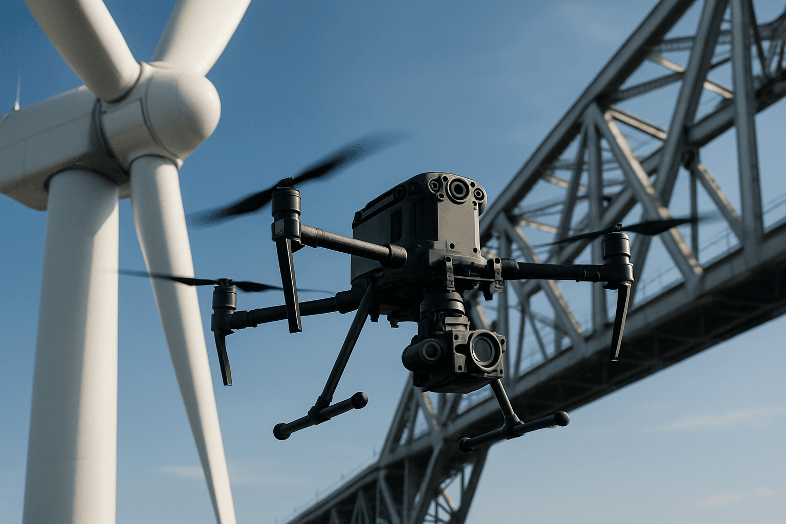
Visual inspections are the most common type, where drones act as the inspector’s eyes in the sky . Drones capture high-resolution images and videos of assets, allowing inspectors to identify defects, damage, or other issues . This method is used across various industries, including :
- Infrastructure: Bridges, buildings, roads, and dams .
- Energy: Power lines, wind turbines, solar panels, and oil & gas pipelines .
- Construction: Monitoring progress, ensuring quality control, and identifying safety hazards .
2. Thermal Imaging
Drones equipped with thermal cameras can detect heat variations, revealing hidden problems that are not visible to the naked eye . Thermal imaging is particularly useful for:
- Energy Audits: Identifying insulation flaws and heat loss in buildings .
- Electrical Inspections: Detecting overheating components and electrical faults .
- Leak Detection: Locating moisture buildup and leaks in roofs and pipelines .
3. LiDAR (Light Detection and Ranging)
LiDAR sensors use lasers to create high-resolution 3D maps of objects and environments . This technology is valuable for:
- Geospatial Mapping: Generating accurate terrain models for construction planning and resource management .
- Infrastructure Monitoring: Detecting structural changes and deformations in bridges, buildings, and other critical assets .
- Mining: Mapping underground areas and monitoring excavation progress .
4. Multispectral Imaging
Multispectral cameras capture images in different bands of the electromagnetic spectrum, including visible light, near-infrared, and thermal . This method is primarily used in agriculture to:
- Assess Crop Health: Identifying plant stress, nutrient deficiencies, and disease outbreaks .
- Monitor Irrigation: Detecting variations in soil moisture levels .
- Optimize Yield: Making data-driven decisions about planting, fertilization, and irrigation .
5. Ultrasonic Thickness Measurement
Some specialized drones can carry ultrasonic thickness payloads to measure the thickness of materials . This is particularly useful in:
- Maritime Inspections: Assessing the condition of ship hulls and other marine structures .
- Oil & Gas: Monitoring pipeline corrosion and integrity .
- Infrastructure: Helping determine the condition of structures .
6. Gas Leak Detection
Drones equipped with gas detection sensors can identify the presence of toxic gases in the air . This is crucial for:
- Pipeline Monitoring: Detecting leaks in oil and gas pipelines .
- Industrial Safety: Monitoring air quality at construction sites and chemical plants .
- Environmental Monitoring: Assessing air pollution levels .
Drone Equipment for Inspections
The specific equipment used for drone inspections varies depending on the type of inspection being performed . However, some common components include:
- Drone: Multirotor drones are typically used for inspections of buildings, bridges, and other structures due to their maneuverability and hovering capabilities . Fixed-wing drones are better suited for large-area inspections like pipelines and power lines .
- High-Resolution Cameras: Capture detailed visual data for identifying defects and damage .
- Thermal Cameras: Detect heat variations for identifying insulation flaws, electrical faults, and leaks .
- LiDAR Sensors: Create 3D maps for accurate measurements and geospatial analysis .
- Multispectral Cameras: Capture images in different spectral bands for assessing plant health and other environmental factors .
- Sensors: Various sensors can be added to drones depending on the use case .
- Software: Software such as Geographic Information Systems (GIS), Building Information Modeling (BIM), and photogrammetry software are used to process and analyze the data collected by drones .
Industries Using Drone Inspection Methods
Drone inspection methods are used across a wide range of industries, including:
1. Construction
Drones are used in construction to:
- Monitor site progress and ensure quality control .
- Inspect buildings, bridges, and other structures for defects and damage .
- Create 3D models and maps for planning and documentation .
- Improve safety by identifying hazards and ensuring compliance with safety regulations .
2. Energy
In the energy sector, drones are used to:
- Inspect power lines, wind turbines, and solar panels for damage and defects .
- Detect heat variations and electrical faults in equipment .
- Monitor oil and gas pipelines for leaks and corrosion .
- Improve safety by reducing the need for personnel to work at heights or in hazardous environments .
3. Agriculture
Drones help improve agricultural practices by:
- Assessing crop health and identifying areas of stress or disease .
- Monitoring irrigation and soil moisture levels .
- Creating detailed maps of fields for precision farming .
- Estimating crop yields and optimizing resource allocation .
4. Infrastructure
Drones are used for infrastructure inspection to:
- Assess the condition of bridges, dams, and other critical assets .
- Detect structural changes and deformations over time .
- Perform post-disaster assessments and identify areas of damage .
- Reduce the need for manual inspections, improving safety and efficiency .
5. Mining
Drones equipped with LiDAR and thermal cameras are used in the mining industry to:
- Map underground areas and monitor excavation progress .
- Detect hazards like rockfalls and equipment malfunction .
- Optimize equipment utilization and track environmental impact .
- Improve safety by keeping personnel out of harm’s way .
Benefits of Drone Inspection Methods
Drone inspection methods offer several advantages over traditional inspection techniques:
- Improved Safety: Drones can access dangerous or hard-to-reach areas without putting personnel at risk .
- Increased Efficiency: Drones can complete inspections faster than traditional methods, saving time and labor costs .
- Higher Quality Data: Drones can capture high-resolution images and videos, providing a more detailed and accurate view of the infrastructure being inspected .
- Cost Savings: By reducing the need for manual labor and specialized equipment, drone inspections can save companies money .
- Better Data Analysis: The data collected by drones can be used to create 3D models and interactive site maps, facilitating more efficient analysis and decision-making .
- Reduced Downtime: Drones can inspect structures while they are in use, minimizing downtime and keeping regular inspections on schedule .
- Early Issue Detection: Drones can help detect potential problems early, allowing for proactive maintenance and preventing more significant issues from developing .
Challenges and Limitations
Despite the numerous benefits, drone inspection methods also have some challenges and limitations:
- Weather Limitations: Strong winds, rain, and snow can affect drone operations .
- Regulatory Restrictions: Operating drones for commercial purposes requires permits and adherence to specific regulations .
- Technical Expertise: Operating drones and analyzing the data they collect requires specialized skills and training .
- Limited Flight Time: Drones have limited battery life and range, which may restrict their ability to inspect larger structures .
- Data Processing and Privacy: A large amount of data is collected by drones, which needs to be processed and analyzed, raising data privacy issues .
- Initial Cost: The initial investment in drones and related equipment can be high .
Best Practices for Drone Inspections
To ensure successful drone inspections, it is essential to follow these best practices:
- Proper Training: Drone operators should undergo comprehensive training to operate drones safely and effectively .
- Pre-Inspection Planning: Before each inspection, familiarize yourself with the area, noting terrain and climate, and confirm all attachments are secure and functional .
- Regular Maintenance: Keep drones well-maintained following the manufacturer’s guidelines .
- Weather Considerations: Consider weather conditions before inspections, as strong winds or rain can affect drone performance .
- Secure Data: Implement robust data security measures to protect collected information from unauthorized access .
- Compliance with Regulations: Ensure compliance with local regulations governing drone use and safety .
The Future of Drone Inspection Methods
The future of drone inspection methods looks promising, with advancements in drone technology and data analytics expected to further enhance their capabilities . Some trends to watch include:
- Increased Autonomy: Drones are becoming more autonomous, enabling automated inspections and data collection .
- Advanced Sensors: Drones are being equipped with more advanced sensors and cameras, facilitating more precise and detailed inspections .
- AI-Powered Analytics: Artificial intelligence (AI) is being used to analyze drone data, enabling predictive maintenance and proactive inspection approaches .
- Integration with Other Technologies: Drones are being integrated with other technologies, such as GIS and BIM, to create more comprehensive solutions for asset management .
Conclusion
Drone inspection methods are revolutionizing various industries by providing safer, more efficient, and cost-effective solutions for asset assessment. By utilizing UAVs equipped with advanced sensors and cameras, businesses can gain valuable insights into the condition of their assets, improve safety, and make data-driven decisions. While there are challenges and limitations to consider, the benefits of drone inspection methods are clear, and their adoption is expected to continue growing in the years to come.


