The silent hum of drone propellers is rapidly becoming a familiar sound in the world of wildlife conservation, ushering in a new era of unprecedented precision and efficiency in monitoring animal populations and their vital habitats. Unmanned Aerial Systems (UAS), commonly known as drones, are transforming the way researchers and conservationists understand and protect the natural world, offering solutions to challenges that traditional methods simply couldn’t overcome.
The Evolution of Wildlife Monitoring
For decades, the backbone of wildlife monitoring relied on labor-intensive and often invasive methods. Ground surveys, manned aerial surveys, and camera traps provided valuable data, but each came with significant limitations.
Traditional Methods and Their Limitations
Traditional approaches often involved arduous treks across challenging terrains, direct observation from vehicles or aircraft, and the strategic placement of camera traps. These methods were time-consuming, expensive, and could inadvertently disturb wildlife, potentially altering natural behaviors. Satellite imagery, while covering vast areas, often lacked the resolution needed for detailed species-level tracking or intricate habitat analysis. Manual counting by human observers from the ground or manned aircraft was prone to inaccuracies, especially in dense vegetation or for large, scattered populations, and posed safety risks for personnel.
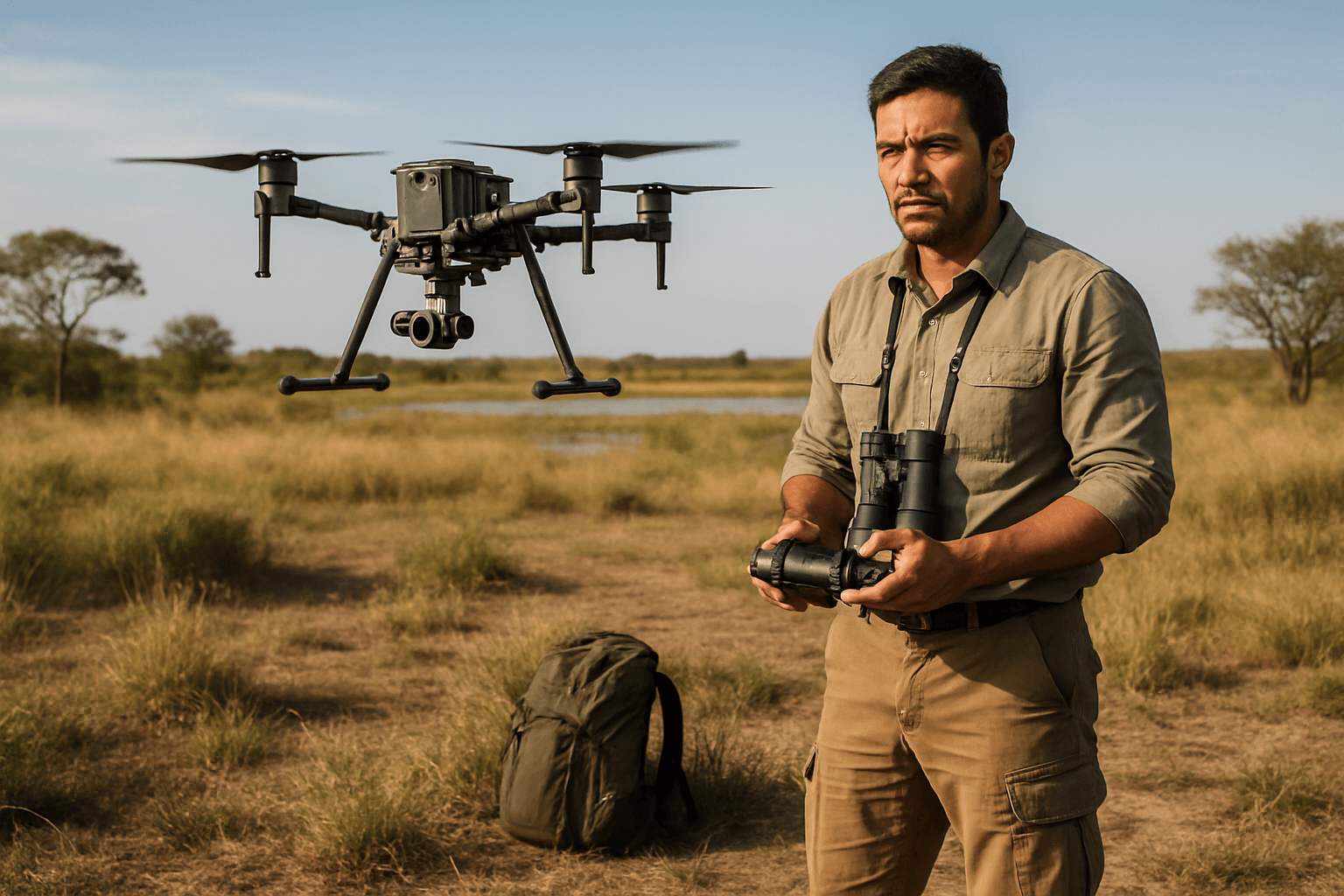
Drones: A Game-Changer for Wildlife Conservation
Drones have emerged as a transformative tool, providing safer, more cost-effective, and less intrusive alternatives to traditional wildlife research. Their ability to offer a “bird’s-eye perspective” over inaccessible landscapes has unlocked new ways for conservationists to survey and access wildlife populations.
Enhanced Data Collection and Accuracy
Equipped with cutting-edge cameras and high-functioning sensors, drones capture powerful imagery and data, providing detailed insights into habitat conditions, wildlife populations, and environmental changes. Studies have shown that drone-derived data for wildlife counts can be significantly more accurate than traditional ground counts, sometimes by as much as 43% to 96%. This high-resolution data is invaluable for conservation planning and decision-making.
Minimizing Disturbance to Wildlife
One of the most significant advantages of drones is their capacity for non-invasive monitoring. Drones can operate from safe altitudes, minimizing stress and disturbance to animals, which is crucial for studying timid or endangered species without altering their natural behavior. This low-impact approach ensures that data accurately reflects wildlife in their undisturbed state.
Accessing Remote and Challenging Terrains
Many critical wildlife habitats are remote, dangerous, or logistically challenging for human access due to rugged terrain, dense vegetation, or extreme weather. Drones can efficiently navigate these areas, collecting data that would otherwise be impossible or extremely difficult to obtain.
Key Applications of Drones in Wildlife Monitoring
The versatility of drones extends across various critical aspects of wildlife conservation, from population assessments to combating illegal activities.
Population Counts and Distribution Mapping
Drones equipped with visual (RGB) and thermal cameras are making wildlife population tracking more precise. They allow researchers to count animals, observe movement patterns, and monitor breeding and feeding behaviors without direct intervention. Thermal imaging drones, in particular, are adept at detecting heat signatures, enabling the efficient and non-invasive surveying of nocturnal, camouflaged, or hidden wildlife, even in dense forests or at night. Automated animal counting, often powered by AI and machine learning algorithms, processes drone-captured imagery to identify, map, and count animals with improved accuracy and efficiency compared to manual methods.
Habitat Assessment and Change Detection
Drones play a pivotal role in assessing ecosystem health through habitat analysis. They capture high-resolution aerial imagery and can perform 3D mapping, surveying inaccessible areas to evaluate ecological health. Multispectral sensors on drones detect variations in vegetation, soil moisture, and land use, helping scientists understand the impacts of climate change and human activity on ecosystems. LiDAR (Light Detection and Ranging) technology, when integrated with drones, provides detailed 3D maps of landscapes, penetrating dense foliage to reveal vegetation height, density, and canopy cover, which is invaluable for identifying critical habitats and monitoring changes over time.
Anti-Poaching and Security Surveillance
Drones are a formidable tool in the fight against poaching and illegal deforestation. By flying over protected areas, they can detect suspicious activities in real-time and alert authorities. Infrared drones are particularly effective at detecting human movement, even at night, allowing for quicker responses to prevent illegal hunting. AI-powered drones can even be trained to differentiate between typical animal behavior and human activity, or even between rangers and poachers, by analyzing movement patterns.
Disease Surveillance and Health Monitoring
While less extensively detailed in general searches, the use of thermal imaging can assist in identifying injured animals or detecting anomalies in body temperature that might indicate health issues, contributing to early disease surveillance in populations. This ability can aid in timely veterinary intervention and reduce disease outbreaks.
Types of Drones and Sensor Technologies Used
The effectiveness of drone-based wildlife monitoring is heavily reliant on the choice of drone platform and the specialized sensors it carries.
Fixed-Wing vs. Multi-Rotor Drones
The selection between fixed-wing and multi-rotor drones depends on the mission requirements.
- Fixed-wing drones resemble small airplanes, offering longer flight times, greater range, and higher speeds. They are ideal for covering vast areas efficiently, such as large wildlife reserves or extensive habitat mapping. However, they typically require open spaces for takeoff and landing.
- Multi-rotor drones (like quadcopters or hexacopters) are known for their vertical takeoff and landing (VTOL) capabilities, superior maneuverability, and ability to hover precisely. These traits make them suitable for detailed, close-range observations, operating in confined clearings, or when precision is paramount, though they generally have shorter flight times.
Visual (RGB) Cameras
Standard high-resolution RGB (red, green, blue) cameras are fundamental for capturing visual aerial imagery. These are used for counting animals, observing nesting birds, tracking movement patterns, and general habitat assessment.
Thermal and Multispectral Sensors
- Thermal cameras detect heat signatures emitted by animals, allowing researchers to locate cryptic or nocturnal species that are difficult to observe visually. This technology is crucial for population estimates, identifying individuals, and monitoring animals in dense foliage or low-light conditions.
- Multispectral sensors capture data across specific light wavelengths beyond the visible spectrum. They are invaluable for assessing vegetation health, mapping changes in land use, and identifying different plant species, which are all crucial for habitat analysis.
LiDAR for 3D Habitat Mapping
LiDAR (Light Detection and Ranging) systems on drones use laser pulses to create highly detailed 3D maps of landscapes. Unlike traditional cameras, LiDAR can penetrate dense tree canopies, revealing the underlying terrain and vegetation structure. This capability is essential for analyzing forest structure, biomass, elevation, and identifying critical habitat features that might be hidden from view, aiding in reforestation efforts and climate change monitoring.
Challenges and Ethical Considerations
Despite the myriad benefits, the widespread adoption of drones in wildlife conservation faces several challenges and ethical considerations that require careful management.
Regulatory Hurdles and Airspace Restrictions
Operating drones is subject to evolving regulatory frameworks and airspace restrictions, which can limit where and how drones can be deployed, particularly in protected areas or national parks. Obtaining necessary permits is often a prerequisite for drone operations in wildlife areas.
Data Processing and Analysis Demands
Drones generate vast amounts of high-resolution data, which can be challenging and time-consuming to process and analyze manually. Extracting actionable insights efficiently requires advanced computational resources and expertise in data management and interpretation. The integration of artificial intelligence and machine learning is becoming indispensable for automated animal detection, behavioral analysis, and population estimation.
Potential for Wildlife Disturbance (Mitigation Strategies)
While generally less intrusive than manned aircraft, drones still have the potential to disturb wildlife through noise and visual intrusion. This can lead to stress or altered behaviors, especially during critical periods like breeding or migration. Mitigation strategies include maintaining higher altitudes, slower speeds, and oblique approach angles to minimize impact. Researchers must also conduct thorough studies on species-specific responses and establish ethical operating thresholds to ensure conservation efforts do not inadvertently harm animal well-being. Monitoring animal responses during drone flights with a “spotter” and ceasing operations if disturbance occurs are also recommended practices.
Cost and Training Requirements
The initial investment in drone technology, including specialized sensors and sophisticated data processing software, can be significant. Furthermore, operating drones effectively for conservation requires trained pilots and personnel with expertise in flight planning, data collection, and analysis, adding to operational costs.
The Future of Drone-Assisted Wildlife Conservation
The trajectory of drone technology in wildlife conservation points towards increasingly sophisticated and autonomous operations, further enhancing their capabilities.
AI Integration and Autonomous Operations
The synergy between drones and Artificial Intelligence (AI) is transforming wildlife monitoring. AI-powered drones can perform real-time species recognition, analyze behavior, and estimate population densities autonomously. This allows for more precise wildlife monitoring and near-instant analysis, accelerating workflows and boosting accuracy by processing massive amounts of data efficiently. Pre-programmed flight paths enable automated tasks without continuous human intervention.
Swarm Technology and Collaborative Monitoring
Future advancements include the potential for drone swarm technology, where multiple drones operate collaboratively. Swarms can cover larger areas simultaneously, optimize data collection through coordinated movements, and enhance situational awareness, leading to more efficient monitoring and improved data accuracy.
Miniaturization and Extended Endurance
Ongoing research and development are focused on miniaturizing drone components and extending flight endurance. Smaller, quieter drones will further reduce the potential for wildlife disturbance, while extended battery life will allow for prolonged monitoring sessions and coverage of even larger, more remote habitats without frequent battery changes.
In conclusion, drones are fundamentally reshaping wildlife monitoring and habitat assessment, offering a powerful, precise, and less invasive means to gather critical ecological data. While challenges related to regulation, data processing, and ethical considerations require ongoing attention, the integration of advanced sensor technologies and artificial intelligence promises an even more impactful future for drone-assisted wildlife conservation. These unmanned aerial systems are not merely tools but catalysts for a deeper understanding and more effective protection of our planet’s invaluable biodiversity.


