Imagine vast national parks and bustling recreational areas, often stretching over hundreds or thousands of square miles, grappling with increasing visitor numbers, ecological threats, and the sheer logistical challenge of oversight. Traditional monitoring methods, often labor-intensive and resource-heavy, are struggling to keep pace. Enter Unmanned Aerial Vehicles (UAVs), or drones, which are rapidly transforming the landscape of park and recreation management by offering an efficient, cost-effective, and safe “eye in the sky” to address these complex issues.
The Expanding Horizon of Drone Applications in Parks and Recreation
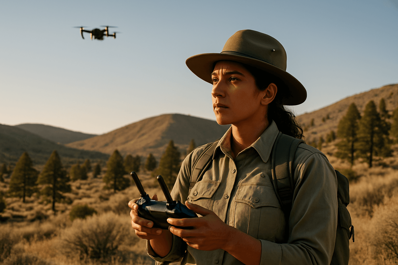
Drones are no longer mere gadgets for hobbyists; they are becoming indispensable tools for land managers across various disciplines. Their agility and ability to gather high-resolution data from unique perspectives make them ideal for a range of applications in park and recreational settings.
Enhanced Surveillance and Security for Public Safety
Park rangers and security personnel are leveraging drones to bolster public safety and enforce regulations. Drones can patrol large areas, monitor events, and identify suspicious activities or individuals more efficiently than ground patrols alone. This aerial perspective is crucial in ensuring visitor safety and maintaining order in expansive recreational spaces.
Critical Roles in Environmental Monitoring and Conservation
For conservationists, drones offer a game-changing solution for understanding and protecting natural resources. They provide a non-invasive way to monitor wildlife populations, track habitat changes, and assess ecological health. This data is vital for crafting targeted conservation strategies and responding to environmental threats.
Efficient Visitor Management and Impact Assessment
As visitor numbers climb, so do the impacts on natural landscapes. Drones can help land managers assess and mitigate these effects, such as tracking the formation of visitor-created trails, monitoring vegetation loss, and identifying areas susceptible to degradation. This allows for informed decision-making to reduce recreational impacts.
Tangible Benefits of Drone Integration
The adoption of drone technology in parks and recreational areas brings a multitude of advantages that enhance operational capabilities and optimize resource allocation.
Significant Cost-Effectiveness and Operational Efficiency
Traditional methods for data collection, such as manned aircraft or extensive ground surveys, are often expensive and time-consuming. Drones provide a cost-effective alternative, capable of covering large areas and collecting detailed data much faster. This efficiency allows park agencies to allocate resources more strategically.
Unprecedented Data Collection and Analytical Depth
Equipped with advanced sensors like high-resolution cameras, thermal imaging, multispectral sensors, and LiDAR, drones can collect a vast array of data that the human eye might miss. This detailed information, often analyzed with the help of Artificial Intelligence (AI), enables researchers to gain deeper insights into ecosystems, track changes over time, and predict potential environmental threats.
Minimizing Human Risk and Ecological Footprint
Deploying drones for tasks in hazardous or remote areas reduces the risk to human personnel, such as firefighters during wildfires or rescue teams in difficult terrain. Furthermore, drones offer a non-intrusive way to monitor wildlife, minimizing disturbance to sensitive habitats and animals, leading to more accurate and unbiased insights.
Diverse Applications in Practice
The versatility of drones allows for their deployment in numerous specific scenarios within parks and recreational zones.
Wildlife Monitoring and Anti-Poaching Efforts
Drones are revolutionizing wildlife conservation by providing “eyes in the sky” for monitoring populations, tracking animal movements, and identifying poaching activities. Paired with AI, drones can differentiate between animal herds and human activity, and even between wardens and poachers based on behavior. Thermal cameras enable nocturnal monitoring of elusive species.
Proactive Forest Fire Detection and Management
Wildfires pose a significant threat to natural areas. Drones equipped with thermal and multispectral cameras can detect heat anomalies and smoke, often hours before flames are visible, enabling early detection crucial for rapid response. During active fires, drones provide real-time data on fire spread, hot spots, and wind direction, helping firefighters make strategic decisions and identify escape routes. They can also assist in post-fire damage assessment and reforestation planning.
Infrastructure Inspection and Maintenance
Parks and recreational areas often contain extensive infrastructure, from trails and bridges to buildings and utility lines. Drones can conduct safer and more cost-effective inspections of these assets, capturing high-resolution imagery and thermal data to assess conditions and plan maintenance. This includes monitoring trail conditions, vegetation, and even detecting illegal logging or mining.
Rapid Search and Rescue Operations
In situations involving lost hikers or emergencies in remote areas, drones are invaluable for search and rescue (SAR) missions. They can cover vast and challenging terrains quickly, providing real-time visual and thermal data to locate missing individuals and guide rescue teams. Thermal cameras are particularly effective at detecting human heat signatures, especially in low light or dense environments.
Mapping and Recreational Impact Monitoring
Drones are used to create high-resolution maps and 3D models of park areas, which can be used as baselines for long-term monitoring. This enables the tracking of recreational impacts, such as new trails, erosion, and vegetation loss, providing critical data for land management decisions.
Addressing the Challenges: Regulations, Privacy, and Technology
While the benefits are substantial, the integration of drones into park management is not without its hurdles. Key considerations include navigating complex regulations, addressing privacy concerns, and overcoming technological limitations.
Navigating Regulatory Landscapes: National vs. Local Parks
One of the most significant challenges is the varying regulatory environment. The National Park Service (NPS) generally prohibits the launching, landing, or operation of drones within all National Parks, citing concerns about wildlife disturbance, visitor safety, and preserving natural ambiance. Violations can lead to substantial fines and even jail time. However, special permits may be granted for scientific research, resource management, or search and rescue. In contrast, National Forests typically have more lenient rules, allowing drones with FAA regulations and US Forest Service guidelines, though restrictions apply in wilderness areas or near wildfires. State and local parks often have their own differing regulations, requiring operators to check specific rules for each location.
Alleviating Privacy Concerns and Nuisance
The use of drones in public spaces raises legitimate privacy concerns among visitors who may feel surveilled. The noise generated by drones can also detract from the peaceful experience many seek in natural settings. Park managers must balance the operational benefits of drones with the public’s right to privacy and a tranquil environment. Clear guidelines on data collection and designated flight areas are crucial.
Overcoming Technological and Operational Limitations
Current drone technology still faces limitations such as battery life, which restricts flight duration and coverage area. Weather conditions like high winds, precipitation, or reduced visibility can also impede drone operations. Additionally, the sheer volume of data collected by drones requires robust data storage and advanced analytical capabilities, often integrating AI and machine learning, which can be complex to implement.
The Future Trajectory of Drone Technology in Green Spaces
The field of drone technology is evolving rapidly, promising even more sophisticated solutions for park and recreational area monitoring.
Advancements in AI and Autonomous Systems
The future will see greater integration of Artificial Intelligence and machine learning, enabling drones to process environmental data in real-time and conduct increasingly autonomous missions. This will lead to more efficient data analysis, predictive modeling for threats, and enhanced species identification and tracking.
Integrated Sensor Technology and Data Ecosystems
Further advancements in sensor technology will allow for even more precise and diverse data collection, including improved thermal and multispectral imaging, LiDAR, and acoustic sensors for a comprehensive understanding of ecosystems. These drones will feed into integrated data ecosystems, providing a holistic view for land managers.
Public Acceptance and Educational Initiatives
As drone technology becomes more prevalent, fostering public acceptance through transparent communication, educational programs, and clear policy frameworks will be paramount. Engaging communities and demonstrating the positive impacts of drones in conservation and public safety can help mitigate concerns and build support for responsible drone integration.
In conclusion, drones represent a transformative tool for monitoring and managing parks and recreational areas. From safeguarding wildlife and detecting wildfires to assessing visitor impacts and aiding in search and rescue, their capabilities are vastly expanding the reach and effectiveness of land management efforts. While challenges related to regulations, privacy, and technology persist, ongoing innovation and responsible implementation promise a future where drones play an ever-more critical role in preserving our cherished green spaces for generations to come.


