Search and Rescue (SAR) operations are among the most critical and challenging endeavors, often conducted in perilous environments where every second counts. Traditionally, documenting these dynamic missions for subsequent training and review has been a complex undertaking, relying heavily on anecdotal reports, scattered photos, and limited video footage. However, the advent of Unmanned Aerial Systems (UAS), or drones, is revolutionizing this crucial aspect of SAR, offering unparalleled capabilities for comprehensive documentation, realistic training, and meticulous post-operation analysis.
The Evolving Landscape of SAR Documentation
Effective SAR relies on continuous improvement, which is impossible without thorough documentation and review of past missions. Traditional methods of documenting SAR operations often face significant limitations:
- Limited Perspectives: Ground-based documentation can only capture a restricted view of the incident, often missing the broader context or critical details obscured by terrain, vegetation, or structures.
- Safety Risks: Placing personnel in hazardous areas solely for documentation purposes introduces unnecessary risk.
- Incomplete Records: Manual note-taking, disjointed photo collections, and limited video segments often fail to provide a cohesive or exhaustive record of the operation’s progression.
- Time Constraints: During high-stress operations, extensive documentation can detract from primary rescue efforts.
These challenges underscore the need for advanced tools that can autonomously and comprehensively record SAR events, paving the way for more effective training and systematic review.
Drones: A Game-Changer for Aerial Documentation
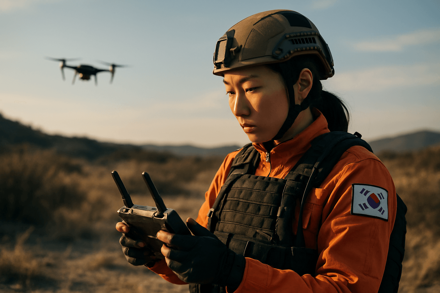
Drones, equipped with advanced cameras and sensors, provide a transformative solution to SAR documentation challenges. Their ability to rapidly deploy, access difficult terrain, and offer a bird’s-eye view makes them indispensable assets. Drones can capture high-resolution imagery and video, including thermal and night vision feeds, which are crucial for operating in low visibility or after dark. This aerial intelligence provides SAR teams with critical real-time information on the search area, enhancing situational awareness and speeding up search times by as much as 50% in some cases.
Real-time Situational Awareness and Live Feeds
One of the most immediate benefits of drones in SAR is their capacity to provide real-time video feeds to incident commanders and ground teams. This live stream allows decision-makers to:
- Assess Scene Dynamics: Observe the evolving situation, including hazards, terrain, and the movement of both subjects and rescue personnel.
- Coordinate Resources: Make informed decisions about resource allocation and tactical approaches, such as deploying appropriate teams immediately to assist trapped individuals.
- Enhance Safety: Monitor ground teams operating in dangerous areas, identifying potential risks and guiding them safely through complex environments.
This real-time data transmission significantly improves situational awareness for responders, enabling swift, coordinated, and effective actions.
High-Resolution Imaging for Post-Operation Analysis
Beyond live feeds, drones capture high-resolution still images and video footage that are invaluable for detailed post-operation analysis. These assets provide:
- Comprehensive Visual Records: A complete visual timeline of the mission, from initial deployment to extraction, offering an objective perspective on how the operation unfolded.
- Evidence Collection: High-quality visuals serve as crucial evidence for incident reconstruction, legal documentation, and internal accountability.
- Detailed Terrain Mapping: Drones can create detailed maps and 3D models of disaster areas, offering a clear overview of the terrain and aiding in planning future operations. This is particularly useful for assessing damage after natural disasters like floods or earthquakes.
Thermal and Multispectral Sensing
Many SAR drones are equipped with advanced sensors, including thermal imaging cameras, which can detect heat signatures from humans and animals in challenging conditions such as smoke, fog, dense vegetation, or complete darkness. This capability is vital for locating missing persons when visual detection is impossible, extending search capabilities into night hours when traditional manned aircraft might be grounded.
Transforming SAR Training with Drone Documentation
The rich data collected by drones offers unprecedented opportunities to enhance SAR training programs, moving beyond theoretical exercises to highly realistic and data-driven learning experiences.
Scenario-Based Learning and Simulations
Drone footage and data can be integrated into training to create immersive and realistic scenarios. This allows teams to:
- Review Real Incidents: Analyze actual mission footage to understand decision-making processes, identify successes, and pinpoint areas for improvement.
- Practice in Diverse Environments: Utilize 3D maps and high-resolution imagery of various terrains (urban, mountainous, forested, maritime) to simulate different rescue situations.
- Evaluate Tactical Approaches: Test and refine new search patterns, deployment strategies, and communication protocols based on visual evidence from past operations.
- Develop Situational Awareness: Trainees can practice interpreting real-time drone telemetry and payload data, distinguishing objects, and adapting to dynamic environmental changes, which are crucial skills for drone operators.
Performance Evaluation and Feedback
Drone-captured data provides an objective record for evaluating team and individual performance during training exercises and actual missions.
- Objective Assessment: Instructors can review footage to assess adherence to protocols, communication effectiveness, and individual skill application without subjective bias.
- Targeted Feedback: Specific moments from an operation can be replayed and discussed, allowing for precise and actionable feedback on areas like search pattern efficiency, casualty identification, or team coordination.
- Identification of Best Practices: Analyzing multiple documented missions helps identify patterns of successful strategies and develop standardized best practices that can be disseminated across SAR units.
Streamlining Post-Operation Review and Analysis
The systematic review of SAR operations is crucial for continuous improvement and accountability. Drone documentation significantly streamlines this process, providing a wealth of information for in-depth analysis.
Incident Reconstruction and Causal Analysis
High-quality drone footage and data enable precise incident reconstruction, helping teams understand the sequence of events and the factors that influenced the outcome. This can include:
- Timeline Analysis: Correlating drone timestamps with operational logs to create a clear timeline of actions and observations.
- Environmental Factors: Analyzing how weather conditions, terrain, or other environmental elements impacted the mission, as captured from an aerial perspective.
- Decision Point Review: Examining critical decision points in the operation and their consequences, fostering a deeper understanding of cause-and-effect relationships.
Identifying Strengths and Weaknesses
Post-operation review with drone data allows SAR teams to objectively identify both strengths and weaknesses in their operations. This critical self-assessment leads to:
- Process Refinement: Adjusting standard operating procedures (SOPs) based on lessons learned from documented missions.
- Equipment Assessment: Evaluating the effectiveness of different drone models, sensors, and other equipment in real-world scenarios.
- Training Needs Identification: Pinpointing specific skill gaps or training requirements that emerge from recurring operational challenges.
Key Considerations and Challenges
While the benefits are clear, integrating drones for SAR documentation, training, and review also presents challenges:
- Regulatory Compliance: Navigating complex and evolving airspace regulations is paramount to ensure safe and legal operations, particularly for flights beyond visual line of sight (BVLOS) or in restricted areas.
- Pilot Training: Effective drone operation in SAR requires specialized training, including flight capabilities, payload management, data interpretation, and maintaining situational awareness in high-stress environments.
- Data Management and Storage: The sheer volume of high-resolution data generated by drones necessitates robust data management, storage, and analysis solutions.
- Technological Integration: Seamless integration of drone systems with existing SAR communication and command structures is vital for efficient workflow.
- Adverse Weather Conditions: While some advanced drones can operate in challenging weather, many consumer-grade drones are limited by rain, snow, and high winds, which are common during SAR incidents.
- Cost and Funding: For many volunteer-based SAR teams, the initial investment in high-spec drones and associated training can be a barrier.
The Future of Documenting SAR Operations
The integration of advanced Unmanned Aerial Systems into Search and Rescue operations for training and review is not just an enhancement; it’s a fundamental shift towards more efficient, safer, and ultimately more successful missions. As drone technology continues to evolve with longer flight times, enhanced sensors, and AI-powered analytics, their role in documenting, analyzing, and improving SAR capabilities will only expand. From providing real-time aerial intelligence to serving as an invaluable tool for post-incident debriefs, drones are cementing their place as an indispensable asset in the critical mission of saving lives.


