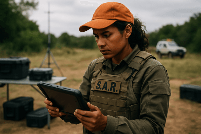
When disaster strikes or an individual goes missing, every second counts. Search and rescue (SAR) operations are inherently challenging, often taking place in remote, rugged, or hazardous environments where traditional methods are slow, risky, and resource-intensive. Imagine trying to locate a lost hiker in a dense, mountainous forest or assess the damage after a major landslide. These scenarios demand rapid, accurate, and comprehensive understanding of the terrain. This is where the transformative potential of Unmanned Aerial Systems (UAS), commonly known as drones, for topographic mapping of search areas comes into sharp focus. Drones are revolutionizing SAR by providing an unprecedented ability to generate detailed topographic maps quickly, safely, and cost-effectively, offering a critical bird’s-eye view that significantly enhances operational efficiency and, ultimately, saves lives.
Understanding Topographic Mapping in Search and Rescue
Topographic maps are fundamental tools that depict the Earth’s surface, including elevation, relief, and both natural and man-made features. In SAR, these maps are indispensable for understanding the operational environment. They show contour lines that represent elevation and the shape of the land, helping teams visualize slopes, valleys, ridges, and potential obstacles.
Why Topographic Data is Crucial for SAR Missions
- Situational Awareness: Detailed topographic maps provide SAR commanders with a comprehensive overview of the search zone, enabling them to identify possible locations for missing persons, assess potential hazards, and understand the best routes for ground teams.
- Route Planning: Knowing the terrain’s gradient and features allows for the planning of safer and more efficient routes for rescue personnel, whether on foot or using vehicles. This is vital in areas with steep slopes, dense vegetation, or unstable ground.
- Resource Allocation: Understanding the topography helps in deploying resources effectively. For instance, identifying flat areas for landing helicopters or areas prone to landslides for careful monitoring.
- Damage Assessment: Following natural disasters like floods or landslides, topographic maps generated rapidly by drones can show changes in surface elevation, helping to assess the extent of damage and identify critical areas for immediate attention.
Advantages of Using Drones for Topographic Mapping in SAR
Traditional topographic surveying methods, often relying on ground surveys, manned aircraft, or satellite imagery, can be time-consuming, labor-intensive, and expensive. Drones offer a compelling alternative with numerous benefits:
Speed and Efficiency
Drones can rapidly cover vast areas, often mapping hundreds of acres in a few hours, a task that would take ground teams days. This speed is critical in SAR, where quick deployment and data acquisition can significantly reduce response times.
Enhanced Safety for Rescuers
Deploying drones eliminates the need for human rescuers to enter hazardous or difficult-to-reach environments, such as steep slopes, unstable terrain, dense forests, or collapsed structures. This minimizes risks to personnel, allowing them to assess danger zones remotely.
High Accuracy and Resolution
Modern drones equipped with advanced sensors can collect high-resolution imagery and data, producing detailed 2D and 3D models with centimeter-level accuracy. This level of detail surpasses traditional methods and provides richer, more visual datasets for better insights.
Accessibility to Challenging Environments
Drones can easily access areas inaccessible to humans or traditional aircraft due to obstacles, dense vegetation, or dangerous conditions. LiDAR-equipped drones, for instance, can penetrate dense foliage to map the bare ground surface beneath.
Cost-Effectiveness
Compared to manned aircraft or extensive ground crews, drone-based topographic mapping is often more cost-effective. Fewer personnel are needed, field time is reduced, and the overall deliverables are more comprehensive at a fraction of the cost.
Key Technologies and Workflow
The effectiveness of drone-based topographic mapping hinges on specific UAS platforms, sophisticated sensors, and powerful software.
Unmanned Aerial System (UAS) Platforms
- Multicopters (e.g., Quadcopters): Highly maneuverable, capable of vertical take-off and landing (VTOL), and excellent for smaller, complex areas or hovering for detailed inspection.
- Fixed-wing Drones: Better for covering large areas quickly due to longer endurance and faster flight speeds. They require more space for take-off and landing.
- Hybrid Drones (VTOL Fixed-wing): Combine the benefits of both, offering the endurance of a fixed-wing with the VTOL capabilities of a multicopter, ideal for varied search areas.
Advanced Sensors for Data Acquisition
- RGB Cameras (Photogrammetry): High-resolution cameras capture overlapping images that are stitched together using photogrammetry software to create 2D orthomosaics, 3D point clouds, and digital surface/terrain models (DSM/DTM).
- LiDAR (Light Detection and Ranging): LiDAR sensors emit laser pulses to measure distances, creating highly accurate 3D point clouds. Unlike photogrammetry, LiDAR can penetrate vegetation, making it ideal for mapping wooded or uneven surfaces and creating bare-earth models. Advanced LiDAR systems can capture multiple returns per pulse, providing richer data on vegetation layers and ground cover.
- Thermal Cameras: While primarily used for locating heat signatures of missing persons, thermal data can also contribute to understanding ground temperature variations in certain topographic analyses.
Data Processing Software
Once data is collected, specialized software processes it into usable maps and models:
- Photogrammetry Software (e.g., Pix4Dmapper, DroneDeploy): These tools take the captured images and generate orthomosaics, 3D point clouds, DSMs, DTMs, and contour maps.
- GIS (Geographic Information Systems): Integrates and analyzes various geospatial data layers, allowing SAR teams to overlay drone-generated maps with other critical information.
- AI and Machine Learning: Increasingly, AI algorithms are used to process drone data, identify objects of interest, optimize search patterns, and enhance accuracy.
The Topographic Mapping Workflow
- Mission Planning: Defining the search area, required accuracy, flight altitude, and overlap. This often involves automated flight planning software.
- Data Acquisition: Flying the drone along pre-defined patterns, collecting imagery or LiDAR data. Real-time kinematic (RTK) and Post-Processed Kinematic (PPK) GPS systems enhance accuracy by providing real-time or post-processed corrections to location data.
- Ground Control Points (GCPs): For high-accuracy surveys, physical markers with known coordinates are placed on the ground to georeference drone data, aligning aerial data with coordinate systems.
- Data Processing: Uploading captured data to specialized software for processing. This involves stitching images, generating point clouds, and creating various map products like orthomosaics, DSMs, and DTMs.
- Analysis and Delivery: Analyzing the generated maps for critical information, validating outputs, and delivering usable data to SAR teams for operational planning and execution.
Challenges and Limitations
Despite the significant advantages, drone-based topographic mapping in SAR faces certain challenges:
- Battery Life and Endurance: Multicopters, while versatile, have limited flight times, especially in large search areas, necessitating multiple batteries and potentially limiting coverage.
- Weather Conditions: Adverse weather, such as strong winds, heavy rain, or snow, can significantly hinder drone operations.
- Regulatory Landscape: Navigating complex and varying regulations for UAV operations, including flight altitude restrictions and airspace access, can be time-consuming.
- Data Processing Demands: Processing high-resolution data requires powerful computing resources and specialized expertise.
- Obstructions: Dense tree canopies can still present challenges for photogrammetry, though LiDAR mitigates this to some extent. In areas with thick vegetation or high relief, using ground control points (GCPs) can be challenging.
The Future of Drones in SAR Topographic Mapping
The integration of drones into SAR is continuously evolving. The future promises even more sophisticated capabilities:
- Increased Autonomy and AI Integration: Drones will become more autonomous, capable of planning and executing optimized search patterns, dynamically adjusting to changing conditions, and autonomously identifying objects of interest.
- Advanced Sensor Fusion: Further integration of LiDAR, thermal, and multispectral sensors will provide richer and more comprehensive data for rescuers.
- Real-time Mapping and Predictive Modeling: Enhanced processing capabilities will enable real-time generation of topographic maps in the field, coupled with predictive modeling for hazards like landslides or floods.
- Drone Swarms: Coordinated groups of autonomous drones could cover vast areas even more quickly, navigate complex spaces, and relay real-time information on survivors and structural integrity.
- Beyond Mapping: Drones are already being used to deliver essential supplies, such as medical kits and life vests, to victims in isolated areas. Their role will expand to include more direct support functions in concert with mapping efforts.
Drones have cemented their role as indispensable tools in modern search and rescue operations. By rapidly providing highly accurate and detailed topographic maps of search areas, they not only enhance situational awareness and optimize resource deployment but also significantly improve rescuer safety and the chances of a successful outcome. As technology continues to advance, the capabilities of drones in this critical field will only grow, ushering in an era of more efficient, effective, and safer emergency response.


