The global shift towards renewable energy sources like solar, wind, and hydropower is accelerating, driven by the urgent need to combat climate change and secure sustainable power. However, the success of these ambitious projects hinges on meticulous site assessment—a process that traditionally has been time-consuming, costly, and often hazardous. Enter drone technology, an innovative solution that is fundamentally transforming how potential renewable energy sites are evaluated, developed, and maintained. Unmanned Aerial Vehicles (UAVs), commonly known as drones, are proving to be indispensable tools, offering unparalleled efficiency, accuracy, and safety in surveying and monitoring the landscapes that will power our future.
The Critical Role of Site Assessment in Renewable Energy
Before a single solar panel is laid or a wind turbine erected, a comprehensive understanding of a site’s characteristics is paramount. This initial assessment dictates the feasibility, optimal design, and long-term performance of any renewable energy project. Traditional methods often involve extensive manual surveys, ground-based measurements, and reliance on existing, sometimes outdated, data. These approaches can be slow, expensive, and expose personnel to dangerous environments, especially in remote or challenging terrains.
Accurate site assessment ensures maximum energy production, minimizes environmental impact, and helps mitigate financial risks. Without precise data on topography, weather patterns, and environmental factors, projects can face significant delays, cost overruns, and underperformance. The scale of modern renewable energy farms, often spanning hundreds or thousands of acres, further amplifies the need for more efficient and robust assessment tools.
Drone Technology: A Game Changer for Renewable Energy
Drones are revolutionizing the renewable energy sector by providing rapid, high-resolution data collection capabilities that far surpass traditional methods. Equipped with advanced sensors and imaging tools, these aerial platforms can gather detailed information across vast areas in a fraction of the time, significantly accelerating project timelines.
Enhanced Efficiency and Cost Reduction
One of the most compelling advantages of integrating drones into site assessment is the dramatic increase in efficiency and reduction in costs. Drone surveys can map large areas much faster than ground-based teams, reducing the need for extensive manual labor and expensive equipment like helicopters. For solar projects, drones can accelerate the planning process by up to 75% compared to manual surveys, even for smaller installations like rooftop PV systems. This speed not only saves money but also allows developers to make informed decisions more quickly. By streamlining the site assessment process, drones contribute to a higher return on investment for renewable projects.
Improved Safety and Accessibility
Renewable energy sites often involve challenging and hazardous environments, from rugged mountainous terrain for wind farms to expansive, exposed fields for solar installations. Drones eliminate the need for human exposure to these risks by performing aerial surveys and inspections remotely. This significantly reduces workplace accidents and enhances overall safety standards. Drones can easily access hard-to-reach areas, such as inspecting hydroelectric dams for structural weaknesses or assessing tall wind turbines, without requiring dangerous manual climbs or specialized heavy machinery.
Superior Data Collection and Analysis
Drones deliver highly precise and detailed data, thanks to their advanced sensor payloads. High-resolution cameras, thermal imaging sensors, and LiDAR (Light Detection and Ranging) technology capture comprehensive topographical and environmental data. This rich dataset can then be processed using sophisticated software, often integrated with AI and machine learning algorithms, to create accurate 3D models and digital twins of the site. This granular information enables better decision-making, from optimal placement of assets to predictive maintenance strategies.
Specific Applications Across Renewable Energy Sectors
The versatility of drones allows for tailored applications across different types of renewable energy projects.
Solar Energy Site Assessment
For solar farms, drones are invaluable from the earliest planning stages through construction and ongoing operations.
- Topographical Mapping and Layout Design: Drones create highly accurate topographical maps and 3D models of potential sites, which are crucial for planning the optimal placement of solar panels. This data can be directly imported into CAD software to maximize energy production and minimize shading.
- Irradiance and Shading Analysis: By capturing aerial imagery, drones assist in analyzing sunlight exposure and identifying potential shading issues from terrain, vegetation, or nearby structures. This ensures efficient use of space and maximizes energy output.
- Thermal Inspections for Defects: Thermal infrared (IR) cameras carried by drones can quickly scan large solar fields to detect faulty or underperforming panels. Hotspots, electrical faults, and even individual bypass diode failures within modules can be identified in minutes, allowing for proactive maintenance and minimizing energy loss.
- Environmental Impact Assessment: Drones monitor vegetation changes around solar farms, helping to make informed decisions to minimize ecological disruption.
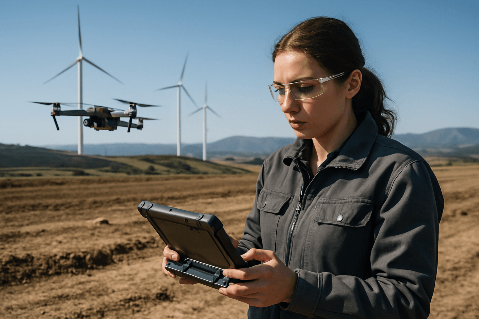
Wind Energy Site Assessment
Drones have become crucial in the wind energy sector, particularly for inspecting hard-to-reach turbines and assessing complex wind patterns.
- Wind Resource Assessment: Drones provide detailed assessments of potential wind turbine sites by analyzing wind conditions, terrain, and obstacles. While not replacing traditional meteorological towers, drones can enhance ground-based assessments by providing a “hummingbird’s eye view” of the terrain and its obstacles relative to proposed turbine hub heights, aiding in optimizing wind resource based on surrounding features.
- Topography and Obstacle Mapping: High-resolution cameras and LiDAR technology on drones can rapidly map large areas, providing insights into topography and identifying obstacles that could affect wind flow or turbine placement.
- Environmental Impact Monitoring: Drones track environmental impacts such as bird migration patterns and wildlife habitats near wind farms, helping ensure compliance with environmental regulations.
- Turbine Inspection: During site selection, drones can inspect existing structures or assess the general landscape, and later, for operational sites, they are used to inspect turbine blades, towers, and nacelles for cracks, erosion, or other damage without the need for technicians to climb. Thermal sensors can detect variations in heat flow across turbine blades, indicating structural defects.
Hydropower and Geothermal Site Assessment
The benefits of drones extend to other renewable energy sectors as well.
- Hydropower Infrastructure Monitoring: For hydroelectric projects, drones can easily inspect dams, spillways, pipelines, and reservoirs, detecting cracks, erosion, and structural weaknesses in hard-to-reach areas. This reduces the need for dangerous manual inspections, lowering operational costs and improving safety.
- Geothermal Site Assessment: In geothermal projects, drones equipped with thermal sensors can identify hotspots and monitor pipelines for leaks, while also assessing environmental impacts.
Advanced Analytics and Future Trends
The integration of drones with cutting-edge analytical tools is further enhancing their capabilities in renewable energy site assessment.
- AI and Machine Learning Integration: Drones collect vast amounts of data that can be analyzed using artificial intelligence (AI) and machine learning (ML) algorithms. This allows for automated defect detection, predictive maintenance, and optimized energy production.
- 3D Modeling and Digital Twins: Drone data enables the creation of highly accurate 3D models and digital twins of project sites and infrastructure. These virtual replicas allow developers to simulate different scenarios, plan layouts, track progress, and predict potential problems before they occur, improving the overall efficiency and reliability of renewable energy installations.
- Regulatory Landscape: As drone technology advances, regulatory frameworks are evolving to ensure safe and legal operations. Certified operators, flight permissions, and adherence to safety guidelines are crucial for compliance.
- Future Outlook: The future of drones in renewable energy is bright, with continuous advancements in drone capabilities, sensor technology, and data processing. Solar-powered drones, for instance, are emerging as transformative tools for continuous environmental monitoring due to their extended flight times without refueling. These developments will lead to even greater efficiency, cost savings, and reliability in the renewable energy sector, further propelling the transition to a sustainable future.
Conclusion
Drones have unequivocally emerged as a transformative technology in renewable energy site assessment. By offering unparalleled efficiency, significantly improving safety, and providing superior data collection and analytical capabilities, UAVs are streamlining every phase of a renewable energy project’s lifecycle. From the meticulous topographical mapping for solar farms to the critical inspections of towering wind turbines and expansive hydroelectric infrastructure, drones are empowering developers to make more informed decisions, reduce costs, and accelerate the deployment of clean energy solutions. As drone technology continues to evolve, its role in powering a more sustainable future will only grow, cementing its position as an indispensable tool in the global pursuit of renewable energy.


