In the high-stakes world of search and rescue (SAR) operations, every second counts. Traditional methods, while essential, can be time-consuming and fraught with danger, especially in expansive or hazardous terrains. The advent of Unmanned Aerial Systems (UAS), commonly known as drones, has ushered in a new era of efficiency and safety, with drone-generated orthomosaics emerging as a pivotal tool for enhancing mission planning and execution.
These highly accurate, georeferenced aerial maps provide SAR teams with an unparalleled top-down view of incident areas, free from the distortions of standard aerial photography. By offering detailed, up-to-date visual intelligence, orthomosaics empower responders to make faster, more informed decisions, ultimately improving the chances of a successful rescue.
What are Orthomosaics and How are They Created?
An orthomosaic is a large, high-resolution aerial image created by stitching together numerous smaller, individual photographs taken from an aerial platform, such as a drone. Unlike standard aerial photos, orthomosaics are geometrically corrected – a process known as orthorectification – to eliminate distortions caused by camera tilt, lens curvature, perspective, and topographical relief. This correction ensures that the map presents a true-to-scale, seamless representation of the Earth’s surface, where every feature is depicted in its accurate geographical position.
The creation of a drone-generated orthomosaic involves several key steps:
Flight Planning
Before takeoff, meticulous flight planning is crucial. Operators use specialized software (e.g., DroneDeploy, Pix4Dcapture, DJI Pilot) to define the mission area, flight path, altitude, and critical parameters like image overlap. Sufficient overlap (typically 60-70% side overlap and 70-80% front overlap for flat terrain) is essential for the photogrammetry software to accurately stitch the images together. Factors such as minimizing shadows by flying closer to solar noon are also considered to ensure consistent image quality.
Image Capture
Drones equipped with high-resolution RGB or multispectral cameras, coupled with GPS and Inertial Measurement Unit (IMU) systems, fly automated paths over the designated area. These systems capture a series of precisely georeferenced, overlapping photographs. Real-Time Kinematic (RTK) or Post-Processed Kinematic (PPK) GNSS positioning can be used to further enhance the georeferencing precision of each image.
Data Processing
Once the images are captured, they are uploaded to photogrammetry software. This software meticulously stitches the individual photos into a single, comprehensive mosaic. During this process, it performs the orthorectification, correcting all geometric distortions, aligning images based on their GPS coordinates, and adjusting the scale to ensure uniformity across the entire map. Some advanced software can even generate 2D orthomosaics in real-time.
Advantages of Orthomosaics in Search and Rescue
Integrating drone-generated orthomosaics into SAR operations offers a multitude of benefits that significantly enhance the effectiveness and safety of missions:
Enhanced Situational Awareness
Orthomosaics provide a comprehensive, real-time aerial overview of the search area, giving incident commanders and ground teams critical clarity to assess the environment, identify hazards, and coordinate resources with speed and precision. This bird’s-eye view can reveal elements not visible from the ground, such as subtle signs of disturbance or potential paths of travel.
Rapid and Extensive Area Coverage
Drones can cover vast and expansive areas significantly faster than traditional ground teams or even manned aircraft. This rapid assessment capability is crucial in time-sensitive SAR missions, allowing search managers to quickly narrow down the search area and prioritize efforts.
Access to Challenging and Inaccessible Terrains
Drones excel at navigating difficult terrains that are often dangerous or impossible for human responders to access. This includes dense forests, rugged mountains, treacherous coastlines, or areas affected by natural disasters like floods, landslides, or structural collapses. Orthomosaics created from such flights offer vital intelligence without risking human lives.
High-Resolution and Accurate Mapping
The resulting orthomosaics are high-resolution and true-to-scale, enabling precise measurements of distances, areas, and volumes directly from the map. This accuracy is invaluable for planning safe access routes, assessing distances to critical points, and understanding the topography of the search area.
Improved Decision-Making and Resource Allocation
With detailed, up-to-date maps, SAR planners can better analyze the terrain, identify potential hiding spots or distress signals, and determine the most efficient routes for ground teams. In disaster scenarios, orthomosaics are pivotal for rapid damage assessment and recovery planning, helping allocate resources effectively.
Reduced Risks for Search and Rescue Personnel
By providing an initial reconnaissance of hazardous environments, drones minimize the need for human teams to enter potentially dangerous zones without prior knowledge. This acts as a first line of surveillance, significantly reducing risks to first responders.
Real-Time Data and Communication
Many SAR drones can live-stream video and data to command centers, allowing for instantaneous information relay and facilitating informed decision-making. This real-time communication is vital for coordinating multiple SAR teams and adapting action plans as the situation evolves.
Integrating Drone-Generated Orthomosaics into SAR Mission Planning Workflow
The integration of orthomosaics into SAR mission planning follows a structured workflow to maximize their utility:
1. Pre-Mission Assessment and Planning
- Define Search Area: Based on intelligence (last known location, witness reports), define the precise area of interest for drone deployment.
- Flight Path Optimization: Utilize drone mission planning software to create an automated flight plan. This involves setting appropriate altitude for desired ground sample distance (resolution), ensuring adequate image overlap (e.g., 70-80% front, 60-70% side), and considering terrain complexity. For hilly areas, increased overlap may be necessary.
- Weather and Environmental Considerations: Plan flights for optimal lighting (e.g., around solar noon to reduce shadows) and suitable weather conditions.
- Team Coordination: Clearly define roles for drone pilots, visual observers, data analysts, and incident command staff.
2. Data Acquisition (Drone Flight)
- Automated Flight Execution: Launch the drone to execute the pre-programmed flight plan. Modern drones with RTK/PPK GNSS capabilities ensure precise georeferencing of captured images.
- Sensor Utilization: Employ high-resolution RGB cameras for visual identification. In low-light or obscured conditions (e.g., dense foliage, darkness, fog), thermal imaging cameras can detect heat signatures, greatly aiding in locating individuals.
- Real-Time Monitoring: If available, utilize real-time mapping or video streaming features to provide immediate situational awareness to the command center.
3. Orthomosaic Generation and Processing
- Rapid Processing: After the flight, upload the raw images to photogrammetry software. Prioritize rapid processing to generate the orthomosaic as quickly as possible. Some solutions offer real-time or near-real-time processing for immediate operational use.
- Quality Control: Review the generated orthomosaic for any gaps, distortions, or stitching errors to ensure its accuracy and completeness.
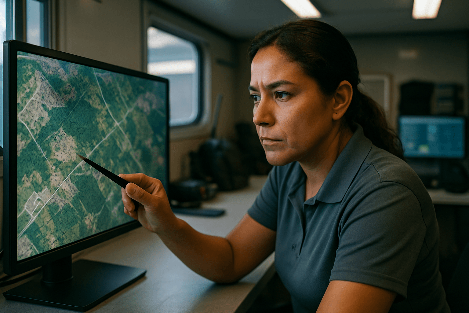
4. Analysis and Integration into SAR Strategy
- Layered Mapping: Overlay the high-resolution orthomosaic with other crucial GIS data, such as topographical maps, property lines, known hazards, and the missing person’s last known point.
- Target Identification: Analysts can meticulously scour the orthomosaic for any anomalies, tracks, objects, or signs of human presence. AI-powered detection algorithms can assist in automatically identifying potential human forms or objects of interest within the imagery, reducing manual interpretation time, which is particularly useful in large datasets.
- Route Planning: Identify optimal and safest routes for ground teams, taking into account terrain, obstacles, and potential hazards shown on the map. This helps avoid impassable areas and directs teams efficiently.
- Resource Deployment: Use the detailed map to strategize the deployment of rescue personnel and resources, ensuring they are directed to areas with the highest probability of detection or identified points of interest.
- Briefing and Communication: Present the orthomosaic maps to all SAR team members during briefings to provide a clear, shared understanding of the operational area and mission objectives. The maps can be shared electronically with ground teams for navigation.
By embracing drone-generated orthomosaics, SAR organizations are equipping themselves with a powerful tool that transforms incident response, making missions safer, faster, and significantly more effective. This technological advancement represents a critical step forward in the continuous effort to save lives in challenging circumstances.


