AALTO HAPS has achieved a significant milestone with the first stratospheric flight of its Zephyr High Altitude Platform Station (HAPS) from its new base in Kenya. This marks a pivotal moment for AALTO and the broader industry, highlighting the potential of HAPS for connectivity and Earth observation.
Soaring to New Heights: Zephyr’s Kenyan Debut
AALTO, an Airbus subsidiary specializing in HAPS, successfully completed a 13-day flight above 60,000 feet (18,288 meters) from its AALTOPORT in Laikipia County, Kenya. This flight represents the highest and longest unrefueled flight over Africa, showcasing the Zephyr’s capabilities and validating improvements to its flight envelope. The Zephyr HAPS was equipped with a direct-to-device (D2D) 4G/5G connectivity payload, developed at AALTO’s Farnborough headquarters, and designed to be compatible with standard smartphones. Testing focused on evaluating video and data service performance.
AALTOPORT: A Hub for Stratospheric Innovation
The establishment of AALTOPORT in Kenya is a strategic move, with the location offering ideal conditions for stratospheric operations. AALTO secured regulatory approvals in 2024 after 18 months of engagement with Kenyan aviation and space authorities. Kenya’s support, through the Kenya Space Agency (KSA) and Kenya Civil Aviation Authority (KCAA), solidifies its position as a pioneer in stratospheric technology. AALTO plans to establish five to six Aaltoports around the world.
What is the Zephyr HAPS?
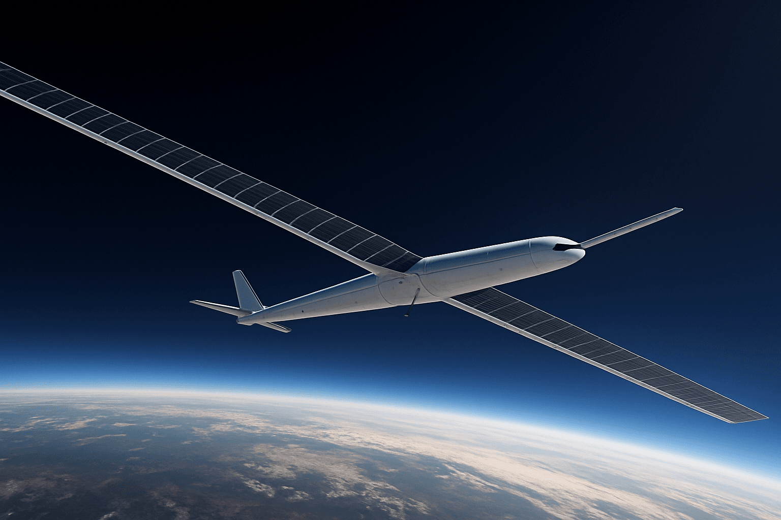
The AALTO Zephyr is a solar-powered, unmanned aerial system (UAS) designed to operate in the stratosphere, at altitudes above 60,000 feet. It functions as a High Altitude Platform Station (HAPS), bridging the gap between satellites and conventional aircraft.
Key Features of the Zephyr HAPS:
- Persistent Flight: Zephyr can fly for days, weeks, or even months at a time. Its current endurance record is over 67 days. The theoretical maximum with existing technology is 90 days, but AALTO believes this could be stretched to 200 cycles by the end of 2024.
- Solar-Powered: The Zephyr is powered by solar cells, with secondary batteries that recharge during the day to enable night flight.
- Stratospheric Operations: Flying above 60,000 feet, Zephyr operates above weather and conventional air traffic.
- Payload Agnostic: Zephyr can integrate various payloads, including connectivity and Earth observation systems.
- Direct-to-Device Connectivity: Equipped with a connectivity payload, Zephyr can provide low-latency, high-bandwidth cell phone communications directly to handsets.
- Earth Observation: Zephyr can carry high-resolution cameras and sensors for Earth observation, providing imagery and video from the stratosphere.
Zephyr Specifications:
While specifications may vary depending on the Zephyr model, key features include:
- Wingspan: Approximately 25 meters (82 feet)
- Weight: Around 65-75 kg (143-165 lbs)
- Payload Capacity: Up to 5 kg (11 lbs)
- Altitude: Operates above 20 km (65,000 ft) in the stratosphere
- Endurance: Capable of flying for weeks or months
Applications: Tower in the Sky and Eye in the Sky
The Zephyr HAPS offers a range of potential applications for both commercial and government customers.
Connectivity: Bridging the Digital Divide
Zephyr can serve as a “tower in the sky,” providing low-latency connectivity directly to end-user devices. AALTO estimates that the coverage footprint for its 4G/5G payload is approximately 7,500 square kilometers. This capability can:
- Extend mobile network coverage to rural and remote areas: Zephyr can augment existing cell phone networks, delivering high-bandwidth communications without the need for expensive cell towers. One Zephyr can replace up to 250 terrestrial towers.
- Provide connectivity in disaster areas: Zephyr can be rapidly deployed to provide communications in areas where terrestrial infrastructure has been damaged or destroyed.
- Offer a cost-effective alternative to satellites: Zephyr operates at a much lower altitude than satellites, resulting in lower latency and reduced costs.
Earth Observation: Persistent, High-Quality Data
Equipped with Earth observation systems, Zephyr can provide high-resolution imagery and near-real-time video from the stratosphere. This capability can be used for:
- Maritime surveillance: Monitoring coastal waters for illegal fishing, smuggling, and other activities.
- Border monitoring: Providing persistent surveillance of borders to detect and prevent illegal crossings.
- Mapping: Creating high-resolution maps of terrain and infrastructure.
- Forest fire detection and monitoring: Detecting and monitoring wildfires to help emergency responders manage the situation.
- Emergency response: Providing situational awareness to emergency responders during natural disasters and other crises.
- Precision agriculture: Monitoring crops and providing data to help farmers optimize their yields.
- Environmental monitoring: Tracing changes in the world’s environmental landscape, including monitoring oil spills and deforestation.
Military Applications
Zephyr also has potential military applications, including:
- Intelligence, surveillance, and reconnaissance (ISR): Providing persistent surveillance of areas of interest.
- Communications relay: Relaying communications between military units.
- Multi-domain integration: Enabling new concepts and ways of enabling military operations.
The Future is Stratospheric
AALTO’s successful flight from Kenya is a major step towards commercializing the stratosphere. With its unique capabilities and a growing demand for connectivity and Earth observation services, the Zephyr HAPS is poised to play a significant role in the future of aerospace. The company intends to conduct multiple additional flights from Kenya through the remainder of 2025. As AALTO CEO Hughes Boulnois stated, “Zephyr’s return to stratospheric testing and operations is an important step in its commercial roadmap”. Kenya’s participation solidifies its position as a pioneer in stratospheric technology, marking the country as the first to test the solar-powered Zephyr drone.


