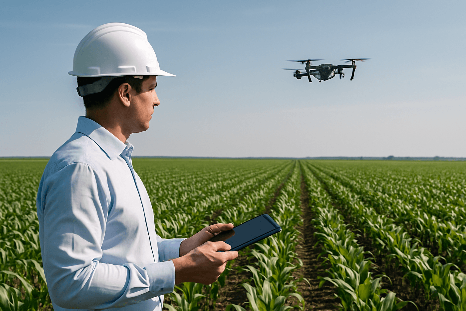
The agricultural landscape is undergoing a profound transformation, driven by innovative technologies that promise unprecedented efficiency and sustainability. At the forefront of this revolution are drones, or Unmanned Aerial Vehicles (UAVs), which have emerged as indispensable tools in precision agriculture. By providing real-time data and enabling targeted interventions, drones are redefining how farmers manage crops, monitor livestock, and optimize resource utilization, ushering in an era of smarter, more resilient farming practices.
The Genesis of Agricultural Drones
Initially developed for military and surveillance applications, drones have rapidly expanded into commercial sectors, with agriculture being one of the most impactful. The Federal Aviation Administration (FAA) first granted exemptions for drone use in agriculture in 2015, paving the way for their widespread adoption. Modern agricultural drones range from small quadcopters to larger fixed-wing aircraft, equipped with sophisticated sensors and data collection tools. Their ability to cover vast areas quickly and capture high-resolution imagery and sensor data has made them invaluable for optimizing resource use, reducing environmental impact, and improving the resilience of agricultural systems in the face of challenges like climate change and food security.
Core Applications of Drones in Precision Agriculture
Drones offer a versatile suite of applications that allow farmers to gather comprehensive information and implement tailored interventions, leading to informed decision-making and enhanced productivity.
Crop Monitoring and Health Assessment
One of the most common and vital applications of agricultural drones is crop monitoring and plant health assessment. Drones equipped with advanced cameras and sensors can quickly and efficiently survey vast areas, providing detailed visual data on crop conditions. This includes identifying issues such as nutrient deficiencies, water stress, pest infestations, and early signs of disease, often before they are visible to the human eye.
- Multispectral and Hyperspectral Imaging: These advanced imaging technologies are crucial for assessing plant health by measuring the crop’s reflectance to specific wavelengths of light. Multispectral sensors capture data in multiple wide color bands, including visible light (RGB) and infrared bands like Near-Infrared (NIR) and Red Edge. Hyperspectral sensors, even more sophisticated, can “read” hundreds of narrow light bands across the electromagnetic spectrum, enabling the detection of subtle chemical plant changes, such as nitrogen deficiencies or fungal infections, at a molecular level before any visual symptoms appear.
- Normalized Difference Vegetation Index (NDVI): Derived from NIR and red spectral bands captured by multispectral sensors, NDVI is a widely used vegetation index that measures crop health and vitality based on plant greenness.
- Thermal Imaging: Drones with thermal sensors can detect water stress by identifying variations in plant temperature, helping farmers optimize irrigation schedules.
Precision Spraying and Application
Drones are revolutionizing the application of agricultural inputs such as fertilizers, pesticides, and herbicides. Instead of blanket spraying an entire field, which can lead to waste and environmental impact, drones can apply spot treatments precisely where needed. This targeted approach significantly reduces chemical use, minimizes chemical runoff and environmental exposure, and lowers input costs for farmers.
- Accuracy and Efficiency: Drones equipped with precision spraying systems can apply liquid fertilizers with 90–95% accuracy, ensuring uniform and targeted nutrient distribution. They can cover large areas quickly, reducing the need for manual labor and expensive machinery.
- Worker Safety: Drone spraying minimizes the need for direct human handling of agricultural chemicals, thereby lowering potential health risks for farm workers.
- Aerial Seeding: Drones are also increasingly employed for precise seeding and the distribution of cover crop seeds.
Mapping and Surveying
Equipped with cutting-edge sensors and high-resolution cameras, agricultural drones facilitate precision mapping and surveying of agricultural landscapes.
- 2D and 3D Field Mapping: Drones can create detailed 2D and 3D maps of farmlands, identifying variations in soil quality, moisture levels, and terrain. This data helps farmers make informed decisions about planting, irrigation, and land leveling.
- LiDAR (Light Detection and Ranging): LiDAR sensors use laser beams to create detailed 3D maps of the terrain, useful for terrain mapping, elevation analysis, and even volumetric biomass calculations by penetrating vegetation.
Soil Health Analysis
Drones enable comprehensive information collection on soil conditions, providing detailed data on pH levels, soil types, and chemical content. They can identify soil compaction and erosion levels using RGB sensors, and soil types and moisture levels using NIR or multispectral sensors. This analysis is critical for optimal nutrient management and sustainable land practices.
Irrigation Management
Drones with thermal or multispectral sensors help farmers identify areas of water stress or over/under-watering. By mapping soil moisture levels, drones help optimize water usage, which is particularly critical in drought-prone regions. This targeted approach conserves water and supports sustainable farming.
Livestock Management
Beyond crops, drones are also a powerful tool for monitoring livestock. They can track animal movement and health, perform counts, herd animals, and look for stray livestock across vast grazing areas. Drones equipped with thermal imagery can even check livestock temperatures, which can indicate illness or infection within the herd. This helps prevent overgrazing and preserves soil quality and biodiversity.
Types of Agricultural Drones
Different agricultural needs dictate the choice of drone type, each offering distinct advantages:
- Multirotor Drones: Such as quadcopters and hexacopters, excel in maneuverability. They can hover, change direction rapidly, and fly at low altitudes, making them ideal for close inspection of crops and precise applications like spraying. They are generally easier to operate and require less training. However, they typically have shorter flight times and smaller payload capacities.
- Fixed-Wing Drones: Resembling traditional airplanes, fixed-wing drones are well-suited for large-scale farming operations as they can efficiently cover extensive areas in a single flight. They offer longer flight times and better handle windy conditions, making them ideal for surveying and mapping vast farmlands. Their maneuverability, however, is limited compared to multirotors.
- VTOL (Vertical Takeoff and Landing) Drones: These hybrid drones combine the advantages of both fixed-wing and multirotor drones. They can take off and land vertically like multirotors and transition to fixed-wing flight for efficient long-distance coverage. This versatility makes them suitable for farms with varied topography and offers extended flight times. VTOL drones can be more complex to operate and maintain.
The Role of Artificial Intelligence and Machine Learning
The true power of agricultural drones is unlocked through their integration with Artificial Intelligence (AI) and Machine Learning (ML). AI algorithms process the vast amounts of high-resolution data collected by drones, transforming raw images and sensor readings into actionable insights.
- Data Analysis and Predictive Analytics: AI and ML algorithms analyze drone-collected data to assess crop health, identify pests and diseases, and evaluate soil conditions with high accuracy. They can predict crop yields, disease outbreaks, and even suggest optimal times for planting, harvesting, and applying treatments.
- Automated Decision-Making: AI-powered drone systems optimize resource usage, allowing for more sustainable agriculture. For example, machine learning models can identify crop diseases by analyzing image patterns, while deep learning algorithms optimize irrigation schedules based on vegetation changes.
- Enhanced Precision: AI enables drones to perform tasks with even greater precision, such as identifying areas requiring pesticide treatment and calculating the optimal amount of chemical needed, leading to significant reductions in pesticide waste. DJI, a leader in drone technology, reports that its AI-powered agricultural drones have helped farmers reduce pesticide waste by 30%, improve crop treatment accuracy by 40%, and reduce labor costs by 50%.
Benefits of Drone Adoption in Agriculture
The integration of drones into agricultural practices brings a multitude of benefits that enhance productivity, efficiency, and sustainability.
- Increased Efficiency and Productivity: Drones automate time-consuming and labor-intensive tasks like crop monitoring, scouting, and spraying, allowing farmers to cover large areas much faster than traditional methods. This leads to significant time savings and frees up human labor for other critical tasks.
- Cost Savings: By enabling precise application of water, fertilizers, and pesticides, drones reduce overall input waste and associated costs. Reduced need for manual labor and heavy machinery also contributes to substantial cost savings. Deloitte Access Economics projected cost savings for the agriculture, forestry, and fishing industries from drone adoption could amount to $3.5 to $10.4 billion from 2020 to 2040 in Australia alone.
- Improved Crop Yields: Early and accurate detection of issues like nutrient deficiencies, water stress, pests, and diseases allows for timely interventions, leading to optimized farming practices and higher crop yields. Precision agriculture techniques, enabled by drones, have been shown to increase yields by up to 25% in some crops.
- Environmental Benefits and Sustainability: Drones contribute significantly to sustainable farming by minimizing the overuse of chemicals, conserving water resources, and reducing greenhouse gas emissions. Targeted spraying reduces chemical runoff and pollution, benefiting ecosystems. Drones also help preserve soil quality by reducing the need for heavy machinery, which can compact soil.
- Data-Driven Decision Making: Drones provide farmers with real-time, high-resolution data and actionable insights into every aspect of their operation, empowering them to make informed, data-driven decisions that optimize farm management.
Challenges and Limitations
Despite their immense potential, the widespread adoption of drones in agriculture faces several hurdles:
- Regulatory Hurdles: The regulatory landscape for agricultural drones is complex and varies significantly across regions. Farmers and operators must comply with regulations regarding flight altitude, airspace restrictions, and certifications. For spraying applications, additional requirements like specific licenses for commercial applicators and FAA exemptions for hazardous material carriage are often necessary.
- Initial Investment and Cost: The upfront cost of acquiring high-end drones with advanced sensors, along with associated software, training, and maintenance, can be significant, especially for small to medium-sized farms. While prices are decreasing, this remains a barrier.
- Technical Expertise: Operating drones effectively and, more importantly, analyzing the large volumes of data they collect, requires specialized skills and training. The steep learning curve can deter some farmers.
- Technical Limitations: Drones have limitations regarding battery life, flight duration, and payload capacity, which can restrict their use for very large-scale operations. Spray drift and inconsistent coverage can also be issues if not managed properly.
- Weather Dependence: Drones are susceptible to adverse weather conditions such as heavy rain, strong winds, snow, or fog, which can limit their operational window.
- Connectivity and Infrastructure: Insufficient internet access, particularly in rural areas, can impede the widespread adoption of precision agriculture techniques that rely on real-time data transfer and analysis.
- Data Management and Privacy Concerns: Drones collect extensive data, raising concerns about data privacy and security, especially when flying over private property or capturing images without consent. Regulations are being developed to ensure secure data transmission, storage, and usage.
The Future Outlook
The future of drones in agriculture is promising, with continuous advancements addressing current limitations.
- Increased Automation and Autonomous Fleets: Expect to see fully automated drone fleets managing entire farms with minimal human intervention, leveraging advanced AI and machine learning for even more complex analyses.
- Enhanced Sensor Technology: Further improvements in multispectral, hyperspectral, and thermal sensors will provide even more granular and precise data for diagnostics.
- Integration with Other Technologies: Drones will increasingly work alongside other farming technologies, such as ground robots, IoT sensors, and advanced AI systems, to create fully integrated, high-tech smart farms.
- Drone Swarms: The concept of drone swarms, where multiple drones collaborate to cover large areas efficiently and dynamically distribute tasks, is an exciting future direction.
- Improved Energy Autonomy: Research and development are focused on improving drone battery life and energy efficiency to extend flight times and coverage areas.
- Standardization and Policy Development: Continued research, stakeholder collaboration, and careful policy development are crucial to harmonize regulations and improve economic accessibility for small-scale farmers. Government subsidies and incentives are also being explored to reduce the financial burden of drone adoption.
In conclusion, drone technology, propelled by innovations in aerospace engineering, AI, and sensor technology, is not just a passing trend but a fundamental shift in agricultural practices. While challenges related to cost, regulation, and technical expertise persist, the transformative potential of drones to enhance efficiency, increase yields, and promote sustainability is undeniable. As these aerial innovations continue to evolve, they are poised to play an increasingly vital role in securing a productive and resilient future for global food production.


