Drones have undeniably revolutionized infrastructure inspection, offering unprecedented access to difficult-to-reach areas, enhancing safety, and boosting efficiency for assets like bridges, pipelines, wind turbines, and power lines. Equipped with advanced cameras, thermal imagers, and LiDAR, Unmanned Aerial Vehicles (UAVs) can capture high-resolution data for condition assessment and maintenance planning. However, despite their transformative potential, the widespread adoption of drones for critical infrastructure assessment faces several inherent limitations. Understanding these challenges is crucial for organizations to effectively integrate drone technology and manage expectations.
Environmental and Weather-Related Constraints
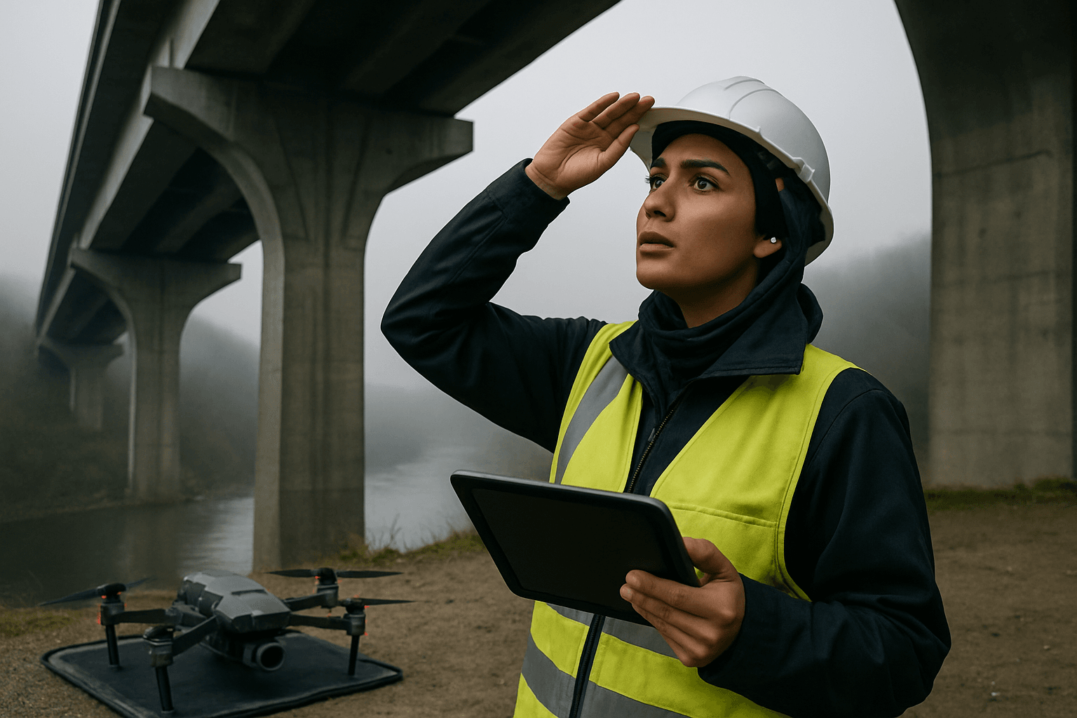
One of the most significant factors influencing drone operations for infrastructure inspection is the environment, particularly unpredictable weather conditions.
Adverse Weather Conditions
Drones are highly susceptible to various meteorological elements that can impact flight stability, battery life, sensor performance, and overall data quality.
- Wind Speed and Direction: Strong winds can cause drones to drift, making it difficult to maintain stability and control, and can even lead to crashes. Wind shear, sudden changes in wind speed or direction, is particularly dangerous. High winds can also compromise data accuracy, leading to blurred images or inconsistent ground sampling distance.
- Precipitation: Most commercial and recreational drones are not waterproof, making electronic components vulnerable to damage from rain or snow. Moisture can also obstruct camera lenses, reducing image quality and interfering with sensors like LiDAR and ultrasonic detectors.
- Fog and Low Visibility: Dense fog, mist, or heavy cloud cover significantly reduce visibility, posing hazards to flight safety and impairing the visual line of sight (VLOS) often required by regulations. This can also affect sensor efficacy and GPS signals.
- Extreme Temperatures: Both excessively hot and cold temperatures can severely impact drone performance. Lithium-polymer (LiPo) batteries, common in drones, are highly susceptible to temperature fluctuations, which can reduce capacity and shorten flight time. Extreme cold can make drone materials brittle, while high heat can cause components to overheat or malfunction.
Technical and Hardware Limitations
Beyond environmental factors, the drones themselves and their integrated technology present several limitations.
Restricted Battery Life and Flight Endurance
A primary technical hurdle is the limited battery life of most drones, which curtails their operational time and range. While some industrial drones can fly for up to two hours, many consumer and professional models offer 20-50 minutes per charge. This limits the area coverage and duration of uninterrupted inspections, necessitating frequent battery swaps or recharging, which adds to operational time and cost.
Navigation and GPS Challenges
Operating in GPS-denied or weak-signal environments, such as under bridges, inside large structures, or in confined spaces, poses significant navigation difficulties. Drones rely on GPS for navigation, and without it, control issues can arise, leading to drifting or even crashes into structural elements. While multi-sensor fusion and AI are improving, this remains a challenge for comprehensive under-bridge inspections.
Sensor and Data Quality Limitations
While drones can carry various advanced sensors, they still have limitations:
- Detection of Minute Defects: Current drone technology, even with advanced sensors, may struggle to identify minute or complex defects that an experienced human inspector could discern through close physical examination.
- Confined Space Challenges: In dimly lit or geometrically complex confined spaces, drones may struggle to capture clear and accurate data. Blurry images, insufficient lighting, and shadows can compromise inspection quality.
- Payload Capacity: The payload capacity of a drone affects the size and number of specialized sensors (e.g., heavy-duty LiDAR, advanced NDT equipment) it can effectively carry, potentially limiting the scope of data collection.
Signal and Communication Issues
Maintaining a stable signal and communication between the drone and the operator is crucial. In environments with many obstacles, such as dense urban areas or within complex infrastructure, walls, metal structures, or other interference can disrupt signals, leading to potential loss of control.
Regulatory and Legal Hurdles
The integration of drones into national airspace and their use in public areas are subject to evolving and often stringent regulations.
Complex Airspace Regulations and Flight Restrictions
Aviation authorities worldwide impose strict rules governing drone deployment to ensure safety and privacy.
- Visual Line of Sight (VLOS): Many regulations, such as the FAA’s Part 107 in the U.S. and CAA rules in the UK, often require drone operators to maintain VLOS with their aircraft, limiting operations over large areas or beyond obstacles.
- Altitude Limits: Drones are typically restricted to maximum altitudes (e.g., 400 feet above ground level in the U.S. and UK), which can be insufficient for inspecting very tall structures.
- No-Fly Zones: Restrictions apply around airports, urban centers, government buildings, and designated no-fly zones, limiting where drones can operate.
- Operations Over People/Night Flights: Specific waivers or authorizations are often required for flying over people or conducting operations at night.
Licensing and Pilot Training
Operating commercial drones for inspection requires skilled and certified pilots. Obtaining the necessary licenses and certifications, like the FAA’s Remote Pilot Certificate, involves passing aeronautical knowledge tests and adhering to specific age requirements. The need for such expertise adds to operational costs and the complexity of deployment.
Privacy and Data Security Concerns
Drones equipped with high-resolution cameras can inadvertently collect sensitive information about individuals or private property, raising privacy concerns. Regulations like GDPR in Europe impact how drone operators collect and process personal data, requiring transparent and secure data handling practices. Furthermore, like all technology, drones can be susceptible to hacking, posing data security risks.
Data Management and Analysis Challenges
The sheer volume and complexity of data collected by drones introduce significant challenges in processing, storage, and interpretation.
Massive Data Volume and Storage
Drones capture vast amounts of high-resolution images, videos, thermal scans, and LiDAR point clouds, quickly accumulating terabytes or even petabytes of data. Storing and managing this massive influx of data requires robust solutions, such as cloud storage services and efficient data compression techniques.
Complex Data Processing and Interpretation
Analyzing drone-collected data demands specialized software, powerful computing resources, and expert interpretation. Processing large datasets in real-time can strain computing resources and lead to delays. While AI and machine learning are advancing rapidly to automate defect detection and reporting, human oversight and specialized expertise are still crucial for accurate insights and validation.
Data Accuracy and Quality Control
The quality of drone data can be affected by various factors, including lighting conditions, drone flight dynamics, and environmental elements. Ensuring the accuracy and reliability of the data requires techniques like image stabilization, sensor calibration, and cross-validation using multiple sensors, along with rigorous quality control measures during data acquisition.
Conclusion
While drones offer significant advantages in safety, efficiency, and data collection for infrastructure inspection, they are not a silver bullet. Environmental volatility, technical limitations in battery life and navigation, complex regulatory landscapes, and the demanding nature of data management all present substantial hurdles. Successfully leveraging drones for infrastructure inspection requires a comprehensive understanding of these limitations, coupled with strategic planning, advanced technology, skilled personnel, and a commitment to evolving best practices. Often, a hybrid approach combining drone inspections with traditional methods offers the most effective and reliable solution, ensuring that the critical infrastructure supporting our modern world remains safe and functional.


