Drones have revolutionized mapping and surveying, offering a faster, safer, and more cost-effective alternative to traditional methods. Equipped with advanced GPS, LiDAR, and high-resolution cameras, drones can capture highly accurate data, creating detailed 2D and 3D models of landscapes, structures, and objects. This article explores the benefits of using drones for mapping and highlights some of the best drones available in the UK market for mapping and surveying in 2025, while keeping you up to date with UK drone laws.
Why Use Drones for Mapping?
Drone mapping, also known as drone surveying or drone topography, involves collecting aerial data using unmanned aerial vehicles (UAVs) equipped with various sensors like RGB cameras, multispectral cameras, or LiDAR payloads. The data is then processed to create detailed maps and models. Here are some key advantages of using drones for mapping:
- Cost-Effective: Drone surveying is significantly cheaper than traditional methods, such as manned aircraft or ground-based equipment. Studies show that drone surveying can be up to five times faster and requires less personnel.
- Time-Efficient: Drones can cover large areas quickly, allowing for faster data collection and project completion.
- High Accuracy: Drones can achieve centimeter-level accuracy, providing detailed and precise data for various applications.
- Safer Operations: Drones can access difficult or dangerous terrains, reducing risks for surveyors.
- Versatile Applications: Drones are used in various industries, including construction, agriculture, archaeology, and disaster response.
Applications of Drone Mapping
Drone mapping is used across a wide range of industries for various purposes:
- Topographic Surveying: Creating high-resolution orthophotos and detailed 3D models for accurate map production.
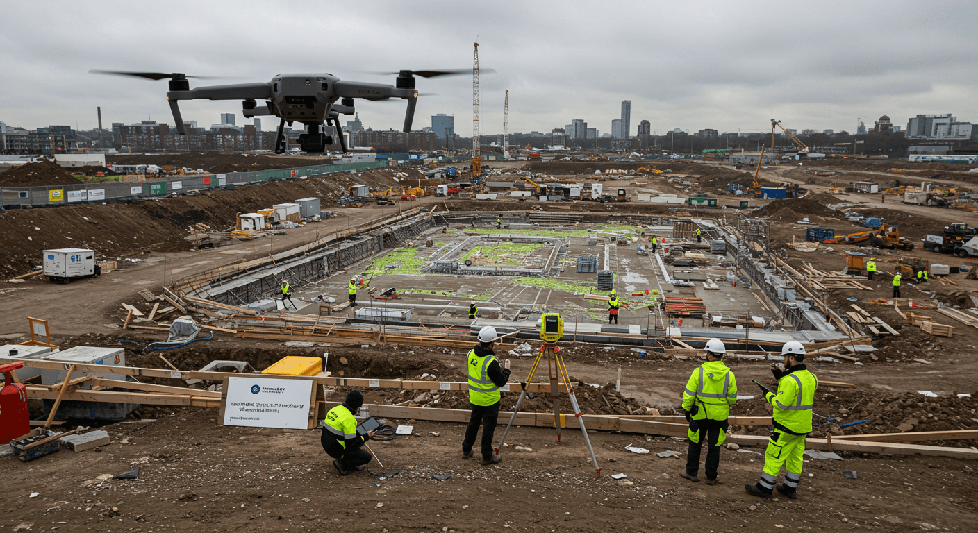
- Construction: Tracking project progress, monitoring material volumes, and site analysis.
- Agriculture: Crop health monitoring, yield estimation, and irrigation management using multispectral imagery.
- Infrastructure Inspection: Assessing the condition of bridges, power lines, and other infrastructure.
- Environmental Monitoring: Assessing environmental conditions, monitoring deforestation, and coastal erosion.
- Disaster Response: Assessing damage after natural disasters, search and rescue operations.
- Archaeology: Creating detailed maps of archaeological sites.
UK Drone Laws in 2025: Key Regulations
Operating drones in the UK is regulated by the Civil Aviation Authority (CAA) under the Air Navigation Order 2016 and UK Regulation (EU) 2018/1139. Here’s what you need to know to fly safely and legally in 2025:
- Registration and Flyer ID: Drones with a camera (unless a toy) or weighing 250g or more must be registered with the CAA. All drone pilots must pass an online theory test and obtain a Flyer ID.
- Maximum Flight Altitude: Drones must not exceed 400 feet (120 meters) above the surface.
- Visual Line of Sight (VLOS): Operators must maintain a clear line of sight with the drone at all times.
- Restricted Airspace: Permission is required to fly in restricted airspace, such as near airports, government buildings, and military bases.
- Airport No-Fly Zone: Drones are prohibited within a 5-kilometer (3-mile) radius of airports.
- Distance from People: Operators must maintain a distance of at least 50 meters from people not involved in the operation. Drones weighing 250g or more must remain 150 meters away from residential, commercial, or industrial zones.
- Labelling: You must legally label your drone with your operator ID so that it is visible from the outside of the aircraft, or within a compartment that can easily be accessed without using a tool.
- Night Flying: Compliance with drone laws is required during both day and night operations. Install appropriate lighting, check weather conditions, and plan for visibility changes.
It is essential to consult the latest drone code from the CAA and use tools like Dronemap.uk to identify no-fly zones and ensure compliance with local restrictions. Apps like Drone Assist also help with flight planning and approvals.
Top Drones for Mapping and Surveying in 2025
When selecting a drone for mapping and surveying, consider factors such as camera quality, flight time, GPS accuracy, and sensor options. Here are some of the best drones available in the UK market in 2025:
1. DJI Mavic 3 Enterprise Series
The DJI Mavic 3 Enterprise Series is a top choice for professional mapping and surveying due to its versatility and high-end capabilities.
- Key Features:
- 20MP camera with a 4/3 CMOS sensor for high-resolution imagery
- Up to 46 minutes of flight time for surveying larger sites
- Built-in RTK module for centimeter-level geotagging
- Multiple sensor options, including thermal and multispectral cameras
- Applications: Ideal for detailed aerial surveys, 3D reconstructions, and agricultural monitoring.
- Benefits: The extended battery life and precise positioning make it efficient for large-scale projects, while the high-resolution camera ensures accurate data capture.
DJI Pilot Hub 2 has a mapping mission planning feature native to the included controller, and it is very intuitive.
2. DJI Matrice 300 RTK
The DJI Matrice 300 RTK is a robust industrial drone known for its modular payload capabilities and exceptional performance.
- Key Features:
- Interchangeable sensor mounts for specialized data collection
- Compatibility with various cameras and sensors, including the Zenmuse P1
- TimeSync 2.0 for millisecond synchronization of system data
- OcuSync Enterprise transmission system for stable connectivity
- Applications: Best suited for large-scale mapping projects, infrastructure inspections, and specialized surveys requiring diverse sensor data.
- Benefits: Its modular design and advanced features make it a versatile and reliable solution for complex mapping tasks.
3. DJI Phantom 4 RTK
The DJI Phantom 4 RTK remains a reliable and budget-friendly option for photogrammetry and surveying projects.
- Key Features:
- 1-inch CMOS sensor for high-quality imaging
- RTK module for centimeter-level positioning
- Dedicated GS RTK app for flight planning and execution
- Mechanical shutter to eliminate rolling shutter distortion
- Applications: Suitable for smaller-scale surveys, 3D modeling, and general photogrammetry tasks.
- Benefits: Despite being an older model, it still delivers superb accuracy and high-resolution imagery at a more affordable price point.
4. Autel EVO II Pro RTK V3
The Autel EVO II Pro RTK V3 offers a balance of portability and precision, making it a great mid-range option for professional surveyors.
- Key Features:
- 1-inch CMOS RGB sensor gimbal camera with 6K resolution
- Up to 38 minutes of flight time
- 8-level wind resistance for stable performance in varying weather conditions
- Transmission range of up to 9.3 miles (15 kilometers)
- Applications: Ideal for photogrammetry, mid-range surveying, and inspections in diverse environments.
- Benefits: Its lightweight design and advanced features make it a versatile tool for various surveying needs.
5. AgEagle eBee X
The AgEagle eBee X is a high-end fixed-wing drone designed for large-scale professional surveying and mapping projects.
- Key Features:
- Multiple camera options, including high-resolution RGB and multispectral sensors
- Large coverage area with long flight times
- Automated flight planning and data processing
- High-precision data collection with RTK/PPK capabilities
- Applications: Best for extensive land surveys, agricultural mapping, and environmental monitoring.
- Benefits: Its fixed-wing design allows for efficient coverage of large areas, while its advanced sensors provide accurate and detailed data.
6. WingtraOne GEN II
The WingtraOne GEN II is another top contender in the fixed-wing drone market, known for its VTOL (Vertical Take-Off and Landing) capabilities and high precision.
- Key Features:
- VTOL design for easy takeoff and landing in confined spaces
- 59 minutes flight time
- Integrated PPK technology for precise data collection
- Swappable payloads for various sensor options
- Applications: Ideal for large surveying projects, infrastructure inspections, and detailed mapping in challenging environments.
- Benefits: Its VTOL capabilities and long flight time make it a versatile and efficient solution for diverse mapping needs.
7. DJI Mavic 3 Multispectral
The DJI Mavic 3M is one of the best drones for agricultural mapping, combining an RGB camera with a multispectral camera.
- Key Features:
- 4/3 CMOS 20MP, 1/2000s mechanical shutter speed, 0.7s high-speed burst when RGB camera is used
- Four 5MP multispectral sensors (Green, Red, Red Edge, Near Infrared)
- Built-in sunlight sensor for accurate NDVI results
- RTK module for centimeter-level positioning
- Applications: Ideal for conducting high-precision aerial surveys, crop-growth monitoring, and natural resource surveys.
- Benefits: Compact, portable and easily transportable. The drone can also conduct field scouting. Import data into DJI Terra or the DJI SmartFarm Platform for detailed maps and models and other insights.
Software for Drone Mapping
In addition to selecting the right drone, having the appropriate software is crucial for processing and analyzing the collected data. Several software solutions are available for drone mapping:
- ArcGIS Drone2Map: A desktop application for processing drone imagery into 2D and 3D models, with offline processing capabilities.
- Site Scan for ArcGIS: An end-to-end cloud-based drone mapping software for imagery collection, processing, and analysis.
- DJI Terra: A comprehensive mapping software for flight planning, data processing, and analysis, specifically designed for DJI drones.
- Dronelink and Litchi: Apps for autonomous mapping missions.
Conclusion
Drones have transformed the mapping and surveying industries, offering numerous advantages over traditional methods. By understanding UK drone laws and selecting the right drone and software, professionals can leverage this technology to achieve accurate, efficient, and cost-effective results. Whether for topographic surveying, construction monitoring, agricultural mapping, or infrastructure inspection, drones provide a powerful tool for capturing detailed geospatial data and creating valuable insights.


