Drones have revolutionized various fields by offering a unique aerial perspective that was once difficult and expensive to obtain. From stunning photography and filmmaking to precise surveying and inspections, the use of drones continues to expand, providing valuable insights and efficient solutions. This article delves into the numerous benefits, techniques, and applications of drone aerial perspective.
Why the View From Above Changes Everything
The primary advantage of using drones lies in their ability to capture aerial views, providing fresh perspectives that were previously unattainable or costly to acquire . This capability has transformed industries and opened up new creative possibilities.
Unmatched Perspectives
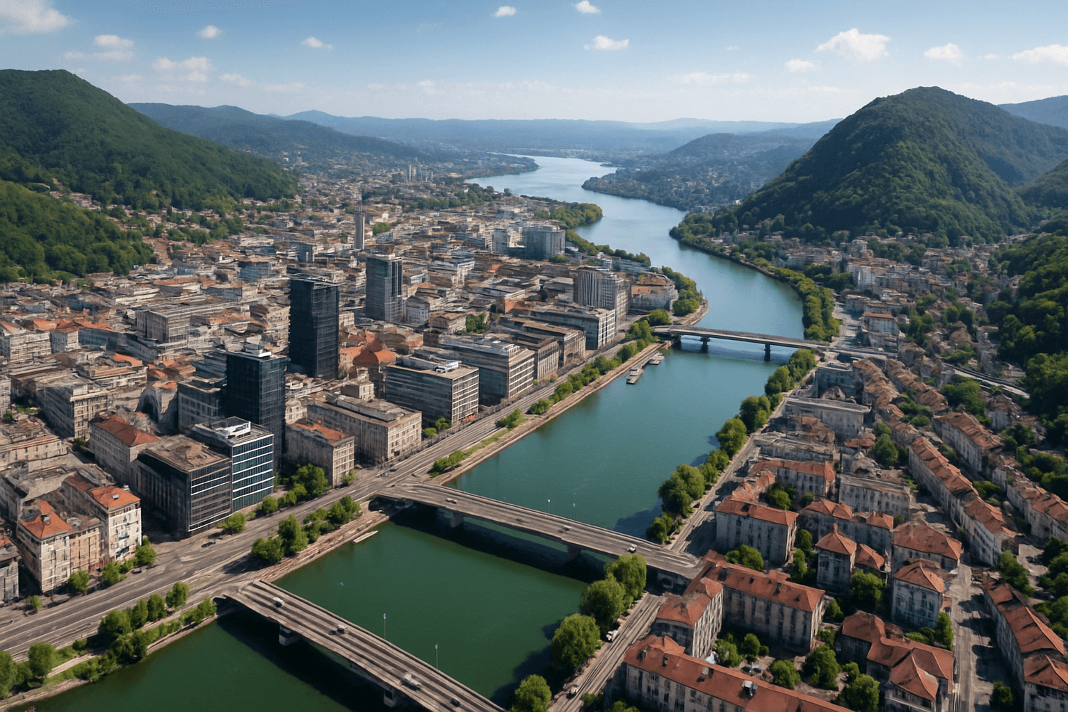
Drones offer bird’s-eye views that ground-level shots simply cannot replicate . This allows for a comprehensive understanding of a subject’s full scope, whether it’s a property’s architectural footprint, a sprawling landscape, or a large crowd .
Revealing Hidden Details
The aerial perspective reveals patterns, shapes, and textures that are often overlooked from the ground . Geometric farms, winding rivers, and repeating building shapes become works of art when viewed from above .
Showcasing Scale
Drones highlight the scale of large objects like stadiums, concert crowds, and buildings, providing a sense of immensity that ground-based photography cannot capture .
Accessing the Inaccessible
Drones enable the safe and easy photography of dangerous or hard-to-reach locations such as mountains, forests, and tall cityscapes, eliminating the need for expensive and risky methods like chartering a plane or helicopter .
Mastering the Art of Drone Aerial Photography
To fully leverage the potential of drone aerial perspective, it’s essential to understand the techniques and best practices involved in capturing stunning aerial imagery.
Composition Techniques
Several composition techniques can elevate drone photography, including:
- Rule of Thirds: Dividing the frame into a 3×3 grid and placing key elements along the lines or intersections creates a balanced and pleasing composition .
- Leading Lines: Utilizing natural lines like roads, rivers, or shorelines to guide the viewer’s eye towards the main subject adds depth and creates a sense of movement .
- Symmetry and Patterns: Capturing symmetrical compositions and mesmerizing patterns from a bird’s-eye view creates visually striking images .
- Framing: Using elements like archways, tunnels, or trees to frame the subject adds context and depth to the composition .
Essential Photography Tips
- Pick the Perfect Time of Day: The best light for aerial photography is often early morning or late afternoon when shadows are long and the light is warm . Midday sun can be too harsh .
- Look for Interesting Patterns and Shapes: Compelling overhead photos leverage patterns like winding roads, patchwork fields, or repeating building shapes .
- Lead the Eye Through the Frame: Use elements in the scene to guide the viewer’s eye through the image .
- Shoot on a Clear Day: Opt for calm, cloudless days to capture crisp, unobstructed views from above .
- Move the Drone Slowly: Gentle, steady movements result in clearer, better-composed shots .
- Change Viewpoints: Capture subjects from multiple sides and angles to add variety .
Camera Settings
Understanding camera settings is crucial for capturing stunning aerial photographs . Key settings include:
- Shutter Speed: A faster shutter speed is ideal for capturing fast-moving subjects without blur, while a slower speed can add artistic motion blur .
- Aperture: Controlling the amount of light entering the camera, aperture also affects depth of field .
- ISO: Use a low ISO to minimize noise, especially when shooting in bright daylight .
Applications Across Industries
The unique perspective offered by drones has found applications in various industries, revolutionizing processes and enhancing efficiency.
Real Estate
Drone photography has become a game-changer in the real estate industry, offering a unique and compelling way to showcase properties .
- Enhanced Property Listings: Aerial shots provide potential buyers with a comprehensive view of the property, highlighting its layout, proximity to amenities, and access routes .
- Accelerated Sales: Properties marketed with drone photography often sell faster and at higher prices .
- Stand Out in a Crowded Market: Aerial shots break the monotony of standard listings, capturing attention and positioning agents as innovators .
Construction and Surveying
Drones have transformed construction and surveying by providing efficient and accurate data collection methods .
- Site Monitoring: Drones enable the visualization of project progress at each stage, allowing for the tracking of completed tasks and their timelines .
- Land Surveying: Drone surveys provide comprehensive aerial perspectives, enhancing project planning and execution with accuracy and efficiency .
- Topographic Surveying: Survey drones produce high-resolution orthophotos and detailed 3D models, even in complex environments .
Inspections
Drones offer a safer, more efficient, and cost-effective way to inspect various assets, from infrastructure to industrial sites .
- Remote Visual Inspection: High-resolution cameras and zoom capabilities enable the remote inspection of difficult-to-reach structures .
- Condition Assessment: Aerial photos help identify roof damage, landscaping issues, and other maintenance needs without physical access .
- Thermal Imaging: Drones equipped with thermal sensors can identify heat patterns, revealing potential energy losses or concealed issues .
Filmmaking and Cinematography
Drones have revolutionized filmmaking by providing aerial perspectives that were previously difficult or impossible to obtain .
- Aerial Perspectives: Drones capture breathtaking aerial footage, adding depth and visual impact to movies, documentaries, and commercials .
- Flexibility and Efficiency: Drones are easily deployed to capture footage in various environments, reducing the need for expensive equipment like cranes and helicopters .
- Stable Footage: Advanced stabilization systems ensure smooth and stable footage, even in challenging conditions .
Other Applications
Drone aerial perspective extends to various other fields, including:
- Agriculture: Detailed analysis of soils and crops .
- Environmental Monitoring: Assessing the impact of natural disasters on ecosystems .
- Urban Planning: Efficient management of infrastructure construction .
Conclusion: The Future is Aerial
Drone aerial perspective has transformed how we see and interact with the world around us. Its versatility, efficiency, and ability to provide unique insights have made it an indispensable tool across various industries. As drone technology continues to advance, we can expect even more innovative applications and groundbreaking discoveries from the skies.


