The drone industry has exploded in recent years, transforming sectors from agriculture to construction and beyond. As drones become more sophisticated, so too does the software that controls them, processes their data, and unlocks their true potential. For professionals, choosing the right drone software is critical for maximizing efficiency, ensuring data accuracy, and maintaining regulatory compliance. This article explores the top drone software platforms for professionals in 2025, highlighting their key features, benefits, and applications.
Why Professional Drone Software Matters
Professional drone software goes far beyond basic flight control. It offers a range of advanced features designed to streamline workflows, improve data quality, and provide actionable insights. These features often include:
- Autonomous Flight Planning: Creating and executing flight paths automatically.
- Real-Time Data Processing: Analyzing information instantly for quick decision-making.
- AI and Machine Learning Integration: Helping drones detect and avoid obstacles automatically.
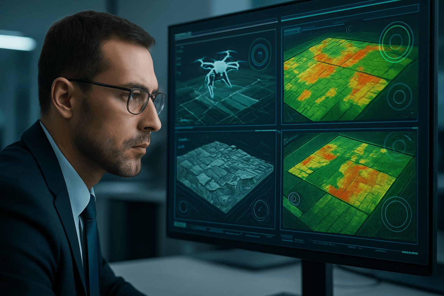
- Data Capture and Analysis: Generating orthomosaics, point clouds, 3D models, and conducting inspections.
- Fleet Management: Allowing a single operator to coordinate an entire fleet of drones.
- Regulatory Compliance: Ensuring adherence to aviation regulations and safety standards.
By leveraging these capabilities, professionals can unlock new levels of efficiency, accuracy, and safety in their drone operations.
Key Features to Look For
When evaluating drone software, consider the following features:
- Compatibility: Ensure the software is compatible with your drone model and operating system (iOS, Android, Web).
- Mapping and Modeling: Look for robust photogrammetry processing, accurate georeferencing, and the ability to generate various outputs like orthomosaics, DSMs, and 3D models.
- Inspection Tools: If you’re conducting inspections, prioritize software with features like automated defect detection, thermal analysis, and reporting tools.
- Flight Planning: Advanced flight planning capabilities, including terrain following, obstacle avoidance, and customizable flight parameters, are essential for complex missions.
- Data Security: Ensure the software provides secure data management, including encryption and access controls.
- Ease of Use: A user-friendly interface and intuitive workflow can save time and reduce the learning curve.
- Customer Support: Reliable customer support and comprehensive documentation are crucial for troubleshooting and getting the most out of the software.
Top Drone Software Platforms in 2025
Here are some of the top drone software platforms that have risen to the top by addressing the key needs of professional drone programs:
1. DroneDesk
- Overview: Dronedesk is an all-in-one operations hub designed for drone businesses. It consolidates flight planning, client and asset management, airspace intelligence, team coordination, and compliance reporting into a single, intuitive dashboard.
- Key Features:
- Flight planning and logging
- Client and asset management
- Airspace intelligence
- Team coordination
- Compliance reporting
- Direct integration with DJI drone data
- Benefits: Dronedesk streamlines complex workflows, reduces administrative overhead, and helps businesses stay compliant. Users report that it can cut job planning time by at least 50%.
- Industries: Construction, inspection, surveying, and general drone service providers.
2. DroneDeploy
- Overview: DroneDeploy is a leading cloud-based platform for aerial mapping, modeling, and data analysis. It’s known for its ease of use and scalability, making it suitable for both individual drone operators and large enterprise teams.
- Key Features:
- Automated flight planning
- Image processing and 3D modeling
- Data analysis and reporting
- Collaboration tools
- Integration with other software platforms
- Benefits: DroneDeploy simplifies drone operations, provides actionable data and mapping insights, and offers a user-friendly platform for teams to collaborate.
- Industries: Construction, agriculture, mining, and energy.
3. Pix4D
- Overview: Pix4D is a robust photogrammetry software known for its accuracy and precision in generating high-quality maps and 3D models. It’s a powerful solution ideal for projects demanding highly accurate measurements and detailed analysis.
- Key Features:
- Advanced photogrammetry processing
- Precise 2D and 3D model generation
- Thermal analysis
- Quality control checks
- Support for various camera types
- Benefits: Pix4D excels in producing highly accurate outputs, making it suitable for applications requiring precise measurements and detailed analysis.
- Industries: Construction, agriculture, mining, and public safety.
4. DJI Terra
- Overview: DJI Terra is a comprehensive drone mapping and modeling software solution developed by DJI. Its tight integration with DJI drones makes it a popular choice for aerial data acquisition, visualization, and analysis.
- Key Features:
- 2D and 3D model reconstruction
- AI-powered water surface optimization
- Support for DJI LiDAR data processing
- Seamless integration with DJI drones
- Model editing tools
- Benefits: DJI Terra offers versatile mapping solutions tailored to the specific needs of different industries, with streamlined workflows and actionable insights.
- Industries: Land surveying and mapping, power transmission, emergency services, construction, transportation, and agriculture.
5. Agisoft Metashape
- Overview: Agisoft Metashape is a premier drone mapping software that excels in photogrammetric processing, allowing users to generate highly accurate and detailed 3D models.
- Key Features:
- Dense point cloud reconstruction
- Mesh generation
- Texture mapping
- Georeferencing and coordinate system support
- Python scripting for automation
- Benefits: Metashape’s accuracy and precision in mapping outputs are highly regarded, making it a preferred choice for professionals seeking detailed and visually compelling 3D models and orthomosaics from aerial imagery.
- Industries: Surveying, mapping, and 3D modeling.
6. Bentley iTwin Capture Modeller
- Overview: Bentley iTwin Capture Modeller is built on Bentley’s advanced iTwin platform and offers a comprehensive suite of tools and capabilities to streamline the mapping and modeling workflow for infrastructure projects.
- Key Features:
- Geospatial data collection from various sources
- 3D model creation and analysis
- Collaboration and data sharing
- Integration with Bentley’s iTwin platform
- Benefits: iTwin Capture Modeller empowers users to create highly accurate and detailed 3D models of infrastructure assets and environments, enabling visualization, analysis, and simulation for planning, design, and maintenance purposes.
- Industries: Infrastructure, construction, and engineering.
7. Dronelink
- Overview: Dronelink is a drone flight control software that supports DJI and Autel drones. It offers cross-platform compatibility and multiple levels of automation for data capture.
- Key Features:
- Cross-platform support (Web, iOS, Android)
- Automated data capture
- Customizable missions
- 3D mission previews
- Real-time adjustments
- Benefits: Dronelink allows users to automate data capture for various use cases and industries, with tools for enhanced precision and accuracy.
- Industries: Construction, energy, telecom, mining, property management, insurance, agriculture, film, public safety, and education.
Other Notable Software Options
- WebODM: An open-source drone mapping software that runs on your computer, even offline.
- Virtual Surveyor: A smart drone surveying software used for topographic surveying, mining, construction earthworks, and stockpile inventory.
- Airpelago Power: Flight automation and project management software for efficient power line inspections with drones.
- Skyline PhotoMesh: Converts drone imagery into high-resolution, textured 3D mesh models for inspections.
Choosing the Right Software
The best drone software for you will depend on your specific needs, budget, and technical expertise. Consider the following factors when making your decision:
- Industry: Different industries have different requirements. For example, construction companies may prioritize software with volume measurement and progress tracking capabilities, while agricultural businesses may focus on plant health analysis tools.
- Drone Model: Ensure the software is compatible with your drone model and supports its specific features.
- Data Processing Needs: Determine the type of data processing you require (e.g., orthomosaics, 3D models, point clouds) and choose software that excels in those areas.
- Budget: Drone software can range from free open-source options to expensive enterprise-level platforms. Determine your budget and find a solution that offers the best value for your money.
- Ease of Use: If you’re new to drone software, prioritize a user-friendly interface and comprehensive documentation.
Conclusion
The drone software landscape is constantly evolving, with new platforms and features emerging regularly. By carefully evaluating your needs and researching the available options, you can choose the right drone software to maximize the value of your drone operations and achieve your business goals. The platforms highlighted in this article represent some of the best options available in 2025, offering a range of features and capabilities to meet the demands of professional drone users.


