Drones have revolutionised data acquisition across various industries, providing a cost-effective and efficient means of collecting high-resolution data. However, raw drone data is rarely useful in its original form. Drone data processing is the crucial bridge that transforms this raw sensor output into meaningful, mission-critical insights. This article delves into the techniques, technologies, applications, and challenges associated with drone data processing, offering a comprehensive guide to harnessing the power of aerial data.
What is Drone Data Processing?
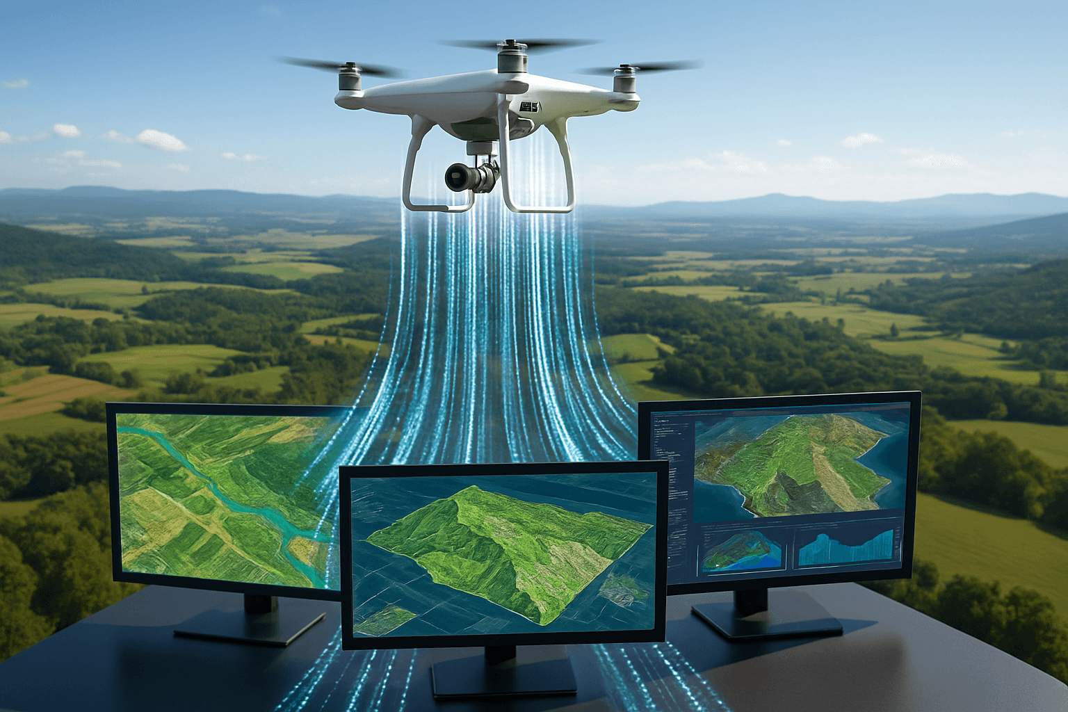
Drone data processing refers to the techniques and technologies used to transform raw data captured by unmanned aerial vehicles (UAVs) into usable outputs. These outputs may include orthophotos, 3D models, maps, volumetric calculations, or real-time alerts. Effective processing enables informed decision-making across applications such as precision agriculture, infrastructure inspection, environmental monitoring, and search and rescue. Data gathered in the field is typically processed using desktop software, cloud-based platforms, or third-party service providers. The choice of workflow depends on factors such as data size, required accuracy, turnaround time, and available computing resources.
The Importance of Drone Data Processing
Effective drone data management allows you to improve efficiency and productivity to ultimately streamline operations. The faster you can process insights collected by drone technology, the sooner your team can optimise resources, reduce waste, save time, and minimise spending.
Other essential benefits of efficient processing and analysis include:
- Maximizing value: Offering meaning from raw drone data.
- Improving decision-making: Supporting informed choices and predictive analytics based on historical insights.
- Enhancing safety and compliance: Monitoring potentially hazardous areas for real-time risk assessments.
- Simplifying data sharing: Enabling easy access to data to quickly communicate findings across teams.
- Driving innovation: Uncovering patterns and trends, leading to opportunities for improvement and refinement.
Organisations can extract actionable insights from the drone-collected data to act in real time — or close to it — and support optimised overall performance.
Drone Data Types Explained
Drones can be equipped with a variety of sensors to capture different types of data, including:
- RGB Imagery: Standard digital images captured by cameras, providing visual information about the surveyed area.
- Multispectral Imagery: Captures data beyond the visible spectrum, including near-infrared, allowing for analysis of vegetation health and other environmental factors.
- Hyperspectral Imagery: Captures data across a wide range of narrow spectral bands, providing detailed information about the composition and condition of objects and surfaces.
- LiDAR (Light Detection and Ranging): Emits laser pulses to create high-resolution 3D maps and point clouds, independent of lighting.
- Thermal Imagery: Detects heat signatures, useful for identifying energy loss, monitoring equipment, and search and rescue operations.
- Sonar: Sound Navigation and Ranging, useful for underwater mapping.
- Telemetry: Data transmitted by the drone, such as position, speed, battery voltage, etc.
Key Technologies & Techniques in Drone Data Processing
Drone data is rarely useful in its raw form. Effective processing techniques include:
- Photogrammetry: Converting overlapping images into georeferenced 2D and 3D models for use in construction, agriculture, and surveying. This technique involves creating 3D models or maps from drone images. Photogrammetry software stitches together hundreds or thousands of images to produce accurate and detailed representations of the terrain or objects.
- AI and Deep Learning: Used for automated object recognition, target tracking, noise reduction, and anomaly detection. Advanced algorithms and machine learning models can be trained on drone data to automate tasks like object recognition or anomaly detection.
- Sensor Fusion: Merging multiple sensor streams, e.g., RGB + LiDAR or multispectral + thermal, for enhanced situational awareness.
- Edge Computing: Onboard processing that enables real-time decision-making, useful in critical missions like disaster response and military reconnaissance.
- Georeferencing: Aligning drone data with real-world coordinates using ground control points (GCPs) or real-time kinematic (RTK) GPS.
- Orthorectification: Correcting geometric distortions in aerial images to create accurate, scale-correct orthomosaics. An orthomosaic is a high-resolution, georeferenced aerial image made by stitching together individual photos. They are invaluable for various applications, such as land surveying and agriculture.
- Point Cloud Processing: Manipulating and analysing LiDAR data to create 3D models, digital elevation models (DEMs), and other geospatial products.
3 Steps to Processing and Analyzing UAV Data
Data processing and analysis is the systematic approach of collecting, managing, and interpreting data obtained by drones, enabling teams to transform raw data into actionable insights. Below are the three main steps involved in UAV data processing and analysis.
1. Drone Data Transfer and Preparation
Transferring data from a drone to a computer or external hard drive is the first step in the data processing workflow. Once data is successfully moved, your team must ensure proper organization. Establishing a clear, orderly format for drone data files is key to easy reference. Use consistent formatting to support efficient data management. A critical part of the data transfer process for drone imagery is quality assurance. Your team must conduct comprehensive quality checks to ensure data is complete and accurate. Look for potential issues, such as:
- Corrupted files
- Incomplete datasets
- Image quality discrepancies
2. Drone Data Processing
Once the imagery has been transferred and prepared, you can start processing it using photogrammetry software. This software converts raw imagery into orthorectified mosaics and 3D models. Ensure you select the correct coordinate system and adjust settings based on your project requirements.
3. Drone Data Analysis and Visualisation
Spatial analysis techniques enable you to gather meaningful insights:
- Measurements: Teams can gauge accurate distances, perimeters, and areas directly from the UAV imagery.
- Volumetric calculations: If your drone has LiDAR or photogrammetry capabilities, it can generate 3D models that allow users to calculate volumes of relevant features, such as stockpiles or excavation sites.
- Change detection: Users can compare drone data collected at different moments to assess landscape changes, such as infrastructure development, vegetation growth, and land use.
Drone Data Processing Workflow
Below is the high level series of steps in the drone data processing workflow:
- GNSS Post-Processing (Optional): If you are using airborne RTK or PPK data, then you have to process that data before the geolocation can be imported into photogrammetry software.
- Photogrammetry: The process of combining photos, geolocation data, and ground control / check points to create a rich 3D model of a site.
- Data Extraction: Rich 3D models have far more data than is useful. They need to be cleaned to only the relevant data about the project site.
- Data Finishing: Once the clean data has been generated, it needs to be imported into CAD, merged with the imagery data, and have appropriate layers and symbology applied.
- Quality Check / Accuracy Measurement: Survey deliverables are useless if their accuracy can’t be relied upon. All files should go through a final QA / QC check, and accuracy measurement before they are considered finished.
Drone Data Analysis and Visualisation
Analyzing drone data allows you to extract actionable insights. You can identify trends, anomalies, and correlations that might be invisible from the ground. Leveraging spatial analysis techniques enables you to gather meaningful insights.
Key Applications of Drone Data Across Industries
Drones are enhancing data collection across many sectors, offering unique capabilities to supercharge accuracy, safety, and efficiency. The following are key applications of drone data across industries such as construction, public safety, mapping, and surveying:
- Agriculture: Assessing crop health, irrigation planning, and yield prediction via multispectral and hyperspectral analysis. AI algorithms can analyze multispectral data from drones to identify crop health, detect diseases, and optimize irrigation and fertilization plans. NDVI Analysis: Normalized Difference Vegetation Index (NDVI) is used to assess plant health.
- Construction and urban planning: Monitoring project progress, performing volumetric analysis, and enabling 3D city modelling. Project managers can leverage these insights to monitor progress, identify delays, or inspect hard-to-reach areas.
- Environmental science: Mapping land cover, evaluating flood risks, and tracking changes over time with photogrammetric and LiDAR data. Data from drones can help teams monitor wildlife and map habitats for better conservation efforts. These insights are also incredibly useful for tracking sediment and erosion on coastlines or riverbanks.
- Energy and utilities: Inspecting wind turbines, power lines, solar farms, and oil pipelines using RGB, thermal, and LiDAR imaging.
- Land surveying: Drone data can be especially beneficial for land surveying tasks, such as topographic mapping and 3D modeling. They can work with LiDAR processing software to generate detailed renderings of terrain, buildings, or property boundaries.
- Site inspections: Uncrewed solutions can collect data for progress monitoring and safety inspections on construction sites.
- Geographic information systems (GIS): Drones can collect essential data for GIS platforms, facilitating detailed mapping and analysis for teams involved in resource management, urban planning, or environmental investigations.
- Quality assurance: By capturing images and data, drones can help construction teams ensure designs meet relevant codes and specifications for quality assurance.
- Disaster recovery: Drones make quickly surveying emergency zones or disaster-impacted areas possible, providing real-time insights to assess damage and locate individuals in need. They can also help monitor events like wildfires to support strategic response efforts.
- Public Safety: Expansion of drone services in public safety.
Drone Data Processing Software and AI Tools
Here are some of the best drone data processing software and AI tools available today:
- PIX4Dmapper: Delivers software solutions intended for professional drone-based mapping, solely from images. The software of Pix4D uses images captured either manually, by drones, or by planes, and produces adaptable results that enhance.
- DroneDeploy: Is a platform widely operated by various companies in industries such as construction, oil and gas, and renewable energy. The firm assists these industries in automating the process of reality capture using advanced technologies, This data is then combined in one platform where it undergoes AI-powered analysis.
- Site Scan for ArcGIS: Is a cloud-based drone mapping software that is part of the ArcGIS Reality suite of products. Designed to handle the entire workflow of drone imagery data, it offers a comprehensive solution for planning, capturing, processing, and analyzing aerial data.
- SimActive’s Correlator3D: Is photogrammetry software designed to process large mapping projects, delivering high-quality results from drone, aircraft, and satellite imagery.
- Mapware: Specializes in offering drone data management software for companies integrating drone technology into their operations. Additionally, the firm provides consulting services for such businesses.
- OpenDroneMap: A command line toolkit to process aerial images.
- WebODM: A user-friendly, extendable application and API for drone image processing. It provides a web interface to ODM with visualization, storage and data analysis functionality.
- Autodesk: Their software integrates various capabilities, including design, visualization, and analysis, allowing users to efficiently plan, design, and construct projects. Autodesk’s drone data processing tools enable users to capture detailed site data, create 3D models, and perform accurate analysis, facilitating better decision-making throughout the project lifecycle.
- DJI Terra: Is a 3D model reconstruction software that has photogrammetry as its core technology. It supports a range of accurate and efficient 2D and 3D reconstruction of visible light, and data processing through DJI LiDAR. DJI Terra is a perfect match for DJI Enterprise drones and payloads. It works in conjunction to build a complete application solution that caters to vertical scenarios such as land surveying and mapping, power transmission, emergency services, construction, transportation, and agriculture.
Market Trends
The global drone data services market is experiencing rapid growth, driven by increasing demand for drone-based solutions across various industries.
- The drone analytics market size is estimated at USD 5.51 billion in 2025, and is expected to reach USD 18.41 billion by 2030, at a CAGR of 27.28% during the forecast period (2025-2030).
- The global drone data services market size was valued at USD 1.05 billion in 2022 and is anticipated to grow at a CAGR of 39.0% from 2023 to 2030.
- The global drone data services market size reached USD 2.4 Billion in 2024. Looking forward, IMARC Group expects the market to reach USD 23.7 Billion by 2033, exhibiting a growth rate (CAGR) of 29.1% during 2025-2033.
- The global drone software market is expected to reach an estimated $11.9 billion by 2030 with a CAGR of 14.6% from 2024 to 2030.
Key trends shaping the market include:
- AI and Machine Learning Integration: AI and machine learning are becoming integral to drone software, enhancing autonomous flight, object recognition, and data analysis. This trend enables drones to perform complex tasks such as real-time obstacle detection and dynamic route optimization.
- Cloud-Based Solutions: Cloud-based platforms are revolutionizing drone software by providing scalable storage, processing power, and accessibility. These solutions enable users to manage and analyze drone data from anywhere, facilitating collaboration and improving efficiency.
- Enhanced Compliance Features: These are crucial for gaining regulatory approval and facilitating safe BVLOS operations. This trend helps address regulatory challenges and supports the widespread adoption of drones in various sectors.
- Integration with IoT and Smart Cities: Drones are increasingly being integrated with Internet of Things (IoT) platforms and smart city infrastructure. This trend involves using drones for real-time data collection and interaction with smart systems, such as traffic management and environmental monitoring.
- The development of autonomous drone operations
- The expansion of drone services in public safety
- Customization for industry-specific applications
- Increasing product usage in Agriculture
Privacy and Security Concerns
The use of drones raises significant privacy and security concerns that must be addressed to ensure responsible and ethical operation.
- Privacy: Drones equipped with cameras and microphones can capture sensitive data, including images, audio, and personal information, without the consent of individuals. This is particularly concerning in urban areas and private settings. If you use these devices where people can expect privacy, such as inside their home or garden, you’re likely to be breaking data protection laws. The threat to privacy and data protection that a drone could pose would depend on its use, as well as what kind of equipment it has, e.g. microphones, cameras, GPS, etc.
- Data Protection Regulations: Operators of drones who register and/or process the images, video, sound, biometric data, geolocation or telecommunication data related to an identified or identifiable person are subject to the General Data Protection Regulation (GDPR).
- Security: Drones rely on wireless communication for control and data transmission, making them vulnerable to hacking, signal interception, and jamming attacks. Problems with GPS systems and other navigation sensors can cause routing errors or even accidents, endangering people and property.
To mitigate these risks, it is essential to implement robust security measures, adhere to privacy regulations, and promote transparency in drone operations. Solutions include:
- Data encryption: Adopting strong encryption protocols can protect data transmitted between drones and their controllers from unauthorized access.
- Software updates: Keeping drone software up to date is essential to fix vulnerabilities and implement new security features.
- Blockchain-Based Authentication: Utilizing a permissioned blockchain (Hyperledger Fabric) to create a decentralized, tamper-proof system for managing drone identities without centralizing sensitive data.
- Quantum-Resistant Cryptography: Employing advanced algorithms like CRYSTALS-Kyber and Dilithium to ensure long-term data protection against potential future threats.
- Selective Disclosure: Implementing protocols that allow drones to prove their authentication without revealing unnecessary information.
Conclusion
Drone data processing is a rapidly evolving field with immense potential to transform various industries. By understanding the techniques, technologies, applications, and challenges associated with drone data processing, organizations can harness the power of aerial data to gain actionable insights, improve decision-making, and enhance operational efficiency. As drone technology continues to advance, the importance of effective data processing will only continue to grow, unlocking new possibilities for a wide range of industries.


