Coastal ecosystems, from lush mangroves and expansive salt marshes to vital sand dunes, stand as critical natural defenses against the relentless march of rising sea levels and intensifying storms. These dynamic environments protect shorelines, support biodiversity, and sequester carbon. However, their health and very existence are increasingly threatened by climate change, necessitating advanced, precise, and frequent monitoring. Traditional ground-based surveys, often labor-intensive and geographically limited, are proving insufficient to capture the rapid, complex changes occurring. Enter drone technology, an innovative solution transforming how scientists and conservationists track the impact of rising sea levels on these invaluable coastal vegetations.
The Escalating Threat to Coastal Green Infrastructure
Rising sea levels, driven by global warming, pose an existential threat to coastal vegetation worldwide. Increased inundation, altered salinity levels, and intensified storm surges lead to erosion, habitat loss, and physiological stress on plant communities. Mangroves, for example, are crucial “blue carbon” ecosystems that protect coastlines and store significant amounts of carbon, but they are highly vulnerable to prolonged seawater exposure and increased pore water salinity. Salt marshes and coastal dunes also face degradation, impacting their ability to buffer inland areas from flooding and erosion. Understanding these impacts requires robust monitoring strategies that can capture fine-scale changes over vast, often inaccessible, areas.
Limitations of Traditional Monitoring Methods
Historically, monitoring coastal vegetation relied on field-based measurements, satellite imagery, and manned aircraft. While these methods provide valuable data, they come with inherent limitations:
- Labor-Intensive and Costly: Ground surveys are expensive, time-consuming, and can only cover small spatial footprints, often biasing results towards easily accessible areas.
- Limited Spatial Resolution: Satellite imagery, while covering large areas, often lacks the centimeter-scale detail needed to detect subtle changes in vegetation health or small-scale erosion patterns.
- Infrequent Data Collection: Manned aircraft and satellite passes are typically infrequent, making it challenging to capture dynamic environmental changes, especially after sudden events like storms.
- Accessibility Challenges: Many coastal wetlands and intertidal zones are difficult or dangerous to access for human surveyors.
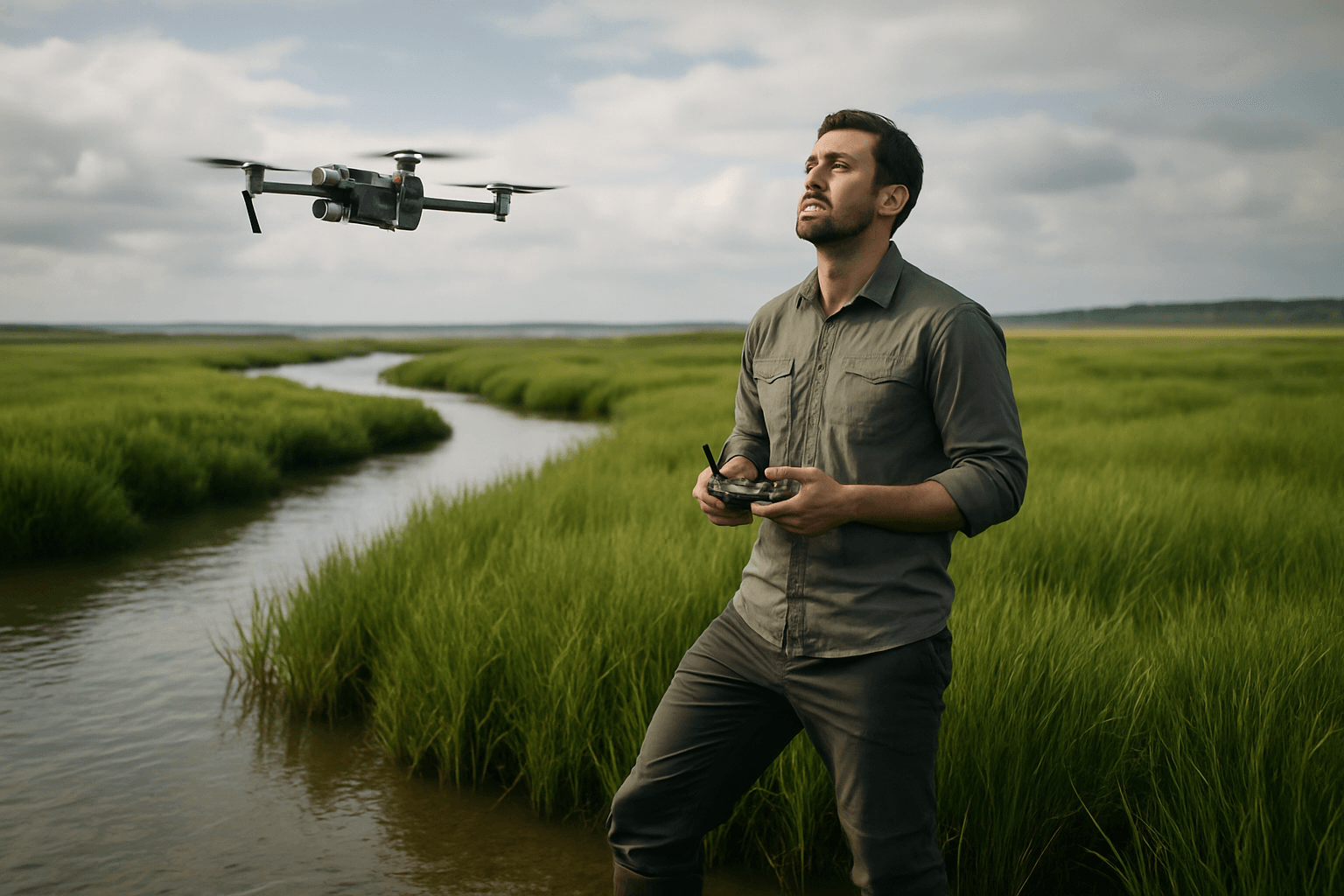
Drones: A Game-Changer for Coastal Vegetation Monitoring
Unmanned Aerial Vehicles (UAVs), commonly known as drones, offer a transformative solution, bridging the gap between localized field surveys and broad-scale satellite observations. Their ability to fly at lower altitudes, deploy rapidly, and operate cost-effectively provides unparalleled advantages for coastal monitoring.
Key Advantages of Drone Technology
- Superior Spatial Resolution: Drones can capture imagery at centimeter-scale resolution, far surpassing what satellites can achieve. This allows for the detection of subtle changes in vegetation health, species identification, and detailed mapping of erosion and accretion.
- Rapid Deployment and Response: Drones can be deployed quickly before and after storm events, providing crucial “before-and-after” data that is vital for assessing damage, informing disaster relief efforts, and evaluating the effectiveness of mitigation measures.
- Controlled Timing and Flexibility: Researchers can schedule drone flights precisely when needed, independent of satellite passes, allowing for optimal conditions (e.g., specific tidal stages or lighting).
- Cost-Effectiveness: Compared to manned aircraft or commissioning expensive satellite imagery, drone surveys are significantly more affordable, making frequent monitoring more feasible.
- Accessibility to Difficult Terrains: Drones can safely and efficiently survey remote, hazardous, or otherwise inaccessible coastal areas, including dense mangroves, expansive mudflats, and steep cliff faces.
Advanced Sensors and Data Analysis for Detailed Insights
The power of drone technology in coastal monitoring is amplified by the sophisticated sensors they carry and the analytical methods applied to the collected data. These tools enable scientists to gather a wealth of information about coastal vegetation health and structural integrity.
Types of Drone-Borne Sensors
- RGB (Red, Green, Blue) Cameras: Standard cameras capture visible light and are excellent for creating high-resolution orthomosaics and 3D models of the coastline, valuable for visual assessment and documenting physical changes.
- Multispectral Imagery (MSI) Sensors: These sensors capture data across several specific wavelength bands, including visible, red-edge, and near-infrared (NIR). Different vegetation types and health statuses reflect light differently across these bands. For example, healthy vegetation strongly reflects NIR light, allowing for the calculation of vegetation indices like the Normalized Difference Vegetation Index (NDVI) to assess plant vigor and biomass.
- Hyperspectral Imagery (HSI) Sensors: Offering even greater spectral detail than multispectral sensors, hyperspectral cameras capture hundreds of narrow, contiguous spectral bands. This allows for highly precise species identification and detection of subtle physiological stress not visible with broader band sensors.
- LiDAR (Light Detection and Ranging): LiDAR sensors emit laser pulses to measure distances, creating highly accurate 3D point clouds of the terrain and vegetation structure. This is invaluable for generating Digital Elevation Models (DEMs) even under dense vegetation, quantifying vegetation volume, canopy height, and tracking changes in ground elevation, which is critical for understanding inundation risk.
- Thermal Infrared (TIR) Cameras: These detect radiation emitted by objects, allowing for the creation of thermal images based on temperature differences. TIR can be used to identify heat stress in plants, water temperature anomalies, or even detect seepages.
Applications in Monitoring Coastal Vegetation
Drones, equipped with these sensors, are being deployed for a variety of critical monitoring tasks:
- Mapping Extent and Distribution: High-resolution imagery enables precise mapping of mangrove boundaries, salt marsh extent, and dune vegetation cover, allowing researchers to track changes over time, including deforestation or expansion patterns.
- Assessing Vegetation Health and Stress: Multispectral and hyperspectral data are used to calculate vegetation indices (like NDVI) to monitor plant vitality, detect early signs of stress due to salinity changes or drought, and identify disease outbreaks.
- Quantifying Biomass and Carbon Storage: LiDAR data can provide 3D structural information (e.g., tree height, canopy density), which, when combined with ground measurements, helps estimate aboveground biomass and assess blue carbon stocks in ecosystems like mangroves.
- Monitoring Erosion and Sedimentation: By generating frequent, high-resolution Digital Elevation Models (DEMs), drones can precisely track changes in shoreline position, dune profiles, and sediment accumulation or loss, providing insights into coastal erosion and deposition processes.
- Inundation Mapping and Sea Level Rise Impacts: Drone-derived topographic data, especially from LiDAR, can be used to simulate shoreline changes, run storm impact models, and predict which areas will be most at risk of flooding due to rising sea levels. This allows for detailed mapping of vulnerable zones and understanding the hydrological impacts on wetlands.
- Species Identification and Biodiversity: Advanced spectral sensors, combined with machine learning, can help identify different vegetation species and track shifts in community composition, offering insights into biodiversity and ecological responses to environmental change.
Real-World Impact and Case Studies
Drone technology is already providing tangible benefits in coastal management and research:
- Mangrove Ecosystems: In Malaysia, UAVs are used to monitor coastlines and track the effects of sea level rise and storm events on mangrove ecosystems. Studies demonstrate that drone-derived mangrove canopy cover estimates correlate highly with field measurements, but require significantly less time and resources.
- Coastal Erosion in West Africa: Scientists from the University of Ghana have utilized DJI drones to monitor coastal erosion along the Volta Delta, aiming to build an early warning system for potential floods. Similarly, drones mapped 60km of coastline between Togo and Benin to understand water flows crucial for preparing for rising sea levels.
- Storm Impact Assessment in Maine: Following record-breaking storms in January 2024, drone monitoring provided crucial before-and-after data, aiding communities in assessing damage and supporting FEMA applications for financial assistance.
- Submerged Aquatic Vegetation (SAV): Drones offer a cost-effective method to monitor submerged aquatic vegetation, with drone-borne topobathymetric LiDAR providing high-resolution 3D information about vegetation volume and bathymetry.
- Coastal Dunes and Salt Marshes: Drones are used for 3D vegetation mapping of coastal dune complexes, identifying plant species, and analyzing vegetation dynamics, as well as monitoring structural characteristics of salt marsh vegetation using LiDAR and photogrammetry.
Challenges and Future Directions
Despite the immense potential, the application of drones in coastal vegetation monitoring faces certain challenges. Environmental conditions such as changing tides, strong winds, wave action, cloud cover, and specific lighting conditions can adversely affect data collection and accuracy, especially for submerged habitats. Legal restrictions on drone flights also need to be navigated.
Future advancements will likely focus on improving sensor capabilities, developing more sophisticated data processing and analysis algorithms (including AI and machine learning for automated classification and change detection), and integrating drone data with satellite and ground-based observations for a multi-scale monitoring approach. The development of specialized drones for challenging coastal environments, alongside standardized mapping and sampling methods, will further enhance their utility.
Conclusion: A Clearer Picture of Our Changing Coasts
Drones are undeniably transforming our ability to monitor the profound impacts of rising sea levels on coastal vegetation. By providing high-resolution, frequently updated, and cost-effective data, they offer an unprecedented understanding of these vital ecosystems. This enhanced situational awareness empowers scientists, conservationists, and coastal managers to make more informed decisions, develop effective conservation strategies, and implement adaptive measures to protect our vulnerable coastlines for future generations. As climate challenges intensify, drone technology will play an increasingly crucial role in safeguarding the natural infrastructure that stands as our first line of defense.


