Coastal regions worldwide are vital ecosystems, supporting diverse biodiversity and acting as significant economic hubs. However, these crucial areas are increasingly threatened by coastal erosion, a natural process exacerbated by rising sea levels and extreme weather events linked to climate change. It’s estimated that nearly 70% of sandy coasts globally are experiencing erosion. This escalating challenge necessitates accurate, efficient, and frequent monitoring to inform effective coastal management and protection strategies. Traditional monitoring methods often face limitations in cost, safety, and data granularity, paving the way for advanced solutions like drone technology.
The Growing Threat of Coastal Erosion
Coastal erosion refers to the wearing away of land and the removal of beach or dune sediments by wave action, tidal currents, wave currents, or high winds. This phenomenon has profound environmental, economic, and social impacts. Globally, sea levels have risen by 8-9 inches (21-24 centimeters) since 1880, with the rate accelerating in recent decades. This rise, driven by melting glaciers and ice sheets and thermal expansion of warming seawater, increases the risk of erosion and storm surges.
The consequences of coastal erosion include:
- Loss of land and habitat: Valuable coastal land, including wetlands, mangroves, and beaches, is lost, impacting ecosystems and the species that rely on them. Mangroves, for example, are critical carbon sinks and natural barriers against storms, but Colombia alone has lost 14% of its mangroves in the last 40 years.
- Damage to infrastructure: Coastal communities, where nearly 40% of the U.S. population resides, face risks to roads, bridges, water supplies, and other critical infrastructure from sea level rise and erosion.
- Economic disruption: Industries like tourism, fisheries, and agriculture are directly affected by the degradation of coastal environments.
- Increased flooding: Higher sea levels and eroded coastlines lead to more frequent and intense coastal flooding, often referred to as “nuisance flooding,” which can be disruptive and costly.
Limitations of Traditional Monitoring Methods
Historically, coastal erosion has been monitored using a combination of ground-based surveys, satellite imagery, and aerial photography from manned aircraft. While these methods provide valuable data, they often come with significant drawbacks:
- Cost and logistics: Manned aerial surveys are expensive and require extensive planning. Ground-based surveys are labor-intensive and can be hazardous in dynamic coastal environments.
- Frequency and resolution: Satellite imagery, while covering vast areas, may lack the high resolution needed for detailed localized erosion analysis. Traditional methods can also be infrequent, missing critical short-term changes.
- Safety concerns: Surveying unstable cliffs or active surf zones can pose risks to human personnel.
- Data processing: Large volumes of data from traditional methods can be challenging and time-consuming to process and analyze manually.
The Rise of Drone Technology in Coastal Monitoring
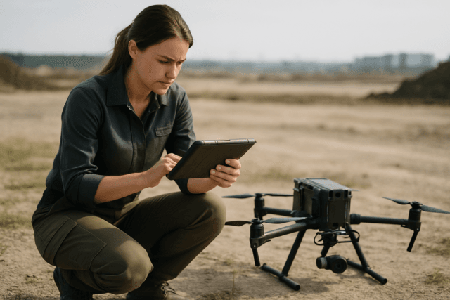
Unmanned Aerial Vehicles (UAVs), commonly known as drones, have emerged as a transformative tool for environmental monitoring, offering a cost-effective, safer, and more efficient alternative to traditional methods. Their flexibility allows for rapid deployment and data collection in areas that are difficult or dangerous for humans to access, providing high-resolution data crucial for understanding complex coastal dynamics.
How Drones Collect Data for Coastal Erosion
Drones are equipped with various sensors to capture a wealth of information about coastal environments:
- Photogrammetry: Drones capture a series of overlapping high-resolution images. Specialized software then processes these images to create detailed 2D orthomosaics and 3D models (e.g., Digital Surface Models – DSMs and Digital Elevation Models – DEMs) of the coastline. These models allow for precise measurements of elevation, volume, and change over time.
- LiDAR (Light Detection and Ranging): LiDAR sensors emit pulsed laser light to measure distances to the Earth’s surface. This technology can penetrate vegetation (like coastal mangroves) to create highly accurate 3D point clouds, providing precise topographic and bathymetric data, even in complex terrain or under challenging conditions. The integration of LiDAR with drone technology is expanding its use in various applications, including environmental monitoring and coastal management.
- Multispectral and Hyperspectral Imaging: These sensors capture data across multiple light spectrums, providing insights into vegetation health, sediment composition, and water quality – factors that can influence or be affected by coastal erosion.
Advantages of Drone-Based Monitoring
The adoption of drones for coastal erosion monitoring offers several key benefits:
- High Resolution and Accuracy: Drones can fly at lower altitudes, capturing images and data with centimeter-level precision, which is critical for detecting subtle changes in shoreline morphology.
- Cost-Effectiveness: Compared to manned aircraft, drone operations are significantly less expensive, making frequent monitoring more feasible.
- Efficiency and Speed: Drones can cover large areas quickly, reducing the time required for data collection. Autonomous flight capabilities further enhance efficiency.
- Safety: Drones can be deployed in hazardous or inaccessible areas, such as steep cliffs or rough surf, without risking human life.
- Repeatability: Automated flight paths allow for consistent data collection over the same area at different times, enabling accurate change detection.
- Real-time Data and Rapid Deployment: Some drone systems offer real-time data transfer, providing immediate insights for emergency response or ongoing analysis. This capability is further enhanced by AI and machine learning for rapid data processing and change detection.
Data Processing and Analysis for Informed Decisions
Collecting data is only the first step. The true power of drone technology lies in the ability to process and analyze the collected information to generate actionable insights.
Creating 3D Models and Orthophotos
Raw drone imagery is processed using photogrammetry software to create:
- Orthomosaic maps: Georeferenced, high-resolution maps that are corrected for topographic relief, providing a true-to-scale representation of the coastline.
- 3D point clouds and meshes: Detailed three-dimensional representations of the terrain, enabling precise volumetric calculations and cross-sectional analysis.
- Digital Elevation Models (DEMs): Raster images representing the elevation of the terrain, essential for identifying changes in beach profiles and dune systems.
Change Detection and Predictive Analytics
By comparing successive 3D models and DEMs captured over time, researchers can quantify coastal erosion rates, identify areas of significant change, and track sediment movement. Advanced analytics, often incorporating Artificial Intelligence (AI) and Machine Learning (ML), can:
- Automate change detection: Algorithms can automatically identify and quantify changes in coastal features, reducing manual effort and increasing efficiency.
- Predict future erosion patterns: By analyzing historical data and current trends, models can forecast future erosion scenarios, aiding in proactive planning and mitigation.
- Integrate multimodal data: Combining drone imagery with other data sources, such as IoT sensor telemetry and geospatial metadata, creates a more comprehensive understanding of coastal vulnerability and infrastructure assessment.
Challenges and Future Outlook
While drone technology offers significant advantages, challenges remain. These include high equipment costs, regulatory concerns regarding airspace, the need for skilled operators, and the extensive infrastructure required for processing large volumes of data. Furthermore, accurately classifying certain features can be challenging due to visual overlaps with natural elements like waves or birds.
Despite these hurdles, the future of drone-based coastal erosion monitoring is promising. Continued advancements in drone autonomy, sensor miniaturization, and AI-powered data processing will further enhance their capabilities. The integration of diverse data sources through multimodal fusion frameworks is also expected to improve accuracy and provide a fuller situational picture for environmental threat assessment and infrastructure monitoring in rapidly changing coastal zones. As technology evolves, drones will become an even more indispensable tool in safeguarding our vulnerable coastlines against the relentless forces of nature and climate change.


