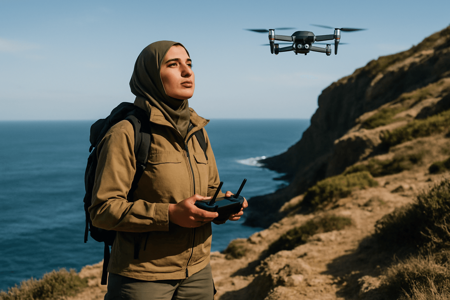
Imagine vast, untamed wildernesses, dense rainforests, or the remote depths of the ocean, all critical to Earth’s biodiversity and climate. Monitoring these remote ecosystems through traditional methods has historically been a monumental challenge, often requiring extensive human involvement, significant resources, and sometimes risking human safety or disturbing delicate habitats. However, a new era of environmental stewardship has emerged, propelled by the transformative capabilities of drones. These Unmanned Aerial Vehicles (UAVs) are revolutionizing how scientists, conservationists, and environmental engineers collect data, offering unprecedented access, precision, and efficiency in safeguarding our planet’s most inaccessible natural treasures.
The Evolving Landscape of Remote Ecosystem Monitoring
The need for accurate and timely data on remote ecosystems is more urgent than ever. Understanding ecological changes, tracking wildlife, and assessing environmental health are vital for informed conservation strategies and sustainable development. Traditional methods, while foundational, often suffer from limitations such as sparse data collection, high costs, and the inability to reach hazardous or expansive areas effectively. Drones, with their advanced technological integration, bridge these gaps, providing a dynamic and non-invasive solution for comprehensive environmental oversight.
Core Drone Capabilities Enhancing Environmental Data Collection
The versatility of drones in environmental monitoring stems from their ability to integrate various cutting-edge sensors and autonomous flight features. These capabilities allow for the collection of diverse data types across vast and often challenging terrains.
Advanced Sensor Integration
Drones can carry a sophisticated array of sensors tailored for specific environmental tasks:
- High-Resolution RGB Cameras: These capture standard visible light images, providing detailed visual documentation for habitat mapping, land-use change detection, and visual surveys. They are effective for creating detailed maps and 3D models of natural habitats.
- LiDAR (Light Detection and Ranging): LiDAR sensors emit laser pulses to create highly accurate 3D maps and models of terrain and vegetation, even through dense canopy, which is crucial for forest management, biomass calculation, and assessing deforestation.
- Multispectral Sensors: These capture data across several specific light wavelengths, including visible and near-infrared bands, to assess vegetation health, identify stress, map different plant species, and monitor water quality.
- Hyperspectral Sensors: Offering even greater spectral detail than multispectral sensors (over 100 continuous bands), hyperspectral sensors can detect minute differences in spectral signatures, providing valuable insights into subtle environmental changes.
- Thermal Imaging Cameras: Detecting heat signatures, these cameras are invaluable for tracking wildlife, especially at night or in dense foliage, and for identifying hotspots in wildfires or temperature variations in water bodies.
- Environmental Sensors: Drones can also be equipped with specialized sensors to monitor air quality (e.g., CO, CO₂ detectors), water quality (e.g., pH, dissolved oxygen, turbidity, chlorophyll detectors), humidity, and barometric pressure, aiding in pollution detection and climate research.
Enhanced Flight and Navigation Systems
Modern environmental drones boast capabilities that extend their operational reach and data quality:
- Extended Flight Time and Range: Advances in battery technology and aerodynamic design allow drones to cover larger areas more efficiently and collect data over extended periods.
- Autonomous Flight Features: Obstacle avoidance, terrain-following, and pre-programmed flight paths ensure safe, efficient, and consistent data collection, especially in complex environments.
- Real-time Data Transmission: Many drones offer reliable communication systems for long-range control and live data transmission, enabling immediate insights and rapid response.
- GPS and IMU: Global Positioning System (GPS) provides accurate location data, while Inertial Measurement Units (IMUs) measure acceleration and rotation, crucial for maintaining stable flight and precise data geo-referencing, even when GPS signals are weak.
Diverse Applications in Environmental Monitoring
Drone technology is transforming various aspects of remote ecosystem monitoring, providing data for critical conservation decisions.
Wildlife Tracking and Biodiversity Monitoring
Drones offer a non-invasive way to study biodiversity and monitor animal populations without disturbing their natural habitats.
- Population Counting and Behavior Study: Researchers can track endangered species, monitor migratory patterns, and gain a better understanding of animal behaviors and population sizes for various species, from elephants and whales to birds and tortoises.
- Anti-Poaching Efforts: Equipped with thermal or night-vision cameras, drones can survey vast areas, detect suspicious activities, and relay real-time information to rangers, significantly enhancing anti-poaching operations in high-risk zones.
- Habitat Assessment for Species Reintroduction: Fine-scale habitat mapping can assist in selecting suitable reintroduction sites for endangered species.
Habitat and Ecosystem Mapping
Understanding the changing landscape of ecosystems is crucial for effective conservation.
- 3D Mapping and Modeling: High-resolution cameras and LiDAR create detailed maps and 3D models of natural habitats, aiding scientists in tracking land-use changes, deforestation, and habitat degradation.
- Forest and Vegetation Monitoring: Drones can assess vegetation health, canopy cover, identify disease and pest infestations early, track growth stages, and detect illegal logging activities. UAV LiDAR provides efficient and precise ground modeling, even through dense vegetation.
- Coastal and Wetland Assessment: Drones are useful for monitoring coastal erosion, coral reefs as indicators of ocean health, and assessing wetland ecosystems.
Water Quality and Pollution Monitoring
Maintaining water quality is a pressing concern for ecological sustainability.
- Pollution Detection and Tracking: Drones equipped with sensors can monitor water bodies, identify pollution sources, track changes in water temperature, and measure pollutant levels, aiding in preventative measures.
- Marine Ecosystem Health: Underwater drones and aerial drones with specialized sensors can monitor coral reefs, chart water depths, and assess aquatic ecosystems, providing data on water temperature, salinity, pH, and dissolved oxygen.
Disaster Management and Environmental Damage Assessment
Drones play a crucial role in the early detection and assessment of natural disasters, allowing for timely intervention.
- Wildfire Management: Thermal imaging drones can pinpoint hotspots and guide firefighting efforts during wildfires, and later map burn areas and assess damage to vegetation and wildlife habitats.
- Post-Disaster Assessment: After events like hurricanes or oil spills, drones can quickly and safely survey affected areas, assess damage, monitor the spread of pollutants, and help coordinate cleanup operations.
Key Benefits of Drone Technology in Remote Monitoring
The advantages of integrating drones into environmental monitoring are substantial and far-reaching:
- Accessibility to Remote and Hazardous Areas: Drones can easily access regions that are difficult, dangerous, or impossible for humans to reach, such as dense forests, remote mountains, or disaster zones.
- Cost-Effectiveness: Compared to traditional methods like manned aircraft or extensive ground surveys, drones can significantly reduce the time, manpower, and financial resources required for data collection.
- Enhanced Data Accuracy and Resolution: Drones capture high-resolution imagery and sensor data from precise vantage points, leading to more accurate, detailed, and consistent data compared to traditional methods.
- Time Efficiency and Real-time Insights: Drones can cover large areas rapidly, collecting data in minutes or hours rather than weeks, and providing real-time information for quick decision-making and intervention.
- Reduced Human Risk and Environmental Disturbance: By deploying drones, researchers can avoid placing personnel in hazardous situations and minimize disturbance to sensitive wildlife and their habitats, ensuring non-invasive studies.
Challenges and Limitations
Despite their immense potential, the implementation of drones for remote ecosystem monitoring faces several challenges:
- Battery Life and Endurance: Many off-the-shelf drones have limited battery life, restricting flight duration and the amount of data that can be collected per flight.
- Regulatory and Legal Issues: Drone operations are subject to evolving aviation regulations, which can vary by region and purpose, impacting flight permissions and operational scope.
- Data Processing and Management: The high spatial resolution data collected by drones often results in massive file sizes, posing significant challenges for storage, processing, and analysis, requiring robust computational methods.
- Weather and Environmental Conditions: Adverse weather conditions such as strong winds, rain, or extreme temperatures can affect drone flight stability, sensor performance, and overall operational safety.
- Technical Limitations: Signal interference can disrupt communication systems, and inexperienced pilots or issues with autonomous flight planning can lead to loss of aircraft.
- Privacy Concerns: The ability of drones to capture high-resolution imagery raises concerns about privacy, particularly in areas where human activity might be present.
- Potential Wildlife Disturbance: While generally non-invasive, improper drone use can still potentially disturb wildlife, necessitating careful operational protocols.
- Initial Costs: The initial investment in high-quality drones and advanced sensor systems can be substantial, although often offset by long-term operational savings.
The Future of Drone-Based Ecosystem Monitoring
The future of drone capabilities in monitoring remote ecosystems is bright, marked by continuous innovation and integration with emerging technologies.
- Artificial Intelligence (AI) and Machine Learning (ML): AI and ML will enhance drone autonomy, enabling them to identify species, track movement patterns, and process vast datasets more efficiently, providing deeper insights.
- Internet of Things (IoT) Integration: Connecting drones with IoT devices will facilitate real-time habitat monitoring and data sharing, creating integrated systems for environmental observation.
- 5G Connectivity: Faster data transmission and lower latency offered by 5G will enable more effective live streaming and remote control of drones, especially in critical applications like disaster response.
- Advanced Sensor Miniaturization: Ongoing advancements will lead to smaller, lighter, and more powerful sensors, expanding payload capabilities and enabling even more sophisticated data collection.
- Improved Battery Technology: Breakthroughs in battery life will address current limitations, allowing for longer flight times and wider area coverage.
Drones have undeniably become indispensable tools in environmental monitoring and conservation, offering unparalleled opportunities to understand, protect, and restore our planet’s vital, yet often vulnerable, remote ecosystems. As technology continues to evolve, their role will only expand, empowering conservationists and researchers with the data and insights needed to face the urgent environmental challenges of our time.


