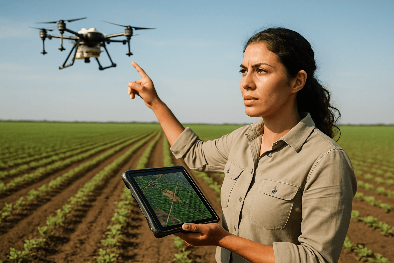
The early stages of crop growth are critical, laying the foundation for an entire season’s yield. Traditionally, assessing crop establishment rates—the number of seedlings that successfully emerge and establish—has been a labor-intensive, time-consuming, and often imprecise manual process. However, a silent revolution is taking flight over agricultural fields: unmanned aerial vehicles (UAVs), commonly known as drones, are transforming how farmers monitor this crucial phase, ushering in an era of unprecedented accuracy and efficiency in precision agriculture.
Understanding Crop Establishment Rates and Their Importance
Crop establishment rate, often referred to as “stand count,” is a quantitative assessment of seedling emergence and plant density within a field. It provides a precise baseline of emerged plants against the target seeding rate, offering a clear metric of initial success or failure. High levels of mortality during seed germination, seedling emergence, and early establishment phases are a significant bottleneck in ecological restoration and successful harvests.
Accurate stand counts are foundational for early-season agronomic decisions because they inform critical management strategies and set the stage for the entire growing season. This data helps farmers:
- Estimate plant population: Providing a precise inventory of emerged plants.
- Identify gaps and inconsistencies: Pinpointing areas with poor germination or damaged seedlings.
- Inform replanting decisions: Determining if and where replanting is necessary to achieve optimal density.
- Optimize resource allocation: Guiding adjustments to irrigation, fertilization, and pest management based on actual plant numbers.
- Project yield early: Offering early insights into potential harvest outcomes.
How Drones Revolutionize Crop Establishment Monitoring
Drones offer a superior alternative to traditional manual scouting methods by providing a rapid, high-resolution, and comprehensive overview of vast agricultural areas.
High-Resolution Imaging and Data Collection
Equipped with advanced cameras and sensors, agricultural drones capture detailed aerial imagery of fields. These high-resolution images are crucial for detecting small objects like individual seeds and seedlings, even in complex ecological backgrounds. Drones can achieve greater spatial resolution compared to satellite imagery and operate in conditions that might hinder other aerial data collection methods.
Advanced Sensor Technology for Detailed Insights
The effectiveness of drones in agriculture is amplified by their specialized payloads:
- RGB Cameras: Standard Red, Green, Blue (RGB) cameras capture visual images, allowing for detailed observation of crop density and individual plant identification.
- Multispectral Sensors: These sensors capture light wavelengths beyond the visible spectrum, revealing subtle variations in plant reflectance that are indicative of stress, nutrient deficiencies, or early disease. This data is used to calculate various vegetation indices, such as NDVI (Normalized Difference Vegetation Index), which helps assess plant health and vigor even before issues are visible to the naked eye.
- Thermal Sensors: Thermal imaging can assess soil moisture levels and plant hydration status, identifying areas of water stress or inadequate moisture.
AI and Machine Learning for Automated Analysis
Once drone imagery is collected, specialized software, often powered by Artificial intelligence (AI) and Machine Learning (ML), processes the vast amounts of data. This technology can:
- Distinguish crops from weeds: Enhancing the accuracy of stand counts.
- Identify and count individual plants: Accurately calculating plant population and density across the entire field.
- Generate detailed population maps and reports: Providing farmers with visual and quantitative data on plant distribution and health.
- Detect anomalies: Identifying skips in rows, areas of poor emergence, or early signs of stress.
- Overcome challenges like leaf adhesion: Specialized algorithms can even address complexities like overlapping leaves in later seedling stages to ensure accurate counts.
Benefits for Farmers and Agricultural Operations
The integration of drones into crop establishment monitoring offers numerous advantages:
Enhanced Accuracy and Efficiency
Drones provide up to 90-99% stand count accuracy, surpassing the variability associated with manual methods which often depend on operator skill and are prone to human subjectivity. They can survey hundreds of acres in minutes, completing tasks up to 68 times faster than traditional methods, allowing farmers to cover large areas quickly and efficiently. This reduces manual labor and costs, freeing up human resources for other critical tasks.
Early Detection and Timely Intervention
By providing real-time data and high-resolution imagery, drones enable farmers to detect issues like poor emergence, nutrient deficiencies, pest infestations, or disease outbreaks days or weeks before they become apparent to the naked eye. This early detection allows for rapid intervention, preventing widespread crop loss and optimizing input use.
Optimized Resource Management and Increased Yields
Precise stand count data empowers farmers to allocate resources efficiently. By tailoring irrigation schedules, fine-tuning fertilizer application rates, or targeting pest management efforts to specific areas identified by drone data, farmers can maximize resource efficiency, promote uniform growth, and ultimately improve yields. This targeted approach reduces waste and lowers costs associated with chemical inputs and water.
Challenges and Limitations
Despite the significant benefits, several challenges need to be addressed for widespread drone adoption in agriculture:
Technical Limitations
- Battery Life and Flight Time: Most drones have limited battery capacity, restricting flight duration to typically 20-30 minutes, which can be a constraint for covering very large farms efficiently.
- Weather Dependency: Drones are vulnerable to adverse weather conditions like strong winds, rain, fog, or extreme temperatures, which can hinder operations and spoil image quality.
- Connectivity and Data Transmission: Operating in remote agricultural fields can lead to inconsistent network connectivity, hampering the seamless transmission of real-time data.
Data Management and Analysis
Drones generate vast amounts of high-resolution images and sensor readings, producing terabytes of data. Efficiently storing, processing, and analyzing this data requires specialized infrastructure and expertise. Integrating drone data with existing agricultural systems and ensuring real-time insights can also be complex due to different data formats.
Regulatory and Operational Hurdles
- Regulations: Airspace restrictions, privacy concerns, and operational safety protocols require farmers to deal with a number of rules. Compliance often necessitates training, certification, and insurance.
- Expertise: Operating drones and interpreting their data effectively requires specialized knowledge and skills, which can be a learning curve for farmers traditionally accustomed to manual methods.
The Future of Drones in Agricultural Monitoring
The role of drones in agriculture is continually expanding, driven by rapid technological advancements:
Integration of AI, Machine Learning, and IoT
The future will see even smarter drones with enhanced AI and ML capabilities, enabling predictive analytics for disease outbreaks, evaluation of crop harvesting cycles, and data-driven decision-making using historical data. Drones will be increasingly integrated with the Internet of Things (IoT), forming wider networks of sensors and data points across farms. This interoperability will enable advanced remote surveillance and management, allowing drones to execute real-time decisions, such as precise irrigation mapping, based on holistic farm data.
Increased Automation and Autonomy
Expect to see fully autonomous drone fleets managing entire farms without direct human input. Self-flying drones are on the rise, making them ideal for large-scale farming operations.
Improved Accessibility and Sustainability
As drone technology improves, prices are becoming more affordable, making these tools accessible to small and medium-scale farms, not just large corporations. Furthermore, drones will play a crucial role in sustainable farming practices by optimizing input use, reducing chemical applications, minimizing water waste, and improving land management, leading to healthier ecosystems for future generations.
In conclusion, drones are fundamentally reshaping crop establishment monitoring within precision agriculture. By offering precise, efficient, and data-driven solutions, they empower farmers to make informed decisions that optimize resource use, enhance crop health, and ultimately lead to more sustainable and productive farming practices in the face of growing global food demands.


