In the competitive landscape of real estate, captivating visuals are no longer a luxury but a necessity. Drone-based virtual tours have emerged as a game-changer, offering prospective buyers an immersive, 360-degree perspective of properties and their surroundings that traditional photography simply cannot match. This guide will walk you through the essential steps, equipment, and considerations for creating stunning, high-quality drone-based virtual property tours.
Virtual tours allow potential buyers to explore properties in detail from anywhere, reducing the need for initial physical visits and attracting more qualified leads. By providing a comprehensive view of the property’s layout, lot size, amenities, and neighborhood context, drone footage, when integrated with 360-degree virtual tours, creates a powerful and engaging experience.
Why Drone-Based Virtual Tours are Essential for Real Estate
The digital revolution has transformed how properties are marketed, with drone photography at the forefront. Drone-based virtual tours offer several compelling advantages:
- Comprehensive Property Showcasing: Drones can capture the entire scope of a property, including yards, driveways, outdoor living spaces, and even the roof, providing a bird’s-eye view that highlights features missed from ground level.
- Enhanced Location and Context: Aerial shots effectively communicate the property’s location, its relation to nearby amenities like parks or schools, and the overall neighborhood, which is crucial for out-of-town buyers.
- Immersive Buyer Experience: Virtual tours, especially when combined with drone footage, create an interactive experience, allowing viewers to “walk through” the property virtually and gain a better sense of its scale and layout.
- Market Differentiation and Faster Sales: Listings featuring drone media consistently sell faster and attract more qualified buyers. Some studies suggest properties with aerial photos sell 68% faster and are 65% more likely to get in-person showings.
- Cost-Effectiveness: Drones offer a more affordable alternative to traditional aerial photography methods like cranes or helicopters.
Essential Equipment for Drone Virtual Tours
Creating professional drone-based virtual tours requires a combination of high-quality hardware and specialized software.
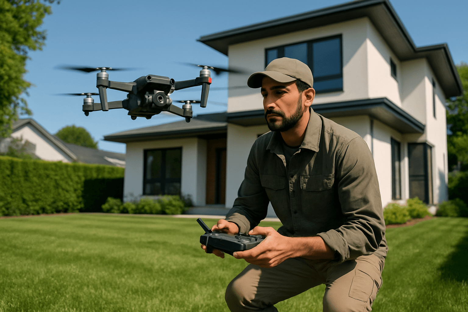
Choosing the Right Drone
The drone is the cornerstone of your aerial photography setup. Key features to look for include:
- Camera Quality: Opt for drones with high-resolution cameras (20-48 MP) capable of recording 4K or even 6K video. A 1-inch CMOS sensor, HDR capabilities, and adjustable aperture settings are beneficial for capturing detail and color accuracy in various lighting conditions.
- Gimbal Stabilization: A 3-axis gimbal is crucial for smooth, cinematic footage, minimizing vibrations and ensuring stable shots even in windy conditions.
- Obstacle Avoidance: Omnidirectional obstacle avoidance is a vital safety feature, especially when navigating around trees, power lines, and tight spaces near properties.
- Flight Time: A drone with a 25+ minute flight time is recommended to ensure you can complete your shot list without constant battery changes.
- RAW Photo Capability: The ability to capture RAW images provides greater flexibility for professional post-processing.
- GPS Return-to-Home: This safety feature ensures the drone can automatically return to its takeoff point if connection is lost or the battery is low.
Popular choices for real estate drone photography include models like the DJI Mini 4 Pro, known for its high image quality and reliable obstacle avoidance.
360-Degree Cameras for Interior Tours
While drones handle the exterior, a dedicated 360-degree camera is essential for creating immersive interior virtual tours. These cameras capture a complete panoramic view of a space.
- High Resolution: Look for cameras that offer high-resolution 360-degree still images (e.g., 21MP to 60MP) and 360-degree video capabilities (e.g., 5.7K to 8K).
- Ease of Use: User-friendly cameras allow for quick and efficient shooting.
- Image Stabilization: Built-in stabilization ensures smooth video capture.
- Accessories: A sturdy tripod or monopod is essential for stable 360-degree shots.
Examples include the Insta360 ONE RS 1-Inch 360 Edition, Insta360 X4, Ricoh Theta Z1, and Ricoh Theta X. Some advanced cameras like the Realsee Galois 3D LiDAR Camera can even create highly detailed 3D LiDAR scans for virtual tours.
Software for Stitching and Tour Creation
Once you have your aerial footage and 360-degree interior photos, specialized software is needed to stitch them together and create an interactive virtual tour.
- Photogrammetry Software: For advanced 3D modeling from drone images, software like Pix4D or OpenDroneMap can turn drone photos into detailed orthomosaics, elevation models, and 3D models.
- 360 Virtual Tour Platforms: Platforms like CloudPano and Kuula allow you to upload your 360-degree photos and drone footage, create interactive hotspots, and link different scenes to build a seamless virtual experience. These platforms often offer features like 3D dollhouse views and floor plan integration.
- Video Editing Software: For editing drone video footage, professional software like Adobe Premiere Pro or DaVinci Resolve Studio is recommended for color grading, music integration, and adding text overlays.
- Image Editing Software: Tools like Adobe Photoshop or Affinity Photo can be used for enhancing 360-degree photos and correcting any imperfections.
Legal and Safety Considerations for Commercial Drone Operation
Operating a drone for commercial purposes, such as real estate marketing, comes with strict legal requirements and safety protocols.
- FAA Part 107 License (or equivalent): In the United States, commercial drone operators must obtain an FAA Remote Pilot Certificate (Part 107 license) by passing a certification exam. This ensures compliance with safety requirements. Similar regulations exist in other countries.
- Drone Registration: Drones weighing over 0.55 lbs (250 grams) must be registered with the relevant aviation authority (e.g., FAA in the U.S.).
- Remote ID Compliance: As of March 2024, drones operating in the U.S. must broadcast identification and location data during flights.
- Flight Rules: Adhere to rules such as flying only during daylight (or with proper lighting and waivers at night), maintaining visual line of sight, staying below 400 feet above ground level, and avoiding restricted airspace. Always check for temporary flight restrictions (TFRs) or no-fly zones using FAA-approved apps.
- Property Owner Consent & Privacy: Always obtain written consent from the property owner before flying over their land. Be mindful of privacy laws and avoid capturing images of neighboring properties or individuals without consent, particularly areas where there is a reasonable expectation of privacy.
- Liability Insurance: Commercial drone operators should carry liability insurance to protect against potential damages or legal risks.
- Local and State Regulations: Be aware that local and state governments may impose additional restrictions on drone operations.
Partnering with certified drone service providers can help ensure compliance and high-quality results.
The Workflow: Creating Your Drone-Based Virtual Tour
Follow these steps to create a compelling drone-based virtual property tour:
1. Pre-Flight Planning and Preparation
Thorough planning is crucial for a successful shoot.
- Understand Client Needs: Discuss with the client what specific features of the property and its surroundings they want to highlight.
- Site Survey: Visit the property to assess the environment, identify potential obstacles (trees, power lines), and plan optimal flight paths.
- Check Airspace and Regulations: Use FAA-approved apps to confirm the airspace is clear and there are no temporary flight restrictions. Obtain any necessary authorizations for controlled airspace.
- Obtain Permissions: Secure written consent from the property owner. If the flight path might include neighboring properties, consider informing or obtaining consent from those owners as well.
- Prepare the Property: Advise the property owner to prepare the exterior (e.g., clean up yards, remove pool cleaners, set up outdoor furniture) to make it look presentable.
- Equipment Check: Ensure all drone batteries are charged, camera lenses are clean, and sufficient storage is available on your memory cards.
2. Drone Photography and Videography
Capturing the aerial visuals requires a strategic approach.
- Establish Shots: Start with high-altitude shots (e.g., 300-400 feet) to showcase the property’s scale, lot size, and surroundings. An initial orbit of the entire property provides excellent context.
- Fly-Throughs and Orbit Shots: Execute smooth, slow fly-throughs to highlight key exterior features like gardens, pools, driveways, and architectural details. Orbit shots can offer a 360-degree view of specific areas.
- “Hero” Shots: Capture specific angles that best showcase the property’s unique selling points, such as a waterfront view or a distinct architectural element.
- Neighborhood Context: Include shots that subtly place the property within its neighborhood, showing proximity to desirable features like parks, golf courses, or natural landmarks.
- Varying Altitudes and Angles: Combine high-altitude wide shots with lower-altitude detail shots to provide a comprehensive visual narrative.
- Capture More Than Needed: It’s always advisable to capture more footage and photos than initially planned to allow for flexibility during editing.
3. Interior 360-Degree Photography
Transition inside for the interactive virtual tour experience.
- Strategic Placement: Place your 360-degree camera on a tripod at human eye level in the center of each significant room or area.
- Room Coverage: Capture all essential interior spaces, including living areas, bedrooms, bathrooms, and kitchens, ensuring a complete view of room sizes and layouts.
- Lighting: Ensure adequate lighting to capture clear and detailed images.
- Consistency: Maintain a consistent shooting height and exposure settings across all interior shots for a seamless tour experience.
4. Post-Production and Virtual Tour Assembly
This is where all your captured media comes together.
- Image and Video Editing:
- Drone Footage: Edit drone videos, applying color grading, stabilization, and adding suitable background music. Some services offer sky and grass replacement to enhance visuals.
- 360 Photos: Stitch individual 360-degree photos if necessary (some cameras do this automatically) and perform any necessary color correction or retouching.
- Virtual Tour Creation:
- Upload all edited aerial footage and 360-degree interior photos to your chosen virtual tour software (e.g., CloudPano, Kuula).
- Create a logical flow by linking different panoramic shots and drone video segments.
- Add interactive hotspots to allow viewers to navigate between rooms or jump to specific points of interest.
- Integrate additional information such as floor plans, property details, and even 3D dollhouse views if the platform supports it.
- Review and Optimization: Thoroughly review the entire virtual tour for smooth transitions, correct information, and optimal loading speeds. Optimize the tour for various devices, including desktops and mobile phones.
- Delivery and Hosting: Share the completed virtual tour via a hosted link that can be embedded on real estate listing websites, social media, and other marketing channels.
By meticulously following these steps and adhering to legal guidelines, you can leverage drone technology to create highly engaging and effective virtual tours that elevate property listings and attract prospective buyers in today’s digital real estate market.


