The intricate, multi-layered world of a forest canopy holds vital clues about ecosystem health, biodiversity, and carbon cycling. Traditionally, studying this complex architecture has been a labor-intensive and often challenging endeavor, limited by accessibility and the sheer scale of forested landscapes. However, a technological revolution is underway, with drone-based Light Detection and Ranging (LiDAR) emerging as a transformative tool that offers unprecedented detail and efficiency in analyzing forest canopy structure for ecological studies.
Understanding Lidar: How Light Unveils 3D Forest Secrets
LiDAR, an acronym for “Light Detection and Ranging,” is a remote sensing technology that employs eye-safe laser beams to generate a highly detailed three-dimensional representation of an environment. The operational principle is straightforward yet powerful: a LiDAR sensor emits pulsed light waves that travel through the air, strike objects (such as tree leaves, branches, or the forest floor), and then reflect back to the sensor. By precisely measuring the time it takes for each pulse to return, the system calculates the distance the light traveled. This process repeats millions of times per second, and when combined with satellite GPS functionality, it creates an exact 3D map, known as a point cloud, of the surveyed area.
Unlike traditional photogrammetry, which relies on ambient light and captures visual textures, LiDAR generates its own illumination, enabling mapping in low-light conditions, under heavy vegetation, or over featureless terrain. This is particularly crucial in forestry, where dense canopies often obscure the underlying structure from standard optical sensors.
The Drone Advantage: Mobile Lidar for Unprecedented Forest Insights
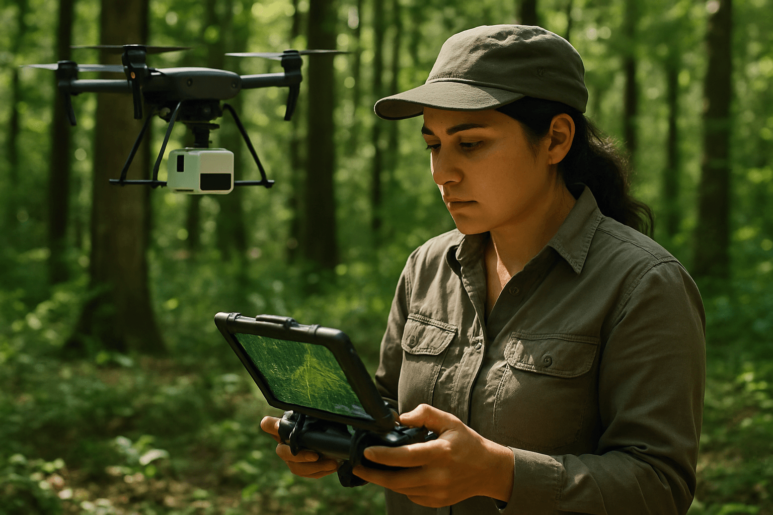
Integrating LiDAR sensors with Unmanned Aerial Vehicles (UAVs), or drones, has significantly enhanced the capabilities of forest research. Drone-based LiDAR systems can carry these sophisticated sensors over vast and often inaccessible forest areas, collecting high-resolution data that was previously difficult or impossible to obtain.
The primary advantage of drone-based LiDAR in forested environments is its ability to penetrate the forest canopy. As laser pulses are emitted, some reflect off the uppermost leaves, while others find their way through gaps in the foliage, bouncing off branches, understory vegetation, and eventually the ground. This multi-return capability allows researchers to capture detailed 3D information not just of the canopy surface, but also of the complex vertical structure beneath it, right down to the bare earth. The resulting point cloud data can provide densities ranging from 50 to 1000 points per square meter, offering an incredibly rich dataset for analysis.
Key Benefits in Ecological Studies
Drone-based LiDAR offers a multitude of benefits that are revolutionizing ecological studies of forest canopy structure:
- High Precision and Accuracy: LiDAR technology delivers exceptional vertical accuracy, typically ranging from 2 to 5 centimeters in most conditions. This precision allows for the measurement of minute details in tree height, crown dimensions, and terrain elevation.
- Efficiency and Speed: Traditional ground-based surveys are time-consuming, labor-intensive, and often limited in scope. Drones equipped with LiDAR can cover large areas rapidly, reducing project completion times from weeks to days and significantly cutting costs associated with fieldwork.
- Accessibility to Complex Terrain: Forests, especially those in mountainous or remote regions, can be incredibly challenging for human surveyors. Drones can navigate these difficult landscapes with ease, collecting data from areas that would otherwise be inaccessible or dangerous.
- Detailed 3D Data and Vertical Structure: The inherent 3D nature of LiDAR data provides a comprehensive understanding of forest structure, including canopy density, leaf area index, and the distribution of vegetation layers. This is crucial for studying vertical niche differentiation and habitat complexity, which are often poorly understood with 2D methods.
- Operation in Diverse Conditions: Unlike optical sensors, LiDAR systems can operate effectively in low-light conditions, such as dawn, dusk, or on overcast days, extending the potential data collection windows.
Diverse Applications in Forest Ecology
The detailed structural data provided by drone-based LiDAR fuels a wide array of applications in ecological research and forest management:
Forest Inventory and Management
Drone LiDAR provides highly accurate measurements of individual tree characteristics, including height, crown diameter, and even estimates of stem volume and biomass. This information is invaluable for sustainable timber management, helping foresters estimate potential yields and plan harvesting activities with greater precision. It also assists in calculating forest density and monitoring growth patterns of various tree species.
Habitat Mapping and Biodiversity Conservation
The detailed 3D models of forest canopies enable ecologists to map critical habitats, identify important micro-environments, and track changes in forest structure over time. This is essential for understanding species distribution, assessing habitat quality, and designing effective conservation strategies for wildlife. Drone-based LiDAR can bridge the scale gap between fine-scale ground observations and broad satellite data, providing ecologically meaningful data for biodiversity assessment.
Carbon Stock Estimation and Climate Change Research
Forests play a crucial role in global carbon cycles. Drone LiDAR data facilitates precise estimation of above-ground and below-ground biomass, which is fundamental for calculating carbon stocks and monitoring carbon absorption rates within forests. This capability is vital for climate change research, carbon accounting initiatives, and understanding how forest management influences atmospheric carbon budgets.
Forest Health Monitoring and Disease Detection
By analyzing tree height, crown dimensions, and detecting irregularities in canopy structure, drone LiDAR can help identify areas affected by disease, pest infestations, or drought stress. Early detection allows forest managers to intervene promptly, preventing large-scale outbreaks and preserving forest health.
Wildfire Risk Assessment and Management
High-resolution terrain and vegetation data from LiDAR are critical for fire management agencies. By identifying fuel loads, mapping firebreaks, and assessing micro-topography, drone LiDAR improves wildfire prevention, response strategies, and post-fire recovery assessments.
Topographic Mapping and Infrastructure Planning
Beyond vegetation, LiDAR’s ability to penetrate the canopy and map the bare earth is essential for creating highly accurate digital terrain models (DTMs). This data is used for planning road construction, deflection lines, and establishing potential harvest boundaries, particularly in complex or dense terrain.
Challenges and Future Outlook
Despite its numerous advantages, the application of drone-based LiDAR in ecological studies does present some challenges. The initial investment in LiDAR sensors and drones can be substantial, though costs are decreasing. Processing the vast amounts of point cloud data generated by LiDAR requires significant computational power and specialized software and expertise. Data quality can also be compromised by occlusion in extremely dense vegetation, although combining drone data with terrestrial laser scanning can mitigate this to a degree. Furthermore, regulatory hurdles for drone operation and the impact of adverse weather conditions can affect data acquisition.
However, the future of drone-based LiDAR in forestry and ecological studies is bright. Advancements in artificial intelligence (AI) and machine learning are continually improving the ability to process and interpret LiDAR data, enabling automated tree segmentation, species identification, and real-time risk prediction. The evolution of sensor technology, autonomous flight systems, and integrated drone-satellite-ground data platforms promises even greater efficiency and detail. As these technologies mature, drone-based LiDAR will become an even more indispensable tool for understanding, monitoring, and managing the world’s forests in the face of environmental change.


