The escalating challenges of environmental degradation, climate change, and biodiversity loss demand increasingly sophisticated and efficient monitoring solutions. Traditional methods, often labor-intensive, costly, and limited by accessibility, frequently fall short in providing the real-time, high-resolution data necessary for effective conservation and management. Enter the era of Unmanned Aerial Systems (UAS), commonly known as drones. These versatile aerial platforms, equipped with advanced sensors, are transforming environmental monitoring by offering unprecedented capabilities to collect, process, and analyze critical ecological data, thereby aiding in vital decision-making for a healthier planet.
The Rise of Drones in Environmental Stewardship
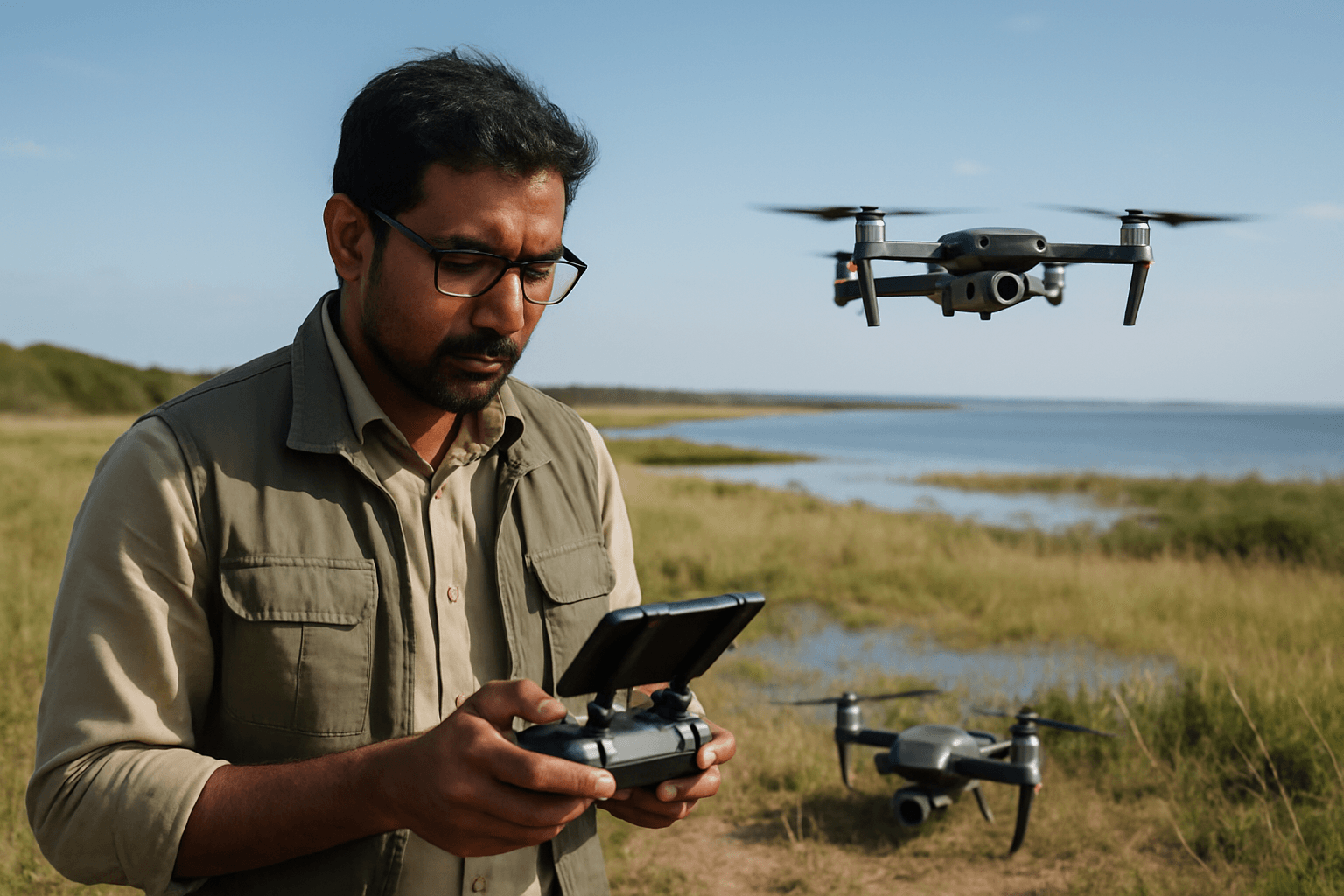
Drones have rapidly transitioned from niche military applications to indispensable tools across various civilian sectors, with environmental monitoring and conservation emerging as a significant beneficiary. Their ability to navigate remote, challenging terrains, coupled with the capacity to gather highly detailed, real-time data, makes them invaluable for understanding and preserving natural ecosystems. This transformation is driven by several factors, including advancements in drone technology, improved sensor capabilities, and the growing demand for precise, actionable environmental intelligence.
Historically, environmental assessments relied on satellite imagery, which often lacked the necessary resolution, and ground surveys, which were often sporadic and costly. Drones overcome these limitations by providing enhanced data accuracy and resolution, capturing images and sensor data with superior precision, sometimes down to 1.7cm/pixel.
Key Environmental Monitoring Applications of Drone Survey Data
The versatility of drone technology allows for a broad spectrum of environmental monitoring applications, significantly enhancing our ability to address complex ecological challenges.
Wildlife Monitoring and Conservation
Drones are revolutionizing wildlife tracking and conservation by offering non-invasive and efficient methods to study animal populations and behaviors. They enable researchers to conduct population counts, track animal movements and migration patterns, and observe breeding and feeding behaviors without disturbing the animals in their natural habitats. Equipped with thermal imaging cameras, drones can detect heat signatures, allowing for nocturnal monitoring and anti-poaching surveillance, even in dense foliage. This capability is crucial for protecting endangered species like rhinoceros and elephants.
Forest and Vegetation Health Assessment
Forests are vital for biodiversity and climate regulation, yet they face threats from deforestation, diseases, and climate change impacts. Drones provide critical aerial insights for monitoring forest health, enabling early detection of issues before they escalate.
- Deforestation and Reforestation: Drones help monitor illegal logging activities and track changes in forest cover, providing high-resolution images to conservationists. They are also instrumental in reforestation efforts, facilitating large-scale tree planting by deploying seed pods in inaccessible areas.
- Disease and Pest Detection: Multispectral and thermal sensors on drones can detect subtle changes in plant health, identifying early signs of disease, pest infestations (like bark beetle outbreaks), or drought stress invisible to the naked eye.
- Biomass Estimation and Forest Structure: LiDAR-equipped drones create detailed 3D models of forest canopies, providing accurate information on tree height, canopy density, and biomass, which is crucial for forest inventory and carbon storage assessments.
Water Quality and Aquatic Ecosystem Analysis
Maintaining water quality is a global concern, and drones significantly contribute to these efforts by monitoring various water bodies.
- Pollution Detection and Source Identification: Drones equipped with specialized sensors can monitor water bodies, identify pollution sources, track changes in water temperature, and measure pollutant levels such as pH, temperature, conductivity, and dissolved oxygen. Some advanced sensors can even detect trace amounts of contamination like proteins, pesticides, bacteria, and viruses using UV light.
- Coastal and Marine Ecosystem Health: In coastal regions, drones monitor coral reefs, assessing changes in coral cover to indicate ocean health. They can also track coastal erosion, map coastlines, dunes, and seagrass meadows, and assess environmental spills in the oil and gas industry. Waterproof and autonomous drones are being developed specifically for challenging marine applications, performing precise landing and take-off on water surfaces.
Land Use and Land Cover Change Detection
Drones are invaluable for mapping and monitoring how land is utilized and how its cover changes over time due to human activities or natural processes. This includes tracking urbanization, agricultural impact, and habitat degradation. By providing detailed maps and 3D models, drones help scientists track land-use changes and identify potential threats, aiding in more timely interventions.
Disaster Response and Environmental Damage Assessment
In the face of natural disasters, timely and accurate information is critical. Drones play a crucial role in the early detection and assessment of natural disasters and their environmental impact.
- Damage Assessment: Drones can quickly and safely survey areas affected by wildfires, hurricanes, floods, or oil spills, assessing damage and identifying risks for responders. They provide real-time data, including high-resolution images and videos, that help rescue teams locate survivors and pinpoint areas of severe damage.
- Fire Management: During wildfires, thermal imaging from drones can pinpoint hotspots and guide firefighting efforts effectively.
- Environmental Spill Monitoring: Drones equipped with sensors can detect hazardous gases, measure radiation levels, and monitor pollution levels after an environmental disaster, such as oil spills or chemical leaks, assisting in long-term recovery efforts.
Types of Data Collected by Drones for Environmental Monitoring
The power of drone survey data lies in the diverse array of sensors that can be integrated into these platforms, allowing for the collection of various types of environmental intelligence.
High-Resolution Orthomosaics and 3D Models
Standard RGB cameras on drones capture high-resolution imagery that can be stitched together to create detailed orthomosaics and 3D models of landscapes and structures. These visual representations are essential for mapping habitats, tracking physical changes, and providing a comprehensive overview of an area.
Multispectral and Hyperspectral Imagery
Multispectral sensors capture data across specific bands of the electromagnetic spectrum, including visible, near-infrared (NIR), and red-edge wavelengths. This data allows for the calculation of vegetation indices like Normalized Difference Vegetation Index (NDVI), which reveal plant health, chlorophyll content, and stress levels invisible to the naked eye. Hyperspectral sensors offer even more spectral bands, providing a deeper understanding of vegetation biochemical composition, moisture content, and biodiversity. These are vital for precision agriculture, forestry management, and environmental monitoring to detect early signs of disease, nutrient deficiencies, or water stress.
Thermal Imagery
Thermal cameras detect surface temperature anomalies by capturing infrared radiation. This data is used to pinpoint heat islands in urban areas, identify insulation breakdown, locate underground water seeps, detect animal heat signatures for wildlife monitoring, and identify hotspots during wildfires.
LiDAR Data
LiDAR (Light Detection and Ranging) systems emit laser pulses to measure distances, generating precise 3D point clouds of the Earth’s surface and vegetation. A significant advantage of LiDAR is its ability to penetrate dense vegetation, providing accurate ground models and detailed information about forest structure, canopy height, and density. This is crucial for forest inventory, health assessment, wildfire risk evaluation, and monitoring coastal erosion.
Advantages of Drone Survey Data in Environmental Monitoring
Drones offer numerous advantages over traditional environmental monitoring methods.
Cost-Effectiveness and Efficiency
By reducing the need for piloted aircraft and extensive ground crews, drones offer an economical solution for data gathering, saving organizations significant resources and manpower. They can cover large areas quickly, providing high-resolution data from various angles, which increases efficiency in data collection.
Access to Remote and Hazardous Areas
Drones can survey areas difficult or dangerous for humans to access, such as dense forests, wetlands, riverbanks, cliffs, or areas affected by spills, extending monitoring capabilities into previously unreachable environments. This reduces risks for human researchers and enables studies in sensitive ecosystems with minimal disturbance.
High Spatial and Temporal Resolution
Drones provide immediate, real-time information through live-feed capabilities, which is crucial for timely assessments during natural disasters or environmental emergencies. Their ability to fly at lower altitudes than satellites allows for the capture of highly detailed images and sensor data with superior precision. Repeated drone flights over time can also track changes with high temporal resolution, providing dynamic insights into ecosystem health.
Reduced Human Impact
Drones can monitor animals and sensitive habitats with minimal disruption, as they operate from a significant altitude and often feature low-noise propellers. This non-invasive approach ensures that data reflects natural behaviors and conditions.
Challenges and Future Outlook
Despite their significant benefits, the widespread adoption of drones in environmental monitoring faces several challenges.
Regulatory Hurdles and Data Processing Complexities
Regulatory restrictions, especially concerning flying beyond visual line of sight (BVLOS), remain a barrier. Additionally, the high volume of data generated by advanced sensors requires expensive hardware and specialized expertise for processing and interpretation. Data ownership, privacy concerns, and the need for standardized workflows are also important considerations. Drone flight time and range can also be limiting for extensive, continuous monitoring projects, and operations are sensitive to adverse weather conditions.
Integration with AI and Machine Learning
The future of drone applications in environmental monitoring is bright, with emerging innovations focusing on greater autonomy and data integration. Artificial Intelligence (AI) and Machine Learning (ML) are enabling drones to process data in real-time, automatically identify and track species, detect environmental changes, and predict future trends, significantly reducing analysis time. Integration with the Internet of Things (IoT) systems promises real-time habitat monitoring. Furthermore, advancements like solar-powered UAVs and drone swarms could address limitations in endurance and coverage, allowing for more comprehensive and continuous surveillance of our planet.
Conclusion: A New Era of Environmental Insight
Drone survey data has fundamentally reshaped how environmental data is collected, analyzed, and utilized, offering unparalleled efficiency, precision, and access to critical information. From safeguarding endangered wildlife and assessing forest health to monitoring water quality and responding to natural disasters, drones provide a powerful lens through which to understand and protect our planet. As drone technology continues to evolve, integrating with AI, machine learning, and advanced sensor capabilities, its role in environmental conservation will only grow, promising a future where humans and nature can coexist more harmoniously through data-driven stewardship.


