Mangrove ecosystems, vital guardians of our coastlines, are facing unprecedented threats from climate change and human activities. Their intricate networks of salt-tolerant trees are rapidly diminishing, yet traditional monitoring methods often fall short in providing the timely, detailed insights needed for effective conservation. Enter drone technology, a transformative force revolutionizing how scientists and conservationists assess and protect these invaluable natural assets.
The Critical Importance of Mangrove Ecosystems
Often referred to as coastal sentinels, mangrove ecosystems represent a crucial link between terrestrial and marine environments, offering a wealth of ecological and economic services. These unique forests, thriving in saline conditions and intertidal zones, are biodiversity hotspots, providing essential habitats for thousands of species, from marine life like fish and crabs to various bird species. They serve as vital nurseries for numerous marine organisms, supporting global fisheries and the food security of coastal communities.
Beyond their role as biological havens, mangroves are indispensable for coastal protection. Their dense root systems stabilize shorelines, mitigating erosion, buffering against storm surges, tsunamis, and high winds, and safeguarding inland communities and infrastructure. Furthermore, mangroves are exceptionally efficient “blue carbon” sinks, capable of sequestering carbon dioxide from the atmosphere at rates up to four times higher than terrestrial forests, locking it away in their roots and soils for generations. They also play a critical role in filtering pollutants and maintaining water quality in coastal areas.
Despite their immense value, mangrove ecosystems are under increasing duress, with an estimated loss of over 3 million hectares between 1980 and 2005 alone. This degradation is driven by anthropogenic activities such as coastal development, aquaculture, pollution, overharvesting for timber and fuel, and the overarching impacts of climate change and sea-level rise.
Traditional Methods of Mangrove Health Assessment: Limitations and Challenges
Historically, assessing mangrove health has relied on labor-intensive and often restrictive methods. Field surveys, while providing direct observation, are time-consuming, costly, and frequently limited by the inaccessibility of dense, remote, and tidal mangrove areas. Researchers often face challenges navigating complex root systems and muddy terrains, making comprehensive on-the-ground data collection difficult and sometimes hazardous.
Satellite imagery has offered a broader overview, enabling systematic, periodic monitoring of vast regions. However, its resolution can be insufficient to detect subtle yet significant changes at the individual tree or stand level. Furthermore, optical satellite data in tropical and subtropical regions where mangroves predominantly occur are often hampered by persistent cloud cover, limiting data acquisition frequency. These limitations underscore the urgent need for more efficient, accurate, and scalable monitoring techniques to effectively manage and conserve these critical ecosystems.
The Rise of Drone Technology in Ecological Monitoring
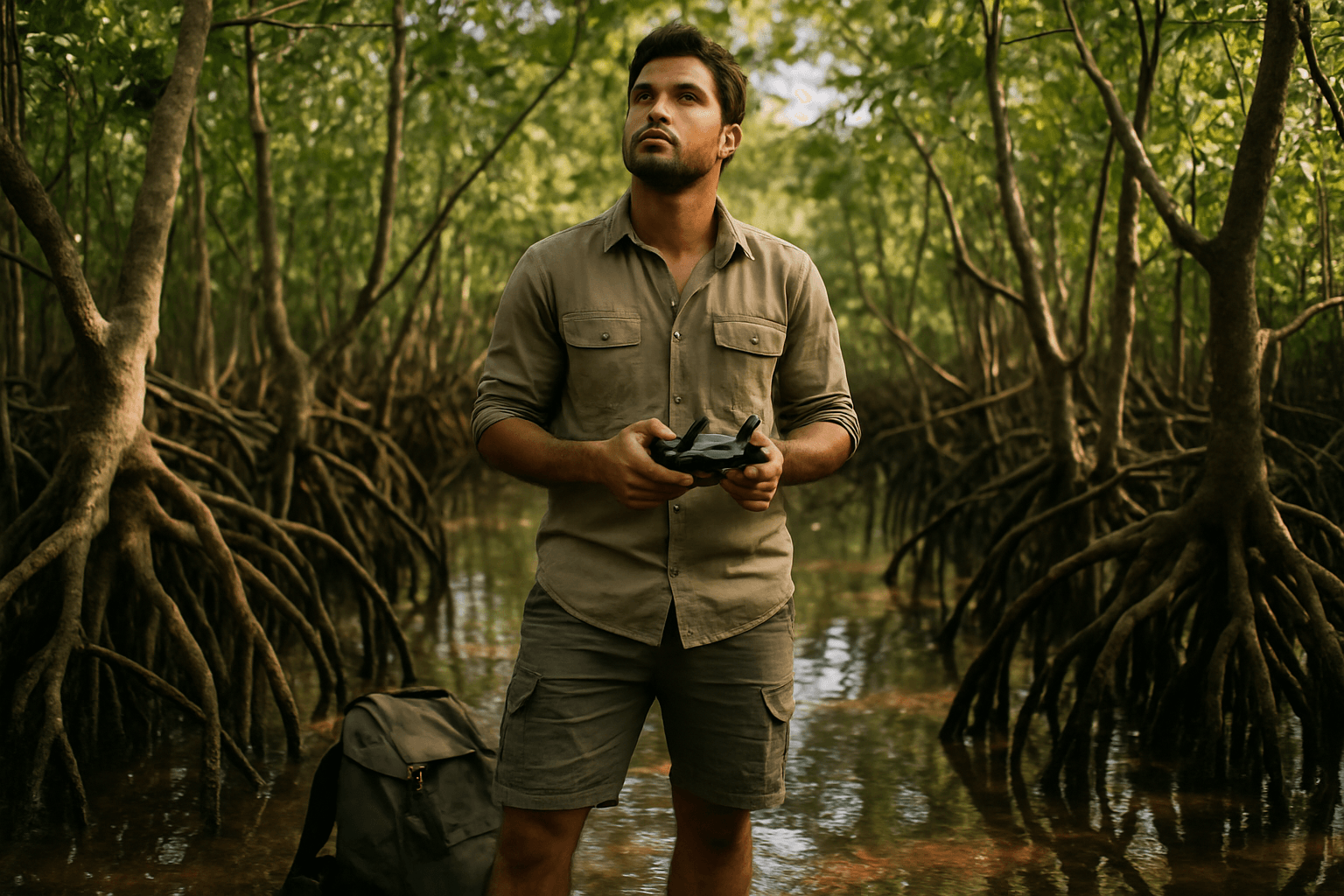
The advent of Unmanned Aerial Vehicles (UAVs), or drones, has introduced a transformative approach to environmental monitoring, offering a paradigm shift in mangrove ecosystem assessment. Equipped with advanced sensors, drones can acquire detailed data over mangrove forests with unprecedented spatial and temporal resolution, overcoming many of the constraints associated with traditional methods. Drones provide high-resolution images (centimeter-level) that bridge the gap between broad-scale satellite monitoring and fine-scale field surveys.
The flexibility and portability of drones allow for deployment in remote or difficult-to-reach areas, enabling timely and cost-effective assessments. This technological leap empowers researchers and conservation managers with actionable information for proactive conservation and restoration efforts.
How Drones Assess Mangrove Health: Key Technologies and Methodologies
Drones leverage a suite of sophisticated sensors and analytical techniques to provide a comprehensive picture of mangrove health.
High-Resolution Aerial Imagery for Mapping and Visual Assessment
Standard high-resolution cameras on drones capture detailed visual imagery, enabling precise mapping of mangrove boundaries and changes in their extent over time. This is crucial for tracking deforestation and expansion patterns. Researchers can visually assess canopy cover, identify areas of degradation, illegal logging, or land encroachment, and monitor the success rates of restoration projects. The ability to capture images with spatial resolutions as fine as centimeters per pixel provides a level of detail far superior to typical satellite imagery.
Multispectral and Hyperspectral Sensors for Physiological Insights
Multispectral and hyperspectral imagers are vital for quantitative measures of mangrove canopy health. These sensors capture data across various bands of the electromagnetic spectrum, including visible, red-edge, and near-infrared (NIR) wavelengths. From this data, vegetation indices like the Normalized Difference Vegetation Index (NDVI) and Enhanced Vegetation Index (EVI) can be derived. These indices provide quantitative measures of canopy greenness and vigor, which indicate plant health, stress, or damage. By analyzing spectral reflectance patterns, researchers can detect early warning signs of stress (e.g., from pollution, disease, or water logging), assess chlorophyll content, and even discriminate between different mangrove species based on their unique spectral signatures, aiding in biodiversity assessments.
LiDAR for Structural Analysis and Biomass Estimation
Light Detection and Ranging (LiDAR) sensors mounted on drones are particularly effective for structural analysis of mangrove forests. LiDAR emits laser pulses and measures the time it takes for these pulses to return, generating detailed three-dimensional (3D) point clouds of the forest structure. This data allows for the accurate assessment of forest height, canopy height models, biomass, and structural heterogeneity, which are critical indicators of habitat quality and carbon storage capacity. LiDAR can effectively penetrate the canopy layer, capturing precise data from the top vegetation down to the ground, offering superior capabilities for biomass estimation compared to traditional optical remote sensing which can saturate in dense canopies. Accurate Above Ground Biomass (AGB) estimation is essential for evaluating ecosystem health, carbon sink capacity, and sustainable development, providing crucial support for global carbon balance research.
Advantages of Drone-Based Mangrove Monitoring
The deployment of drones for mangrove health assessment offers numerous significant advantages:
- High Resolution and Detail: Drones provide centimeter-level spatial resolution, allowing for the detection of subtle changes in mangrove health at the individual tree or stand level that coarser resolution satellite imagery might miss.
- Increased Accuracy: Studies have shown that drone-derived mangrove canopy cover estimates are highly correlated with field-based measurements, often with improved accuracy in species classification compared to satellite data.
- Temporal Flexibility: Drones can be deployed rapidly and on demand, enabling frequent data collection at optimal times, irrespective of fixed satellite orbits or cloud cover, which is a common issue in tropical regions.
- Accessibility and Safety: They can access remote, dense, and otherwise inaccessible intertidal zones, reducing the need for laborious and potentially hazardous field surveys. This also makes them less invasive to the ecosystem and safer for researchers.
- Cost-Effectiveness and Efficiency: While initial drone costs can be higher, for long-term monitoring of smaller areas, they become advantageous over satellite data in terms of user-costs. They can cover larger areas much faster than traditional methods, significantly accelerating data acquisition and reforestation processes.
- Early Warning and Proactive Management: The enhanced detail and frequency of data collection enable the detection of early warning signs of mangrove decline, facilitating proactive interventions to mitigate threats and promote ecosystem resilience.
- Validation of Satellite Data: Drone imagery provides critical information for ground-truthing and validating satellite data, ensuring the accuracy of larger-scale analyses.
Challenges and Future Directions
Despite the immense potential, the widespread adoption of drones for mangrove monitoring faces several challenges. One significant hurdle is the large data size generated by drone imagery, which can lead to extensive processing times, sometimes ten times greater than satellite images. Another challenge lies in the portability of machine learning (ML) models and parameters developed for data analysis; these often need to be re-established and tailored for each new research area, limiting their general applicability. Drones also have limitations in effectively collecting biological data on understory vegetation within dense mangrove forests. Furthermore, while drones are excellent for monitoring changes, pinpointing the exact multifaceted causes of degradation (e.g., local conditions, climate change, sea-level rise, pollution) solely through remote sensing analysis remains difficult.
A broader concern, highlighted in research, is the phenomenon of “helicopter research,” where drone-based mangrove studies are largely conducted by institutions in higher-income countries, often with limited involvement of local scientists, despite the majority of mangroves being located in lower-income nations. This disconnect can lead to barriers in capacity building, technology transfer, and effective data integration into global datasets.
The future of drone-based mangrove monitoring is promising, with continuous advancements in technology. Key areas for future development include:
- Advanced AI and ML Integration: Developing more effective ML algorithms for automated and near real-time analysis of drone data, including automated mangrove species identification, health assessment, and predictive modeling.
- Multi-source Data Fusion: Integrating data from multiple remote sensing sources (drones, satellites, field data) to improve species classification accuracy and enhance the precision of biomass estimates.
- Novel Sensor Technologies: Developing new sensors capable of detecting a wider range of health indicators, such as nutrient levels, water quality parameters, and even early signs of disease.
- Capacity Building and Collaboration: Fostering robust partnerships and investing in local capacity building in mangrove-rich developing countries to ensure equitable use and benefits from aerial tools.
Case Studies and Real-World Impact
Drones are already making a tangible impact globally. In Myanmar, local environmental groups have utilized drones equipped with seed pods to rapidly plant thousands of mangroves, significantly accelerating reforestation efforts. Similarly, initiatives like Panama Flying Labs and Tanzania Flying Labs, part of a global network, are using multirotor drones to monitor sea-level rise, map mangrove boundaries, and create baseline data for flood models and restoration planning, simultaneously building local expertise in marine conservation and drone applications.
Conclusion: A New Era for Mangrove Conservation
The integration of drone technology into mangrove ecosystem assessment represents a pivotal step forward in conservation science. By providing unparalleled detail, efficiency, and accessibility, drones are enabling a more comprehensive understanding of mangrove health, facilitating proactive management, and supporting large-scale restoration efforts. While challenges remain in data processing, model portability, and ensuring equitable global collaboration, the ongoing innovation in drone technology, coupled with advancements in AI and sensor capabilities, promises a future where these crucial coastal ecosystems can be monitored and protected with unprecedented effectiveness. This new era of data-driven conservation offers hope for safeguarding mangroves and the vital services they provide to both people and the planet.


